Discover the Ian Wells Track on Piha Road
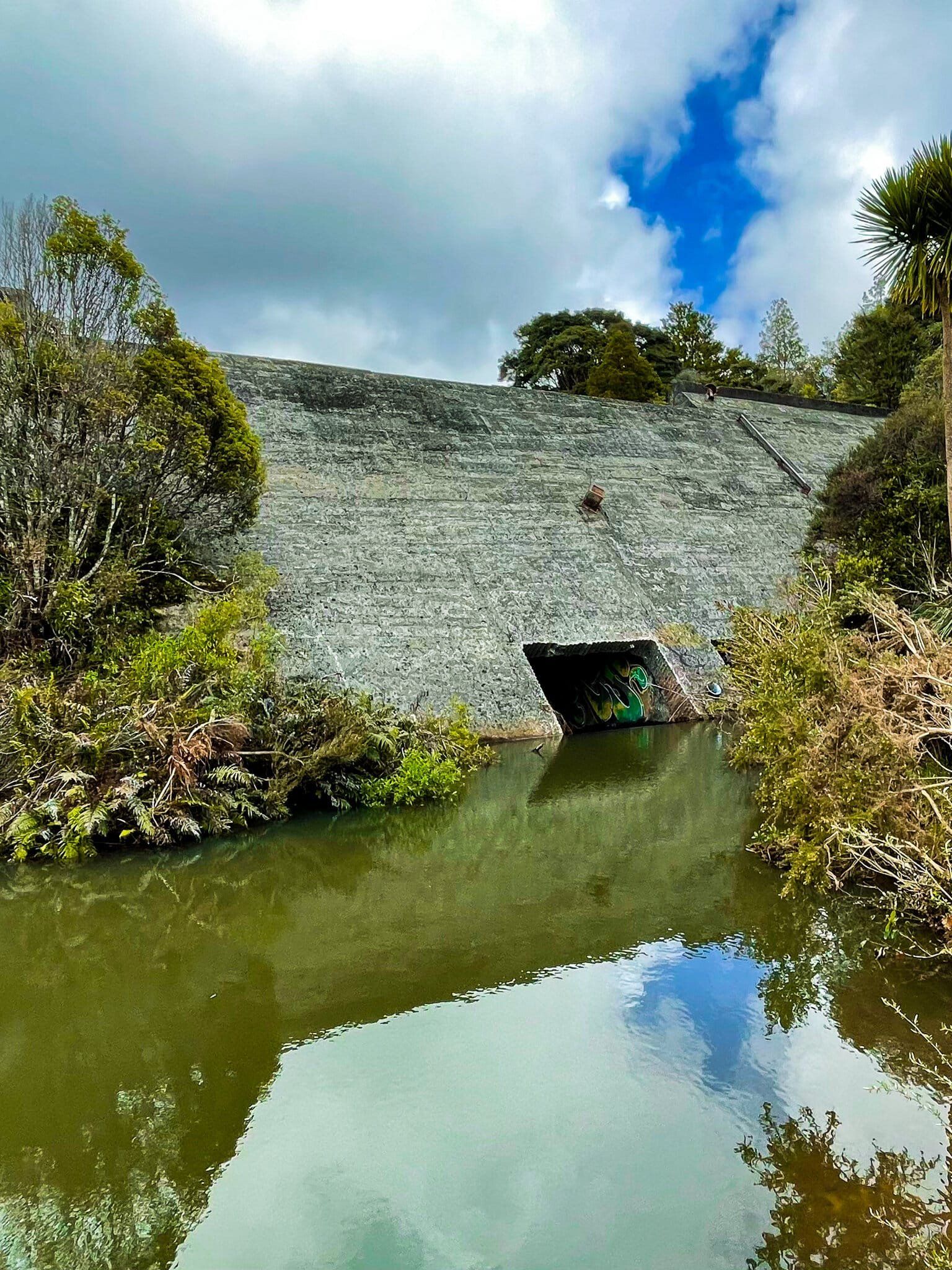
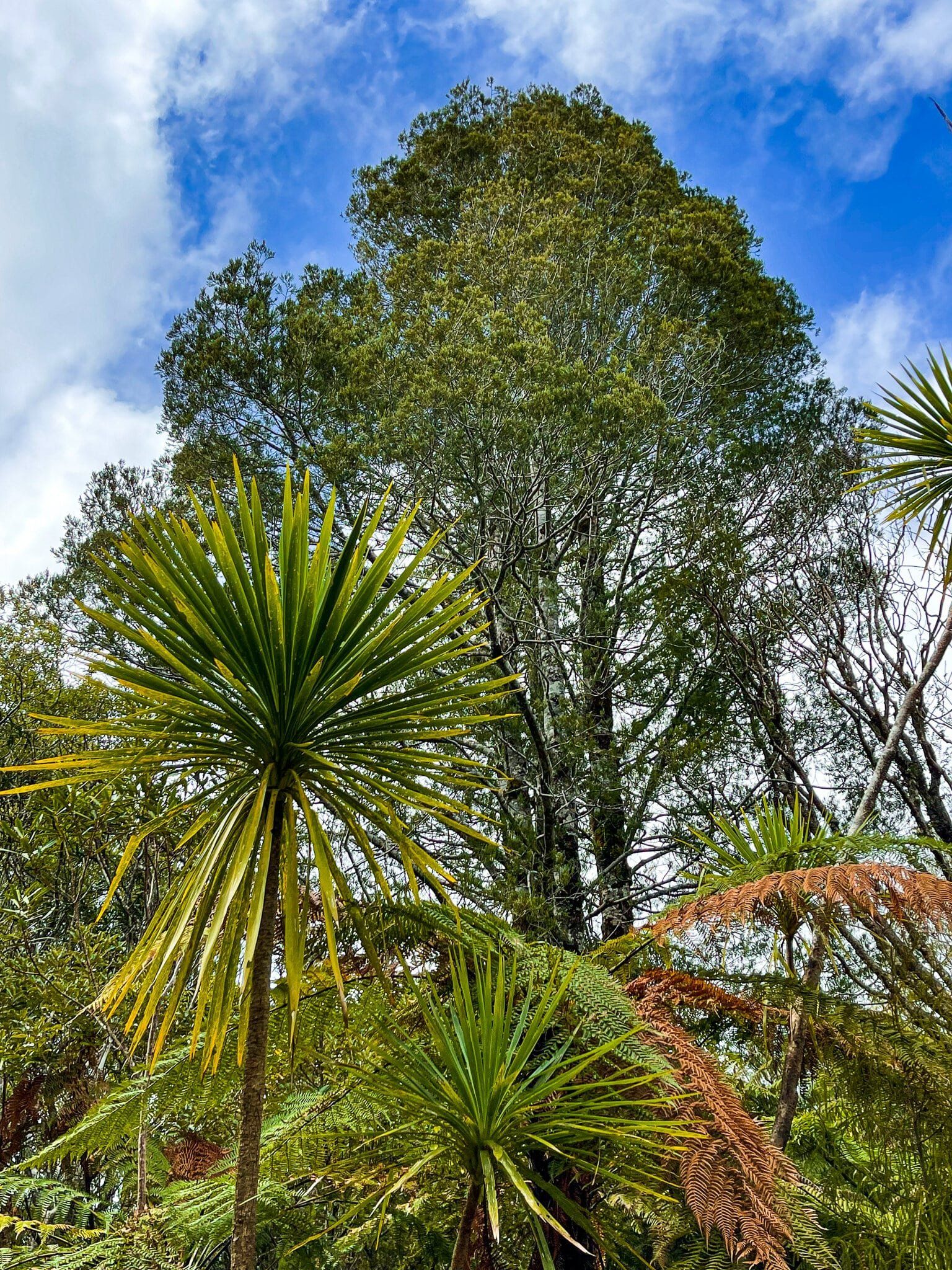
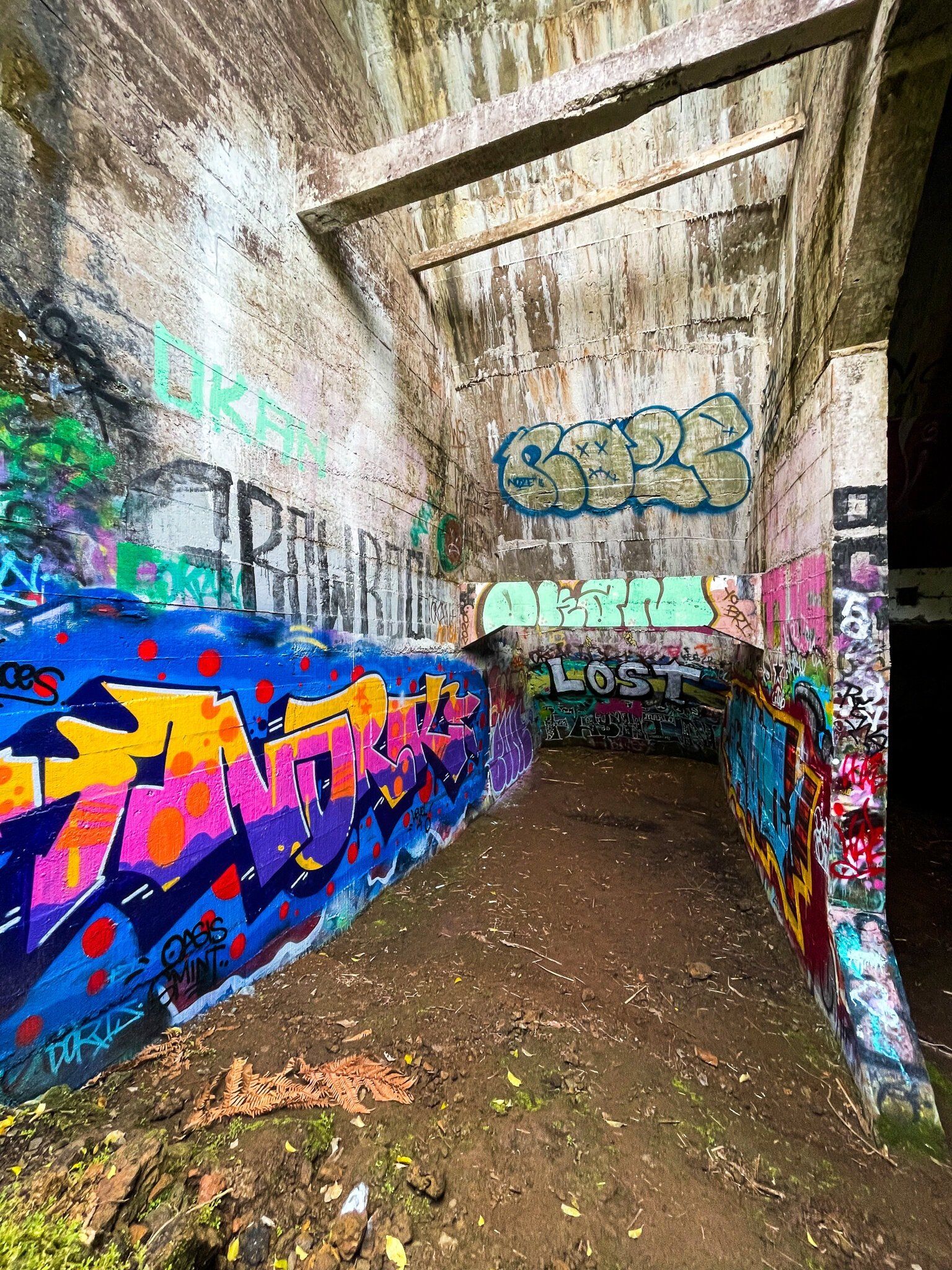
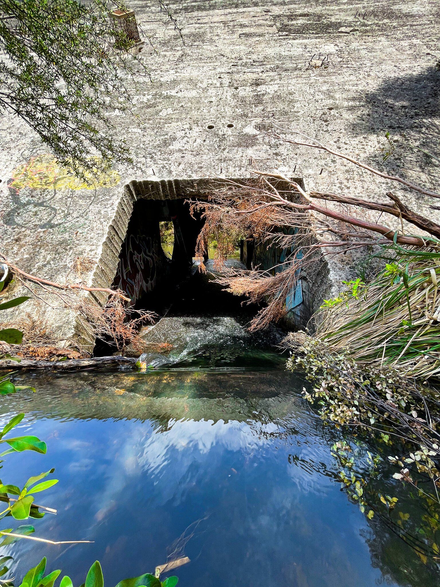
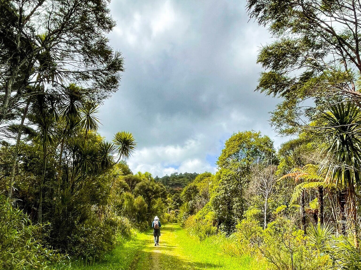
Located in the Waitākere Ranges, the Ian Wells Track is accessed on Piha Road and leads you to a disused dam that was once part of the Auckland water supply. This site combines a short walk through a regenerating forest and an interesting abandoned element of industrial history. While there, spot the vibrant graffiti, which adds a splash of colour to the concrete wall of the dam and forest setting.
Exploring the Track and Dam
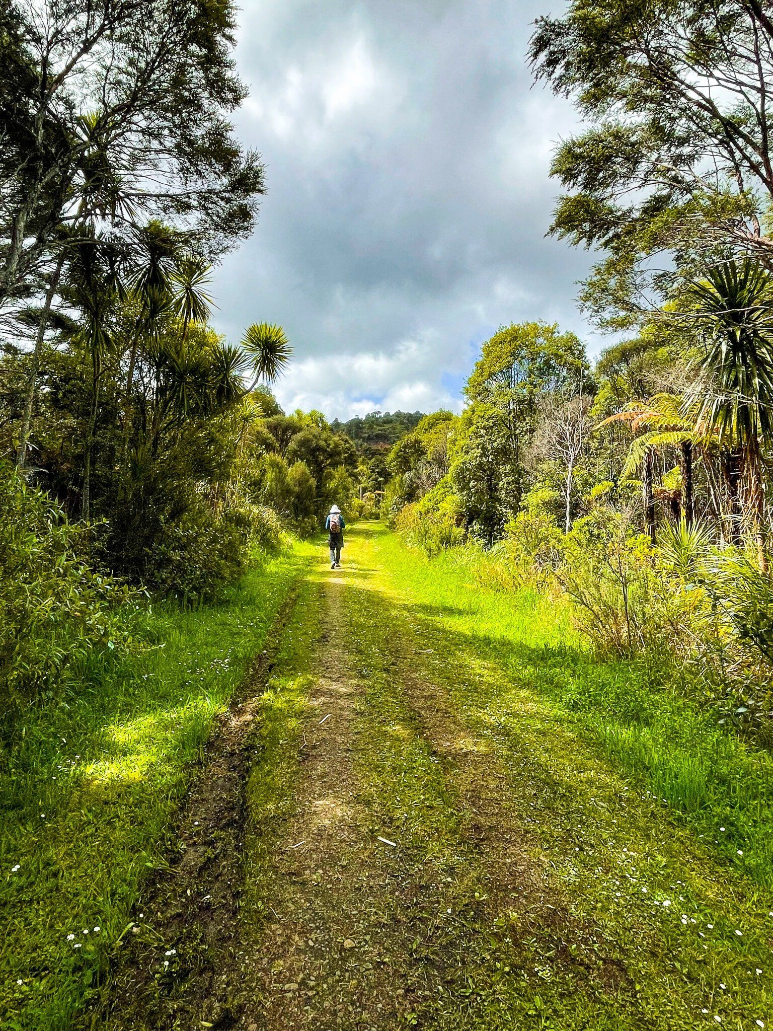
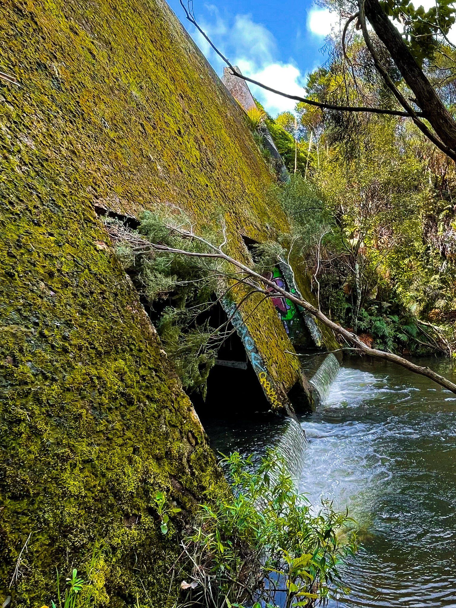
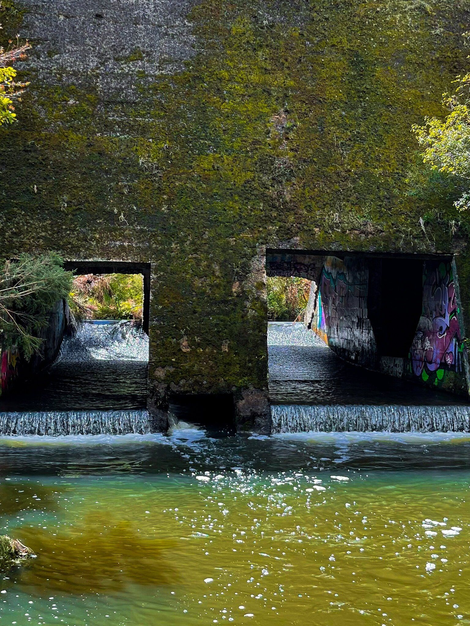
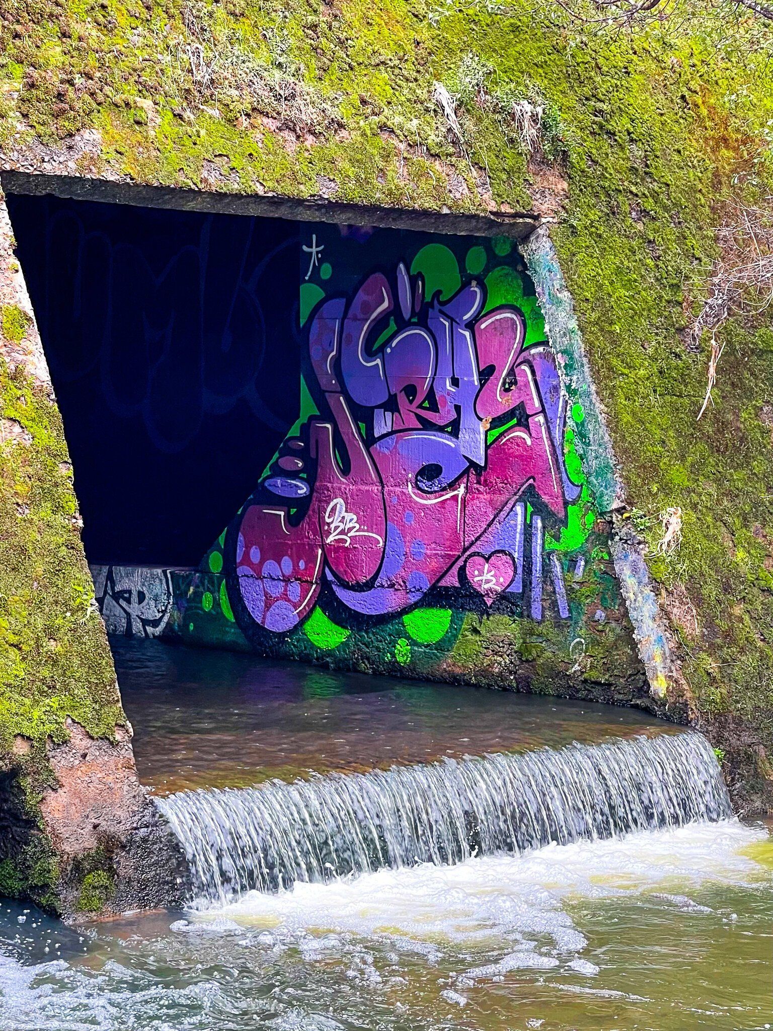
The easy track follows an old access road, flanked by forest regrowth. As you proceed, the path descends to the northwest side of the concrete dam. Walking beyond the dam, you'll find a large grassy area on the west side of the dam. The stream now flows through the former dam gates, and you can see some of the graffiti.
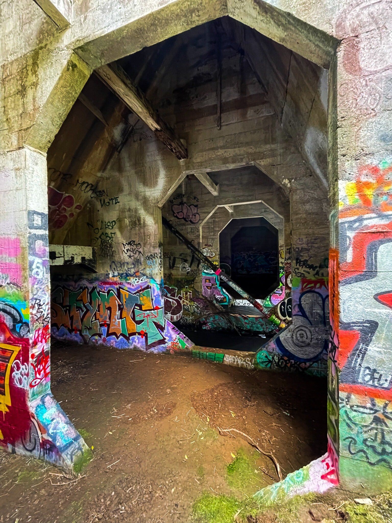
There is also an informal path branching off to the left near the dam. This path leads down to the southeast side of he dam, where there is a somewhat murky lagoon on the stream. From there, you can access the back of the dam, where the graffiti is more extensive. Consider the effort required to bring so many spray cans to this remote location!
How to Get There
The Ian Wells Track is approximately a 30-minute return walk. The track's access point has space for a couple of cars and is located about 300 metres west of the larger car park and access to the Upper Nihotuou Reservoir walk on Piha Road.
Further along Piha Road, you can access Piha, Anawhata and Karekare.