Discover the Wye Creek Track
Located at the southern end of the Remarkables, the Wye Creek Track is a thrilling walking experience with stunning views over Lake Wakatipu. This track is a true hidden gem, featuring dramatic scenery, including cascading waterfalls and a unique cliffside boardwalk.
Starting Your Adventure
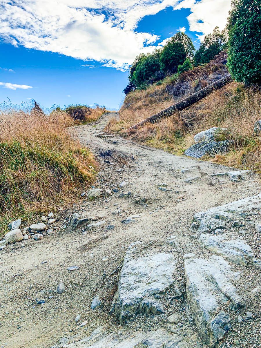
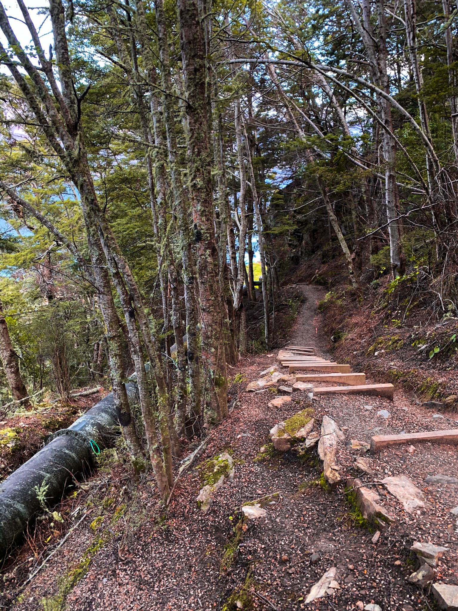
To begin your journey, head to the access point off State Highway 6, the Kingston Road, between Jacks Point and Kingston. The access point is also the southern end of the Remarkables. Drive slowly, as the sign can be easy to miss. You can park at the bottom or, if you have a suitable vehicle, drive up the rough 4WD road to the small car park at the top. From there, follow the rough tramping track.
The Short Walk to the Viewpoint
The walk to the main viewpoint takes about 30 minutes from the top of the 4WD road. Situated around 660 metres high, the viewpoint is near the Wye Creek South Branch.
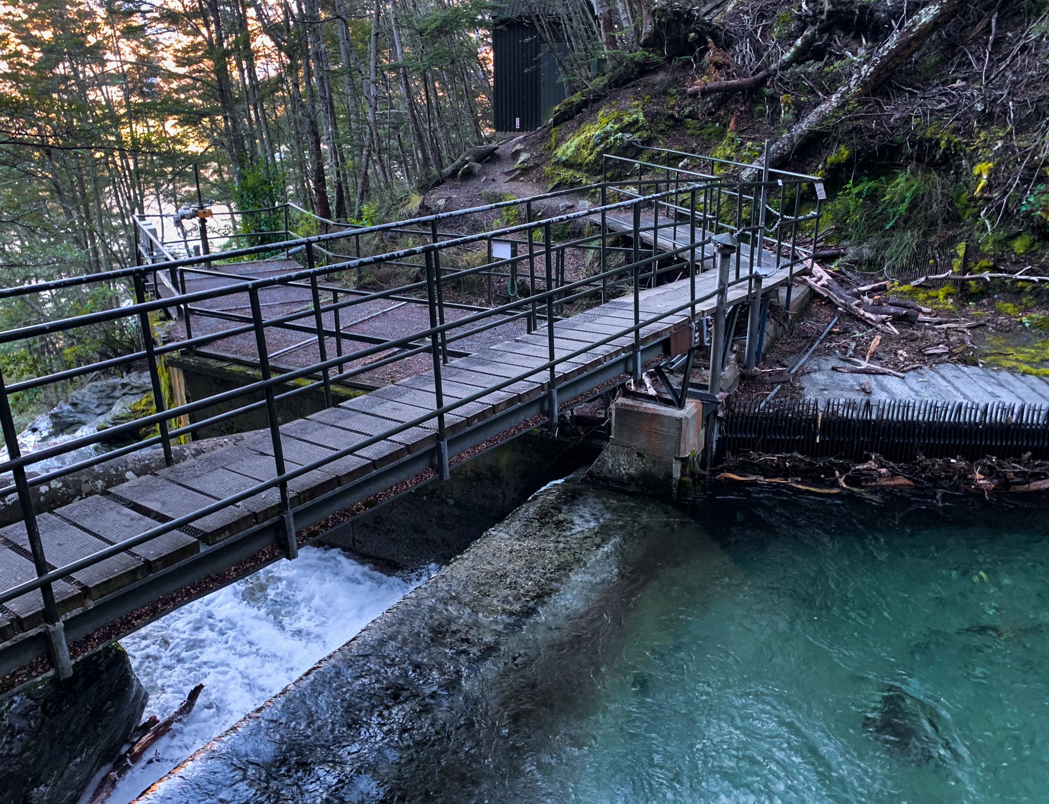
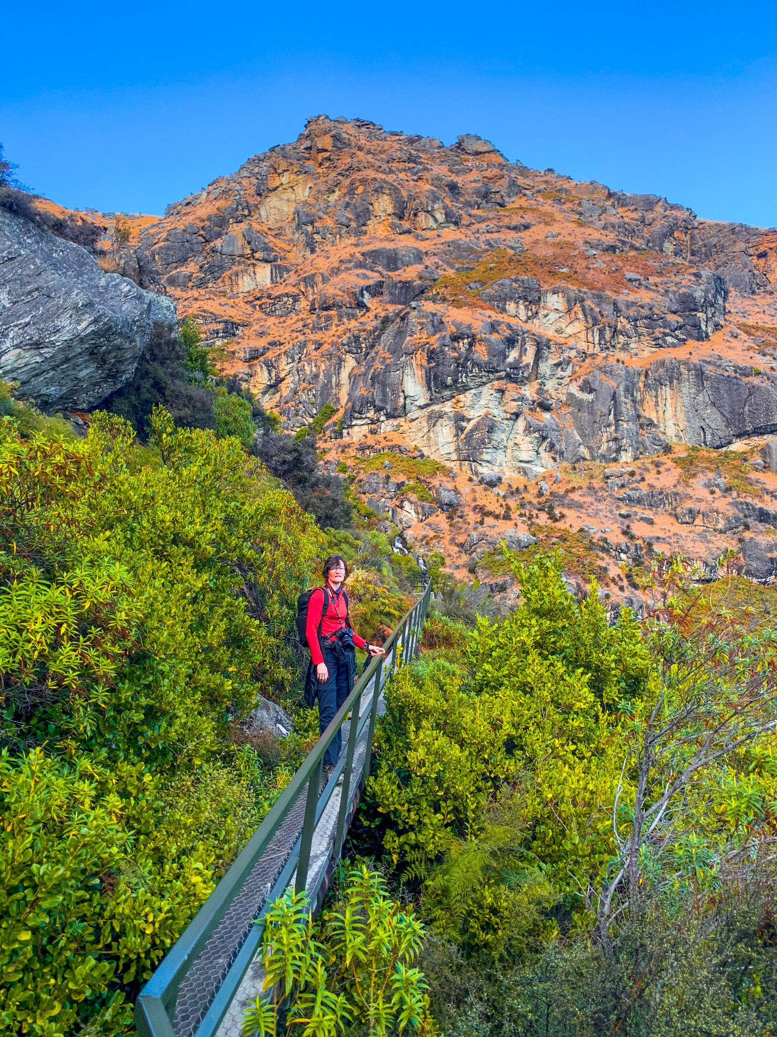
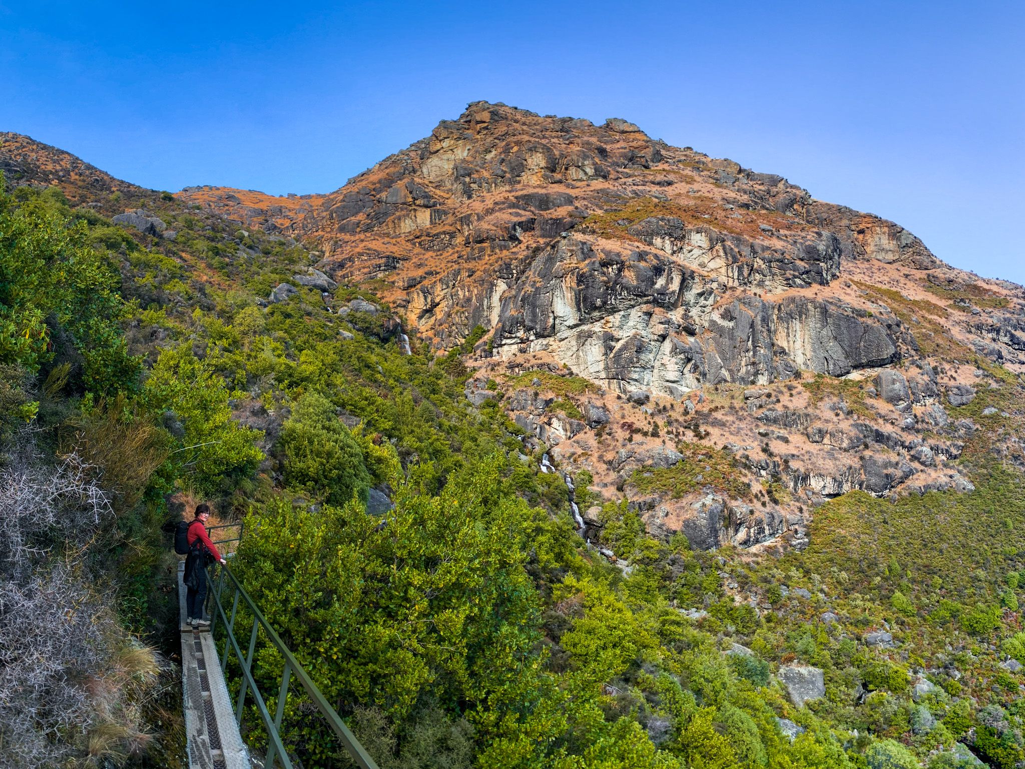
After about 20 minutes from the trailhead, you will reach the small Wye Creek hydropower dam. There, ignore the Wye Creek route sign and walk across the dam. After the dam, the track leads to a narrow boardwalk on a water diversion pipe, part of the hydro power project, attached to the cliffside. Although there is a safety rail, the boardwalk spans about 200 metres and is perched high on the side of the steep Tapuae-o-Uenuku / Hector Mountains, just south of the Remarkables. For some, the walk across may be intimidating.
Scenic Highlights and Rock Climbing
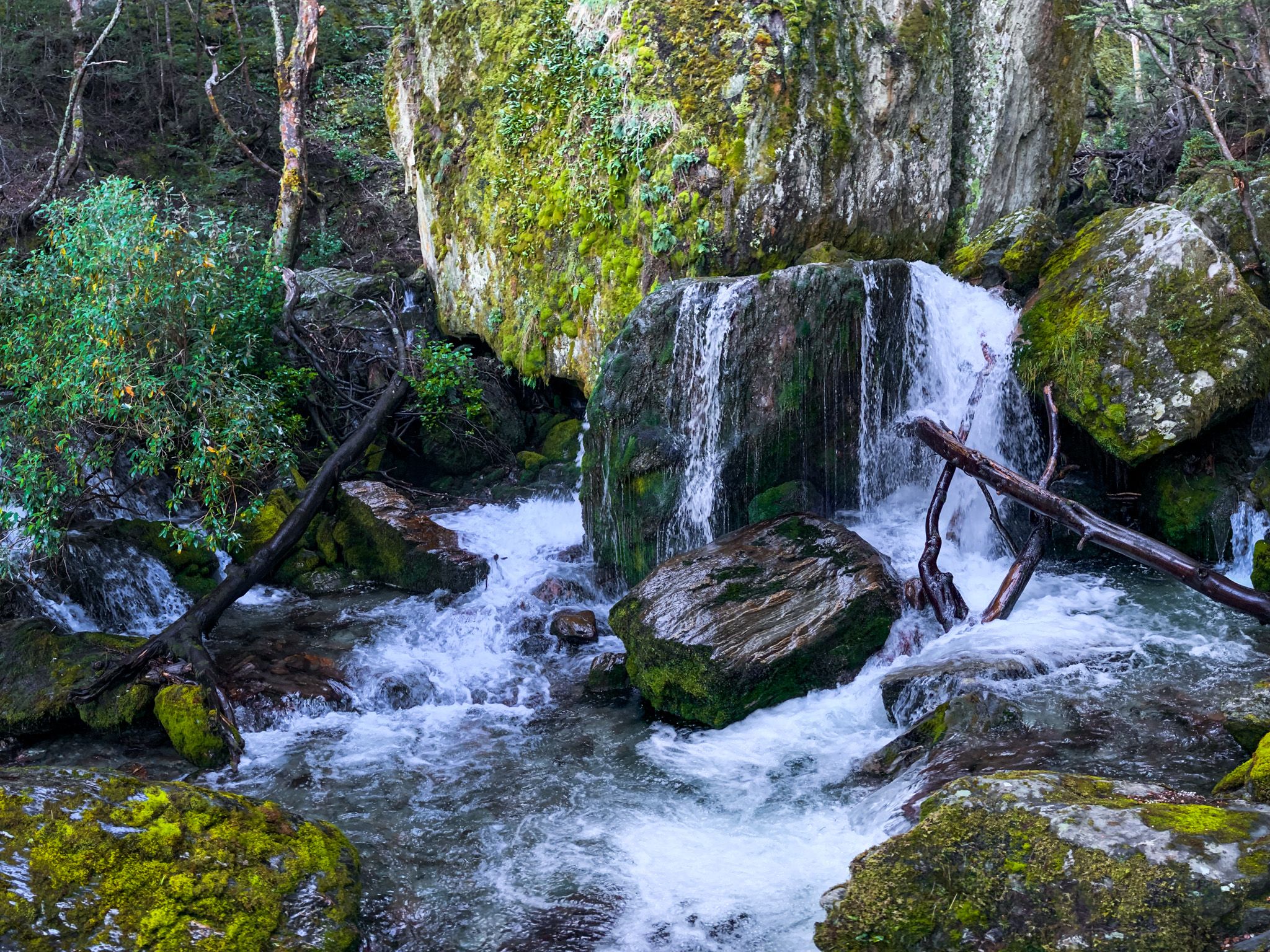
The boardwalk provides breathtaking views back towards Lake Wakatipu and the impressive Wye Creek South Branch waterfalls. Beyond the boardwalk, the track continues briefly to a rock face, which is a popular spot for rock climbers.
Early Hydro Power Development
The Wye Creek hydroelectric scheme is a small but significant hydro project. Originally constructed by a gold mining company, it was acquired in 1941 to provide power to the local community. The scheme supplies electricity to Queenstown and the surrounding areas, harnessing the waters of Wye Creek as they descend from the Remarkables and Hector mountain ranges. The project was an early development of renewable energy infrastructure in the region. Although modest in scale, it played a key role in the early growth of the local community.
The Longer Route Option
For those seeking a more extended adventure, there is a longer version of the track. You can walk either way, but it is easier to start at the Remarkables Ski Field. This remote route involves a hike up Lake Alta, then a walk down the Wye Creek Valley that takes about 6 hours. If you choose this option, plan for a full day and arrange transportation at both ends of the track.
Getting to the Wye Creek Track
From Queenstown, take State Highway 6A to Frankton, then head south on State Highway 6. The drive to the access and lower car park is 21 km and takes 21 minutes.
Other walks in the region include Lake Hayes Walkway, Sawpit Gully Track, New Chums Gully Track, and Queenstown Hill.