
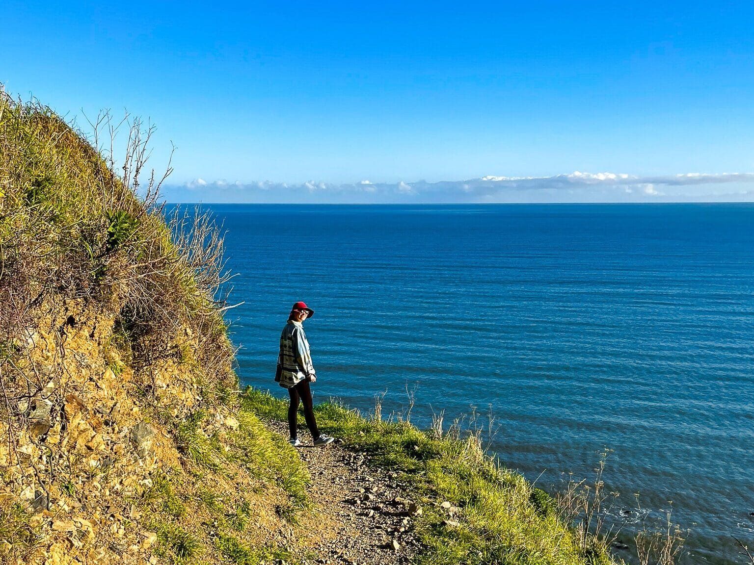
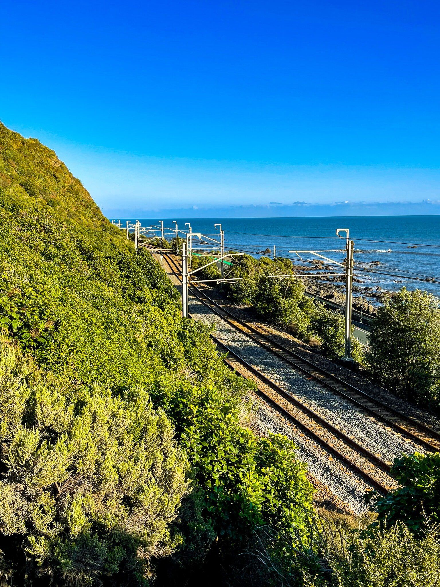
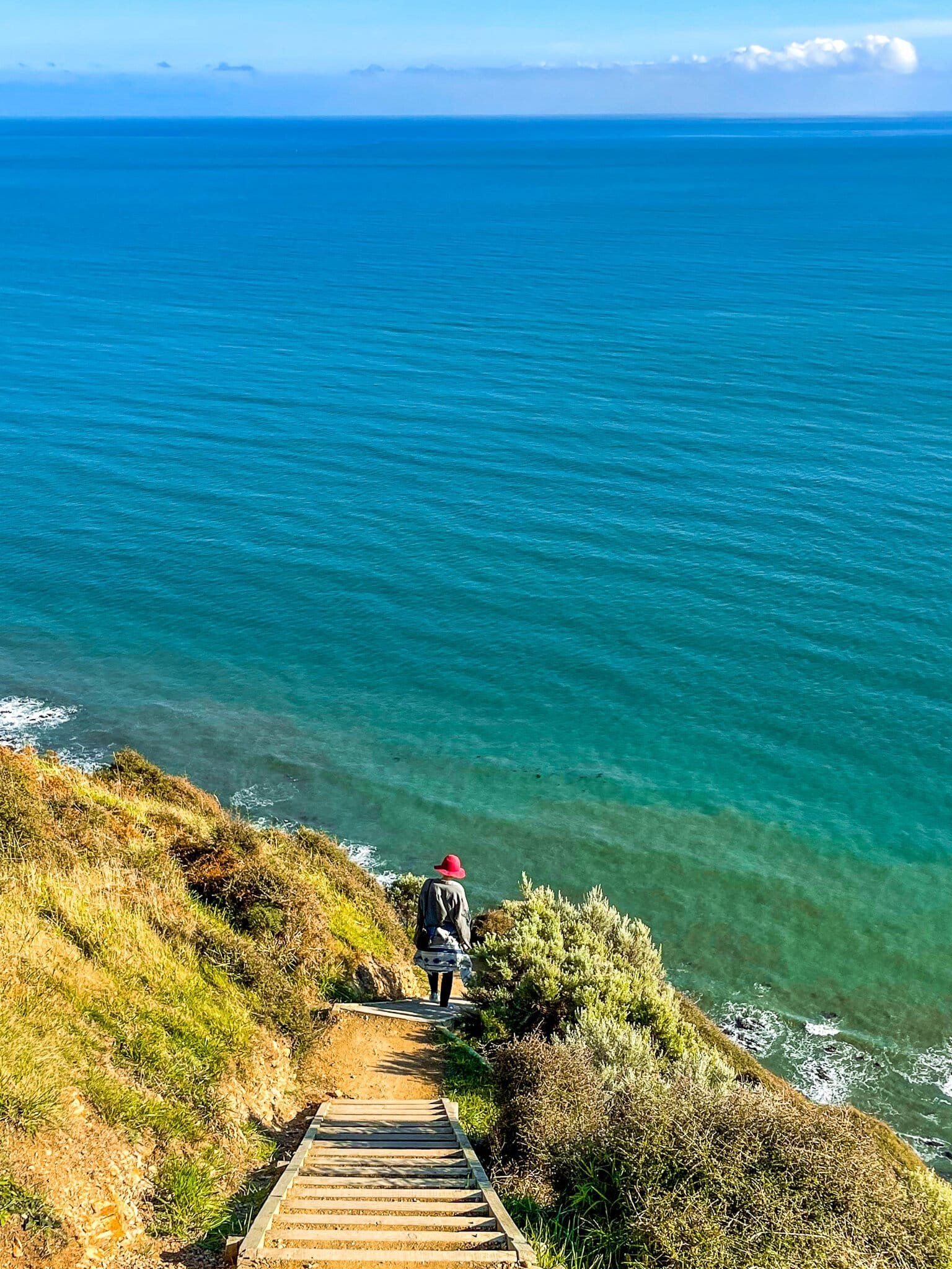
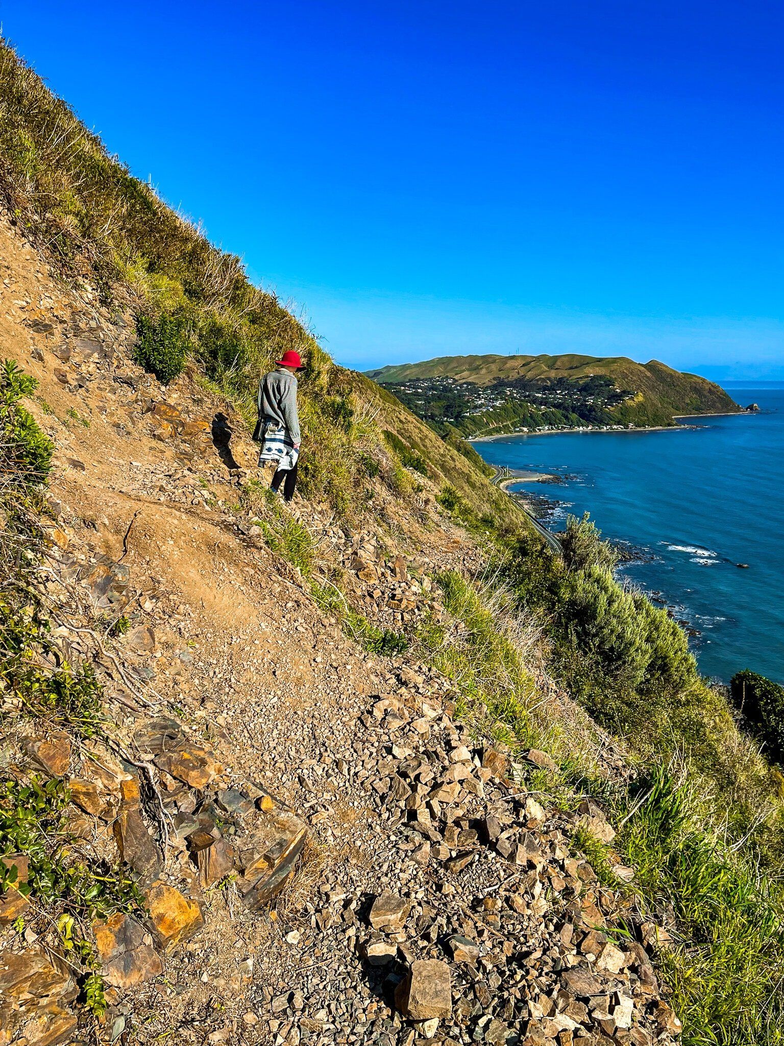
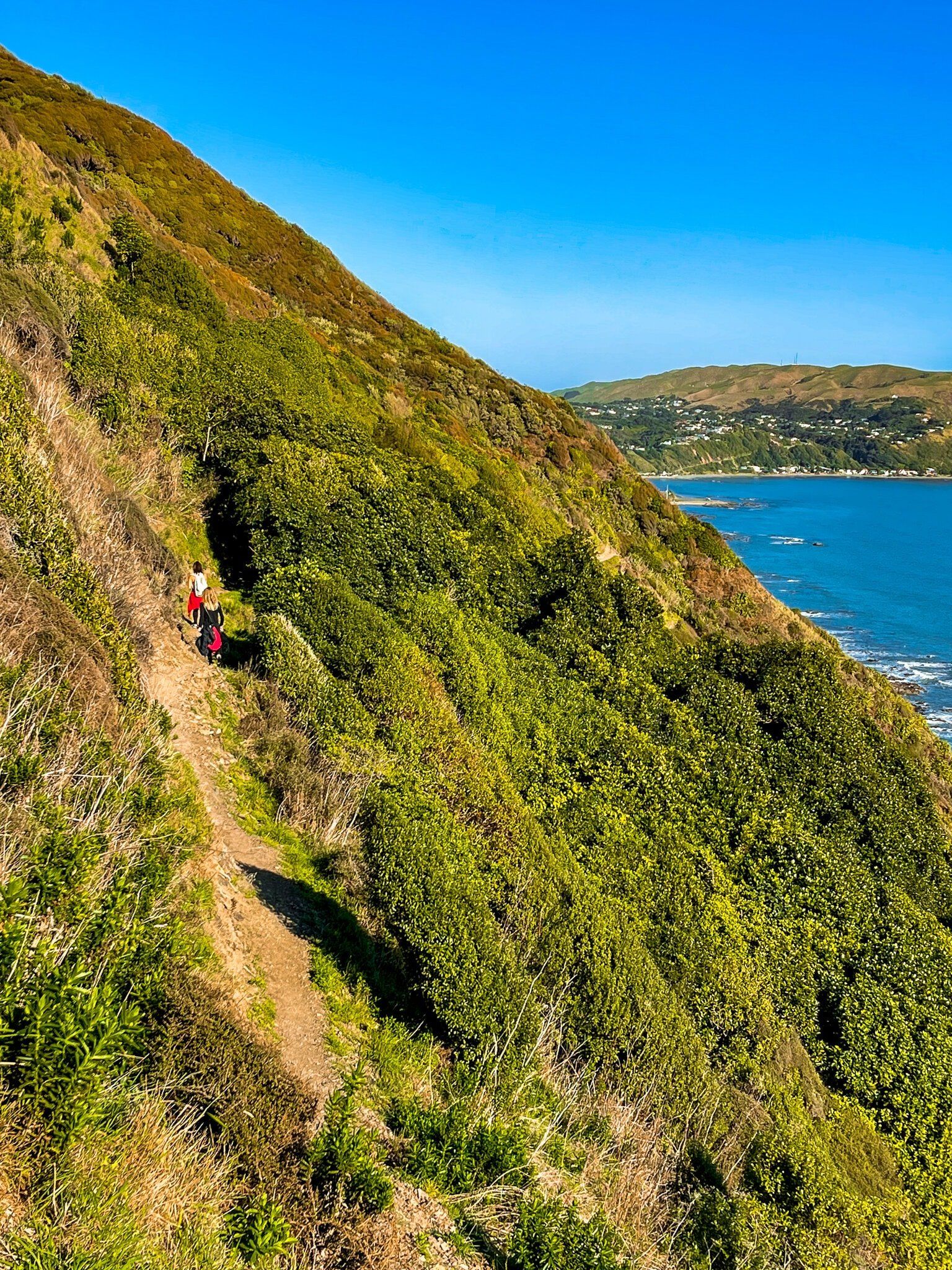
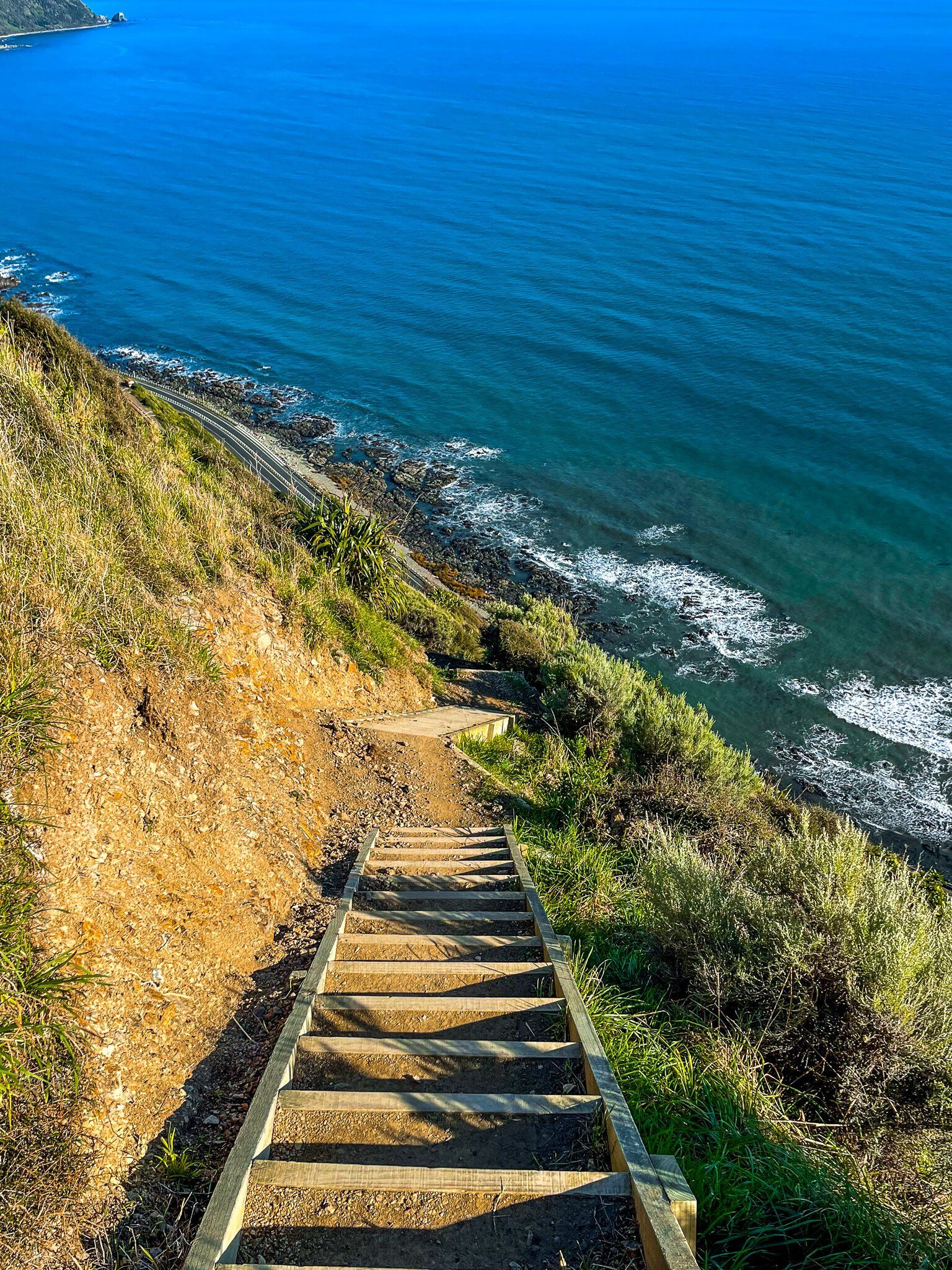
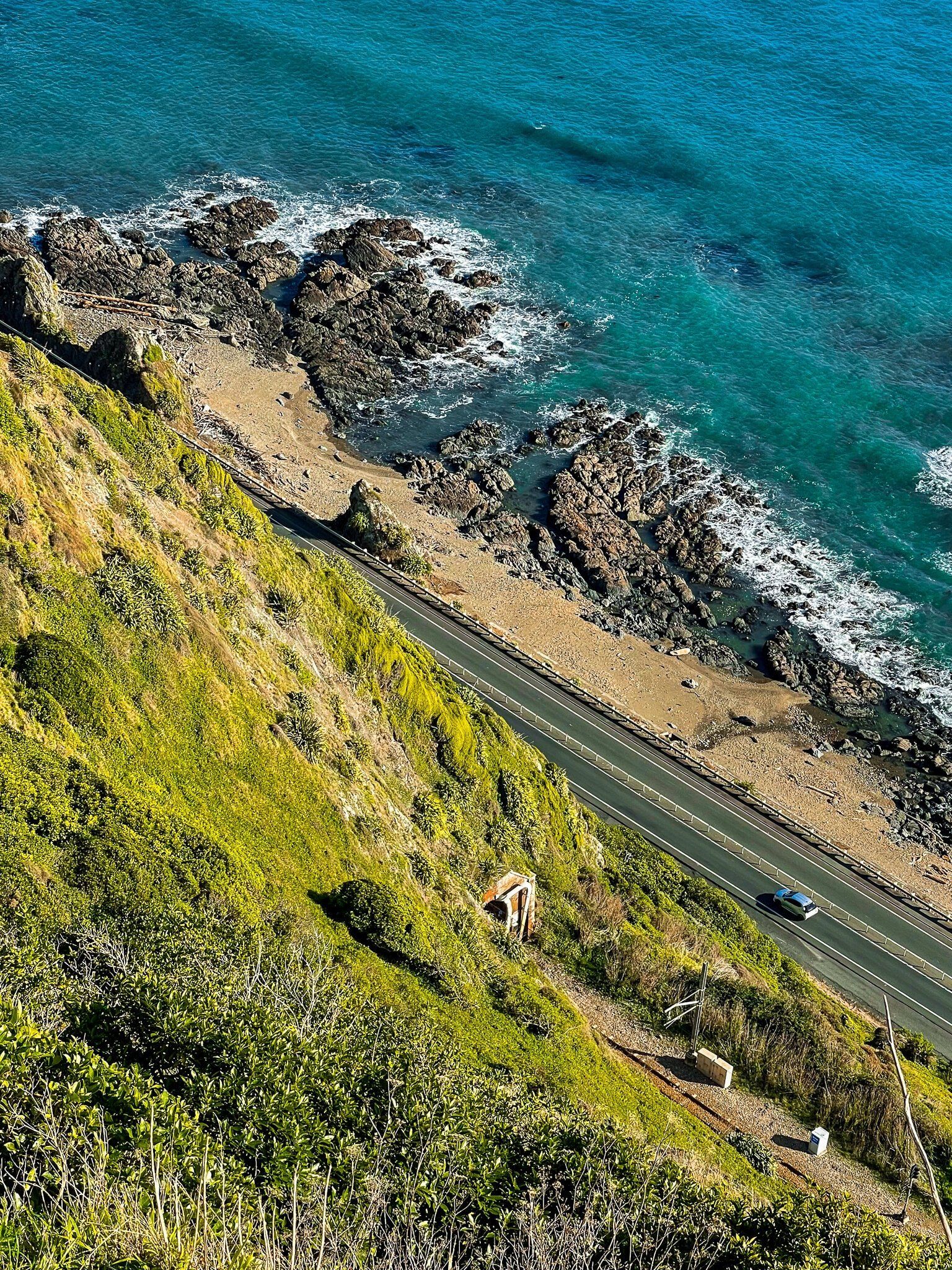
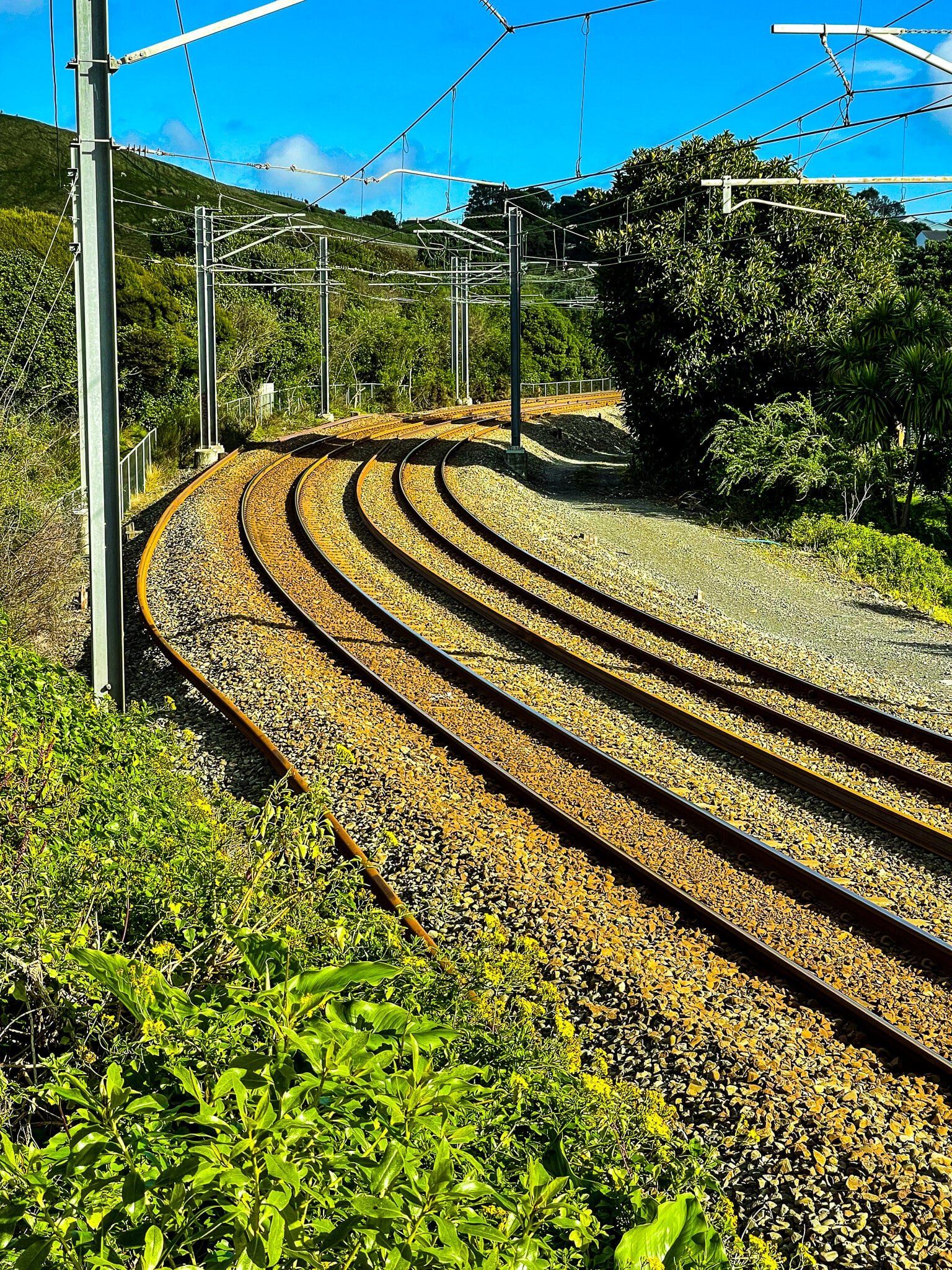
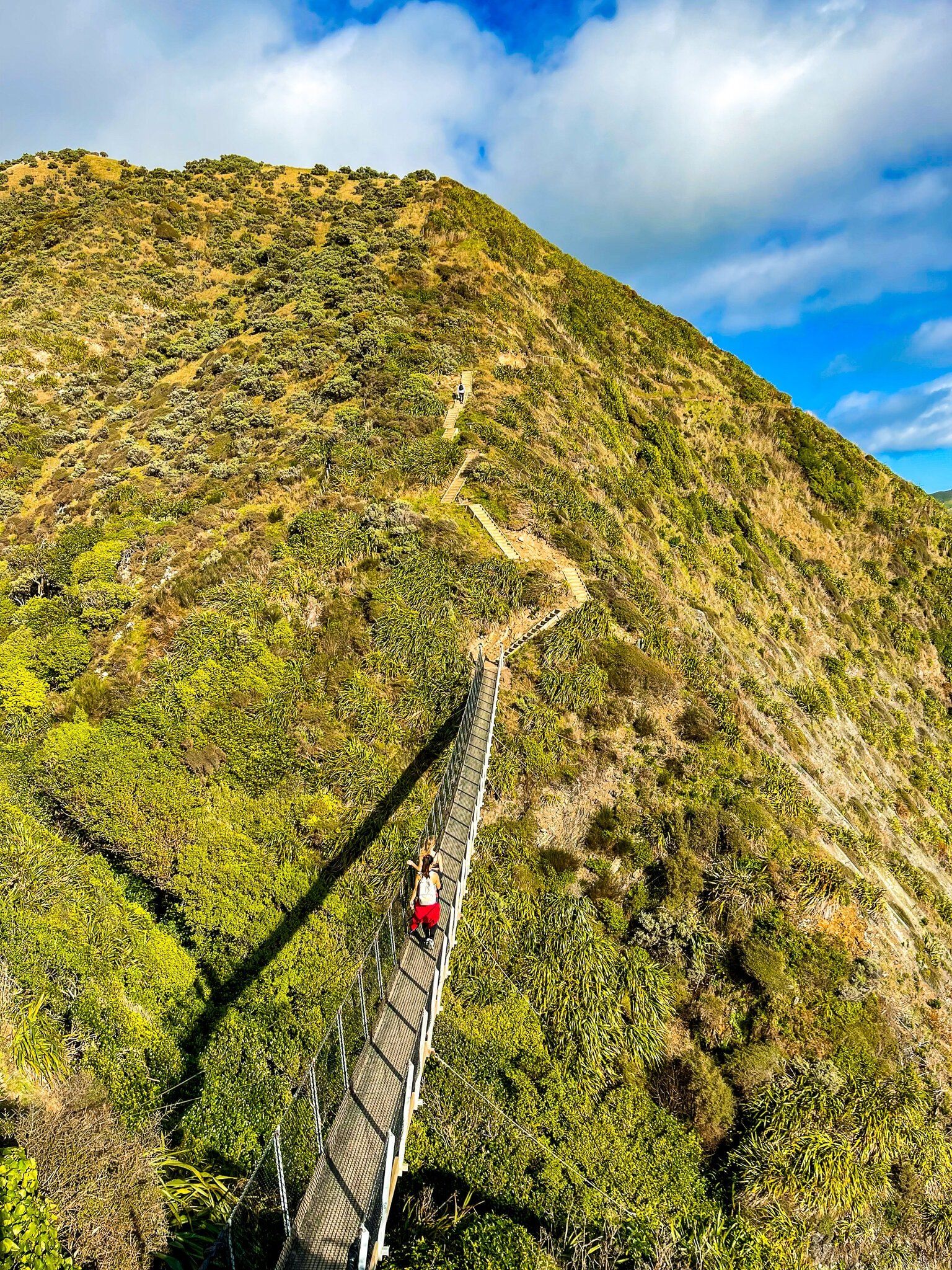
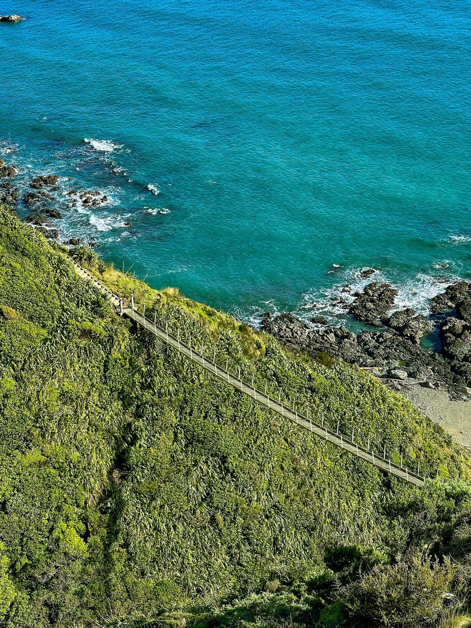
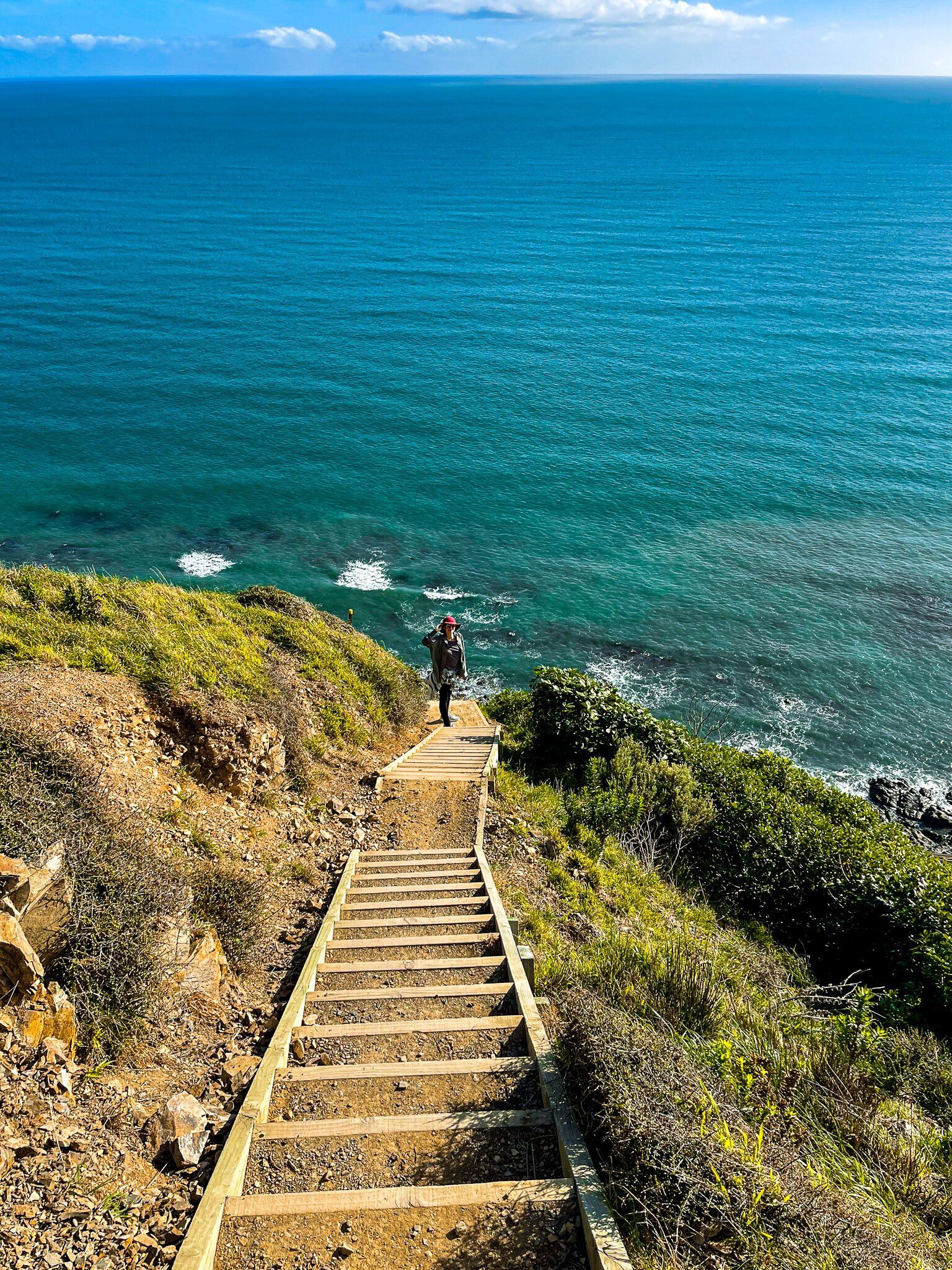
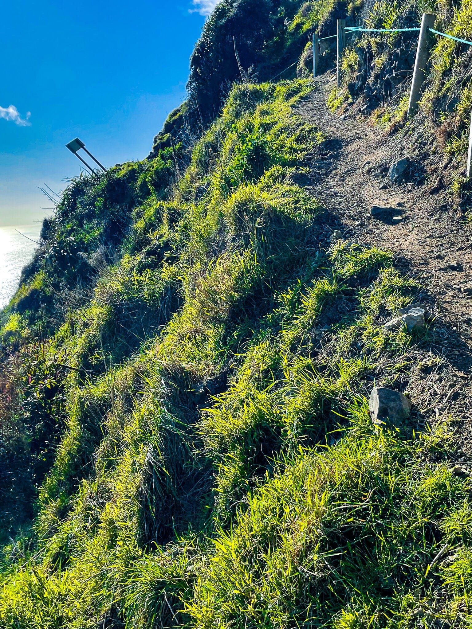
Paekakariki Escarpment Track is a section of Te Araroa on the Kapiti Coast and connects Paekakariki to Pukerua Bay. It has become one of the most recognisable and popular half day walks in the North Island. At 10 kms long and a 200 metre climb, it is not terribly physically challenging, but it is an often narrow track that rises high up the side of Paekakariki Hill overlooking the railway line, coastal road and Tasman Sea. The hillside is mostly very steep and includes the odd cliff edge, plus short sections of moderately damaged track. There are also a lot of steps, especially on the southern side of the high point, none of which have handrails.
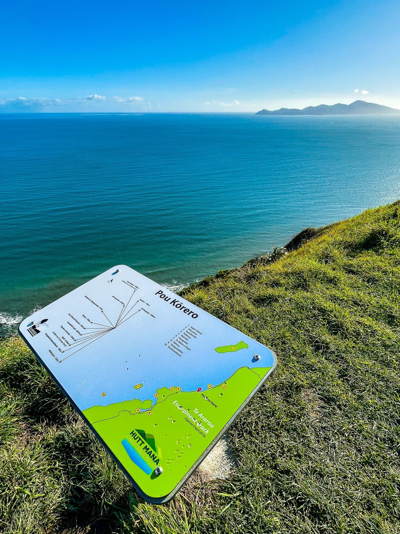
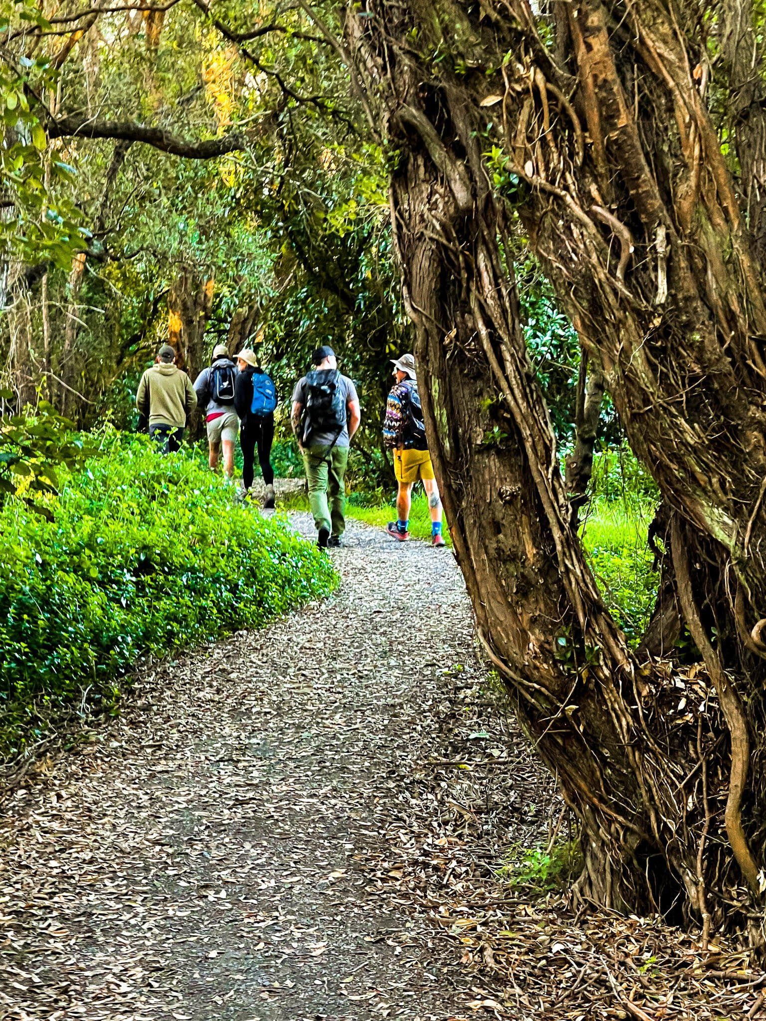
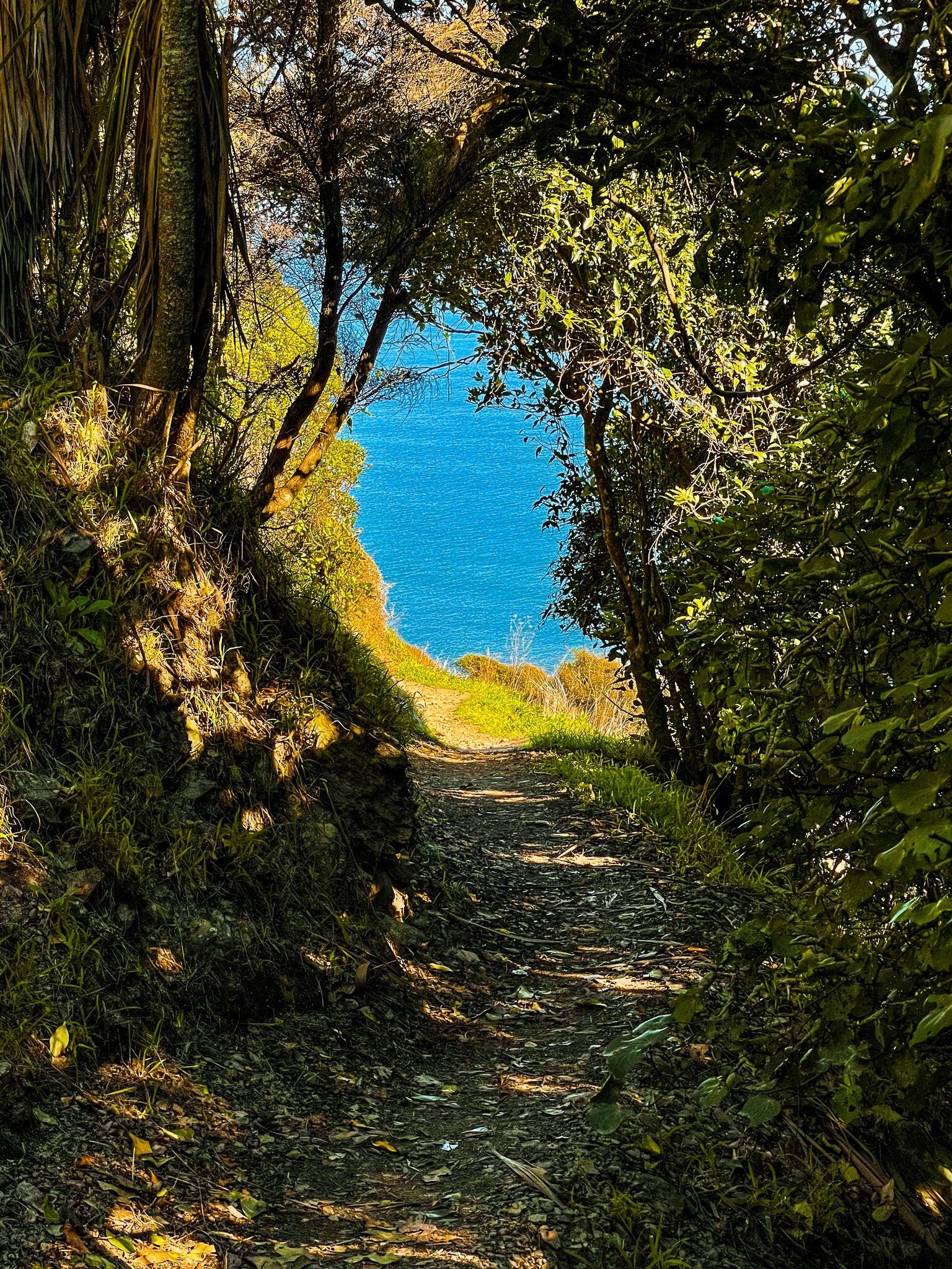
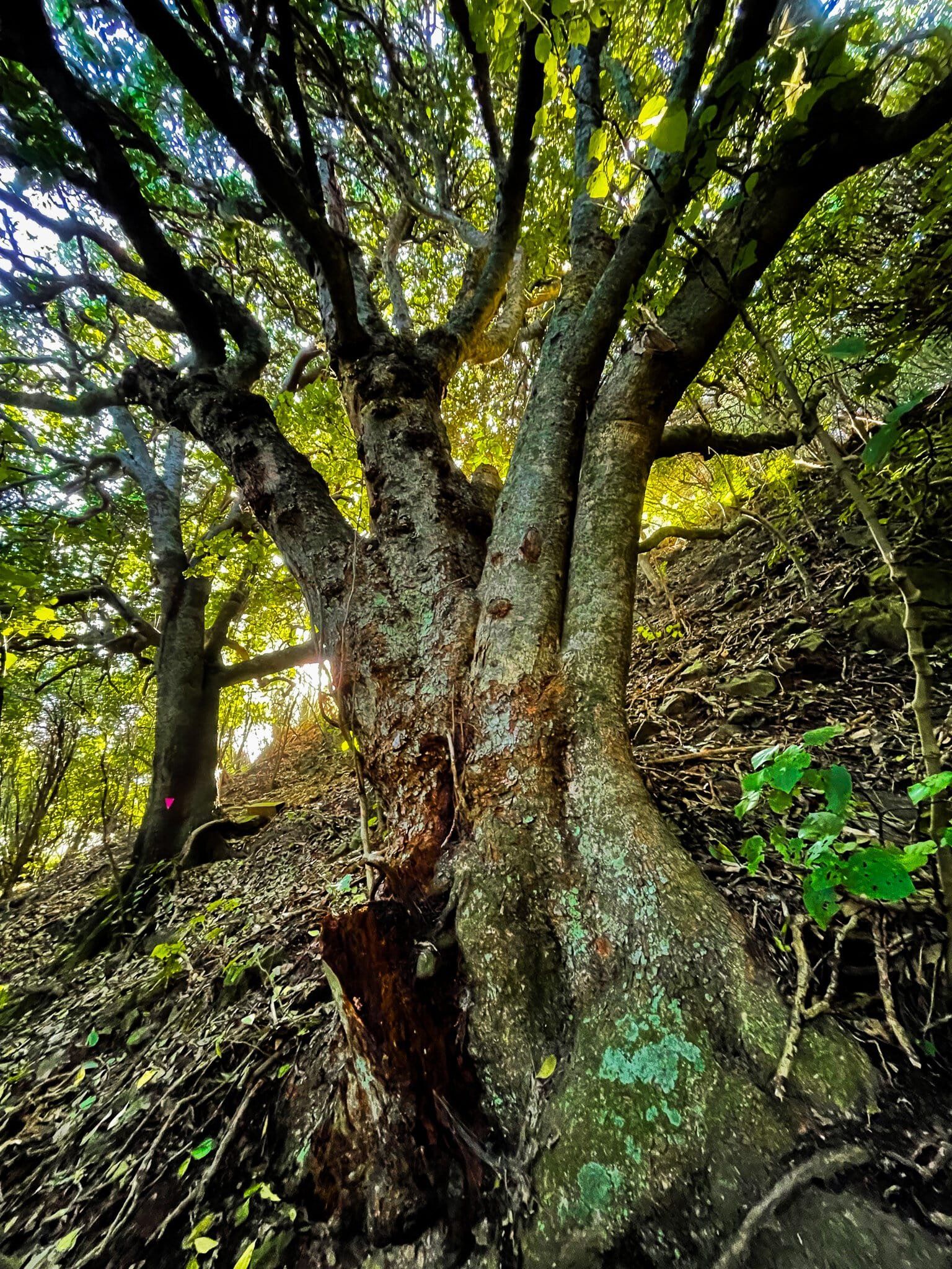
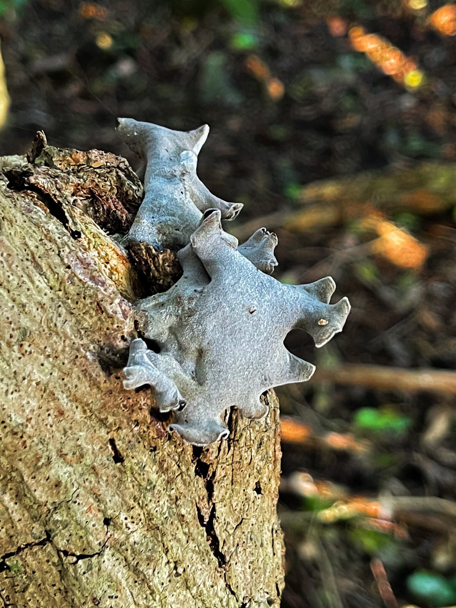
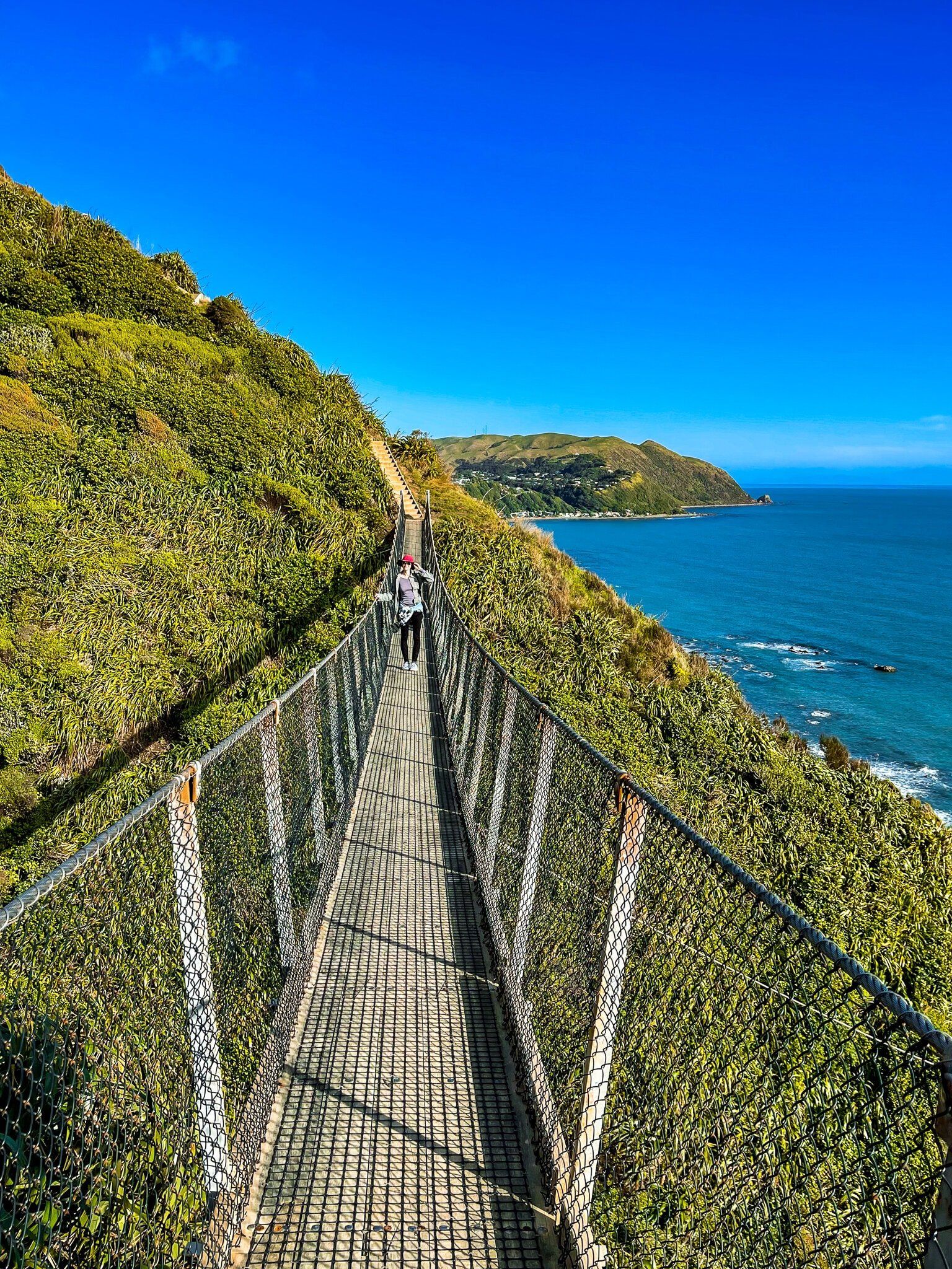
The views are the number one reason for doing the walk, with several lookouts with bench seats along the way. Other points of interest include a section of coastal kohekohe forest (flowering in their unusual way when we passed through), various information panels describing the natural and human history of the area and the two swing bridges towards Pukerua Bay.
The track is mostly exposed to the elements, so try to choose a nice calm day that is not too hot. As it starts and ends next to the local railway stations, you can walk one way then catch the train back (you’ll need cash). We would generally recommend walking north to south, with the sun on your back in the morning. Allow 3 to 4 hours (lots of photo stops) for the walk, wear decent shoes, and take water and some food.
If you have limited time, quicker options include Paekakariki towards the high point, then return, or Pukerua Bay to the swing bridges, or a bit further to the kohekohe forest, then return.
Paekākāriki to High Point
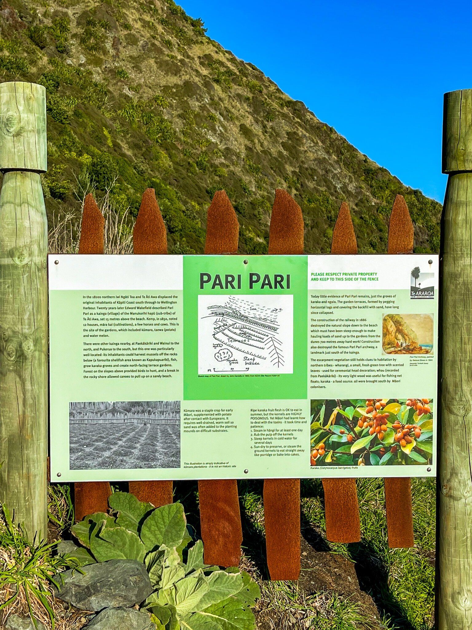
The Paekakariki to high point is the easier of the two climbs. It starts out on the coastal side of the road on the south side of the Paekakariki village rail crossing. The trail meanders for several hundred metres between the coastal road and railway track, then goes under a road bridge to the side of the hill. There is a section of regenerating bush, and then it becomes more exposed with a modest climb to the site of the historic Pari Pari pā site, well marked with informative panels.
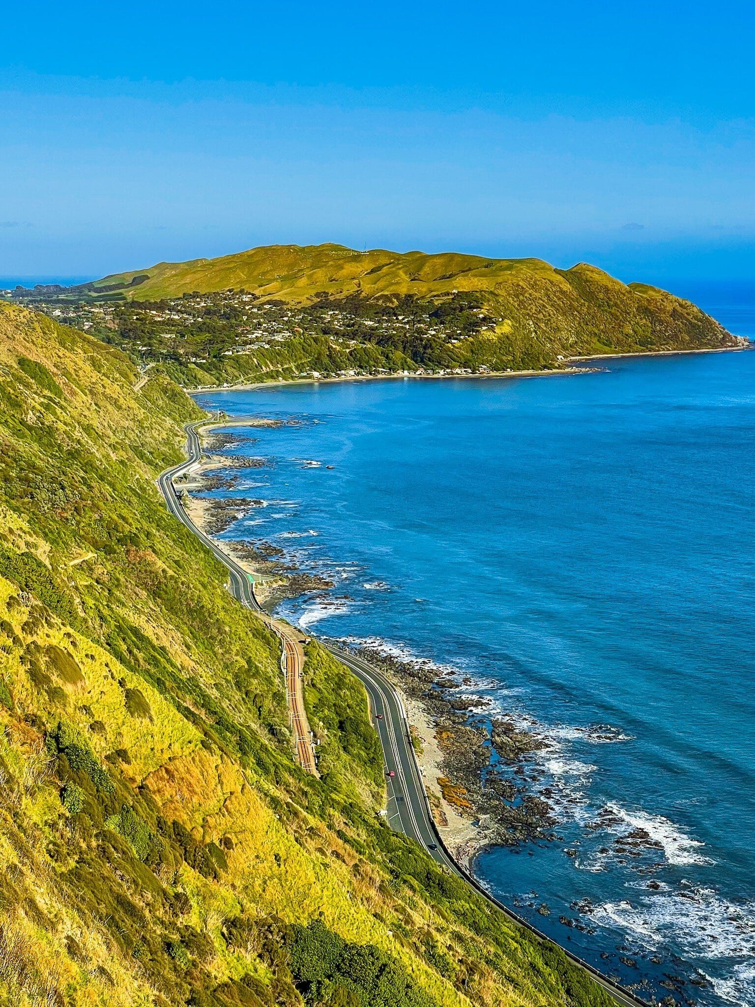
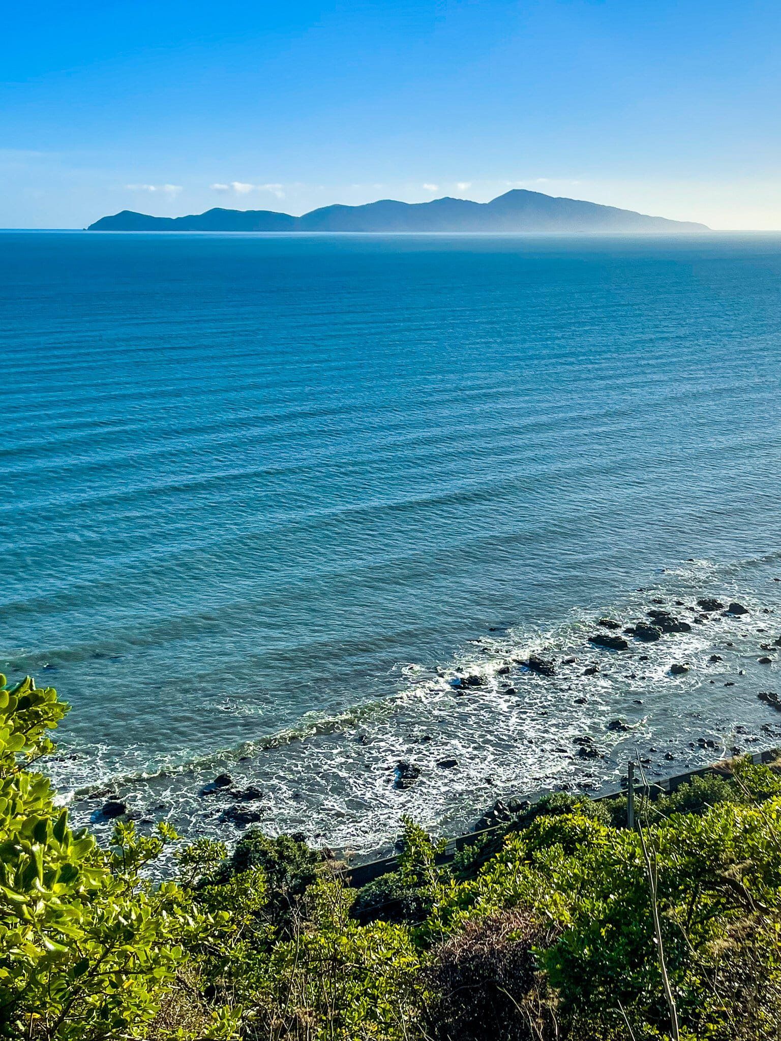
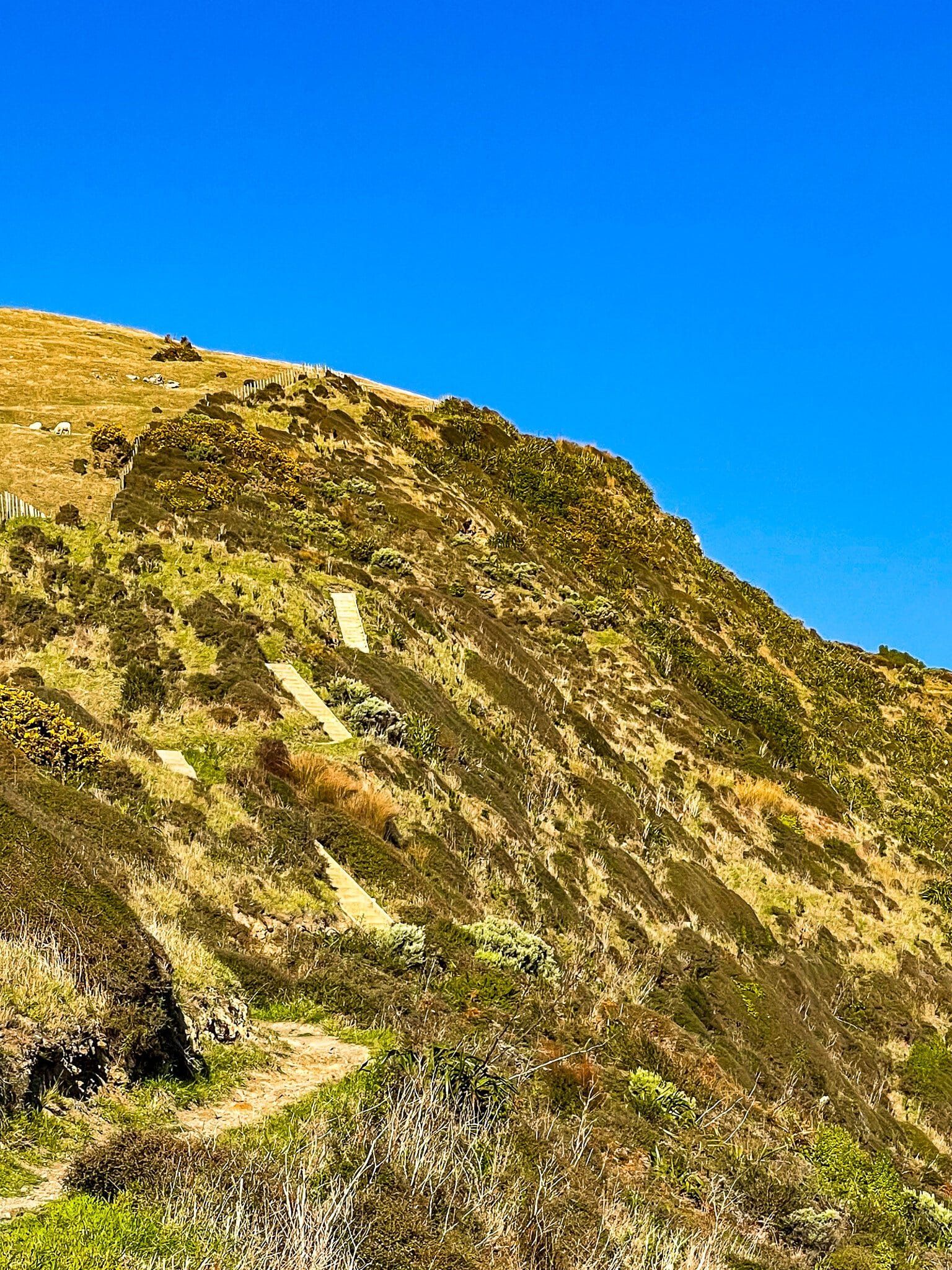
From there, it is downhill to the side of the railway line, then a sharp series of zigzag steps up 80 metres to a viewpoint, with great views north up the coast and across to Kapiti Island. Finally, another series of gentler steps to the high point, with fabulous views all the way.
The highpoint at 220 metres is not quite the top of the hill, and is also short of halfway (about 4 of the 10 kms). Look up to see sheep grazing the area above you! It is a good place to take a break with plenty of bench seating.
High Point to Kohekohe Forest
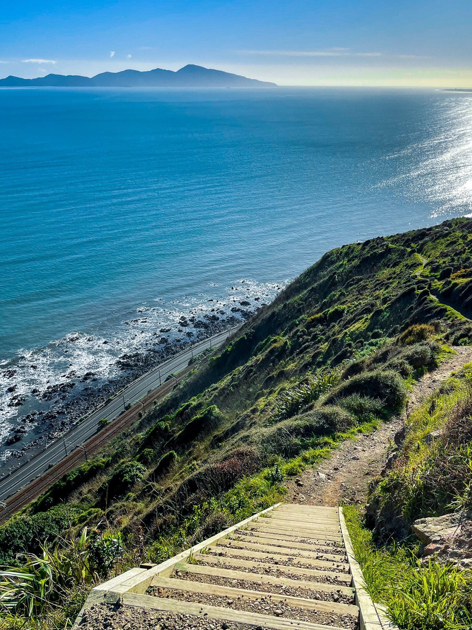
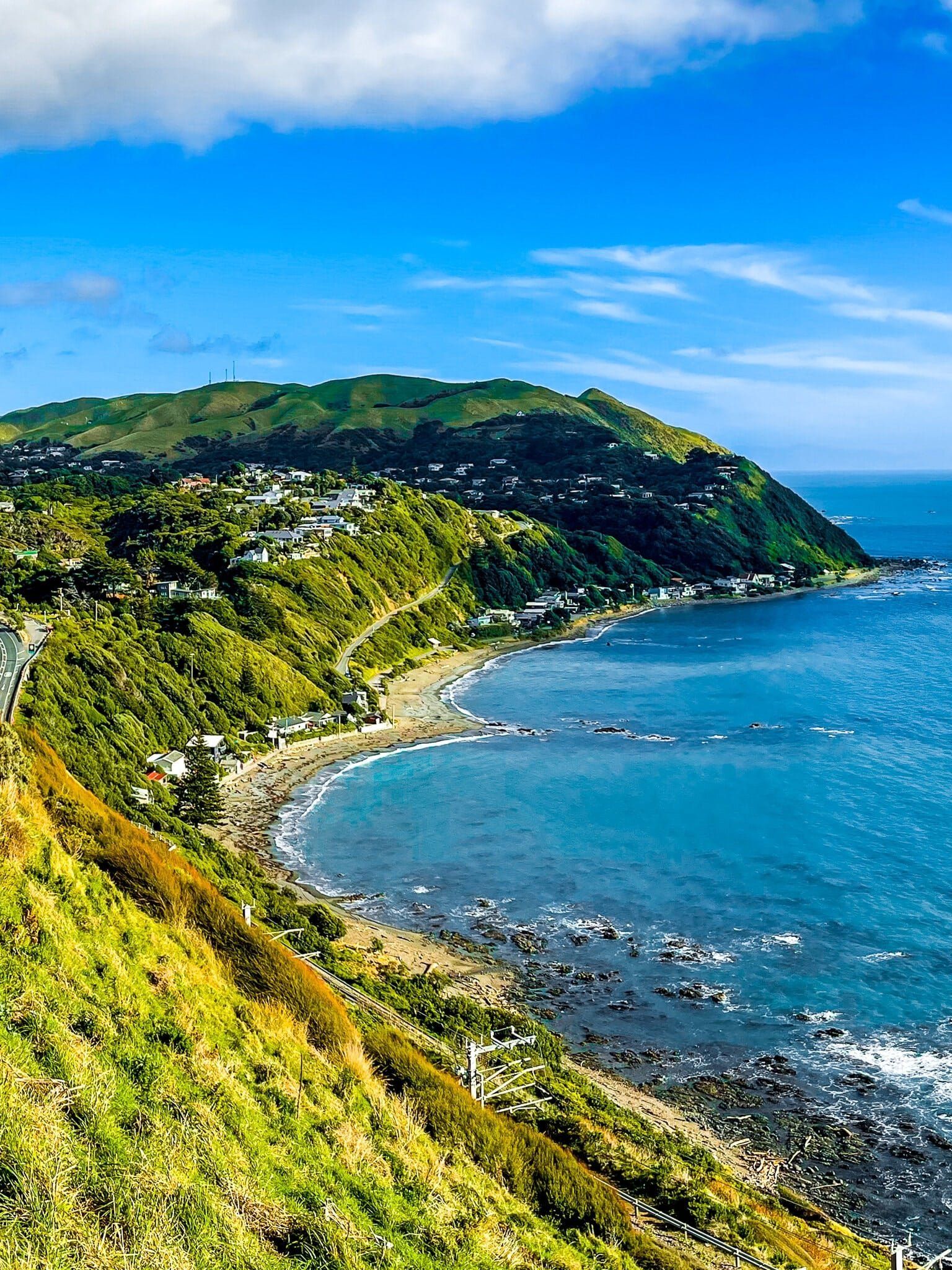
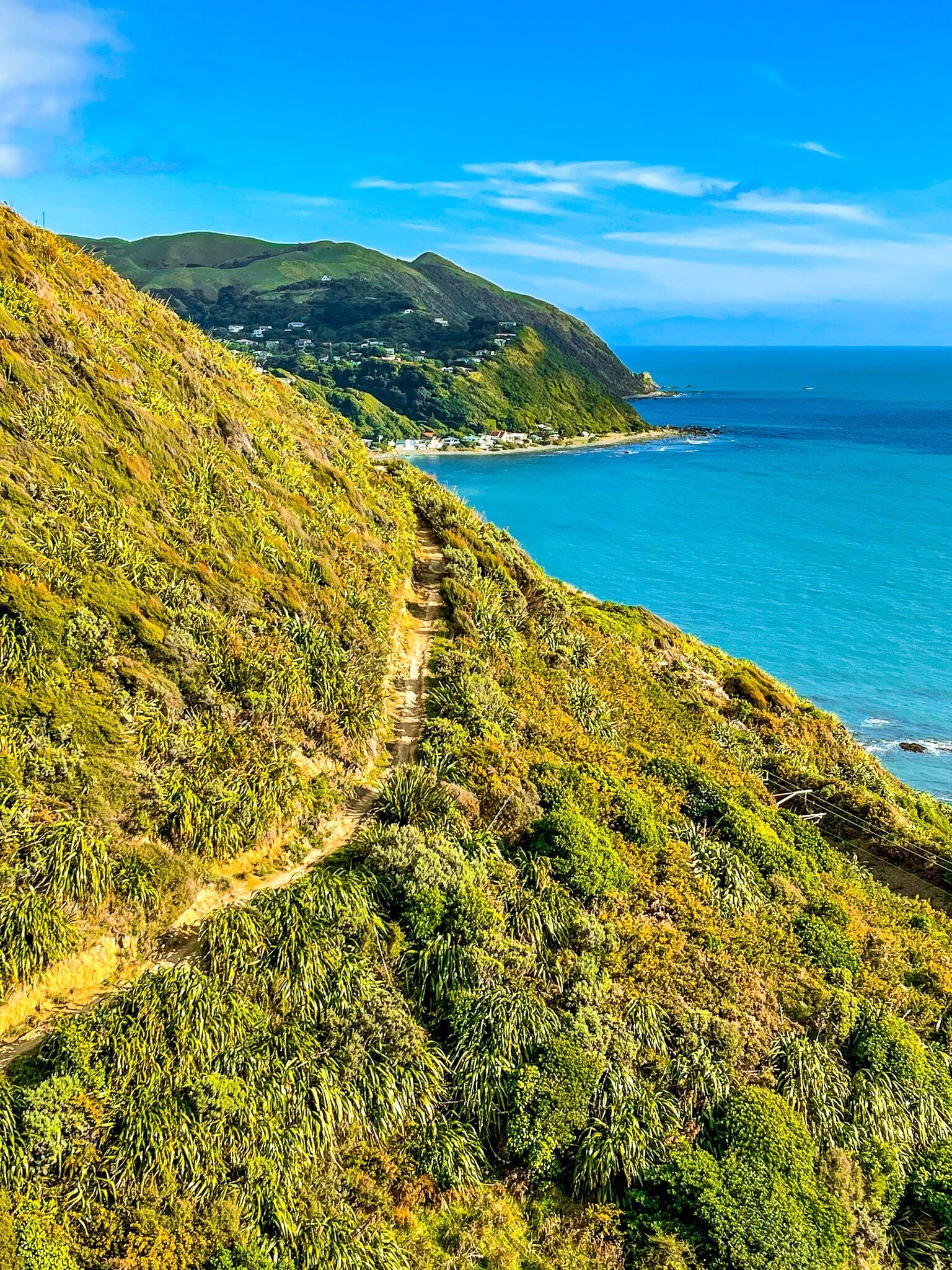
From the Paekakariki high point, there is an immediate series of quite steep steps that quickly drop you down about 100 metres. Our immediate thought was “glad we came the other way”. But from this point you now have better views down the south coast, with Pukerua Bay coming into view.
After the steps, the track meanders quite gently along the side of the very steep hill to a viewpoint sheltered by a section of regenerating bush. More information panels fill you in on the natural and human history of the area, including the tribulations of building the road and railway track around the coast far below you.
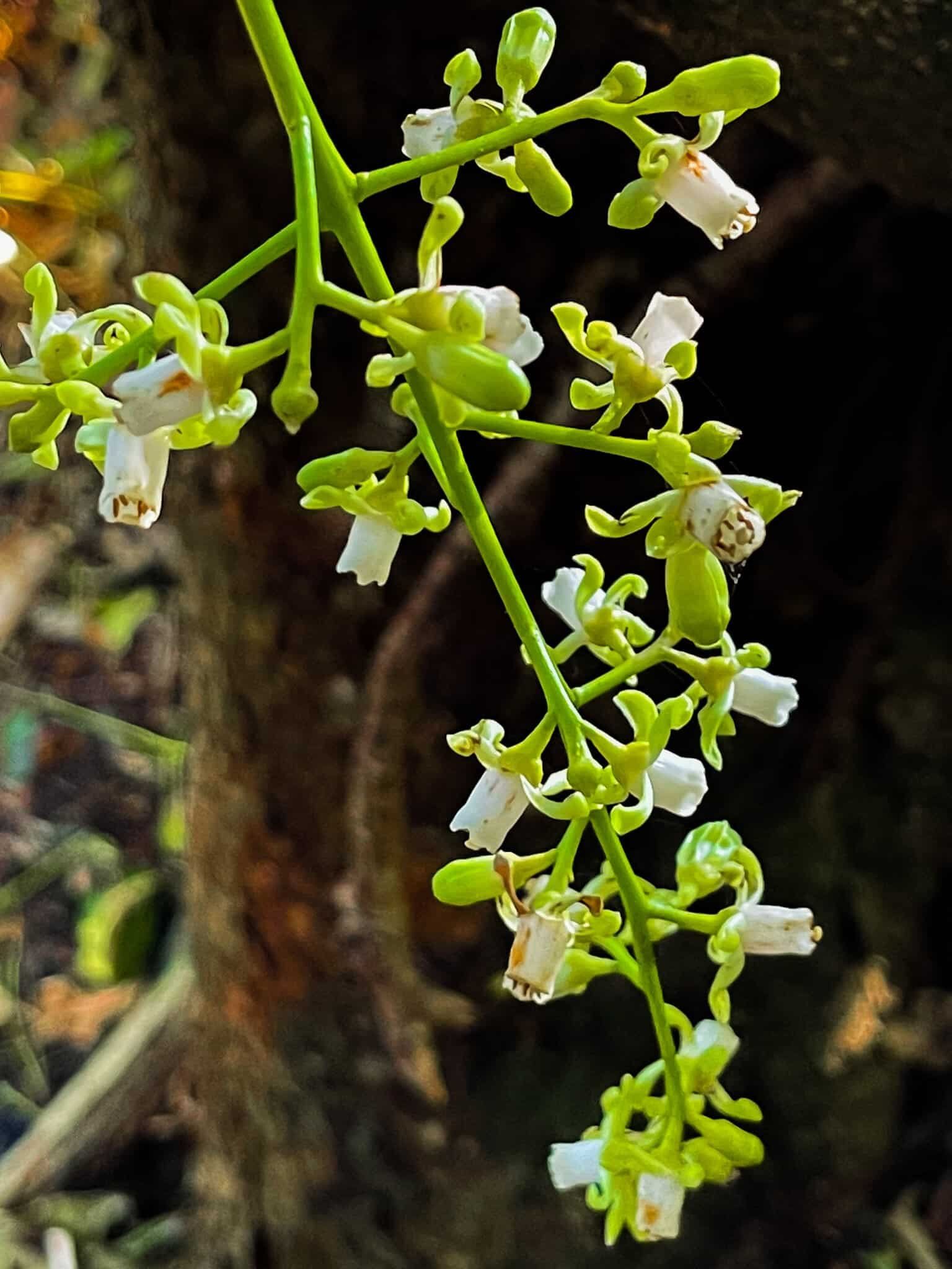
Go a little further and you will find yourself in a striking section of remnant kohekohe forest. We did the walk in early July when the trees were flowering, and one right next to the track was in the late stages of fruiting (an 18-month-long process). Because kohekohe is now relatively uncommon, you generally have to make an effort to see both events.
Swing Bridges to Pukerua Bay
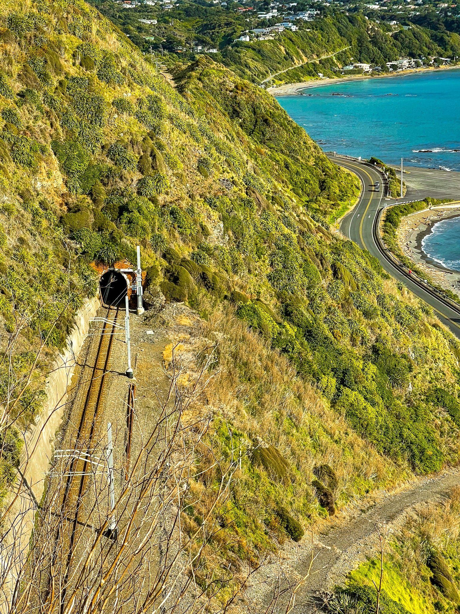
You reach the first swing bridge shortly after the kohekohe forest, after another steep but short series of steps down. The bridge crosses a ravine on the side of the hill, then it’s a short sharp climb up, then a flattish section to the second bridge that crosses another ravine. The view from above this bridge is particularly cool, taking in the bridge, a railway tunnel and the coast.
There is a bit more damage on this section of the track. This is typically caused by small slips that have not been entirely cleared. There are warning signs in the worst places, with safety ropes where needed. One section of the track was closed for repairs and there was a higher bypass (with ropes as needed) to get around the damaged area.
By this stage, you can see Pukerua Bay very clearly and the end is in sight. Unfortunately, once you hit the flat section above the railway line it is still almost one km to the train station, part of which is through suburban Pukerua. The trains come every half hour on the weekends, so you shouldn’t need to wait too long if you are planning to head back via rail.
Want more Trip Ideas?
Check out our blogs on the Kapiti Coast, Atakarawa Road to Wairarapa, and Outdoor Adventures in Wellington.