
Here’s a selection of shorter walks on the east side of the range and in the gorge. Several of these walks provide a great combination of regenerating native forests with old tramlines, tunnels, mines, and the general detritus of an industrial past. Others are just stunningly beautiful, including Wairere Falls and the central section of Karangahake Gorge.
You should also consider touring this area by bike – everything covered here is easily accessible from the Hauraki Rail Trail.
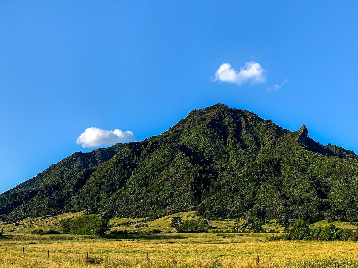
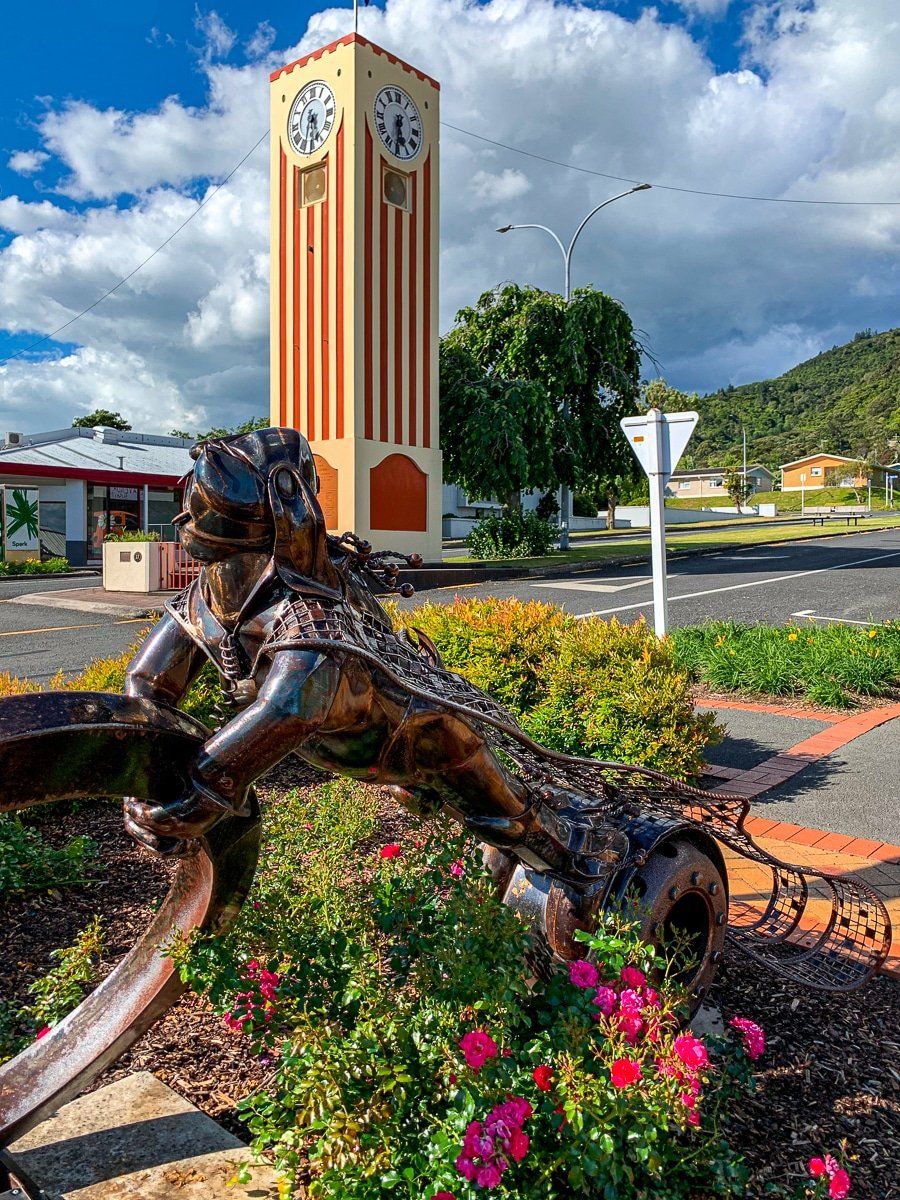
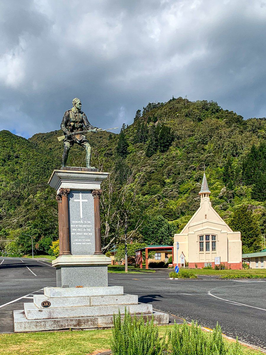
Te Aroha
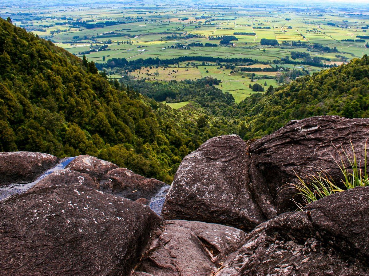
Te Aroha, meaning “the love”, was one of the earliest tourist towns in New Zealand. The town of Paeroa, at the entrance to the gorge, is now more substantial, but it’s Te Aroha that we were interested in – it provides direct access to Mount Te Aroha, the highest point of the range at 953 metres.
If you want to hike to the top of Mount Te Aroha, it’s around 750 vertical metres from the domain and about six hours return. A shorter option is the 200 vertical metre climb to the Whakapipi viewpoint on the same track. There are also other, more lengthy routes up Mount Te Aroha from the north and south of town.
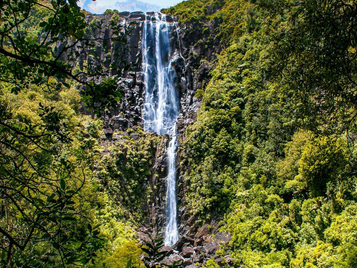
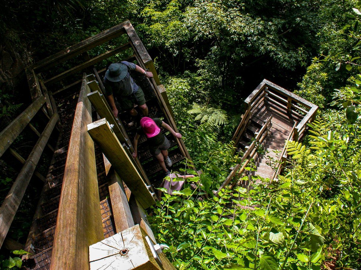
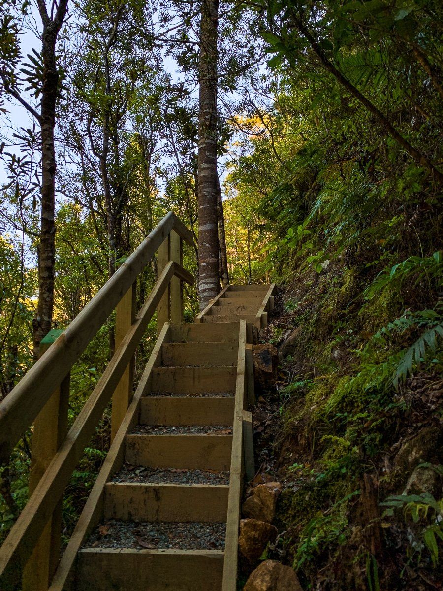
Wairere Falls
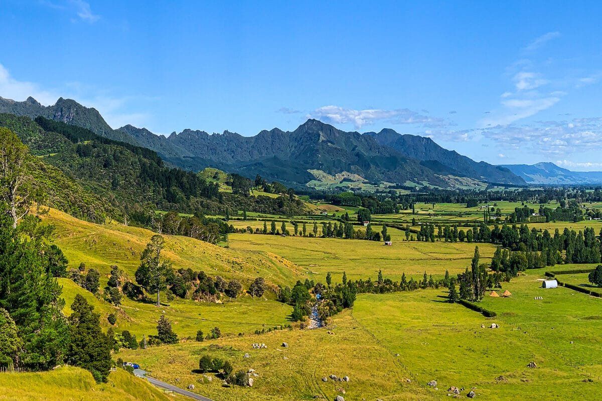
The Wairere Falls are beautiful waterfalls toward the southern end of the Waimai Range. Unusually for New Zealand, you can see them from quite a distance on the Hauraki Plain – but that’s no excuse not to do the hike, which is one of the best day walks in the North Island.
Start with the shorter walk to the base of the falls, then hike up to the top – it’s about three to four hours in total. There are plenty of stairs to help you reach the top and amazing views across the Waikato. The main south-to-north Kaimai tramping track also connects with the Wairere Falls track.
To get to the start of the walking track, take the Te Aroha to Gordon Road from Te Aroha; the road ends at the falls car park.
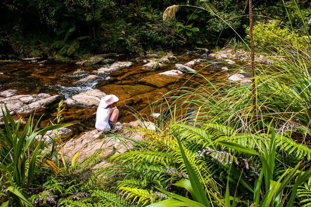
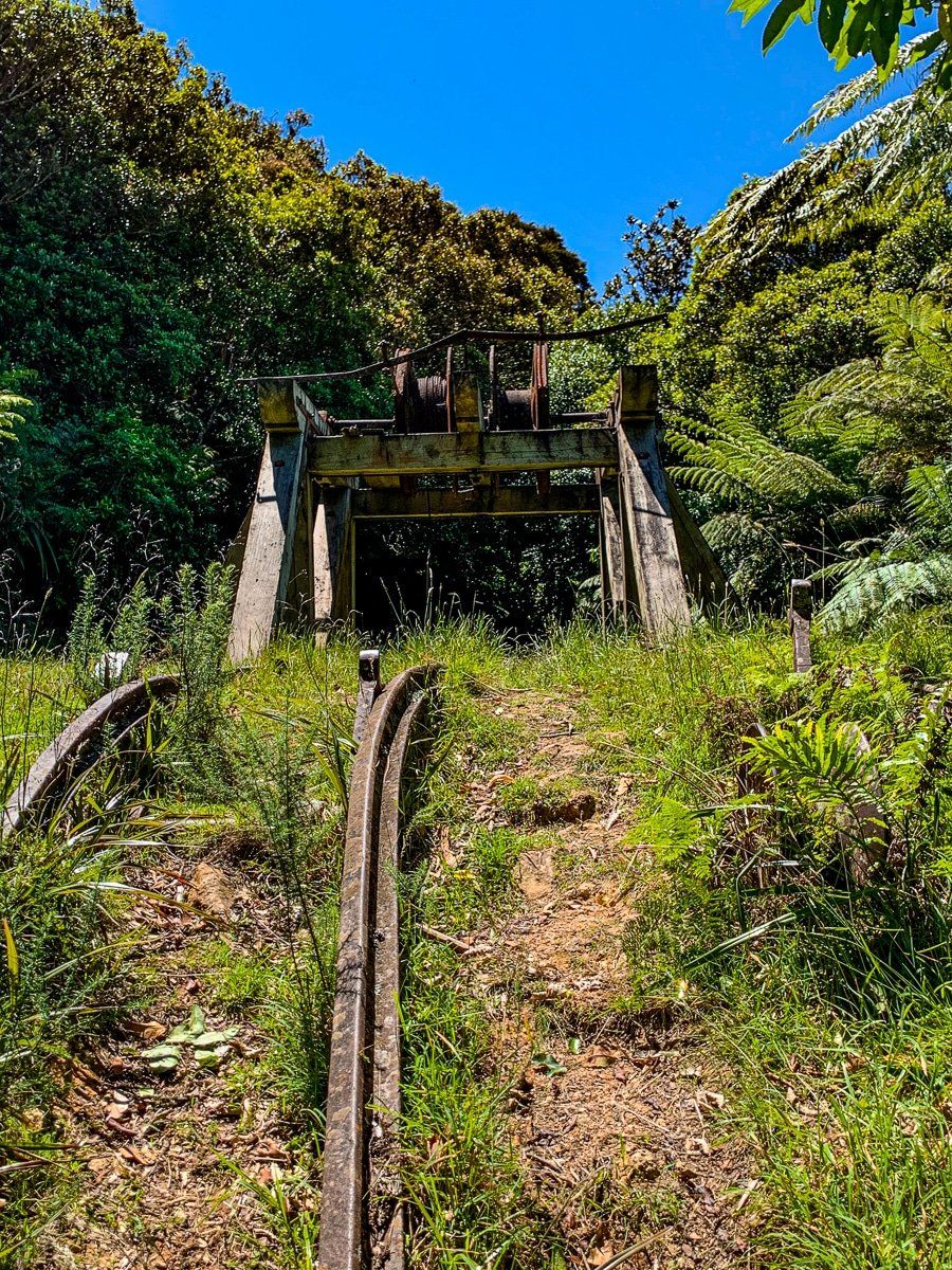
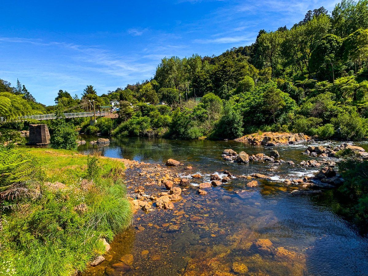
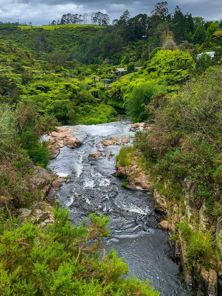
Waiorongomai
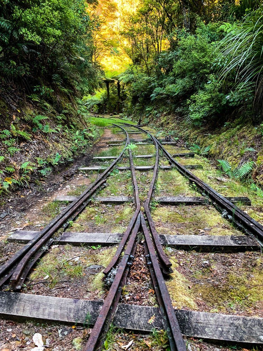
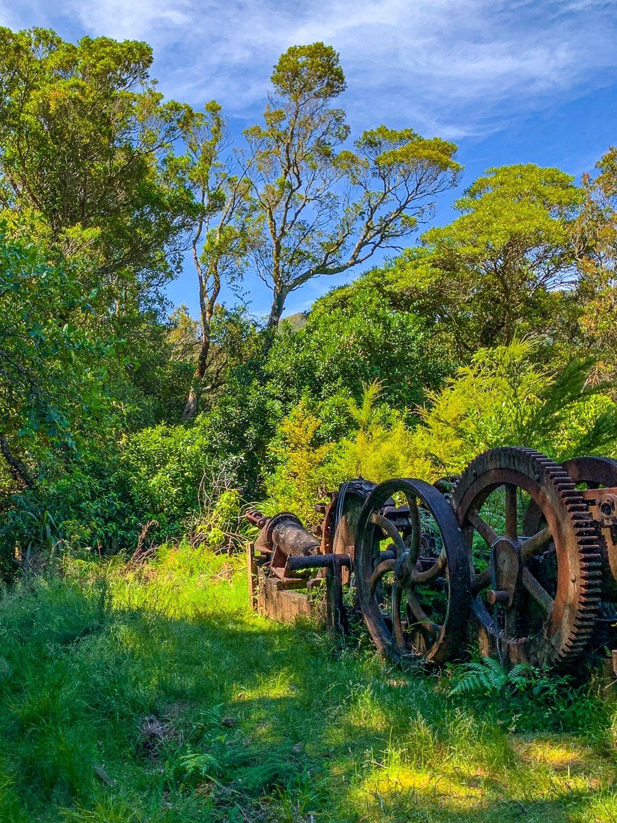
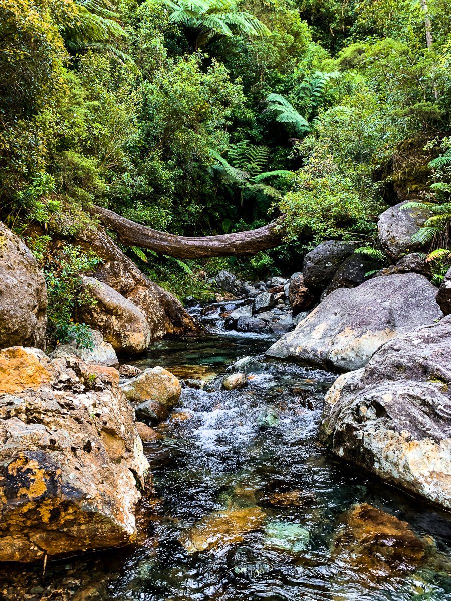
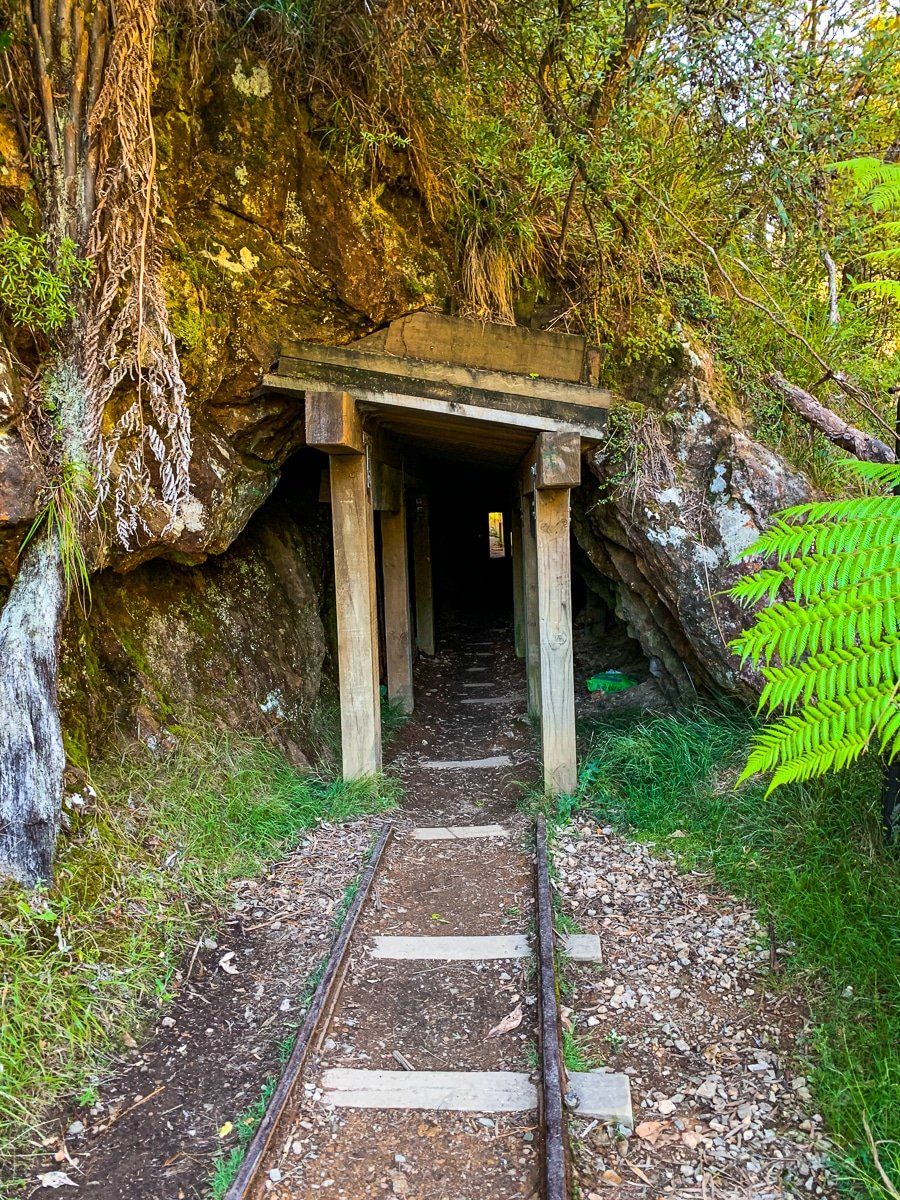
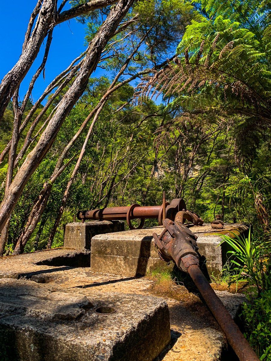
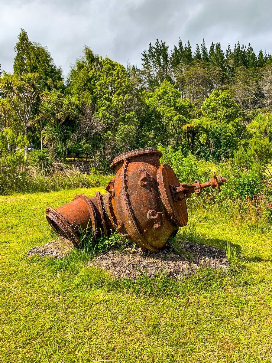
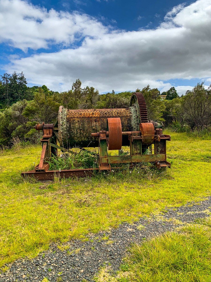
There’s a fantastic series of walks along and above the Waiorongomai Valley. On the northern side, there are the slopes of Mount Te Aroha. The tracks were carved out during multiple failed attempts to commercially mine gold. They include old tramways and several very steep inclines that were created for gravity-driven trams, including the hikeable Butlers. Throughout the walks there’s evidence of gold mining – tram tracks and tunnels, rusty mining equipment and old mineheads and mineshafts. There are also multiple waterfalls where the forest is gradually reclaiming the area.
Check a map carefully to choose your route and match it to the time you have. Some options are very steep and involve stream crossings, whilst others are mostly flat and straightforward. To get there, take Waiorongomai Road off Te Aroha Gordon Road.
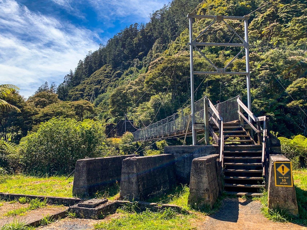
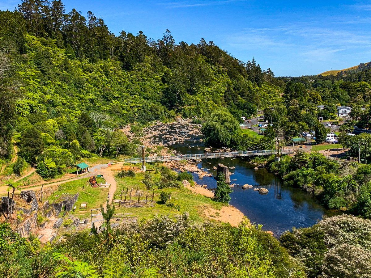
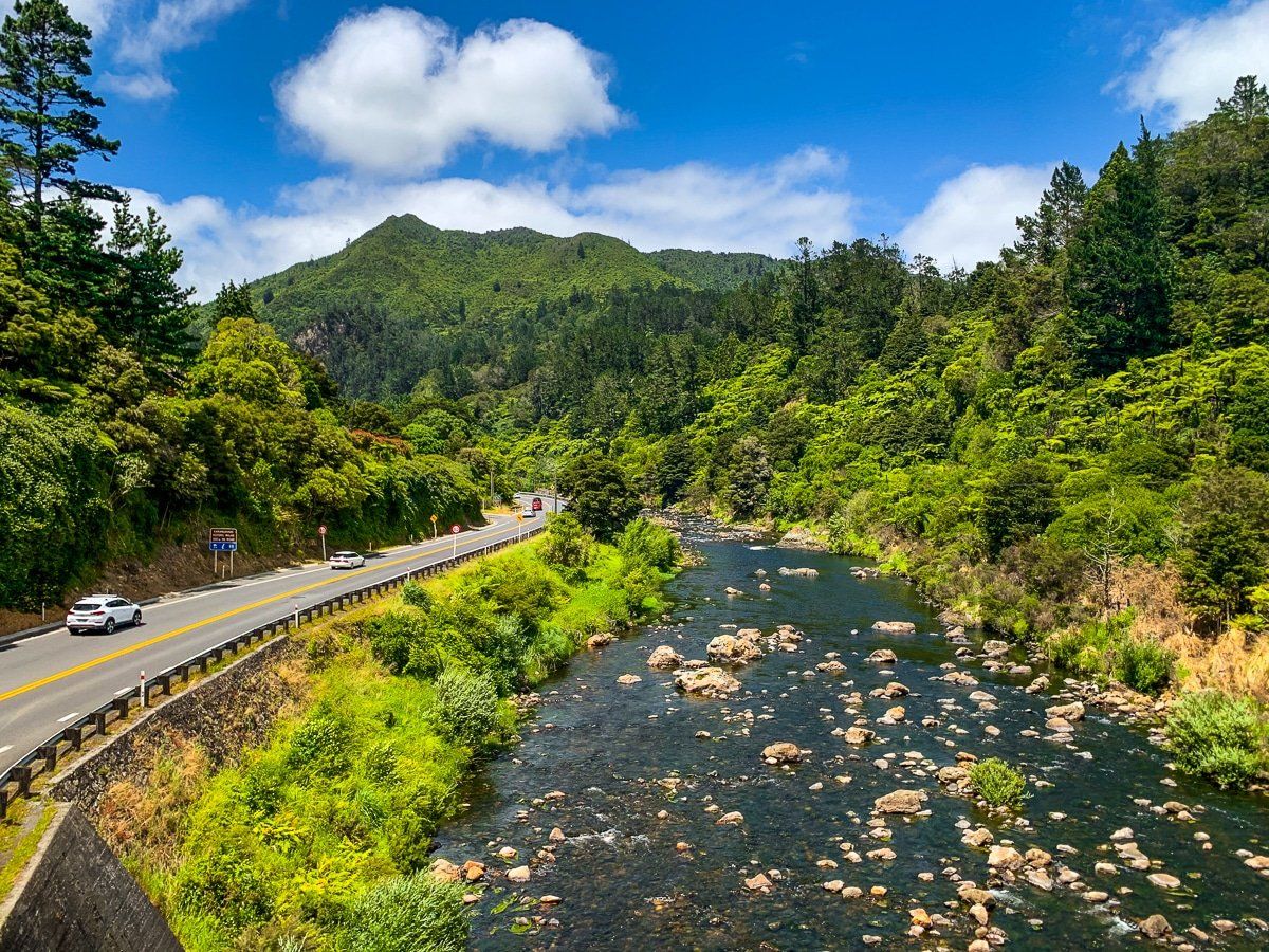
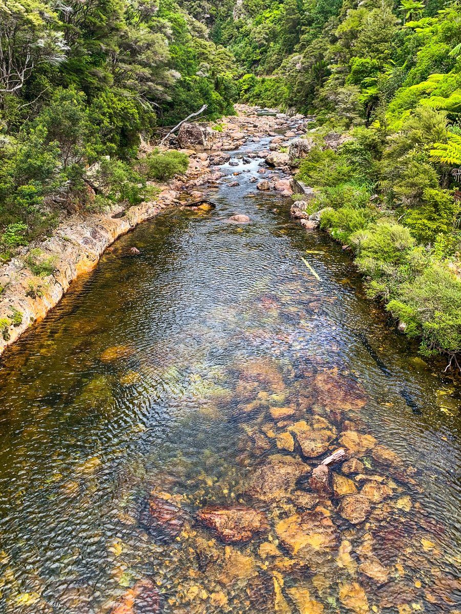
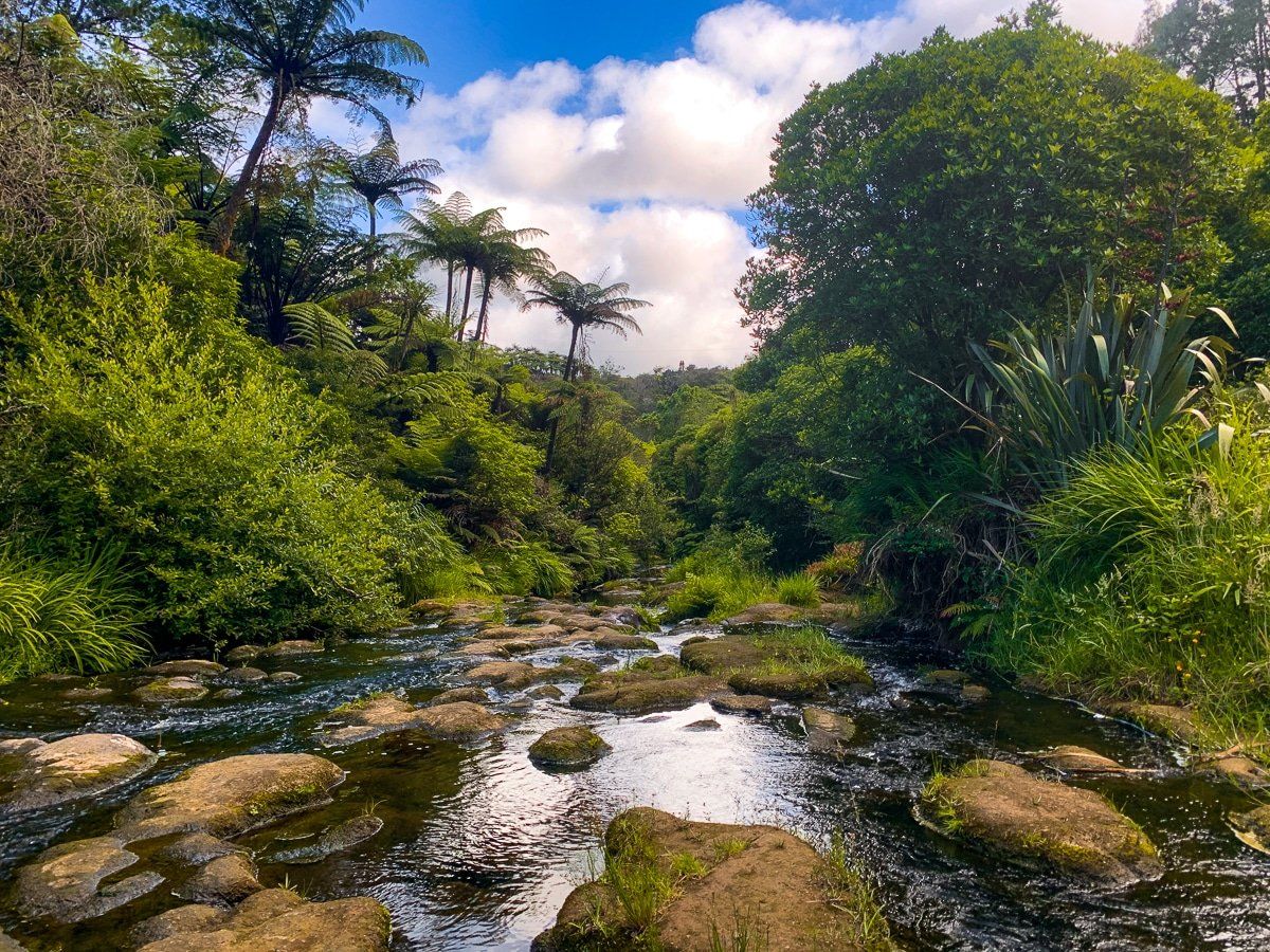
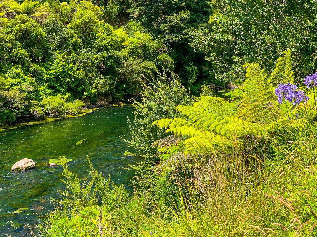
Karangahake Reserve
The Karangahake Reserve is the central reason for a visit to the Karangahake Gorge, and you can drive there or bike in on the Hauraki Rail Trail.
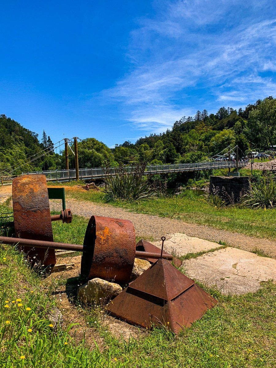
Around the reserve there’s abundant evidence of the extensive gold mining from the eighteen and nineteen hundreds. This was a major industrial centre for early New Zealand which resulted in considerable ecological damage, although today the rivers and bush are starting to recover. The short walks from the reserve are superb, as well as being a point of access to longer hikes around Mount Karangahake, Te Aroha and the multi-day tramps across the range.
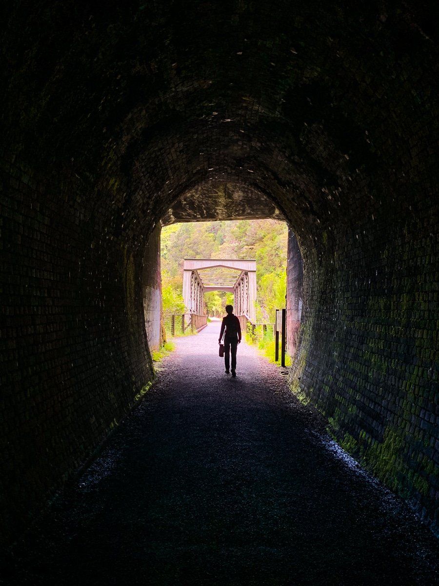
Windows Walk
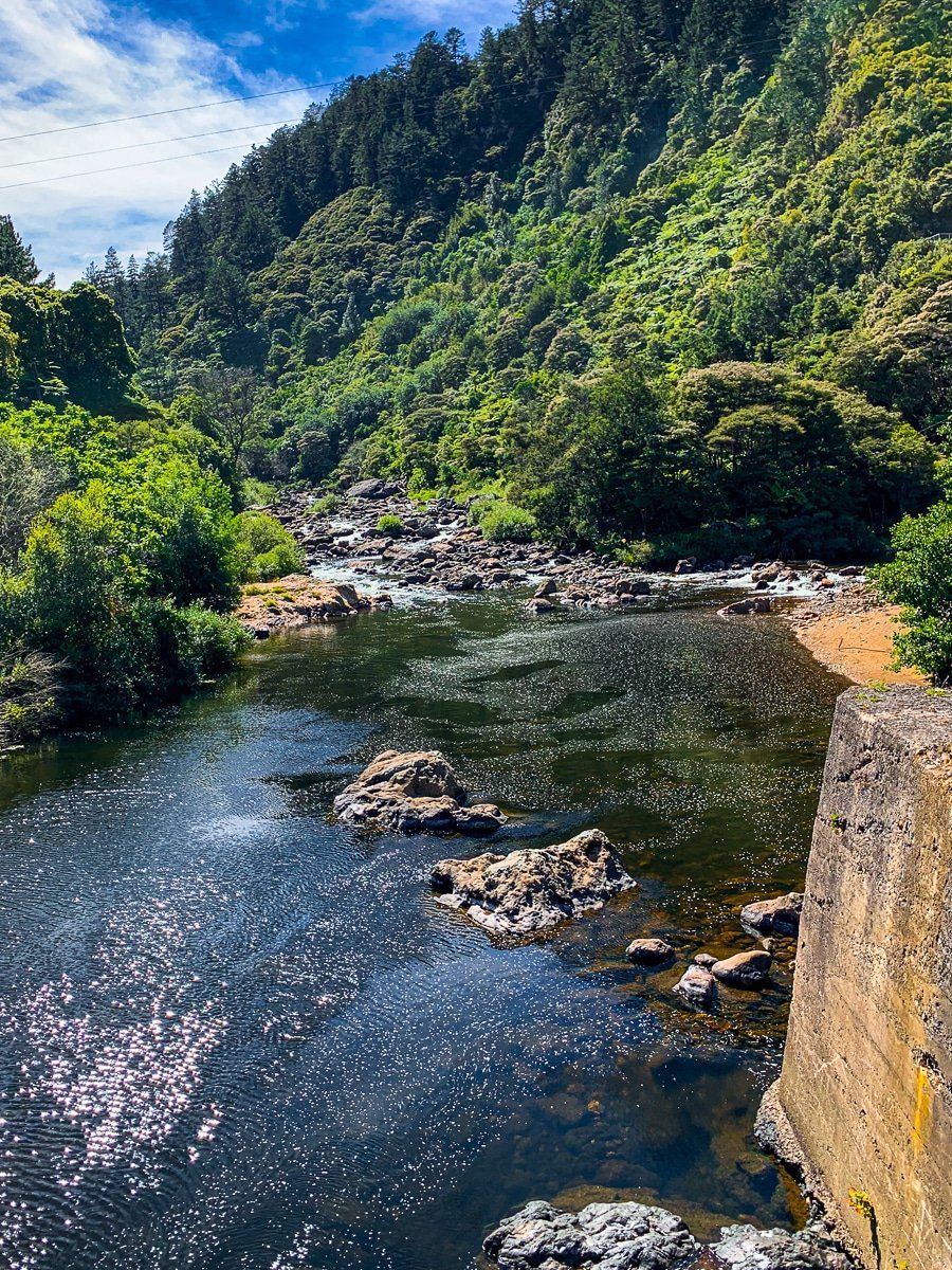
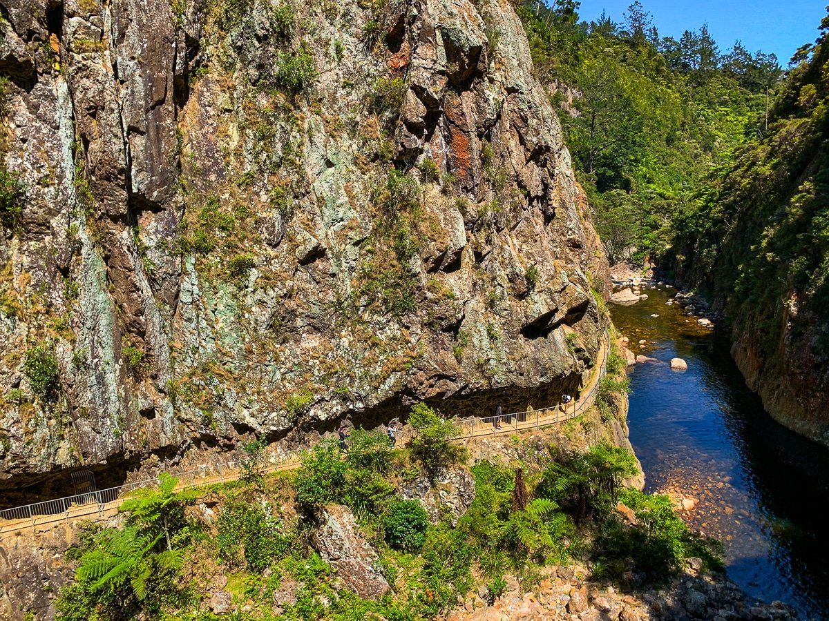
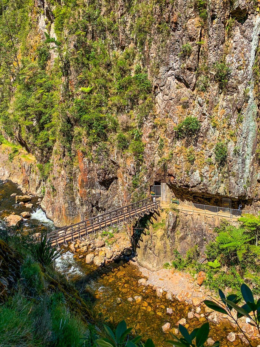
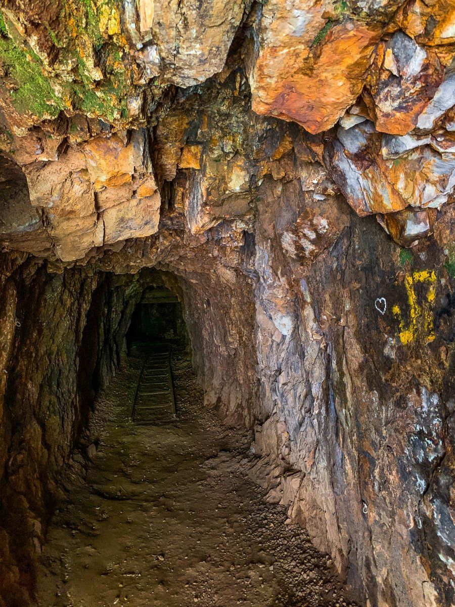
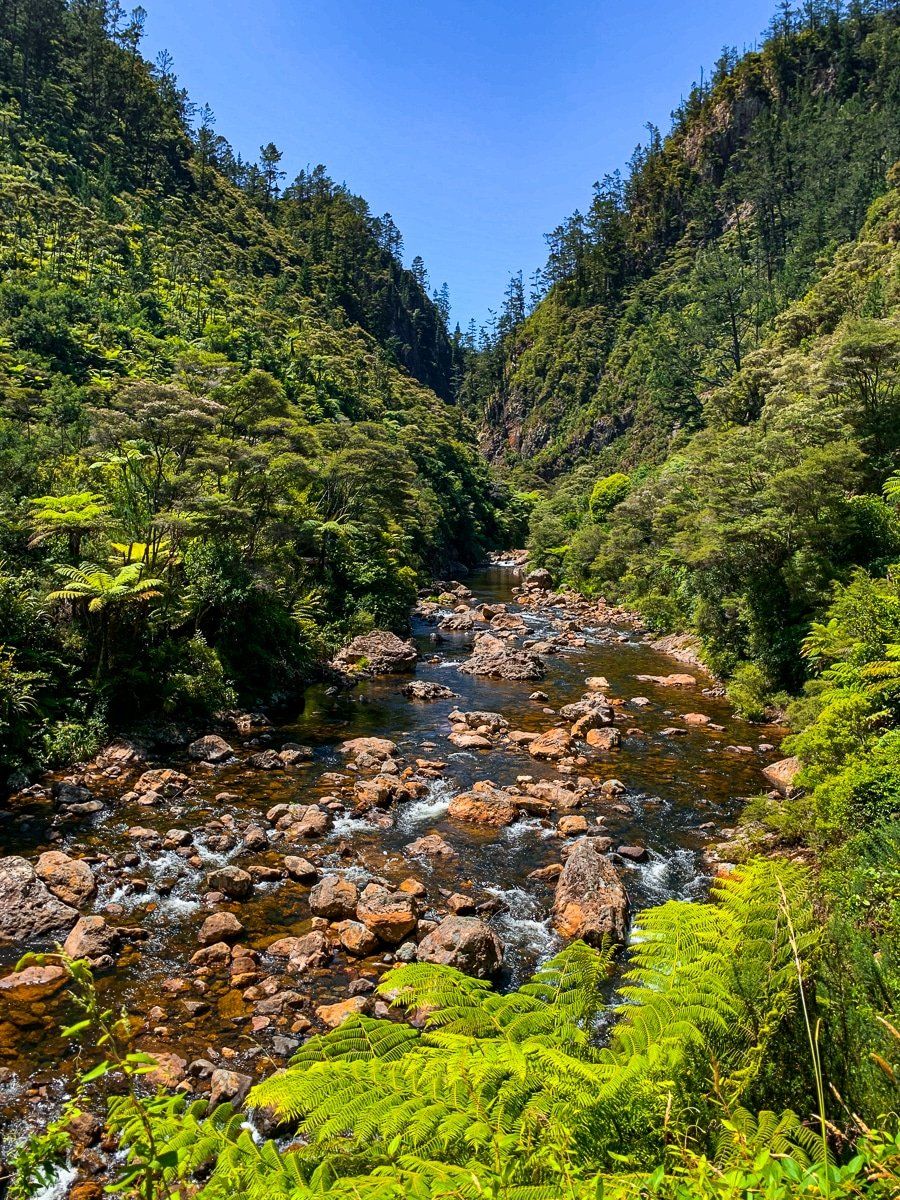
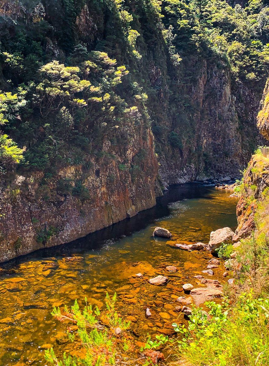
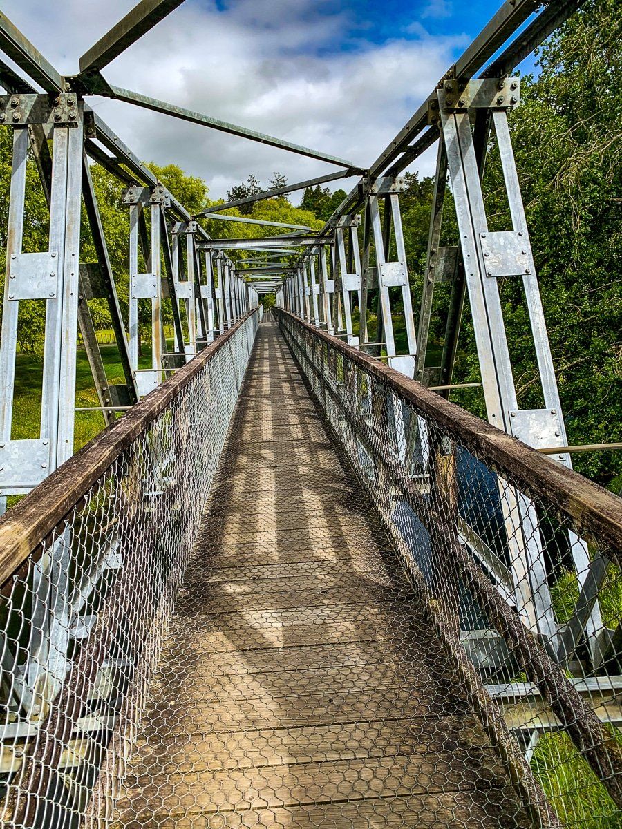
Probably the most popular hike in the Karangahake Reserve is the Windows Walk. It truly is a must do, combining mining history, great views and river gorges – and it’s only about an hour for the loop.
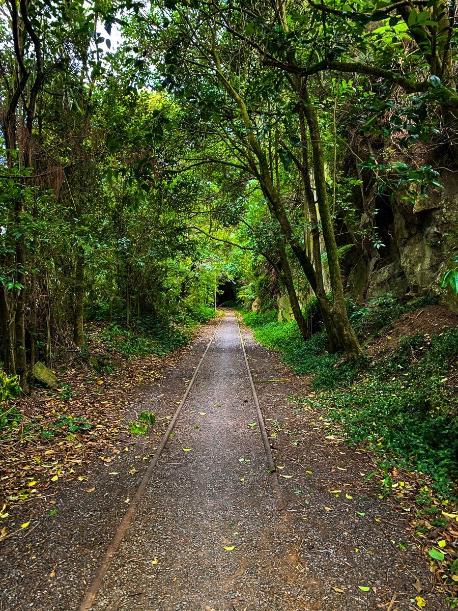
The walk follows a tramway that enters an old gold mining tunnel inside the cliff on the eastern side of the Waitawheta River. Inside the tunnel, there are various points where “windows” were cut in the side of the cliff. You can also explore the odd mine shaft, but take a good torch as your phone light will only get you so far. After the tunnel, you can continue on the east side of the river gorge for a while, or cross over to the other side to return to the reserve.
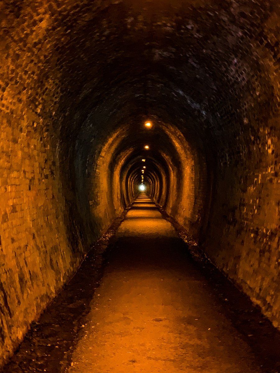
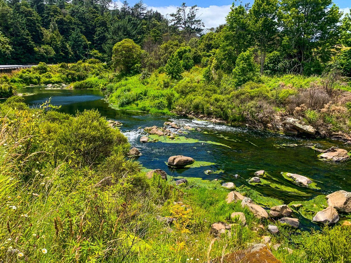
Karangahake Loop
From the reserve, walk north towards the hamlet of Karangahake along the shared cycle and walking trail on the west side of the Ohinemuri River. Alternatively, park in Karangahake by the community hall and start there.
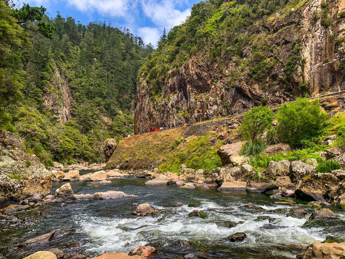
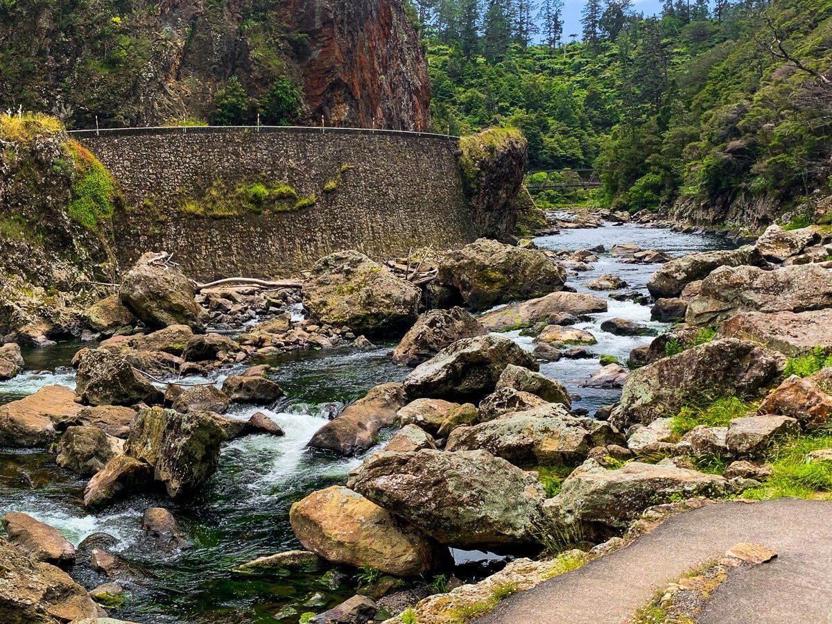
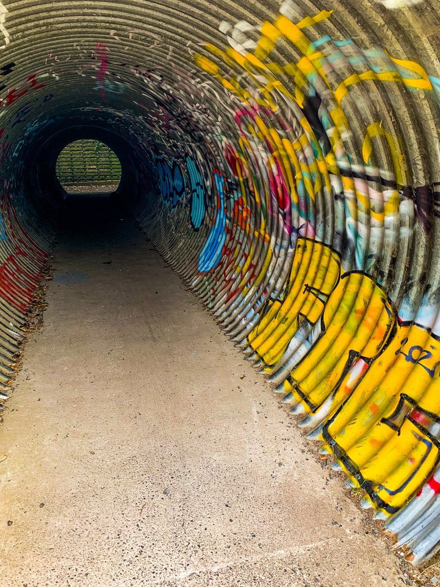
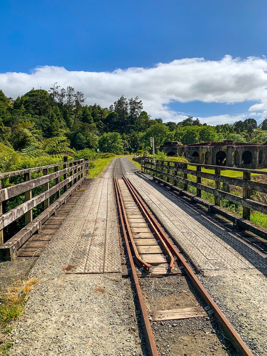
From Karangahake, cross the river and highway on the shared path and walk through the 500-metre tunnel. At the end, cross over the second bridge to the west of the river, then follow the walking track north back towards Karangahake Reserve.
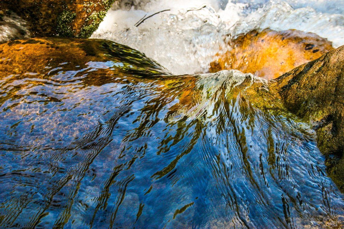
The walking track after the tunnel is the only way to get a real sense of the rapids that run through the tightest section of the gorge, and the engineering that was required to build a road and railway line to the Bay of Plenty.
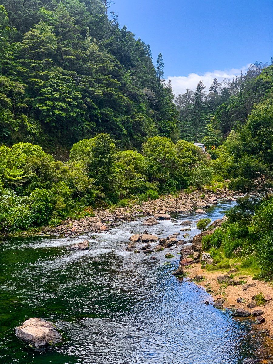
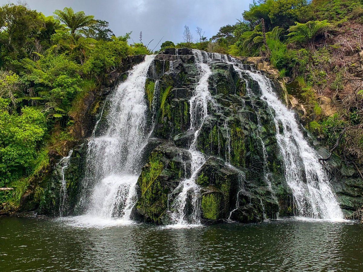
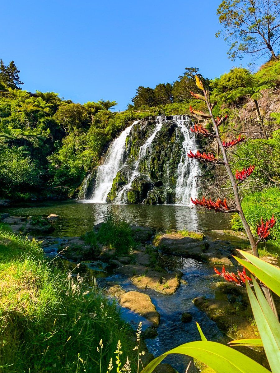
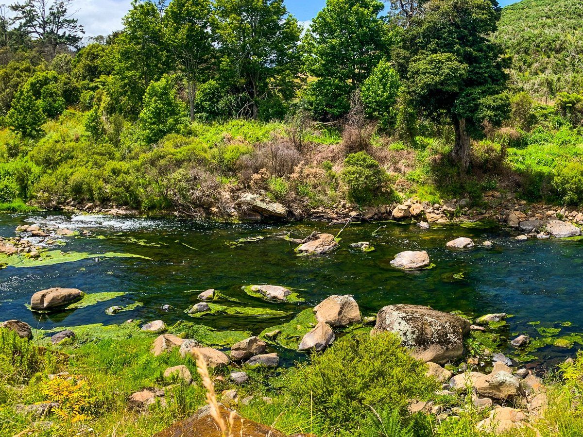
Owharoa Falls
Owharoa Falls is probably one of the prettiest waterfalls in New Zealand, with its unique fan-like shape. To reach Owharoa Falls, continue along the gorge to Waitawheta Road – you can get there by car or along the bike trail. There’s an obvious parking area, then a short walk to the falls.
If you continue up Waitawheta Road and stop near the bridge above the falls, you will also see a series of smaller falls. You can also drive from Waitawheta Road onto Dickey Road, then down to a lovely campground at Dickey Flat. From here you can connect to the Windows Walk and access the other trails around Mount Karangahake, plus other tracks on the north east side of the range.
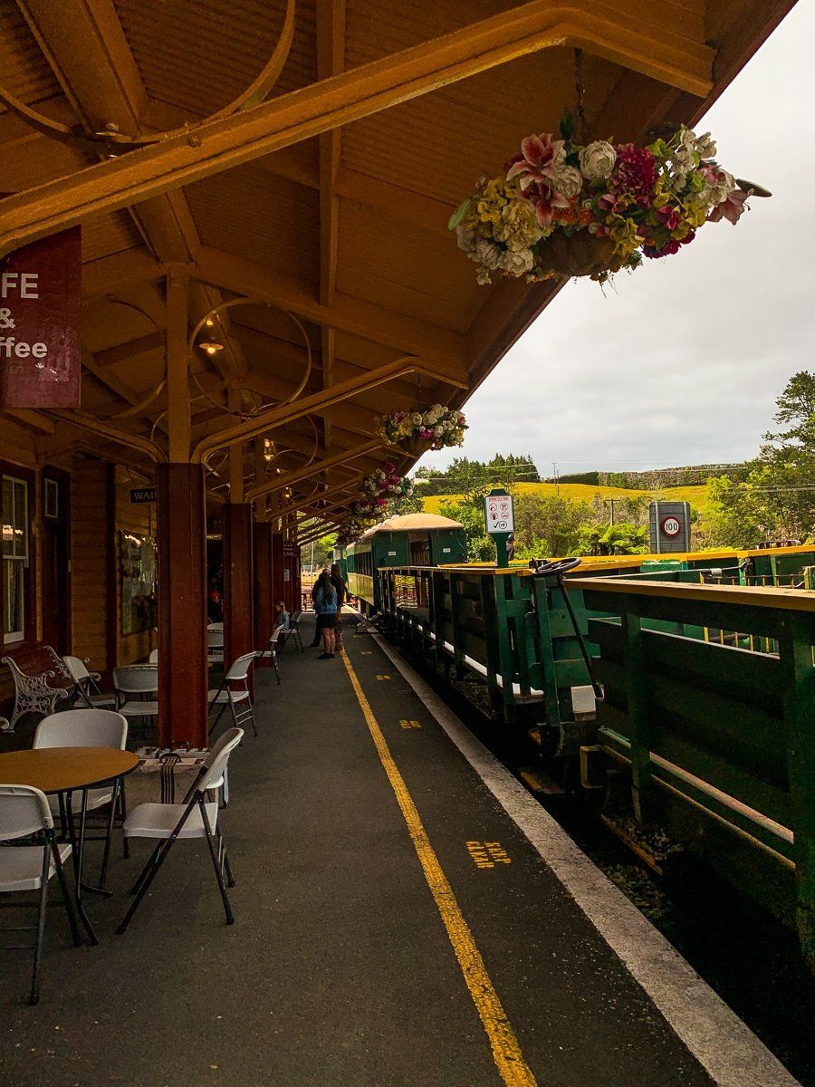
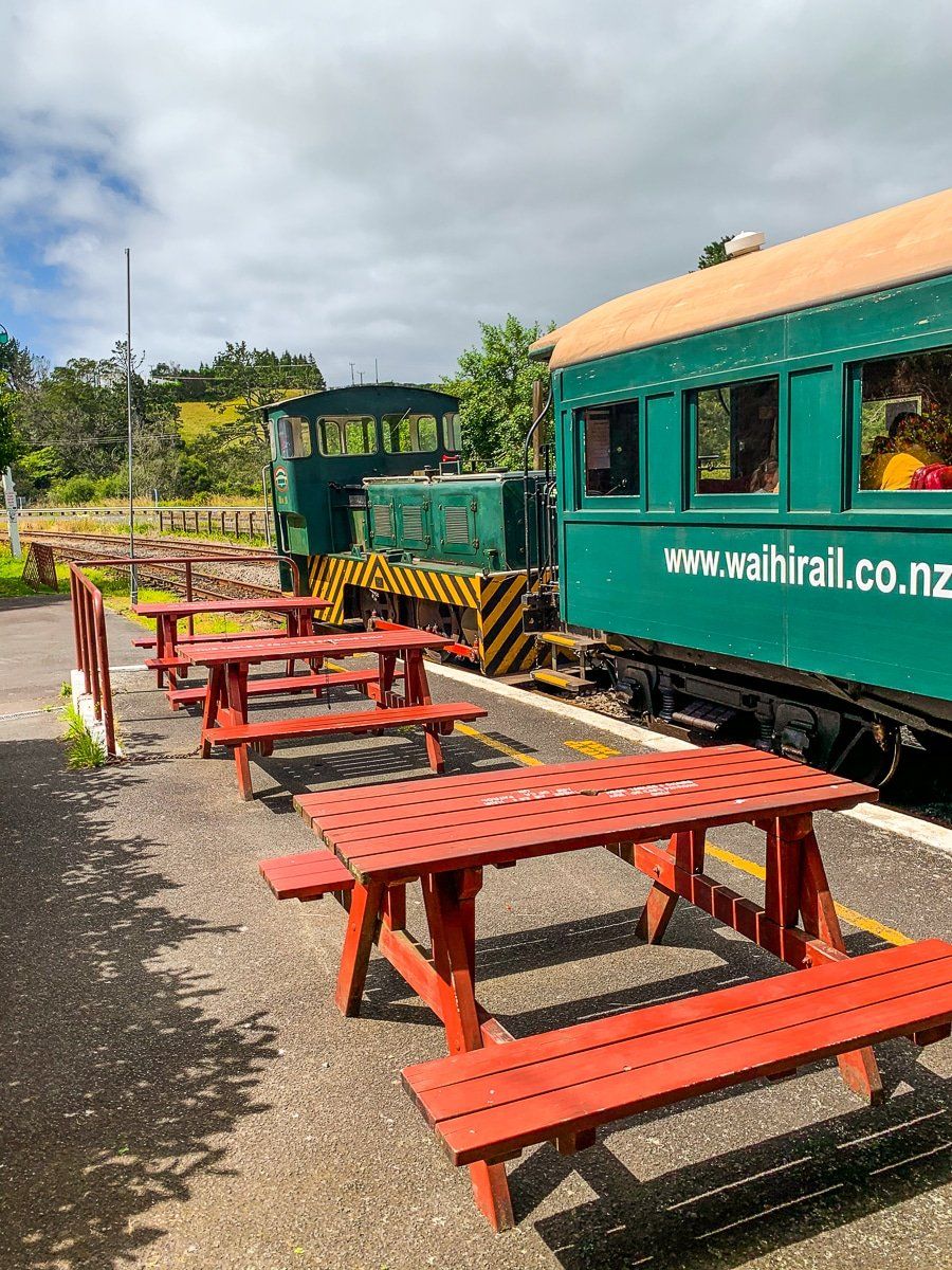
Waikino
Waikino’s main attraction is the old rail station next to the road, plus easy access to Victoria Battery. There’s a cafe and a tourist train to Waihi that currently operates on a daily basis, but check the website for the train timetable in advance!
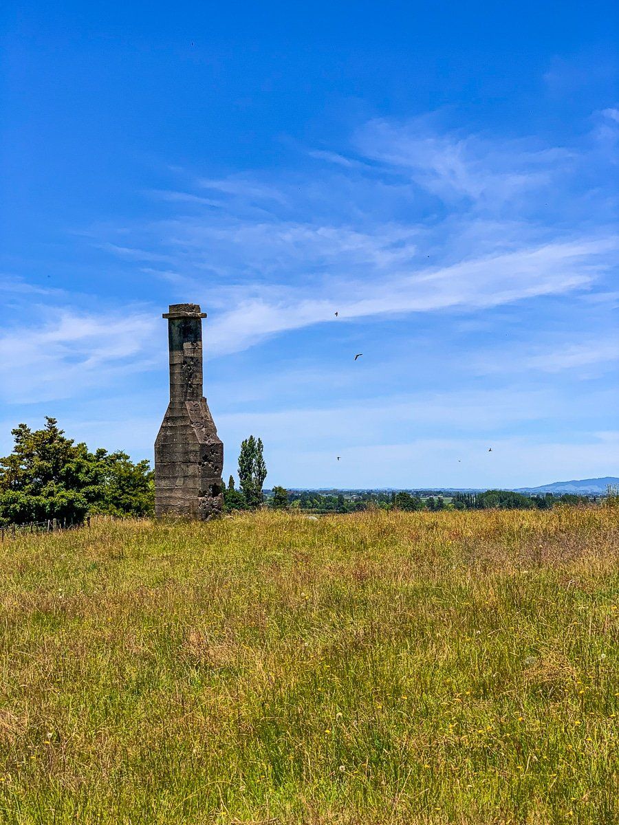
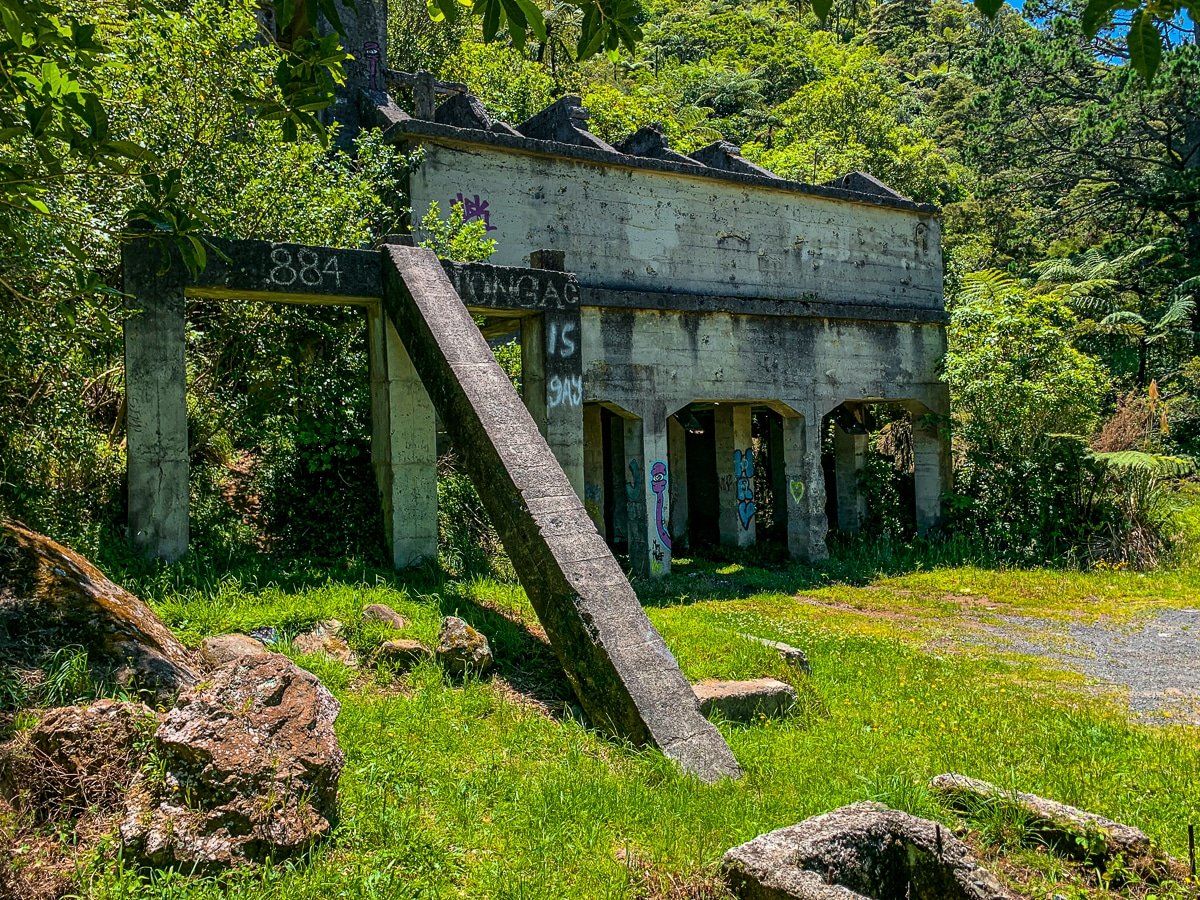
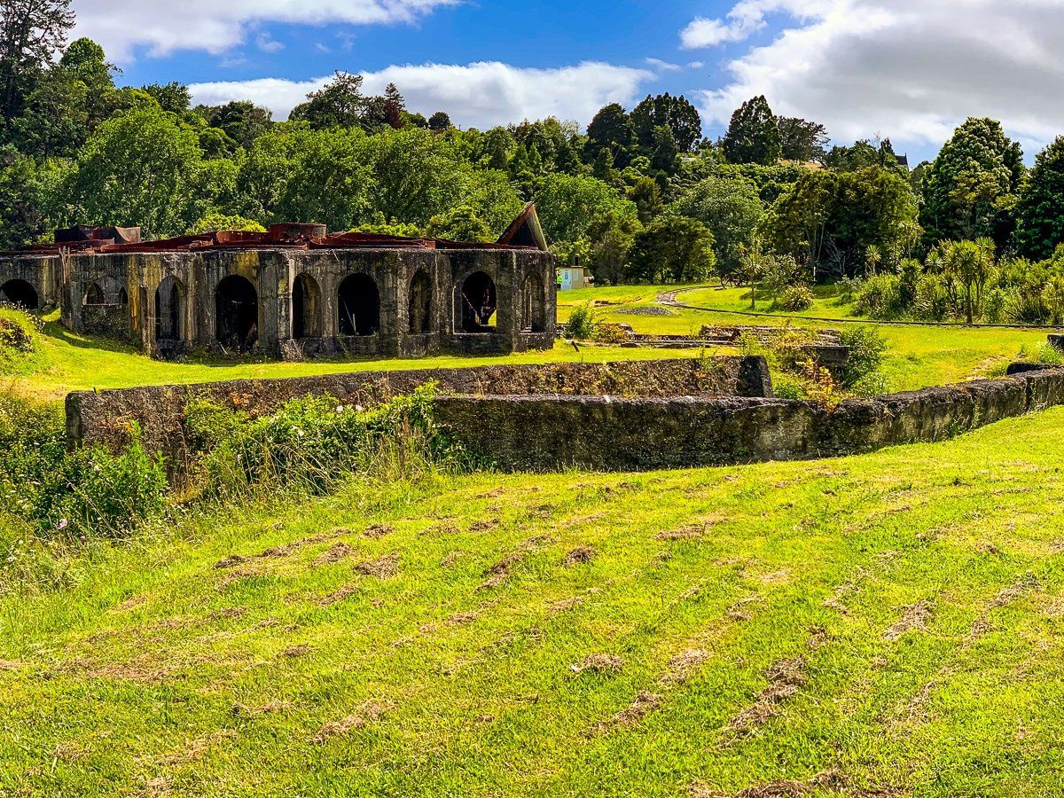
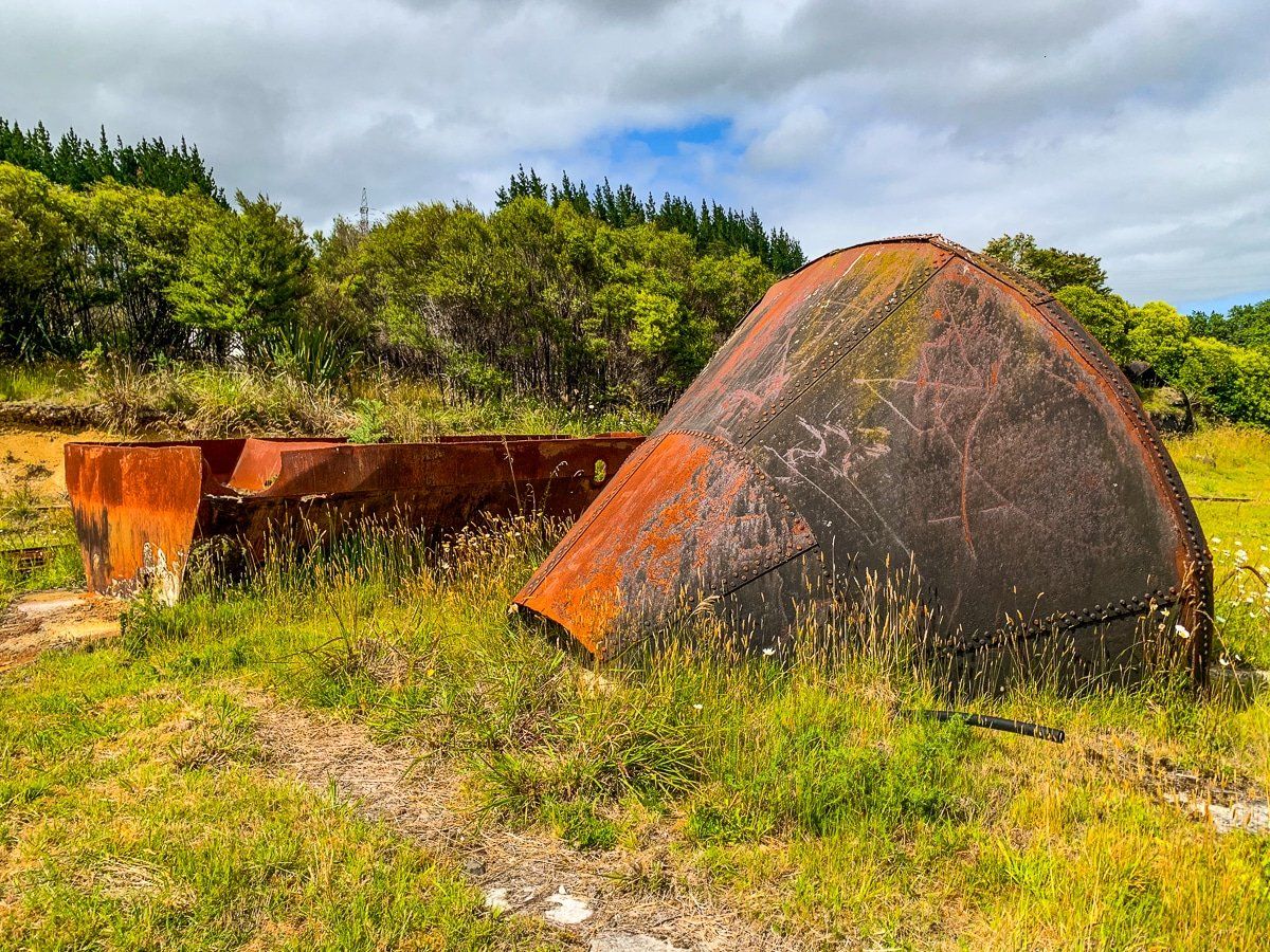
Victoria Battery
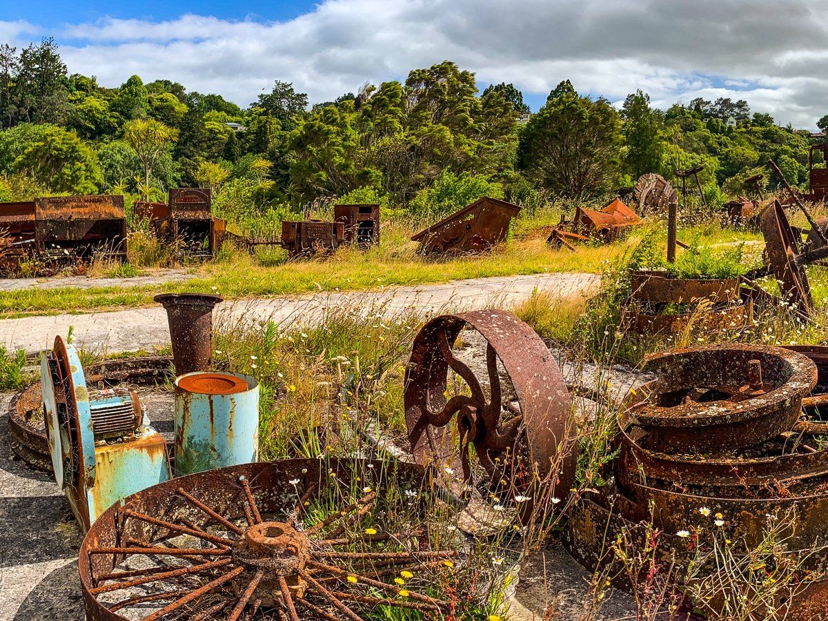
Victoria Battery is the remnants of what was one of the largest gold processing plants in New Zealand, and is just over the road from Waikino. The ruins cover several acres, including a tramway (which still runs for tourists), many rusty bits of equipment, and concrete sections of buildings that were too hard to remove. The old tank facility is particularly curious.
To get there from the road, park at Waikino and take the walkway under the road and over the bridge to the south side of the river. If you’re on a bike, the trail runs directly through the ruins.
Want more North Island trip ideas?
Check out our recent blogs about Blue Duck Station, walking tracks in the Waitakere Ranges, and beaches of Manukau Harbour.