
Waitaki Whitestone (also known as Oamaru Whitestone) is the popular name given to Otekaike Limestone found in the Waitaki region of the South Island. The whitestone was famously quarried to build a major part of Victorian and Edwardian downtown Oamaru. However, this made only a tiny dent in the extensive natural limestone features of the region.
The whitestone formation developed around 25 million years ago, with layers of sediment and dead marine animals compressing under a shallow sea. This was eventually uplifted from the sea as part of the creation of New Zealand Aotearoa.
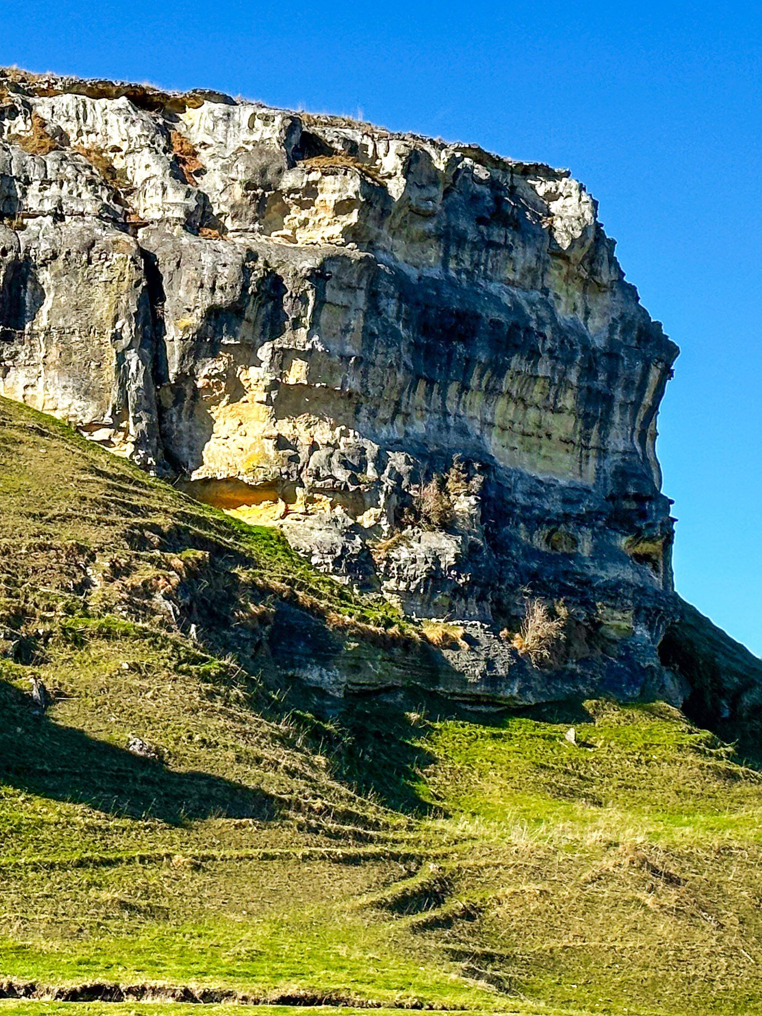
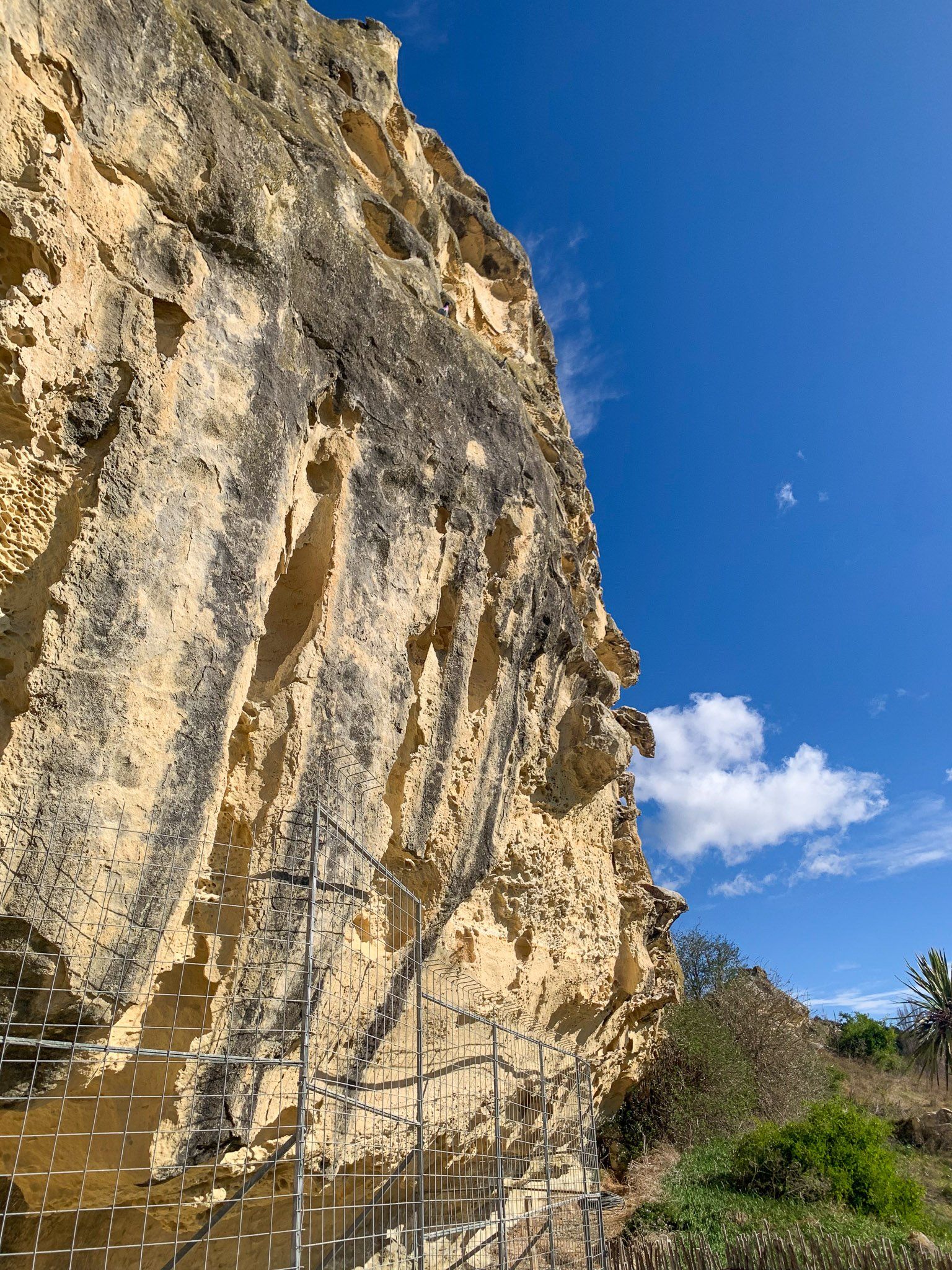
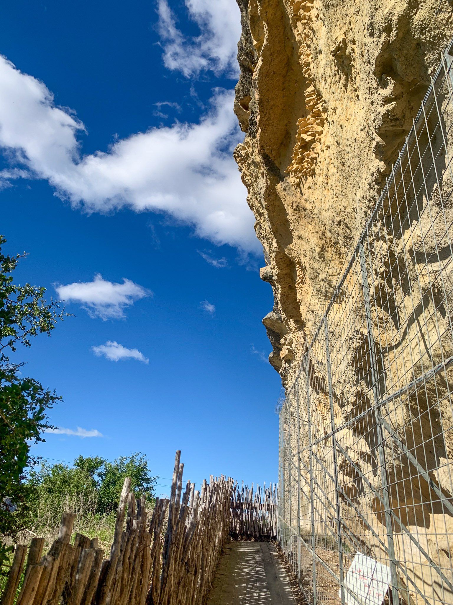
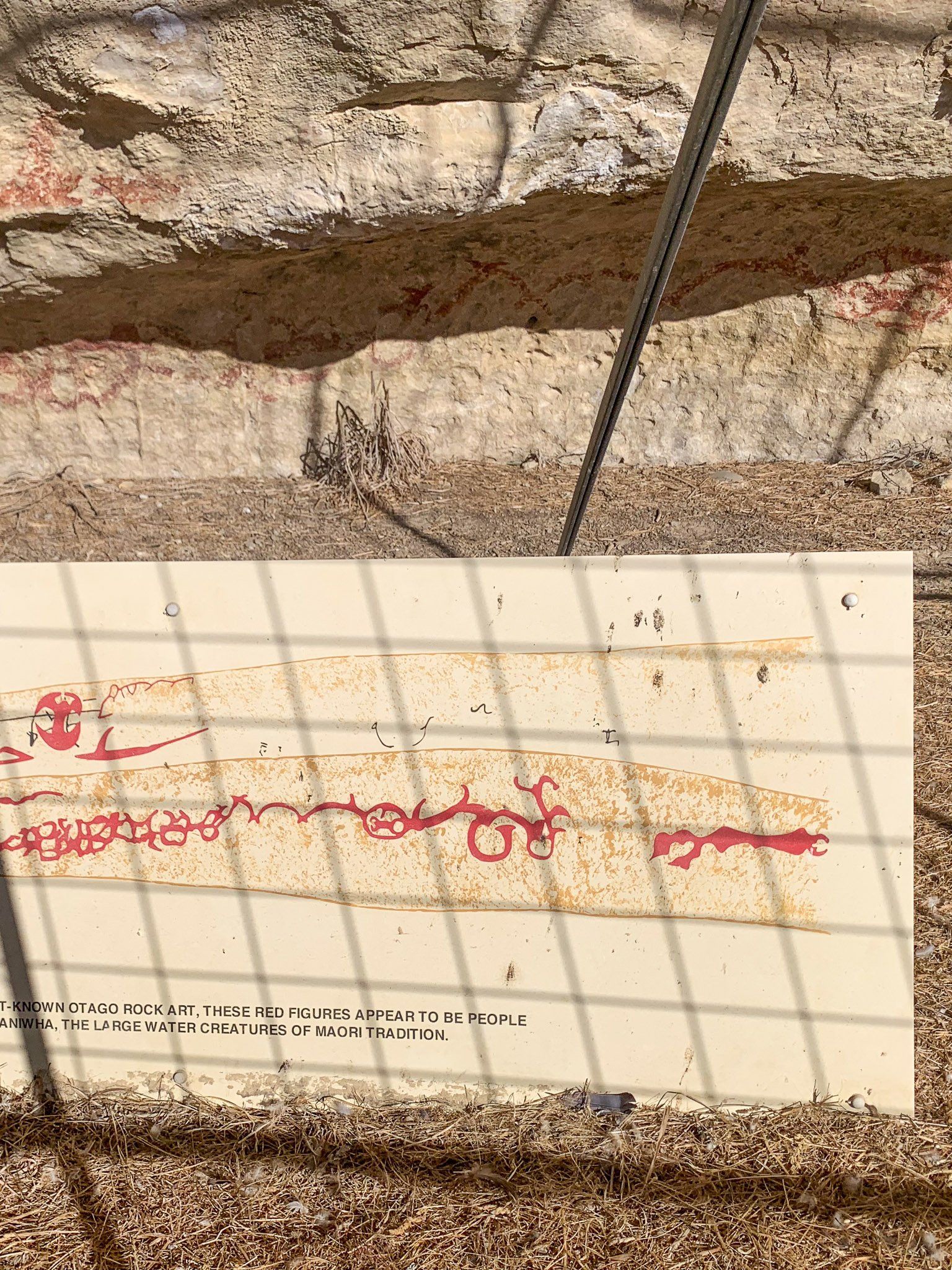
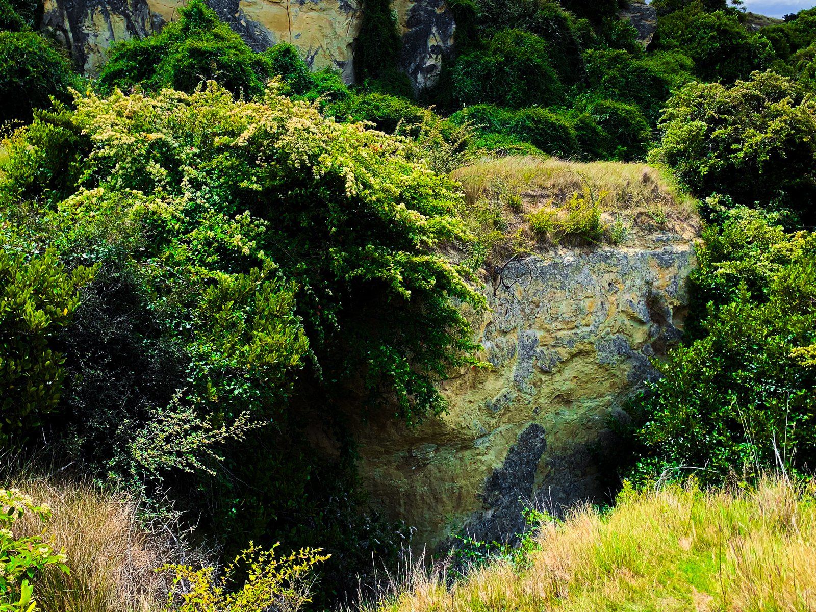
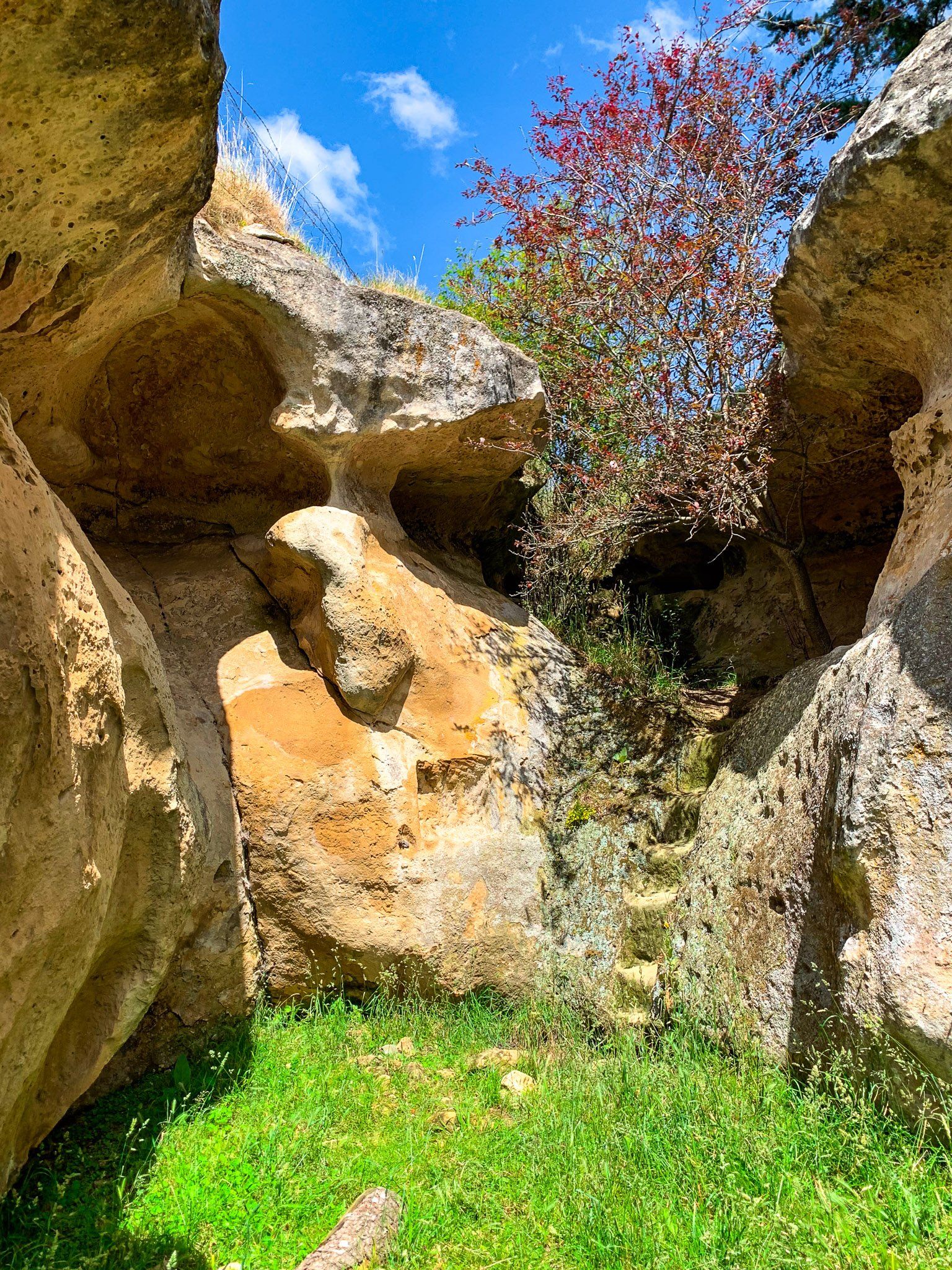
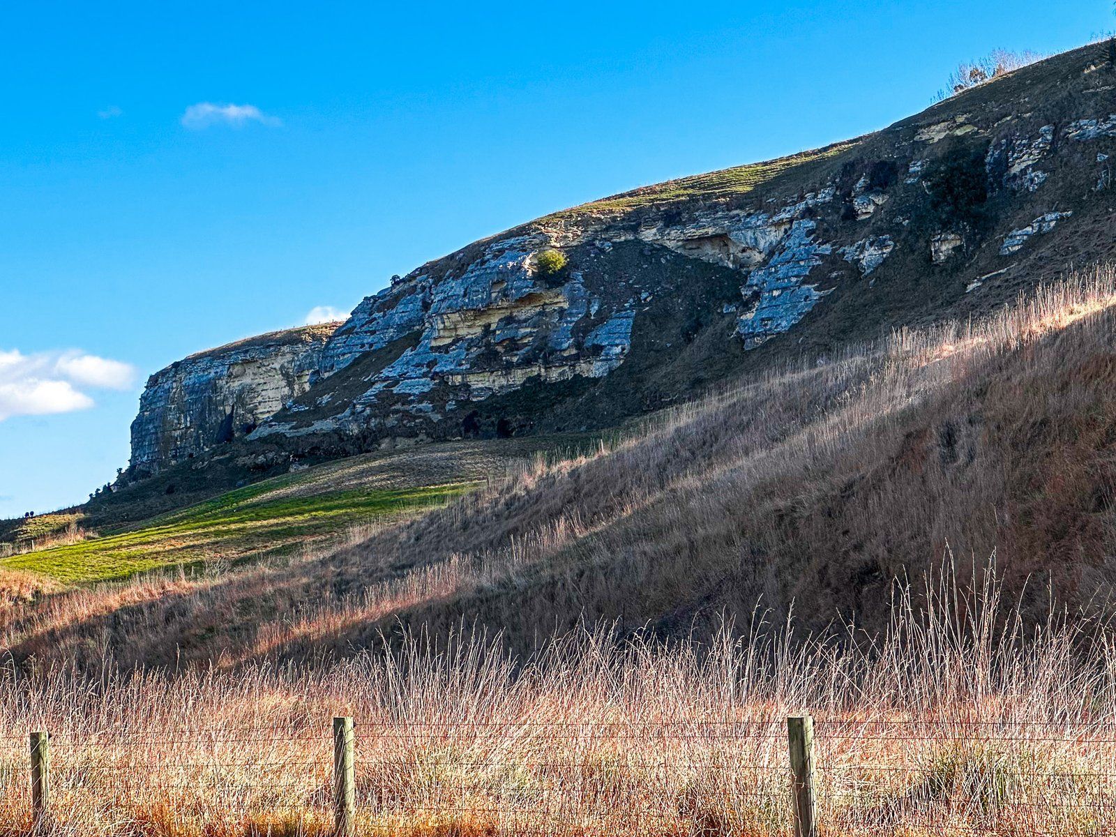
Subsequent erosion has created interesting rock formations and largely white- to cream- to yellow-coloured cliffs. Fossils that match the age of the limestone can also be viewed, along with Māori rock drawings on the cliffs in some locations.
These features are especially prominent near the small town of Duntroon on the south side of the Waitaki River, accessible on State Highway 83, about 42 km northwest of Oamaru.
The short one-day tour route starts in Duntroon with a visit to the Vanished World Centre. This is a small but fun mashup of a fossil and rock museum, activity centre, and souvenir shop. There, you can get a map and general guidance on the nearby Whitestone features, as well as examples of marine fossils (including ancient whales) found in the nearby cliffs and promontories.
The best spots include the Takiroa Māori Rock Drawings, Earthquakes Waipata, Elephant Rocks and the nearby Anatini Fossil. From there, tour Island Cliff for some of the most accessible examples of exposed cliffs.
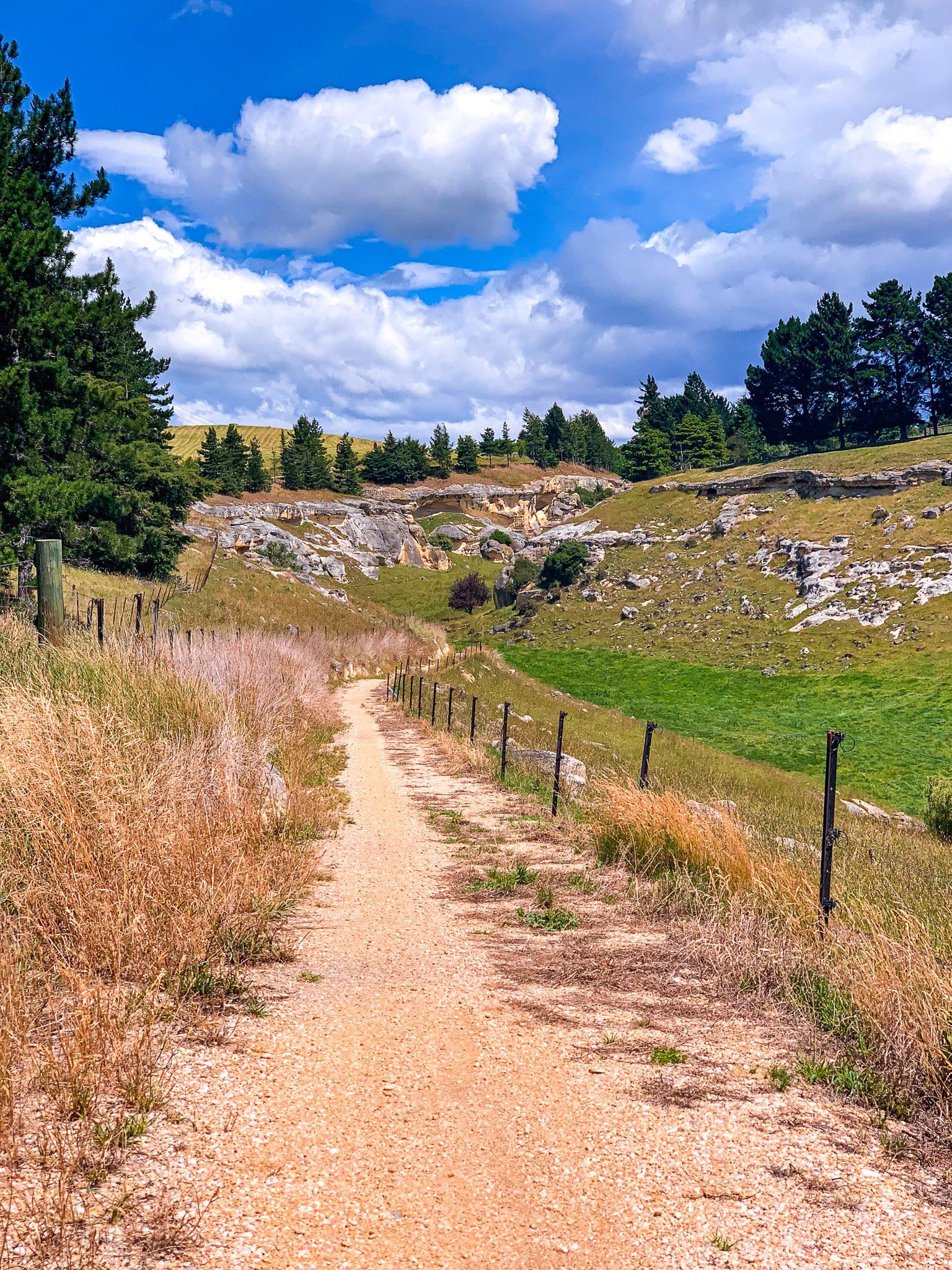
Many of these locations, and others around the wider Waitaki region, are marked by “Vanished World” road signs, which can be a bit obscure. Other signage is more prominent, but a map is useful. The Alps2Ocean Cycle Trail also runs through the area, so it is easy to tour most of the sites from the bike trail.
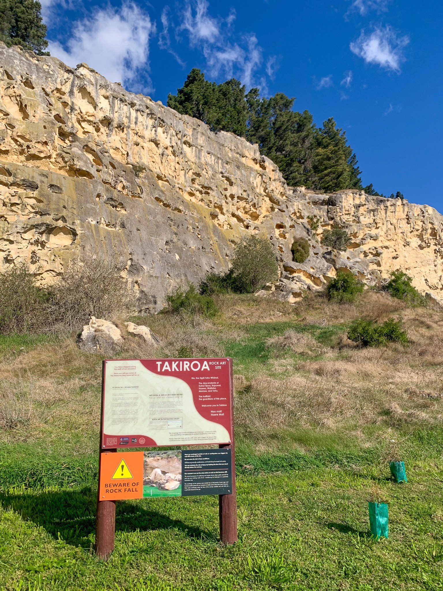
Takiroa and Maerewhenua Whitestone Rock Art
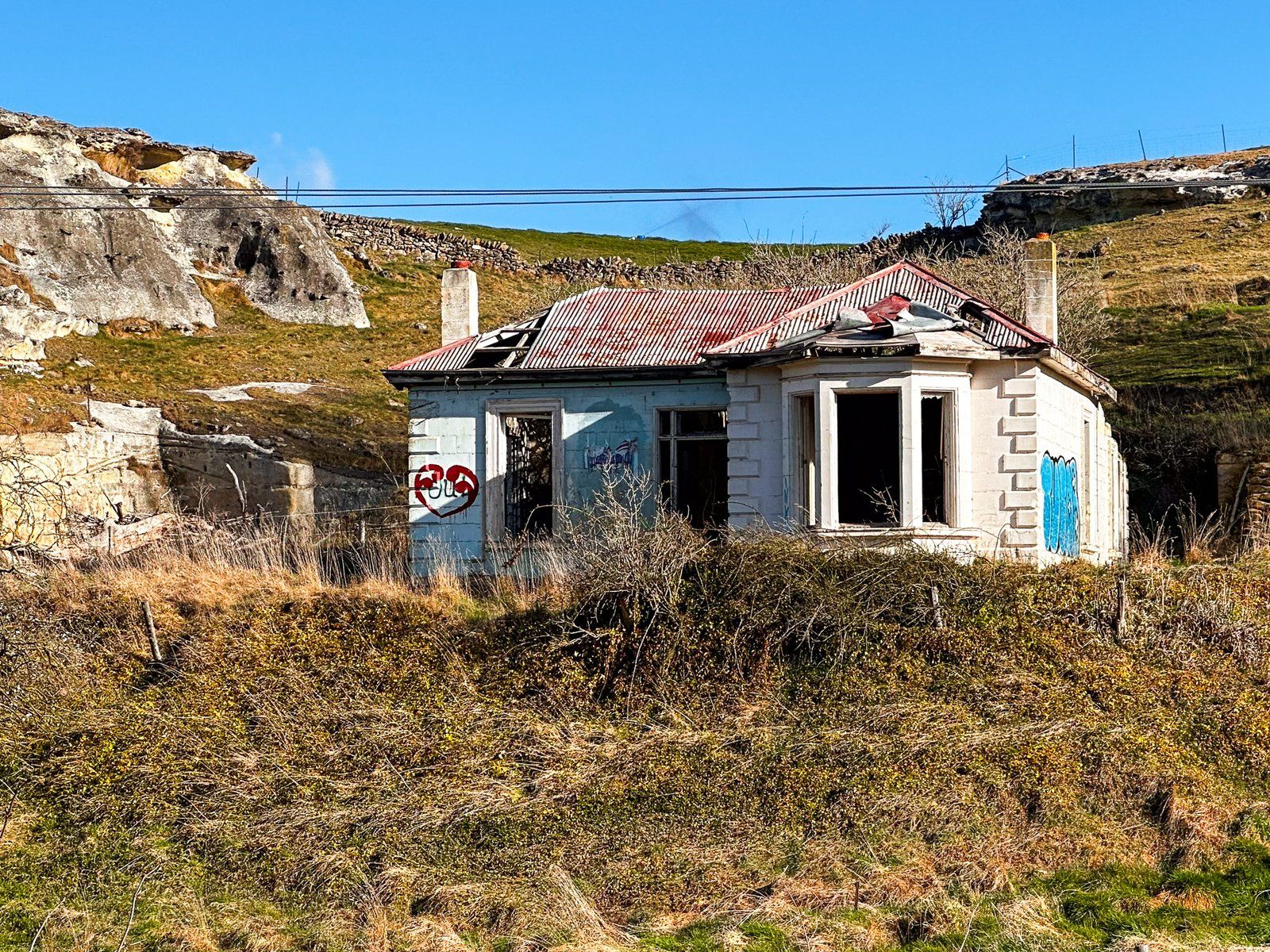
The Waitaki Valley has many signs of Māori habitation and transit from around the 1400s onwards, including examples of rock art on the whitestone cliffs at Takiroa and nearby Maerewhenua. The Valley and its surrounds were a major thoroughfare for hunting moa, the large flightless birds that were hunted to extinction by 1600. One of the earliest archaeological digs in NZ was at the mouth of the Waitaki River, where 1200 moa ovens were uncovered. The ovens have been destroyed by farming, but the rock art has survived.
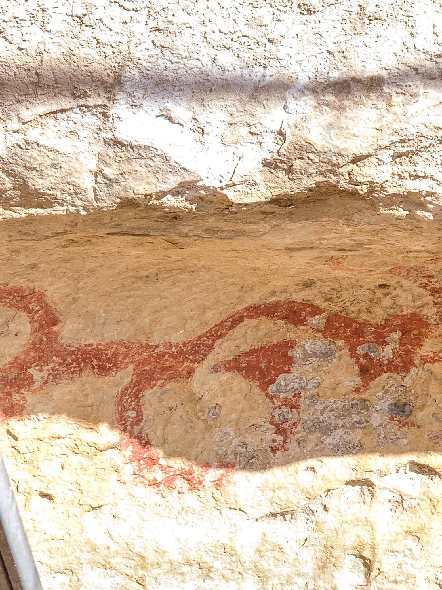
Taikroa is on State Highway 83, two km north of Duntroon. The drawings are on the side of a limestone cliff, protected by a shelter. They date from 1400 to 1900 and record people and birds, including the appearance of Europeans with their horses and ships. The paint used in the drawings was made from ochre, bird fat, and charcoal. Some pieces were removed in 1913 and added to museum collections. Subsequently, there were measures to protect the art, but these have become more effective since Ngāi Tahu iwi gained control of the location in 1998 under the settlement of its Treaty of Waitangi claims.
Maerewhenua Rock Art is also near Duntroon. Take State Highway 83 south, then turn right into Livingstone Duntroon Road. The location is on the left, 400 metres along the road. There is a limestone overhang, and the drawings predate the arrival of Europeans. Moa bones were also found at the site, evidence that it was occupied by Māori. This art is located on private land but is accessible to the public.
Both locations are on the Alps2Ocean Cycle Trail.


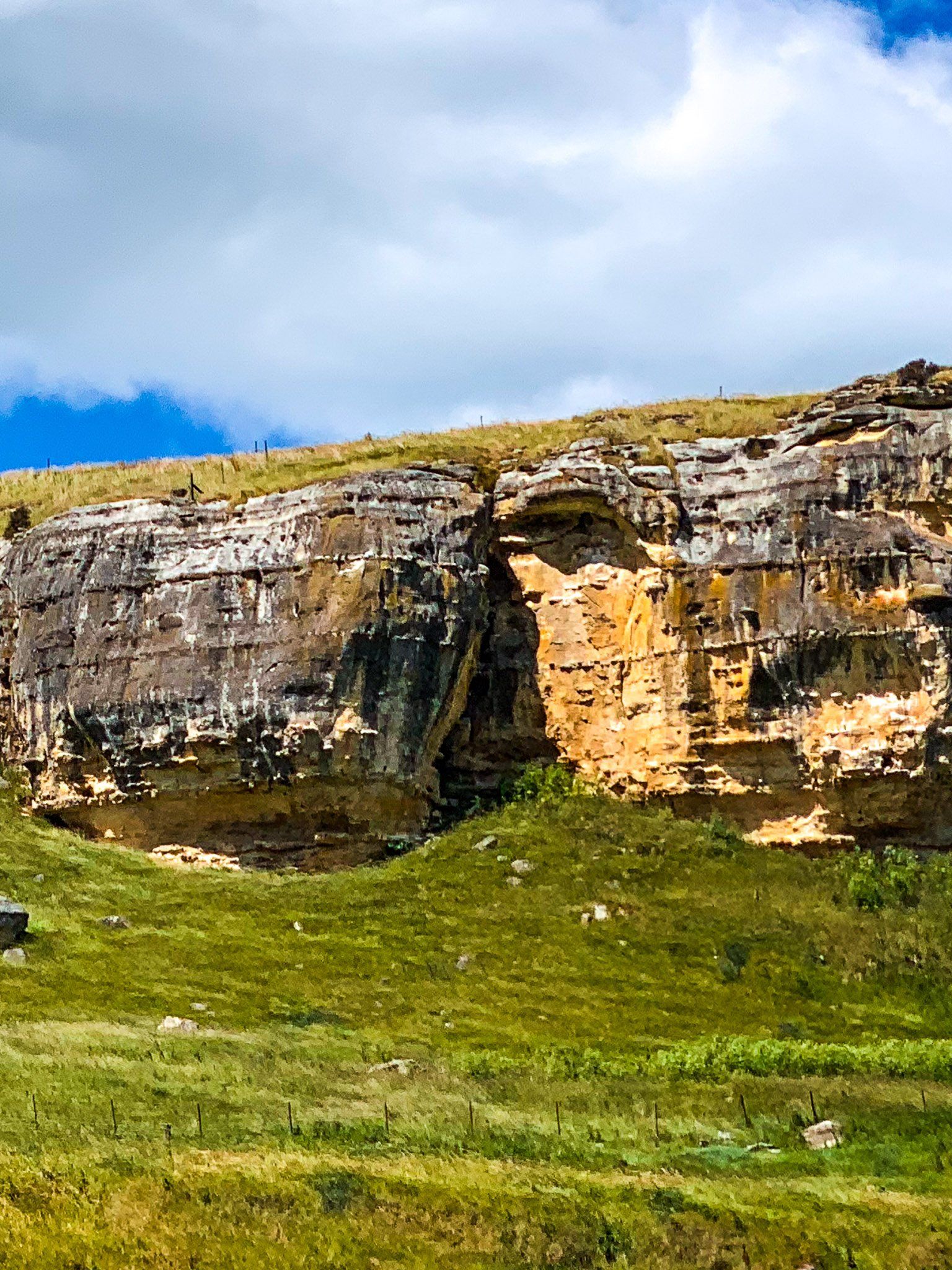
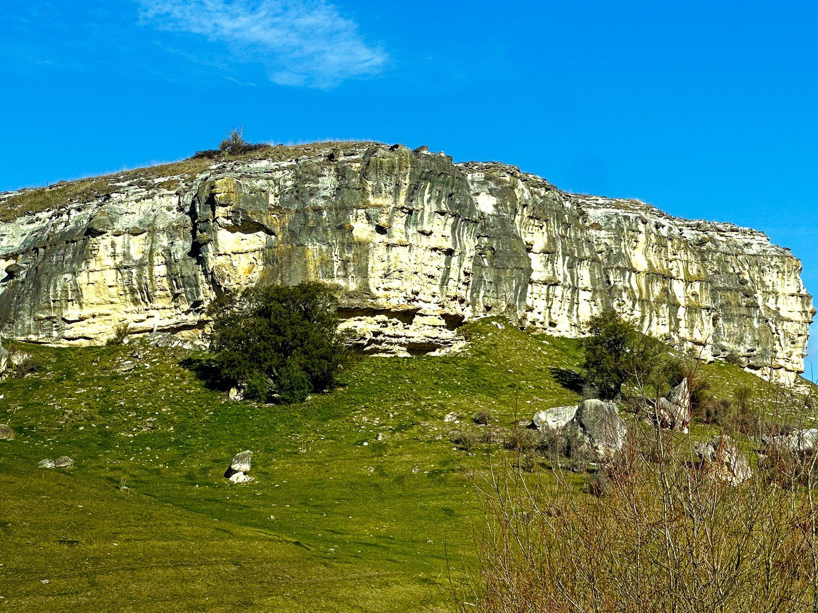
Earthquakes Waipata
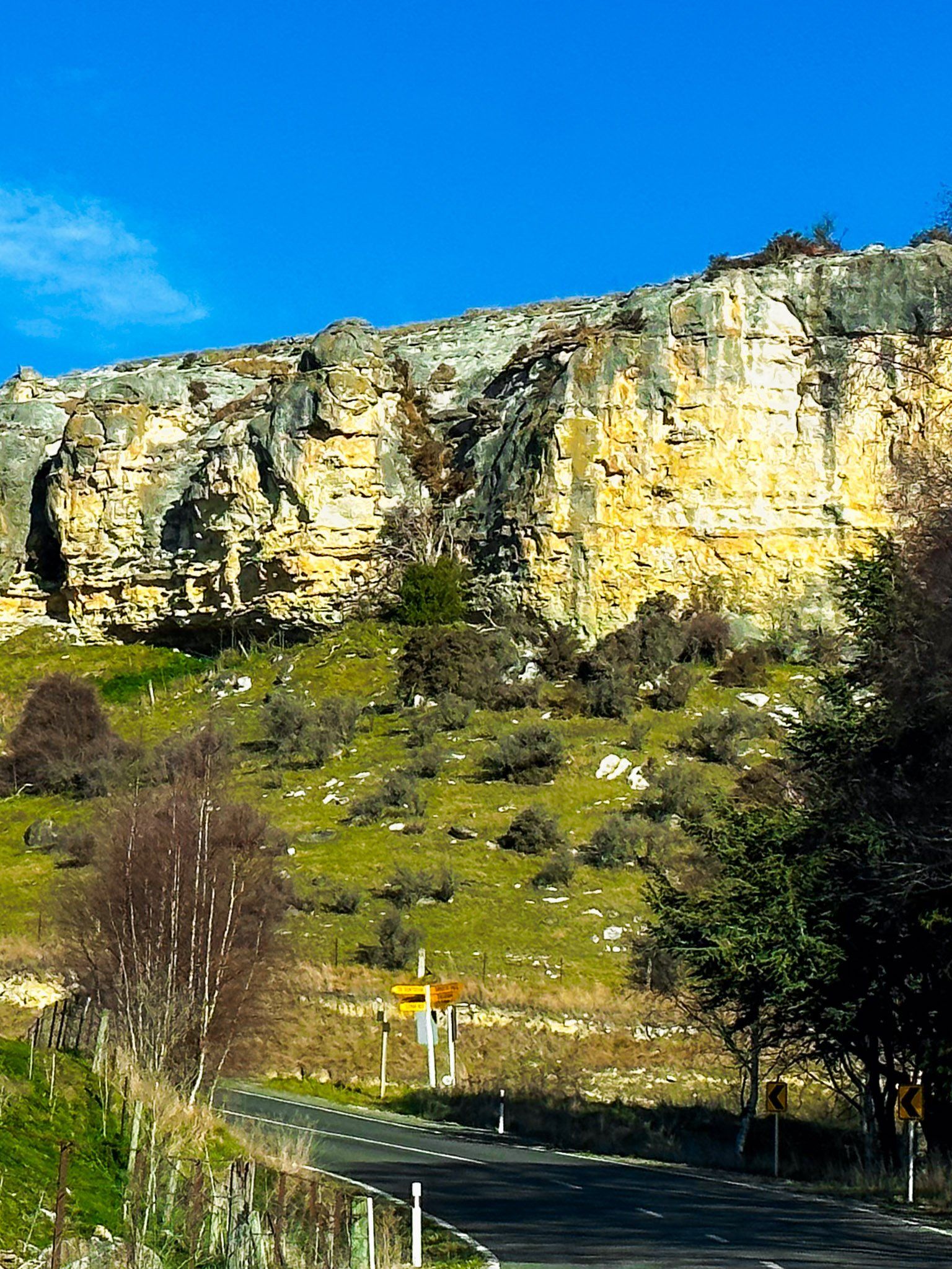
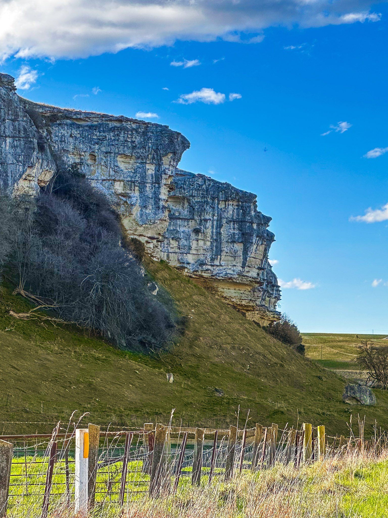
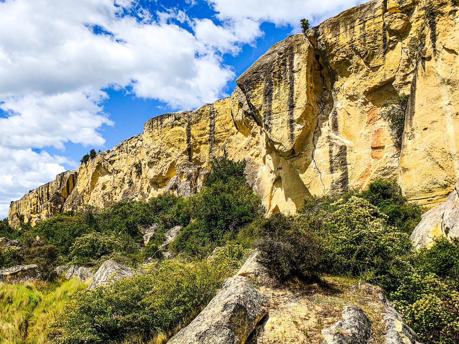
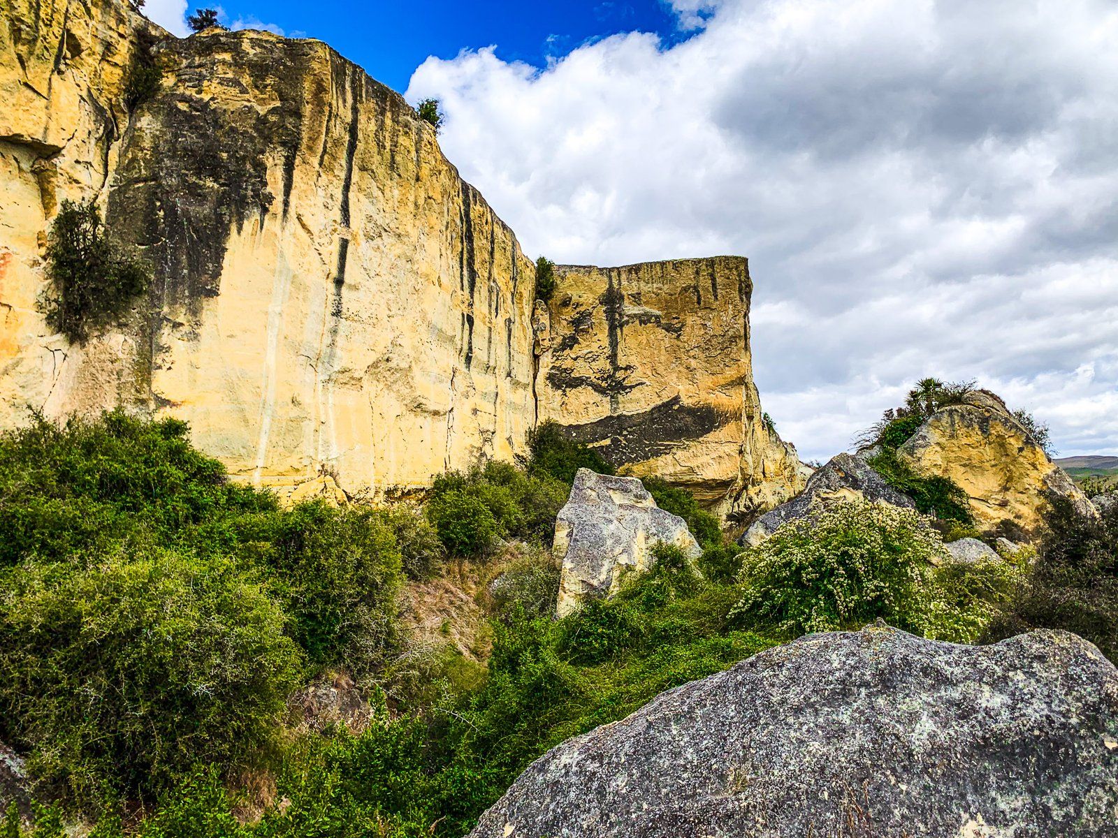
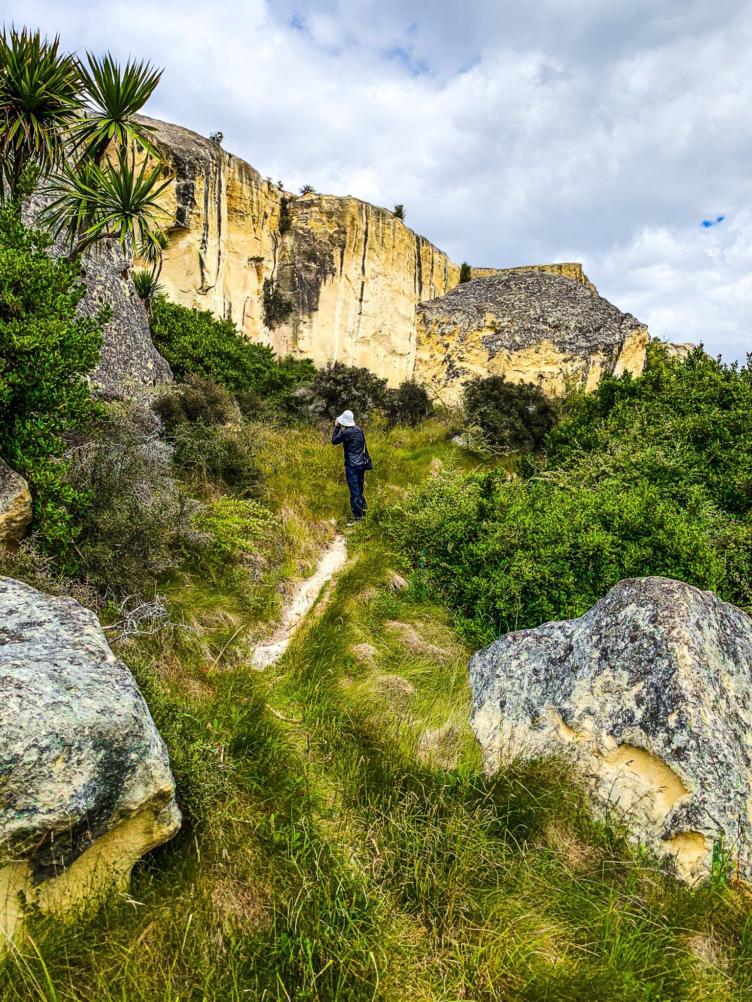
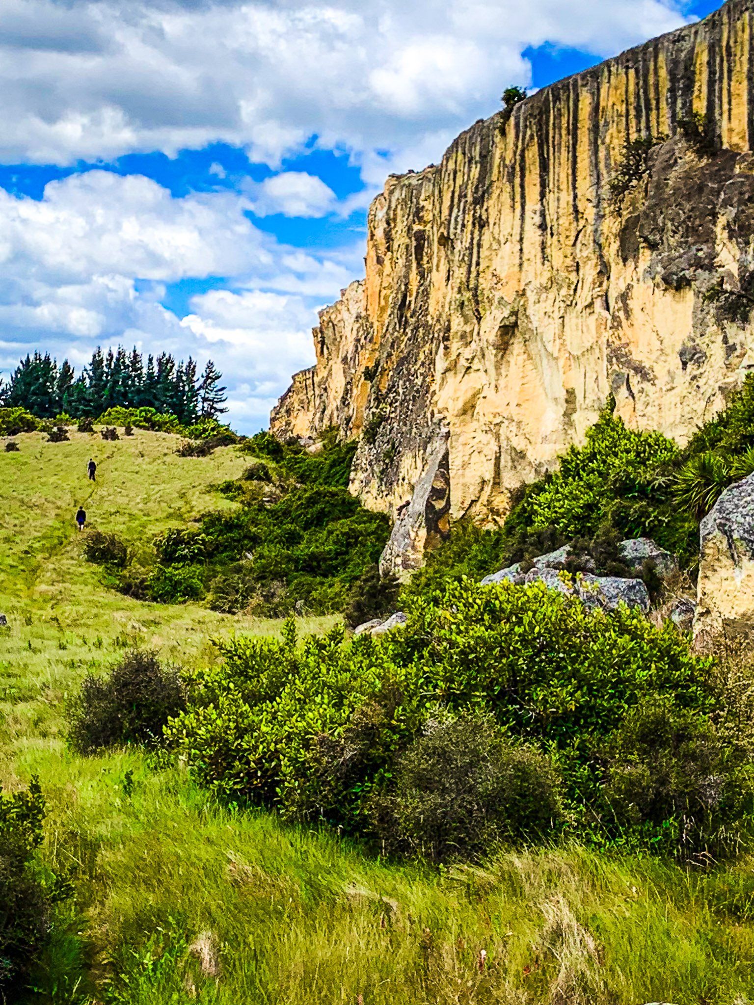
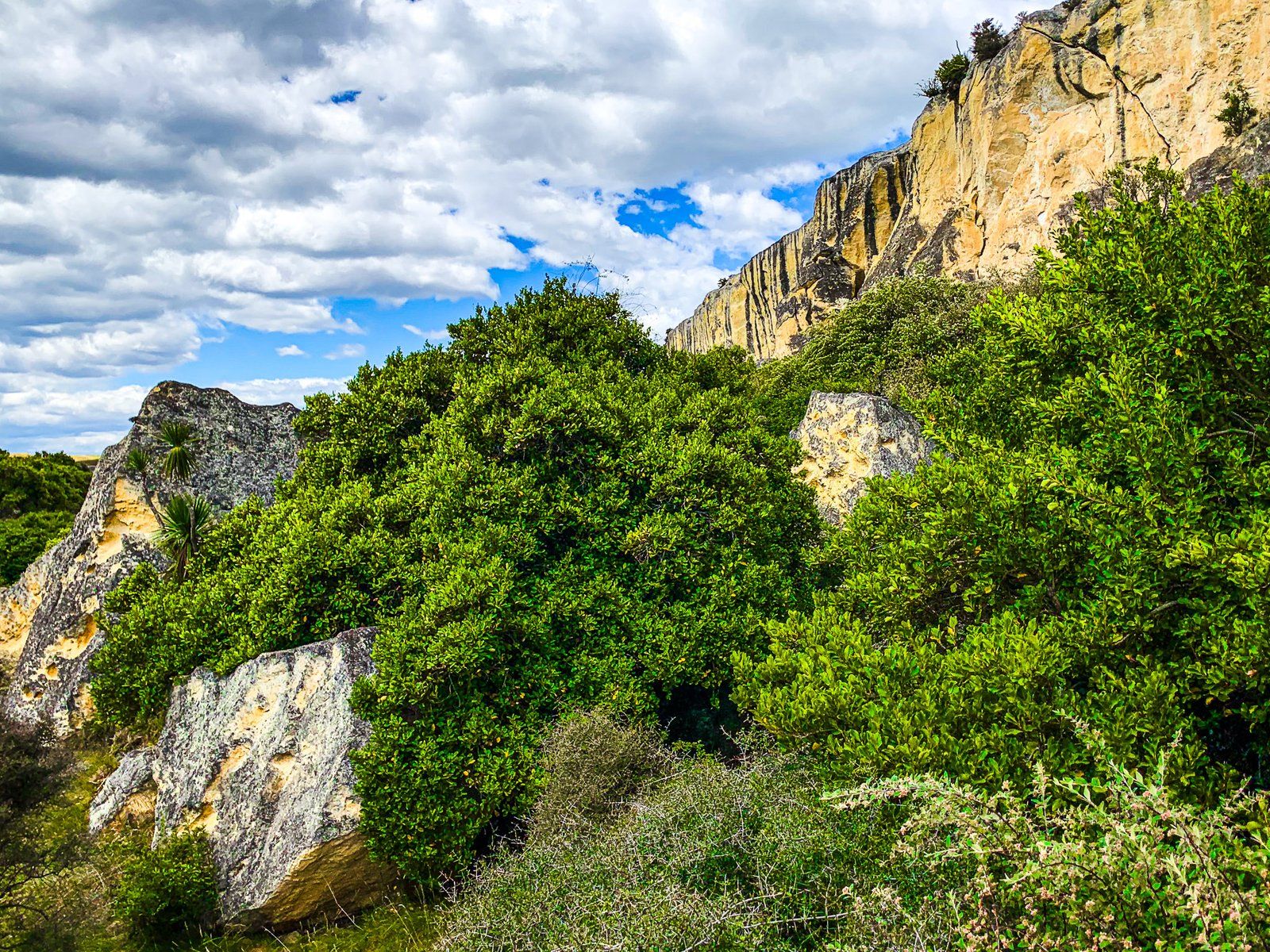
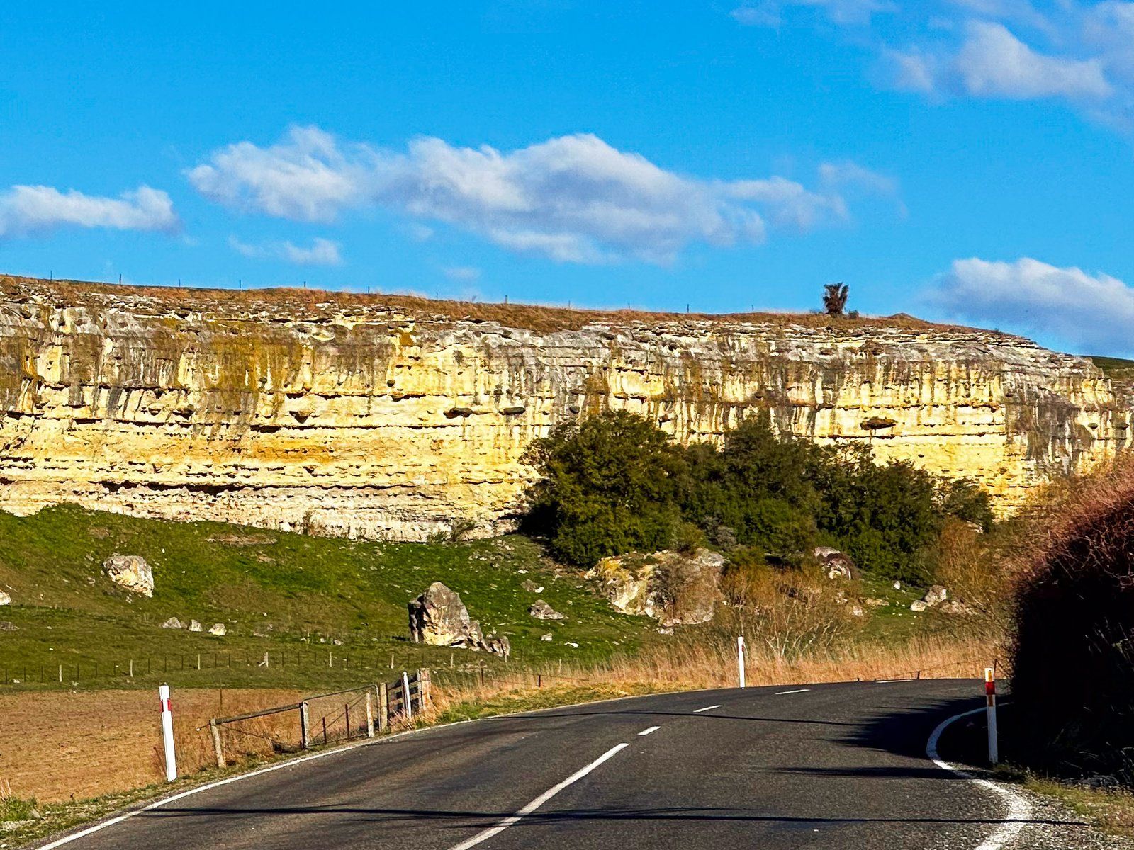
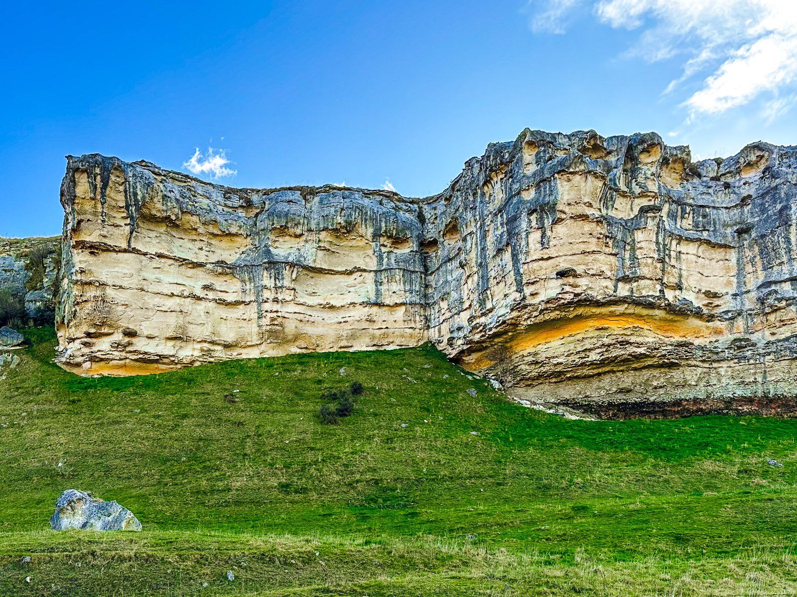
Earthquakes is probably one of NZ’s most oddly named places. It reflected the early European belief that the very large boulders below the creamy to yellow limestone cliff along Earthquake Road were due to an earthquake. This is not the case – rather, the boulders broke off the cliff as it was exposed by a massive slide and subsidence of the front part of the rock formation long ago.
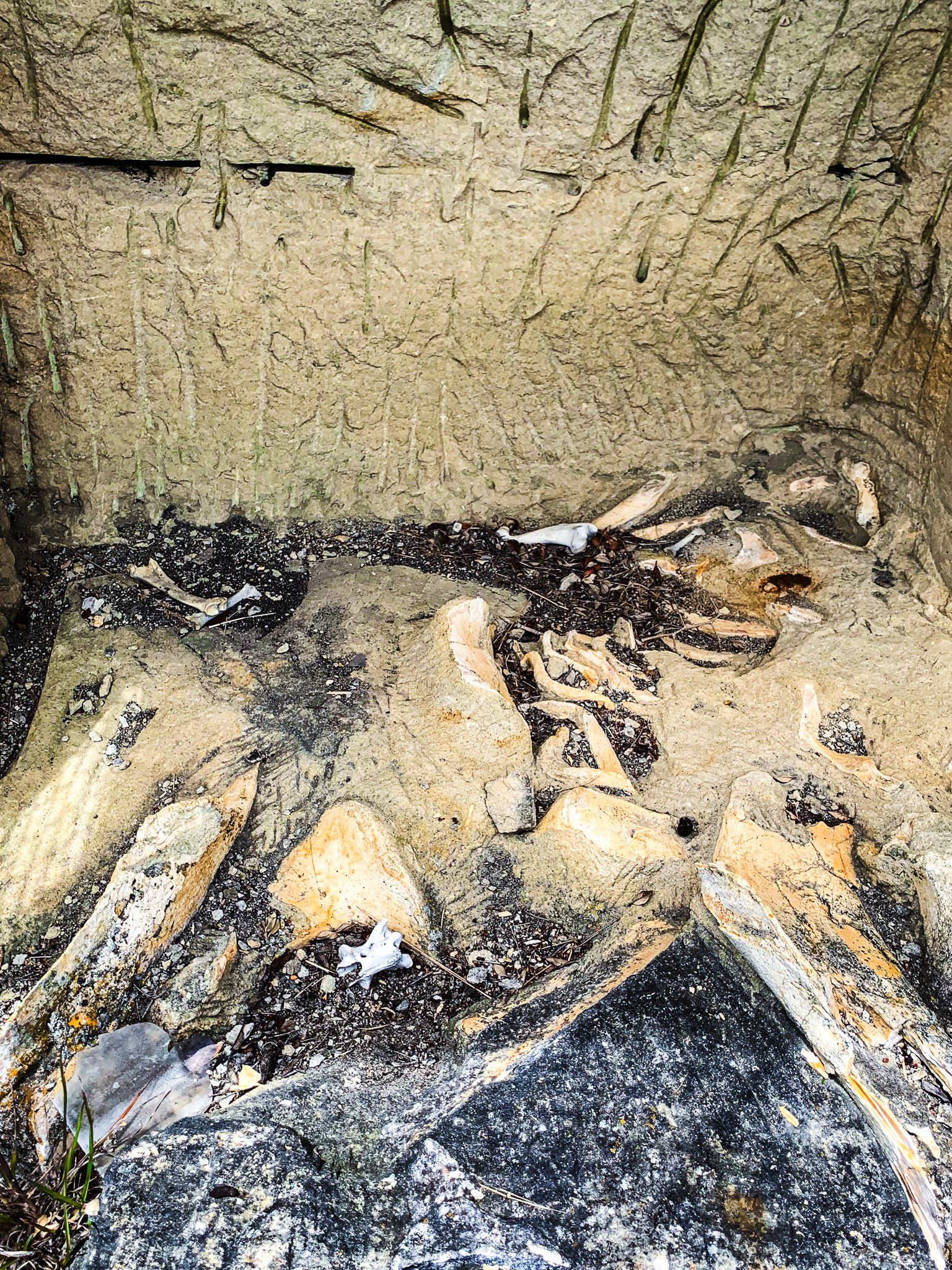
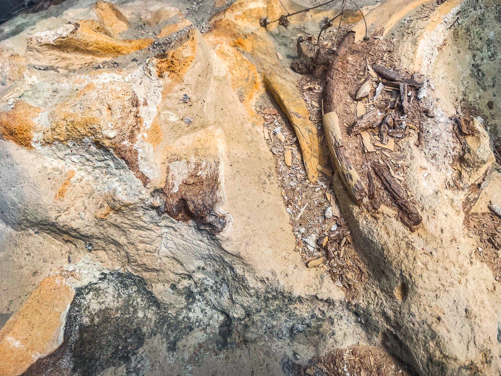
The cliff and boulders are worth the visit, but there is also a carefully protected ancient baleen whale fossil, consisting of its lower jaw. The jaw fragments are toothless and oval in cross-section – similar to the jaw in a modern baleen whale. Exposed fossils in the Waitaki Valley normally consist of just a few bones; this is a larger example. Rare native plants unique to the whitestone ecosystem are also a feature of this site.
Turn off State Highway 83 at the northwest end of Duntroon onto Earthquake Road. The site, with a short walk to the base of the cliff, is about three km along the road. Take care if you choose to walk beyond the baleen whale fossil, as there are crevices and a risk of falling rocks.
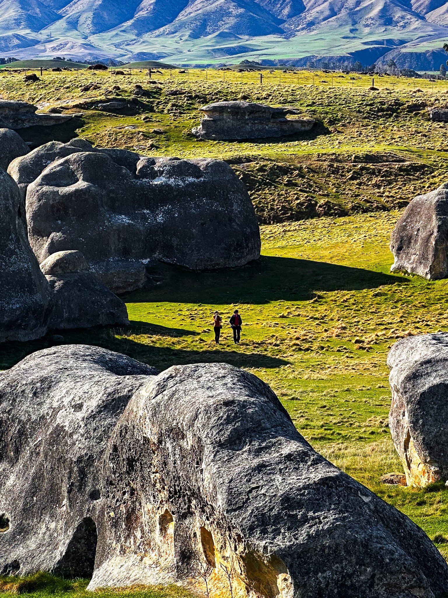
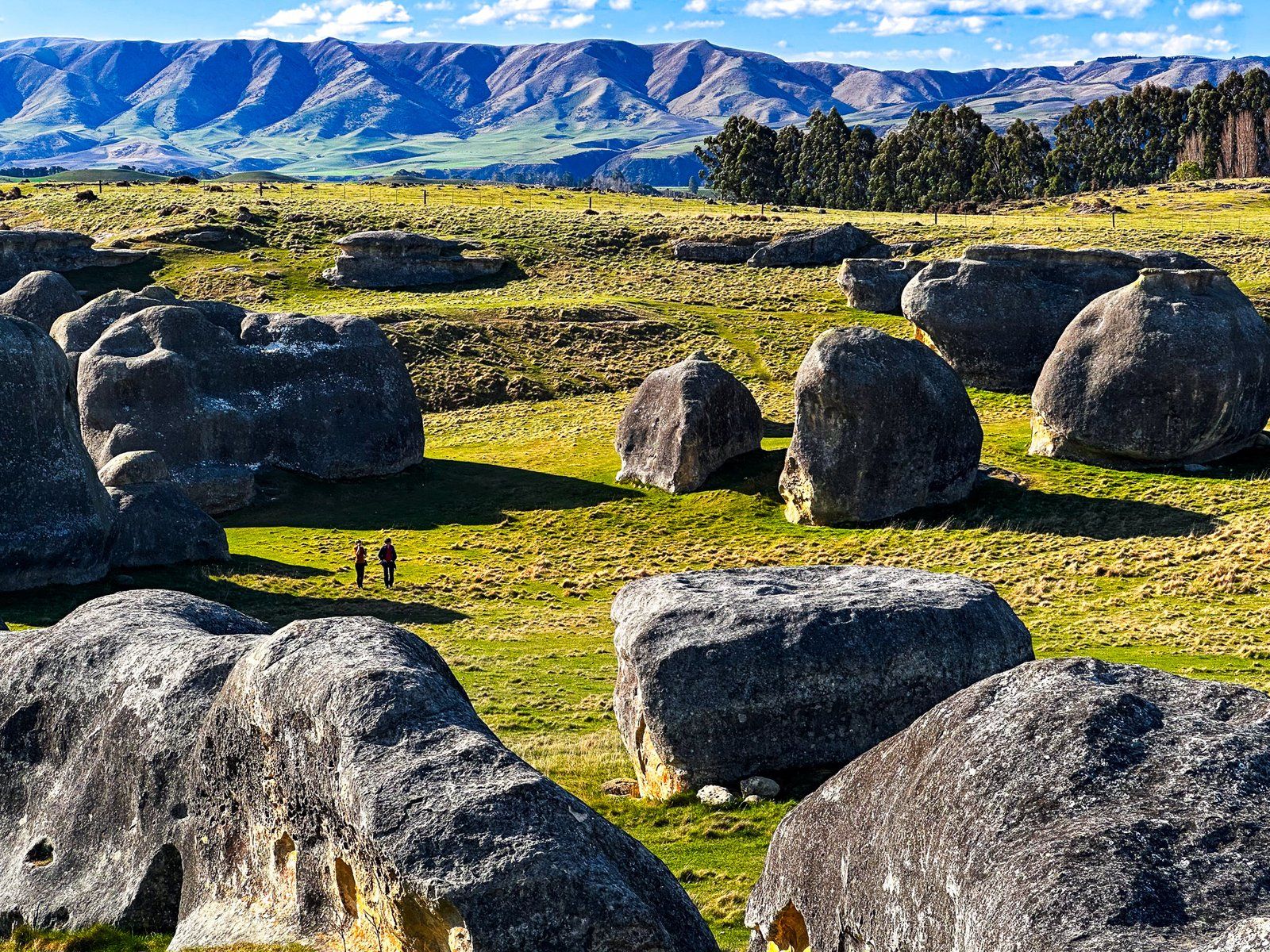
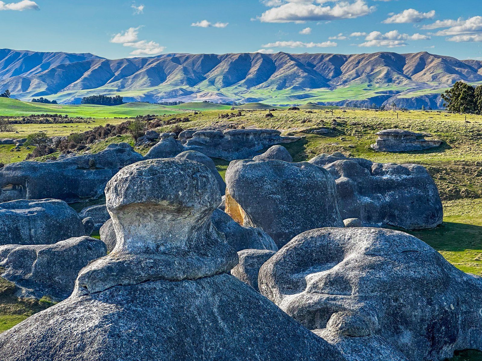
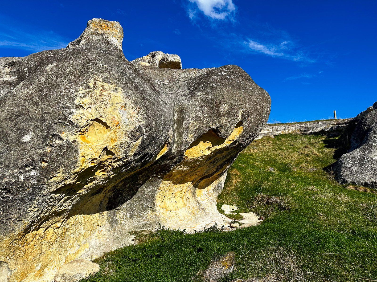
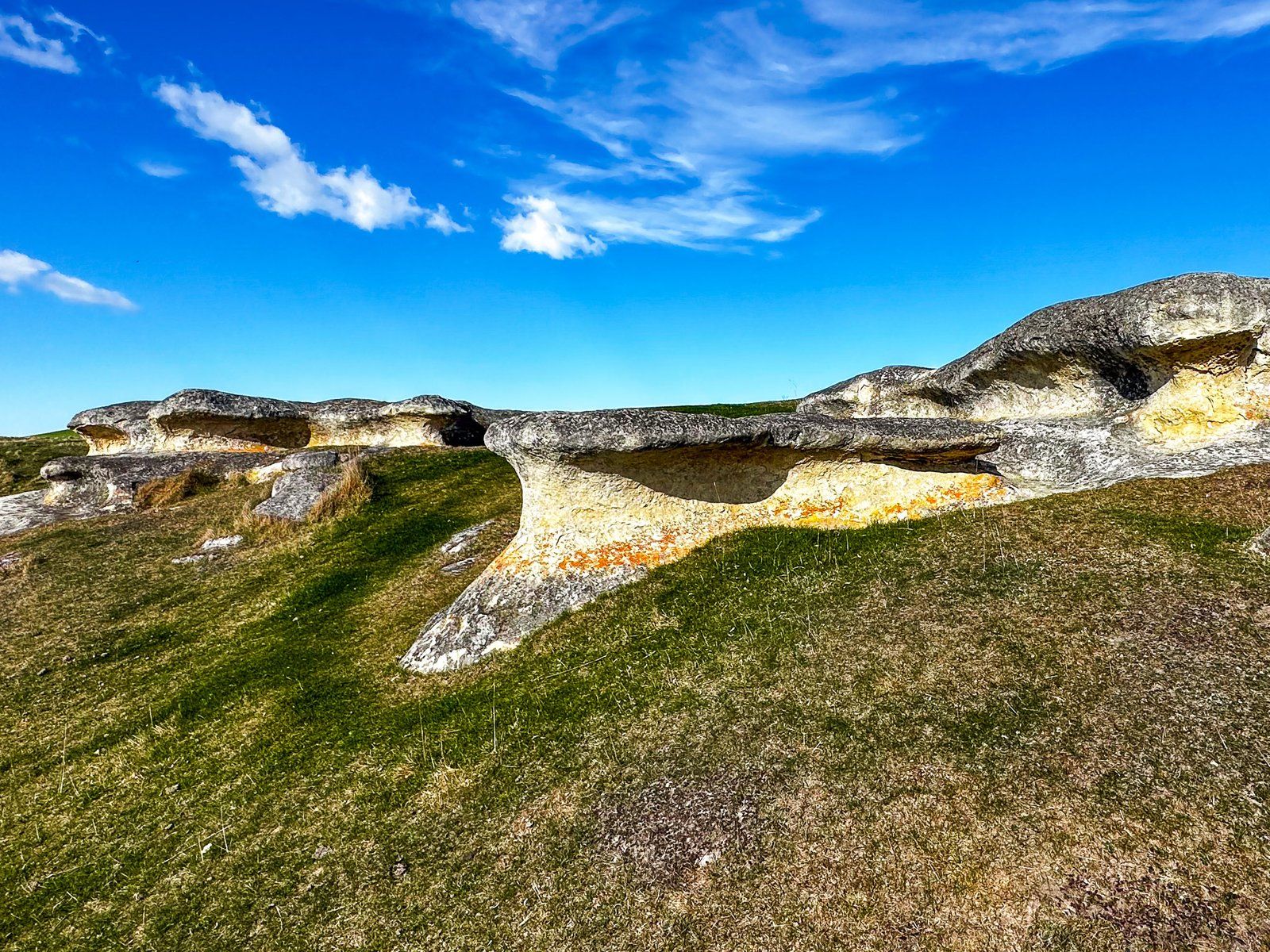
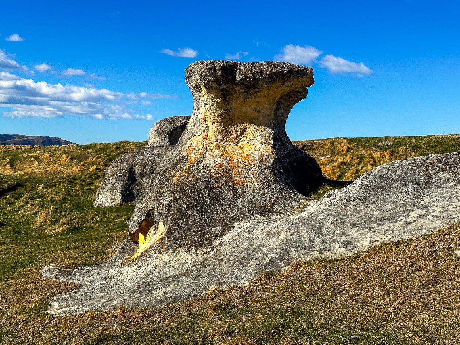
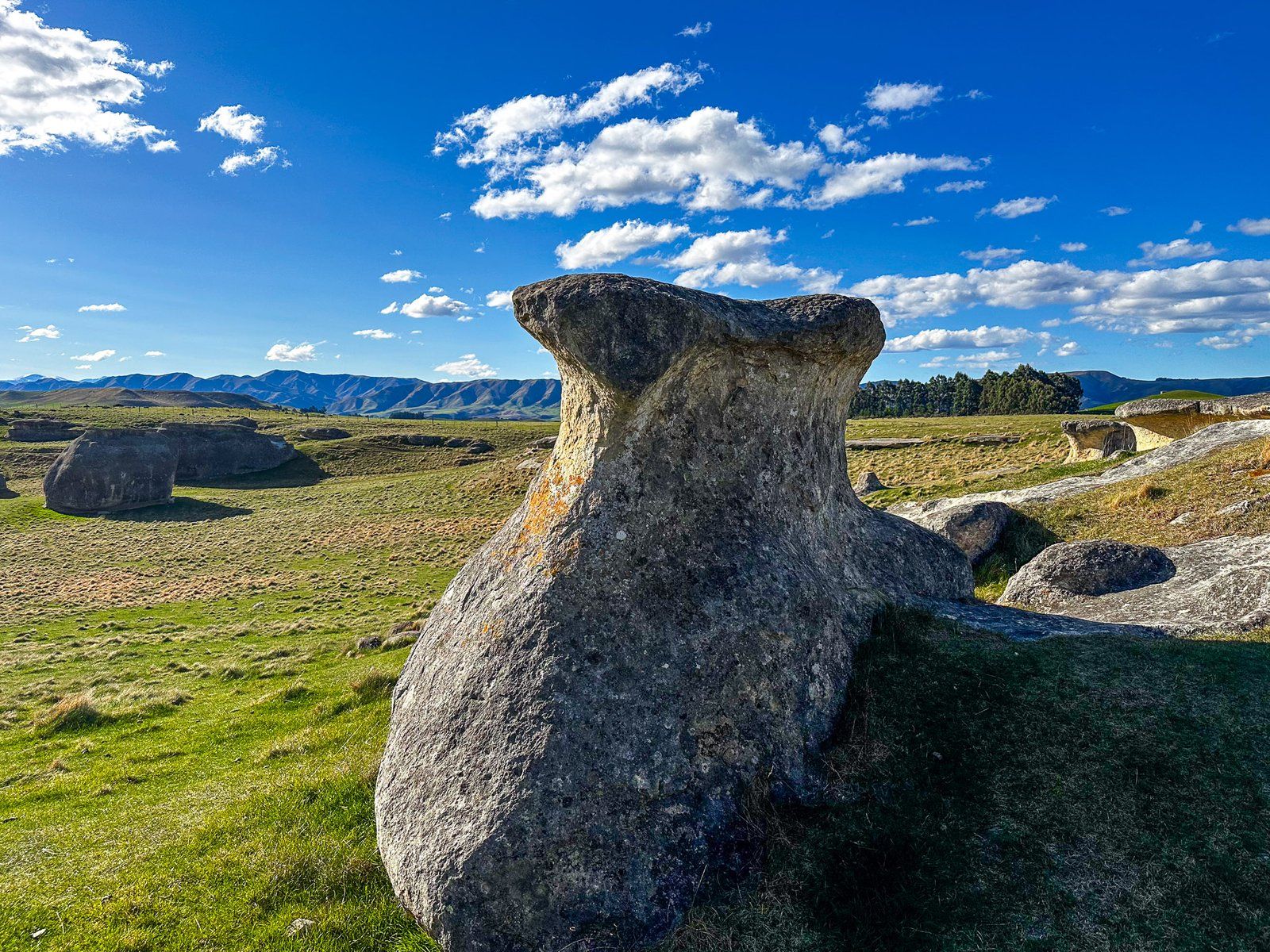
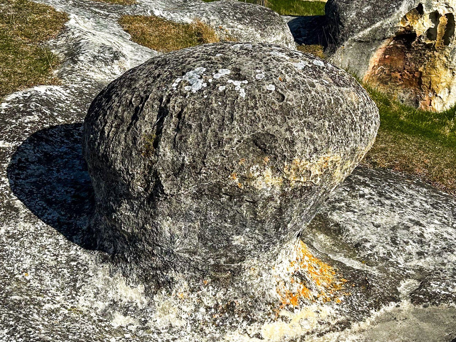
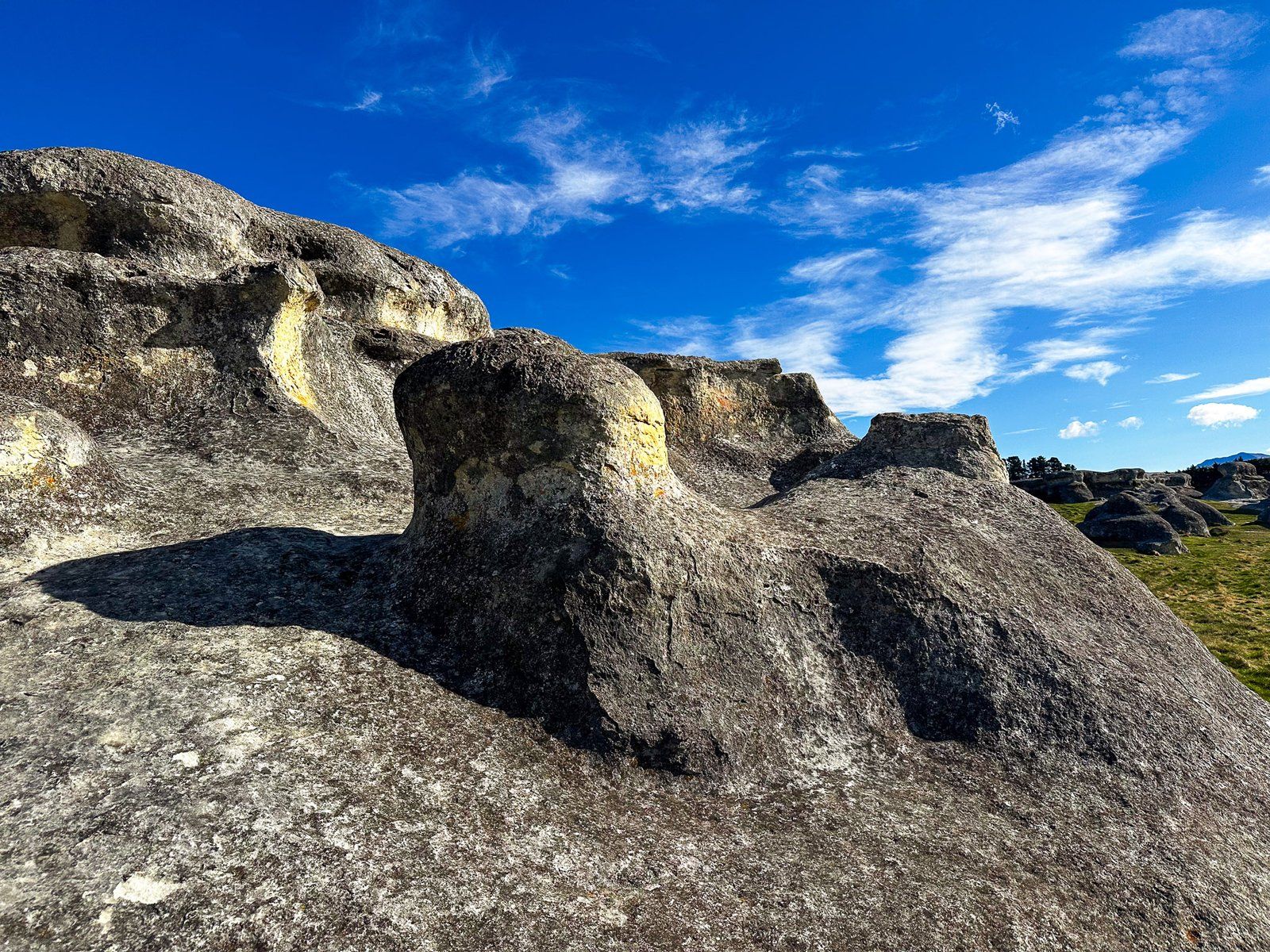
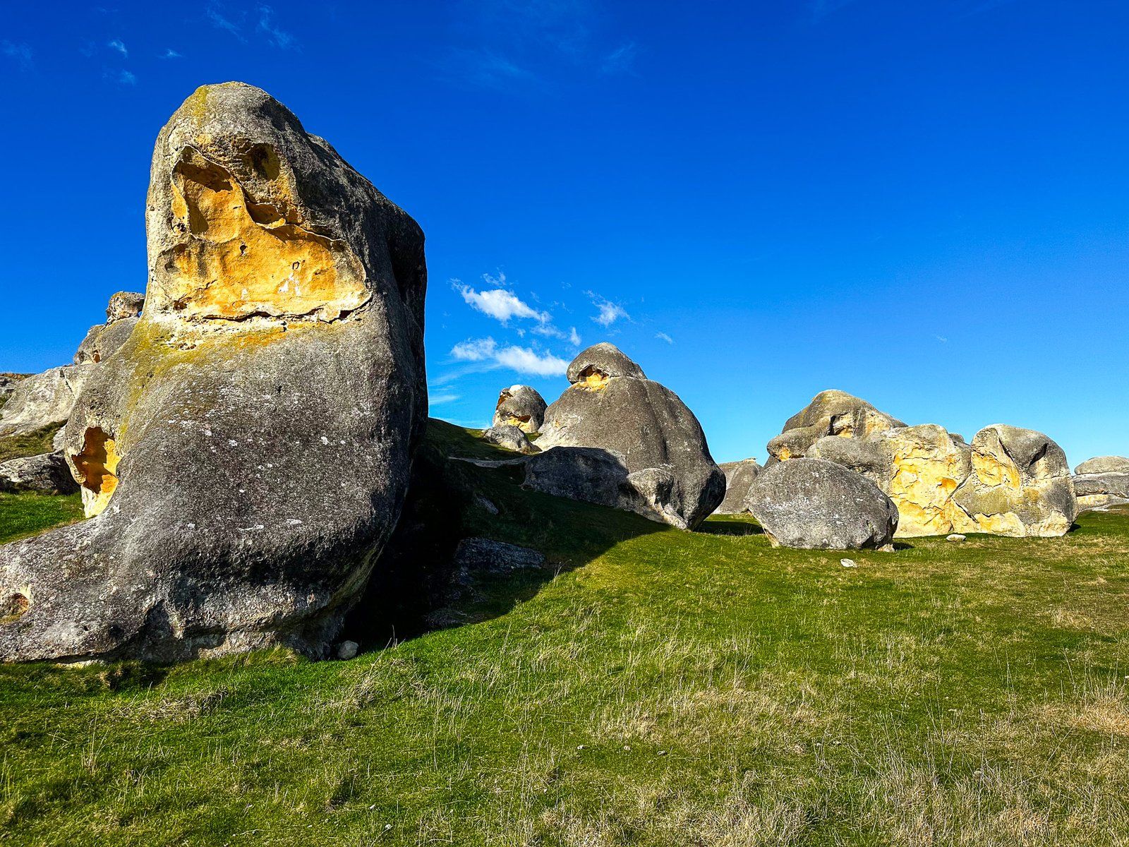
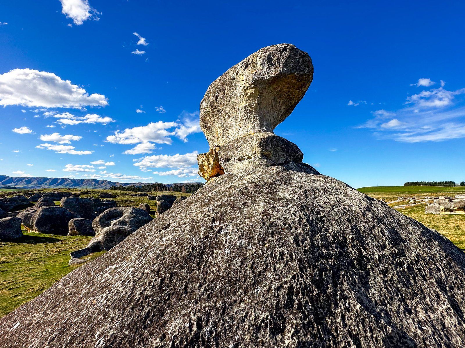
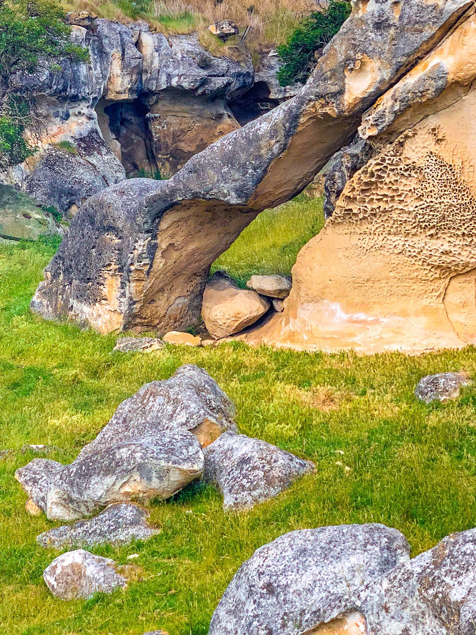
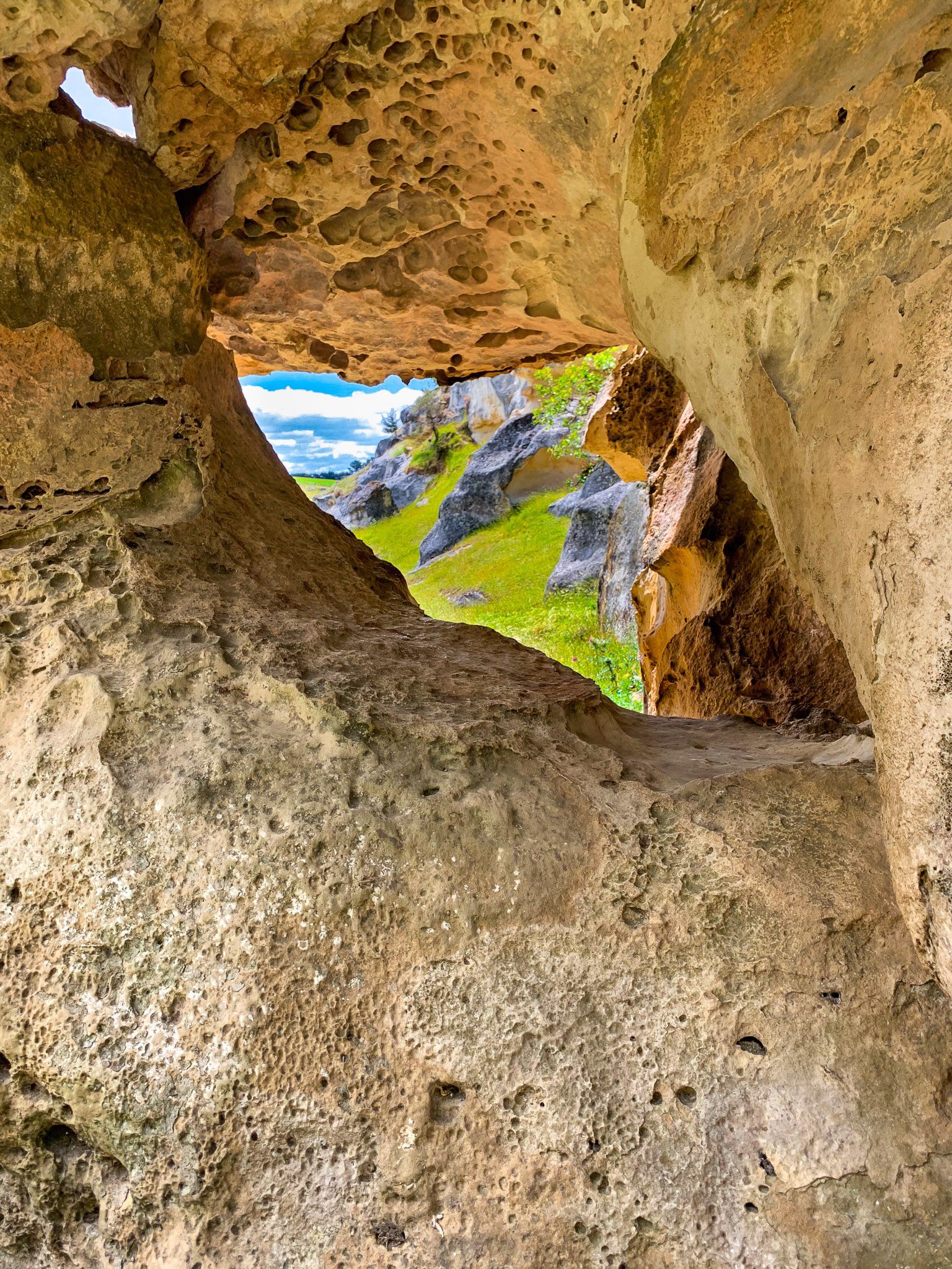
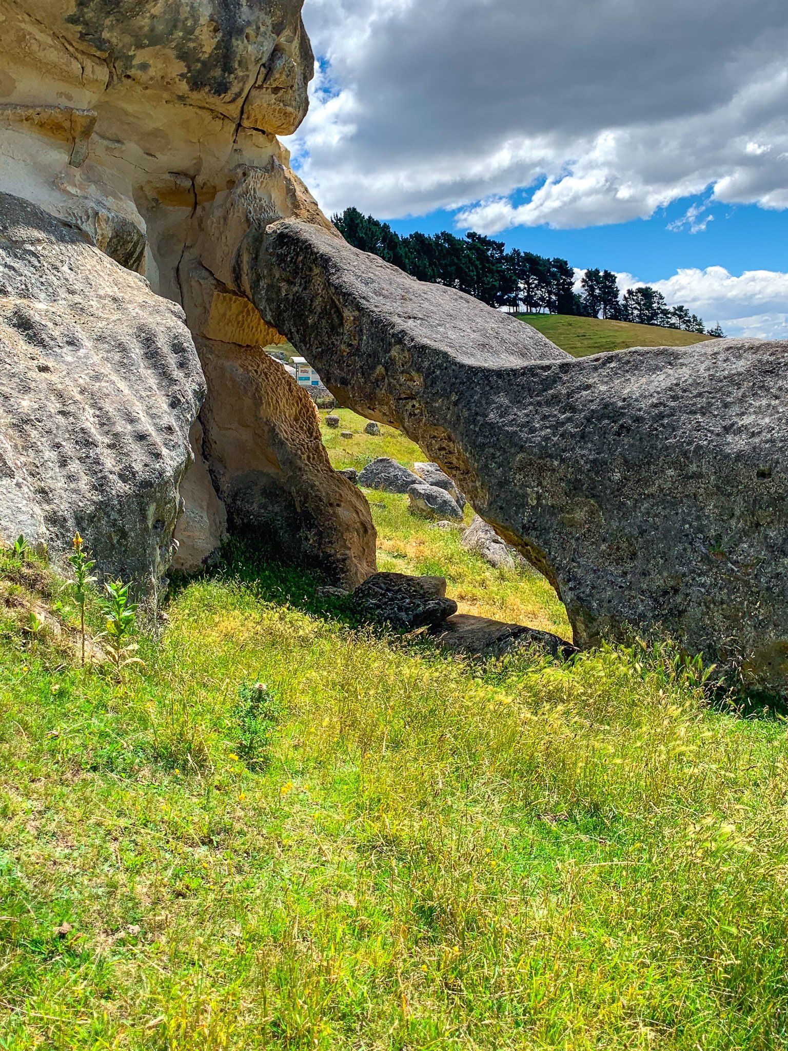
Elephant Rocks
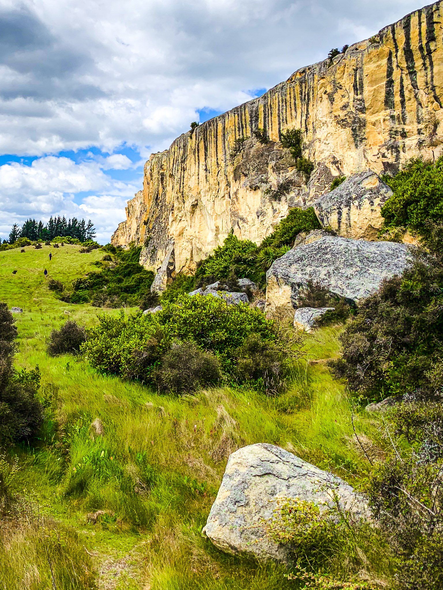
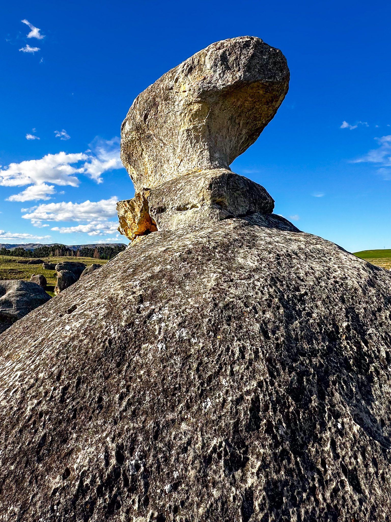
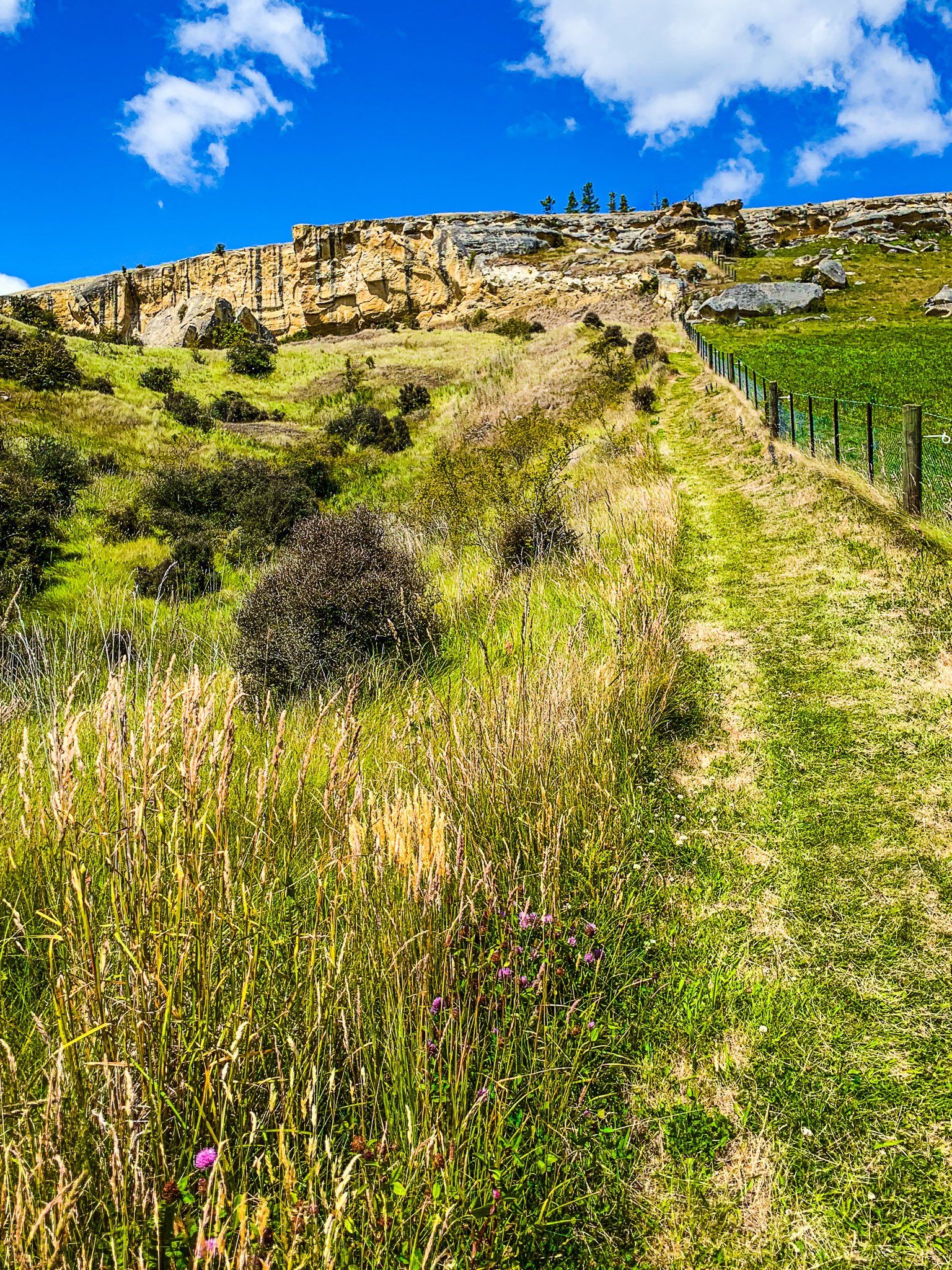
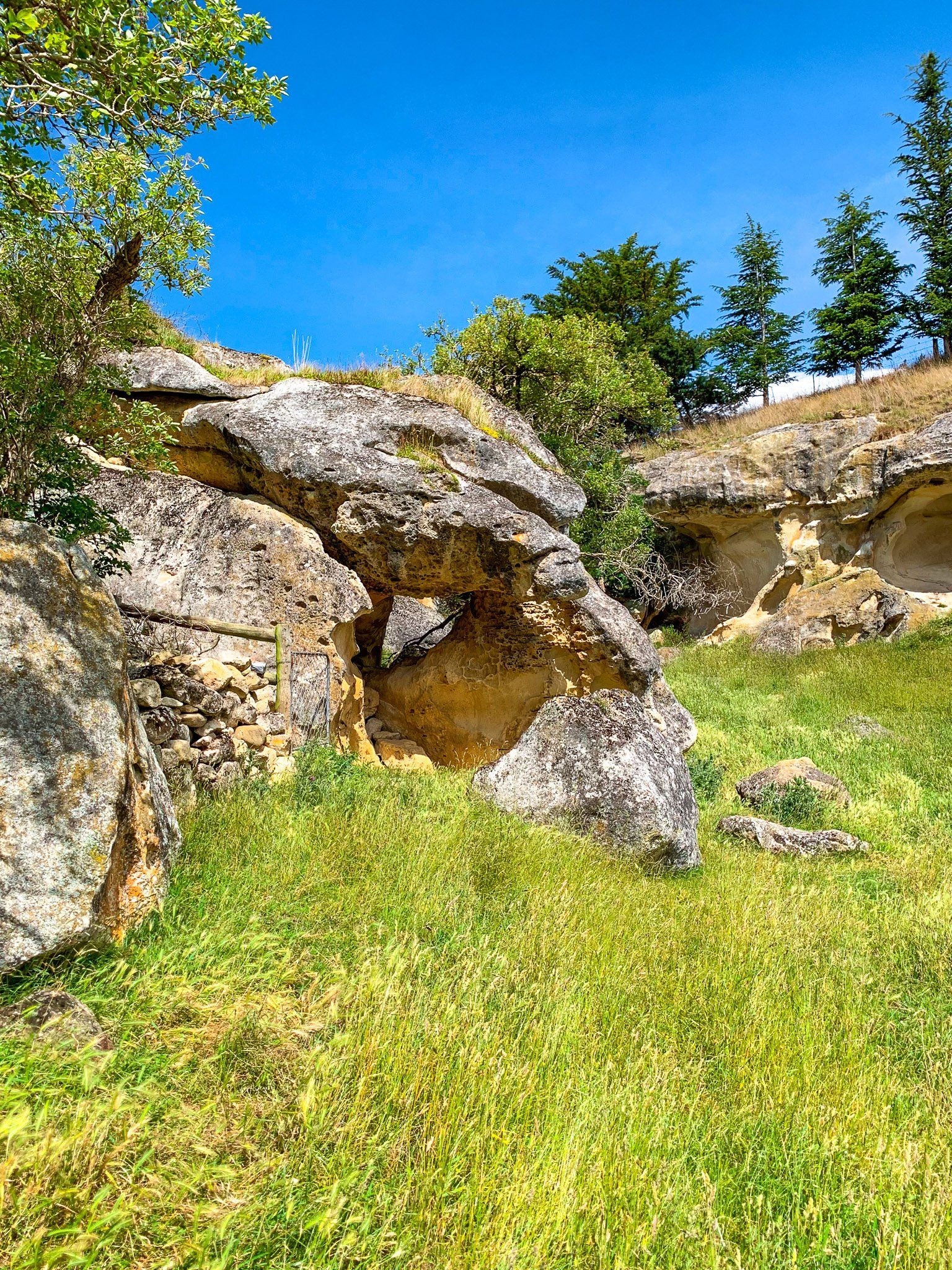
Elephant Rocks are Duntroon’s most interesting whitestone rock features. At one time, there was an enormous single platform of uplifted, 25 million year old limestone. Water ran across the rock into cracks and gradually eroded softer material away to create the extensive rock forms. This has created a large field of “elephants”, surrounded by grass.
To get to Elephant Rocks, take Livingstone Duntroon Road from Duntroon for five km, then turn left into Island Cliff Duntroon Road. The car park is about two km along the road. The field of “elephants” can be seen from the car park and information panel. But take time to do an easy walk around the rocks, which vary in size and shape. Arguably, the rocks look more like a field of modernist sculptures than elephants!
Elephant Rocks is on the Alps2Ocean Cycle Trail.
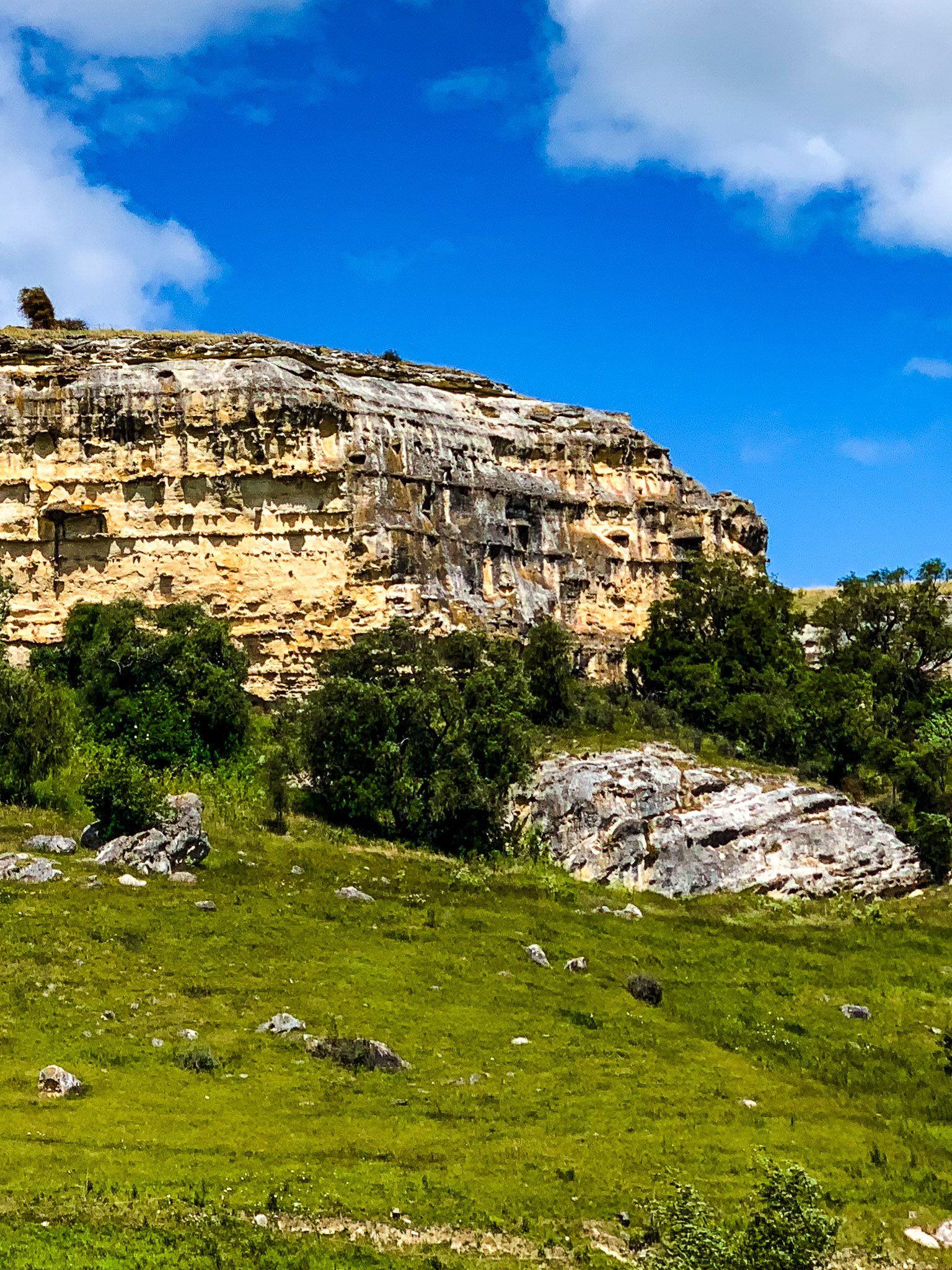
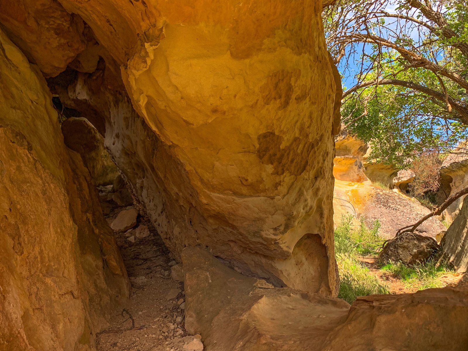
Anatini Fossils
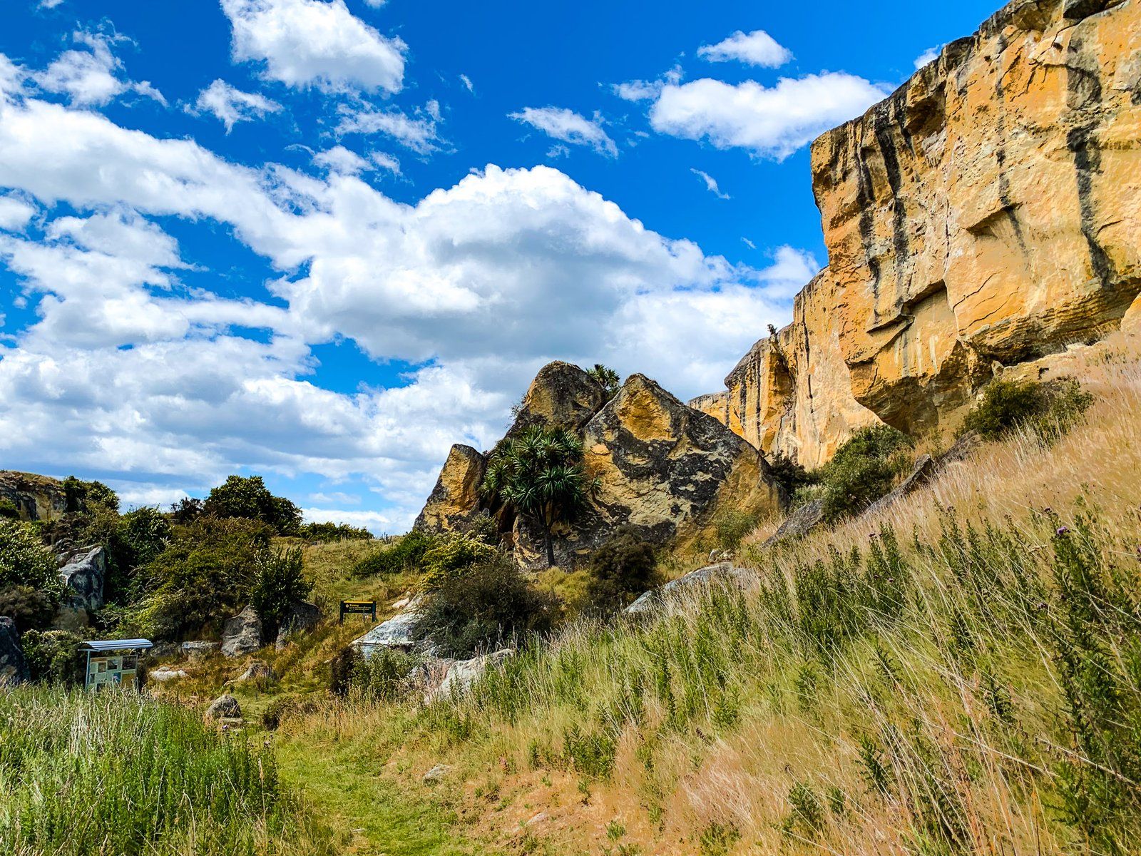
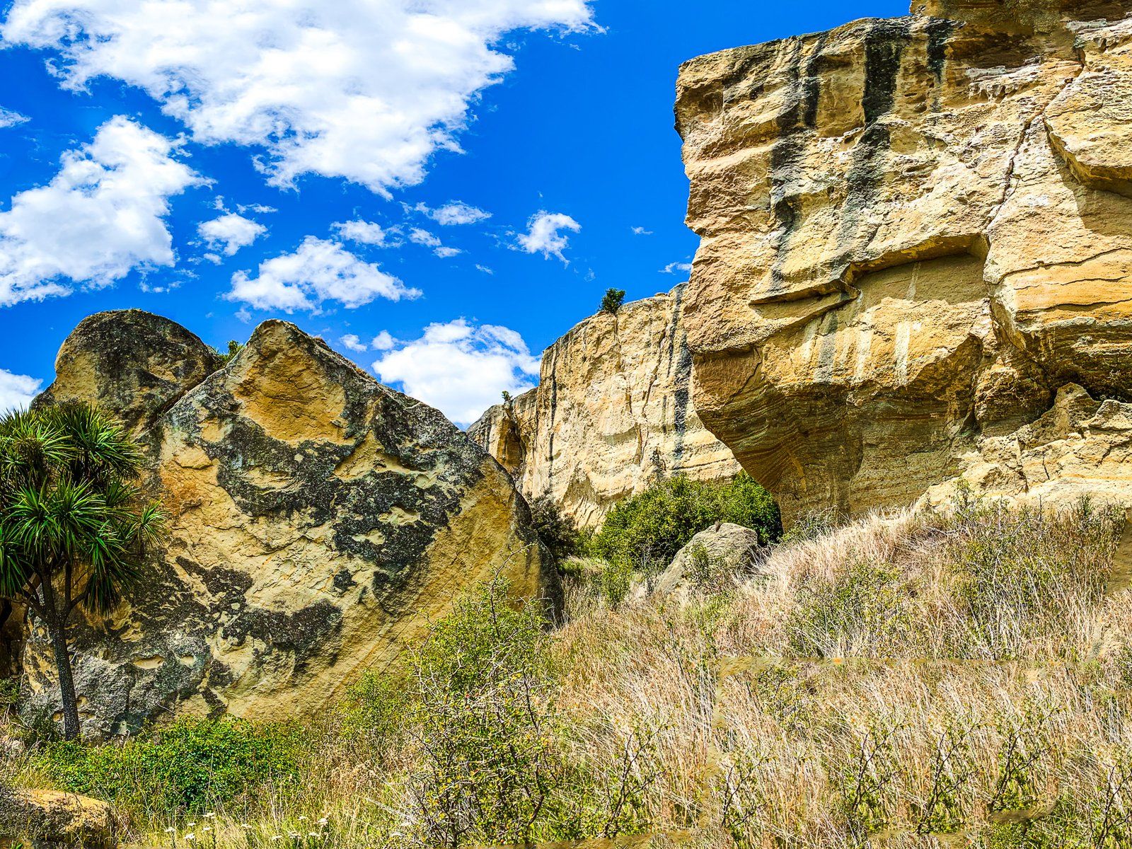
The Anatini Fossils are in a short hidden valley, with 25 million year old whitestone cliffs and rocks on either side. Access is from Island Cliff Duntroon Road, shortly after the car park for Elephant Rocks heading south. From the car park, it is a short walk down the marked track into the valley.
Some interesting rock formations exist, but the main point of interest is a protected baleen whale fossil attached to the cliff face. It is a short sidle up the cliff to reach the fossil. This fossil is similar to the one at Earthquakes Waipata but a little trickier to get to.
Anatini Fossils is on the Alps2Ocean Cycle Trail.
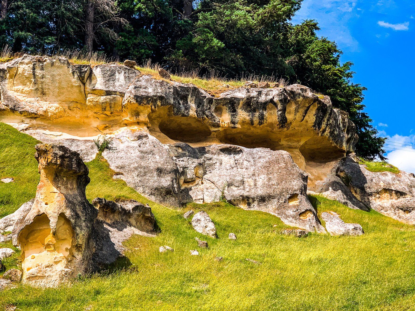
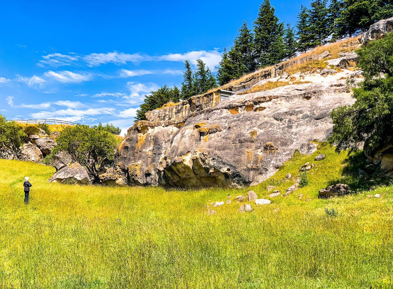
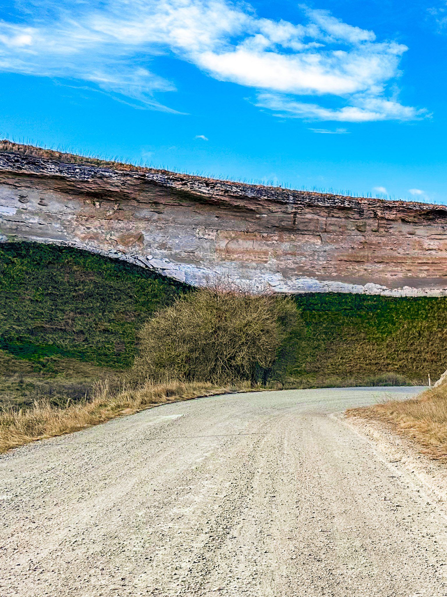
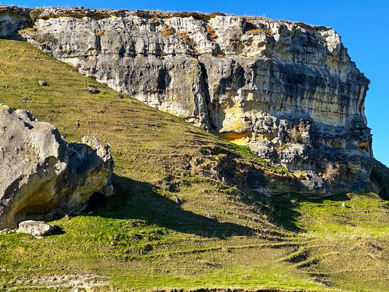
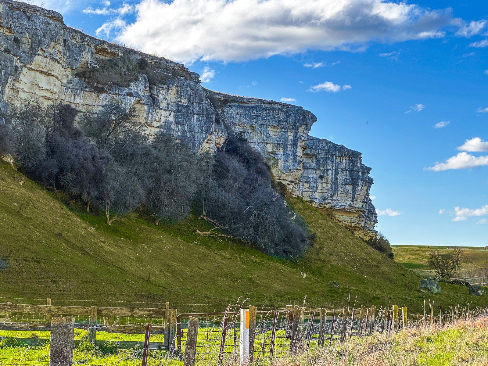
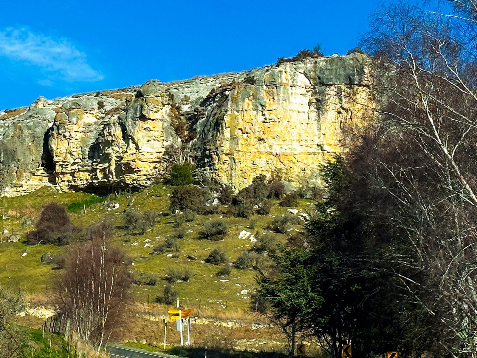
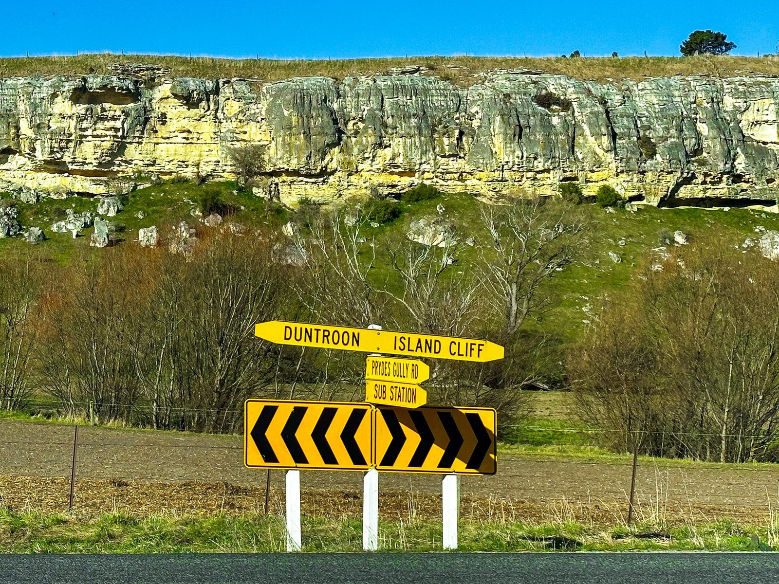
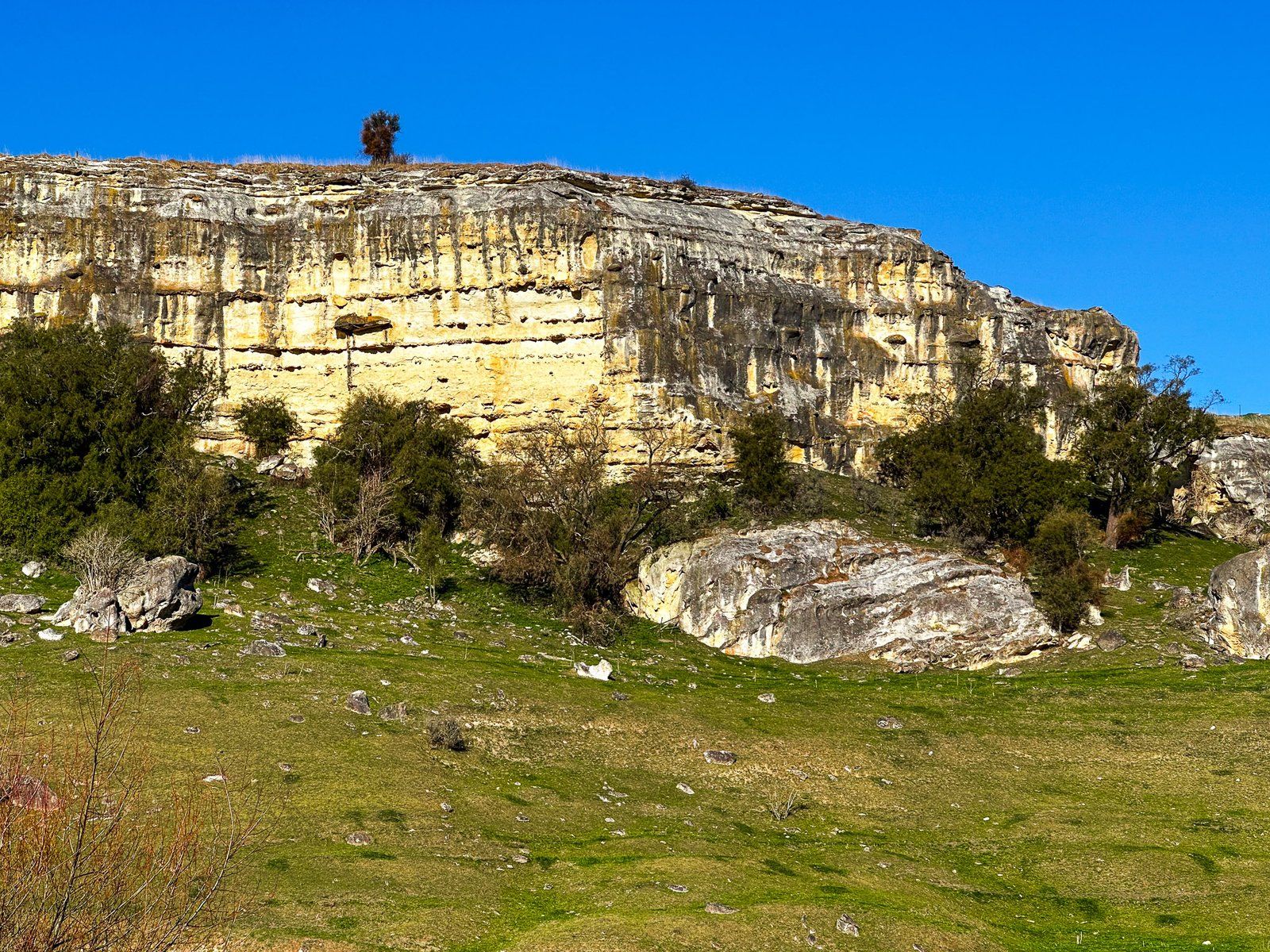
Island Cliff
From Elephant Rocks and Anatini Fossils, Island Cliff Duntroon Road heads south, then drops 60 metres between whitestone cliffs to connect with Tokarahi Ngapara Road. This road has 60 metre high creamy limestone cliffs on either side with streaks of grey. These have been carved out by the unassuming Awamoko Stream that runs alongside the road. Continue along the road to the southwest, and Island Cliff, a flat-topped cliff-bound formation, is to your left.
From there, loop back on Tokarahi Duntroon Road to Livingstone Duntroon Road to Duntroon, or head south on Tokarahi Tapui Road towards Oamaru.
Island Cliff is on the Alps2Ocean Cycle Trail.
Want more Canterbury Trip Ideas?
Check out our blogs on the Alps2Ocean Cycle Trail, Winter Road Trip to Aoraki Mt Cook, and Touring the Ashburton Lakes to Erewhon.