
It is easy to think of Rotorua as a tourist oriented “thermal wonderland”, with a focus on mostly paid visits to one of many thermal hotspots and other organised tourist activities. But there is an extensive and varied range of outdoor activities, including the stunning Okere Falls, many of which are free to access.
For our second blog on the region, we have selected a combination of free sights and activities plus a couple of paid thermal activities. Without the paid activities, the thermal experience is somewhat confined to the smell of sulphur in Rotorua and the odd steaming pool.
This two-day trip starts at Okere Falls Walk and the northwest end of Lake Rotoiti, off State Highway 33. From there it is a picturesque drive on SH30 to the historic Government Gardens in central Rotorua. Whakarewa Forest, with its 100+ year old exotic tree forests, and the nearby Scion forestry research institute can then be found on Long Mile Road on the southeast side of town.
Then take another picturesque drive from the forest along SH5 to Waiotapu Thermal Wonderland. If you have time, go searching for the more remote Orakei Korako, accessed by boat over the Waikato River.
Lake Rotoiti West
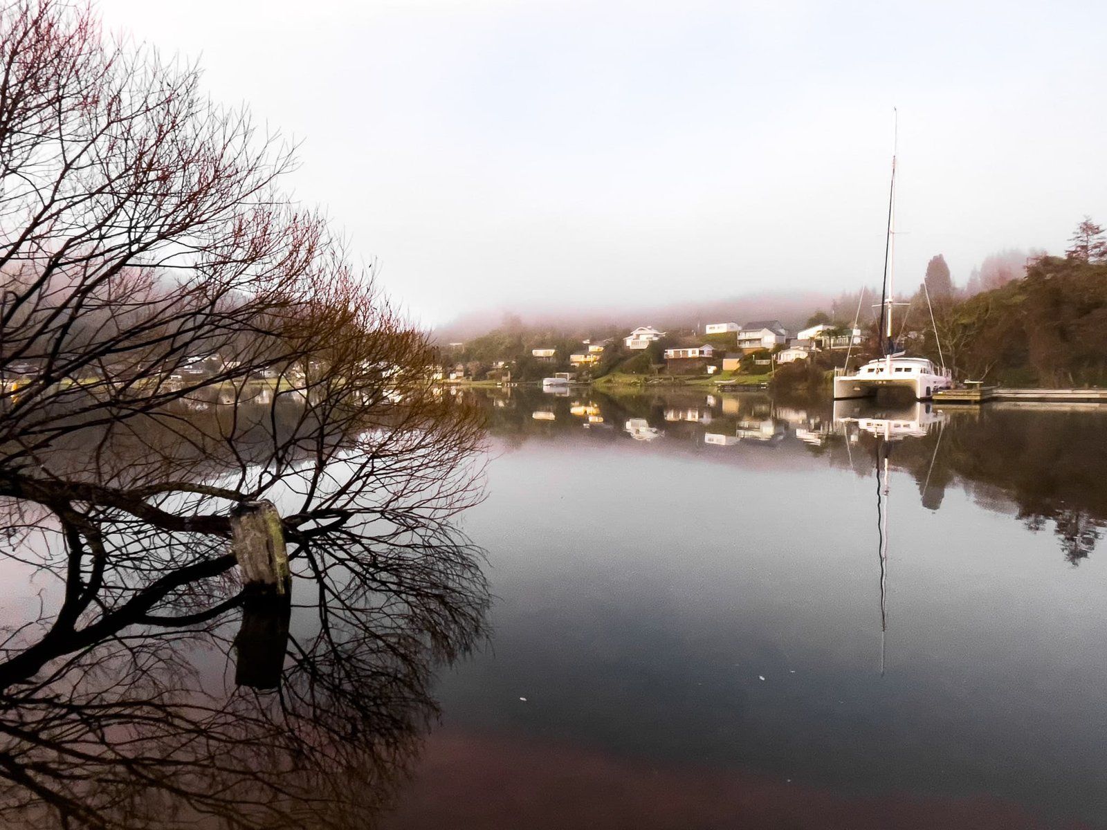
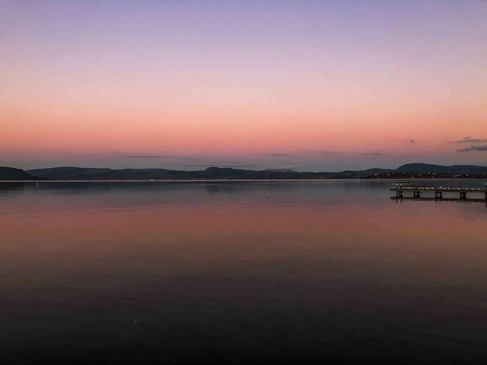
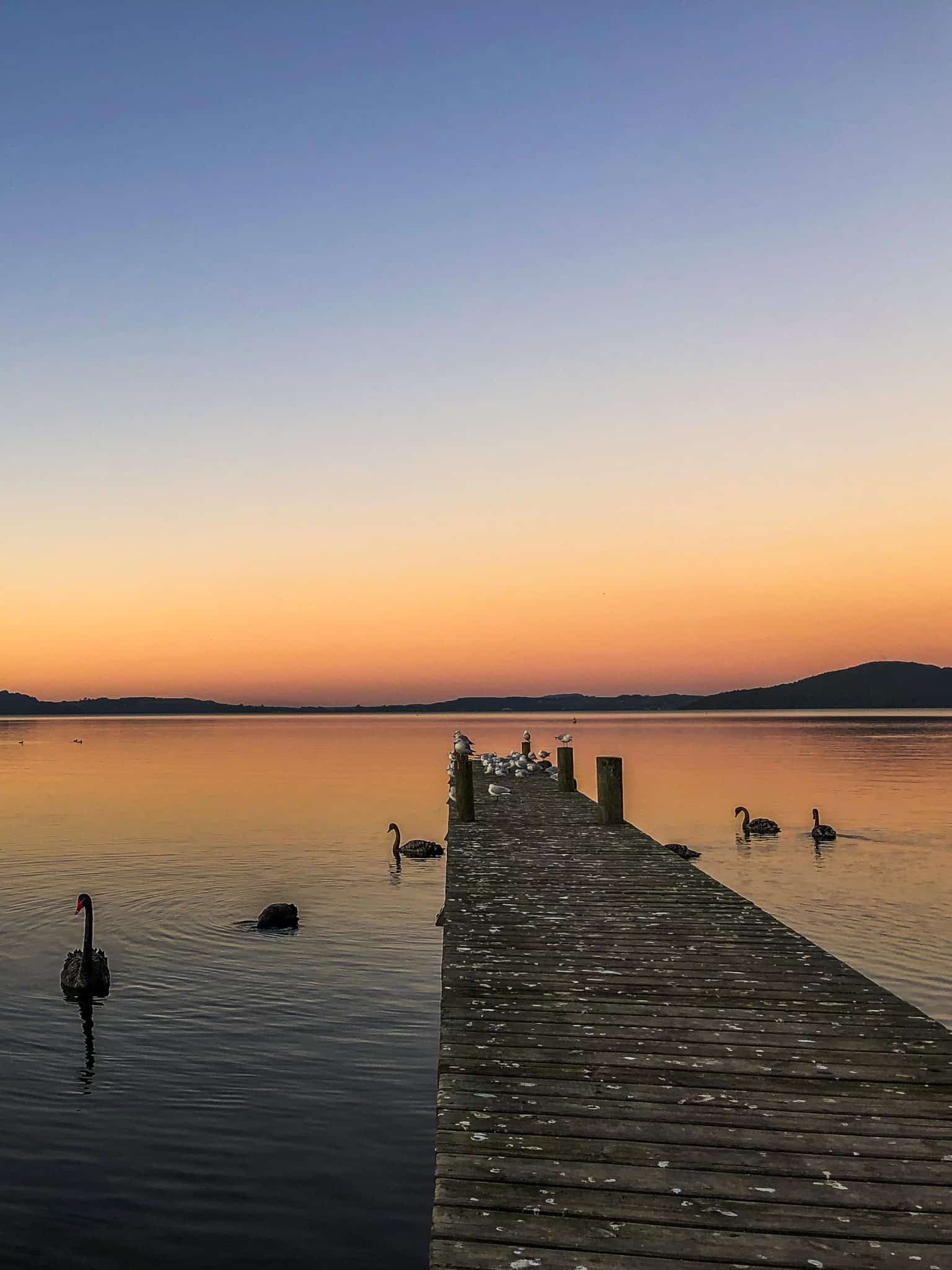
The west end of Lake Rotoiti is a mini hotspot for things to do in the Rotorua region. There is accommodation along State Highway 33 as it runs with the lake, and the superb Okere Falls Store + Craft Beer Garden to cover your coffee needs.
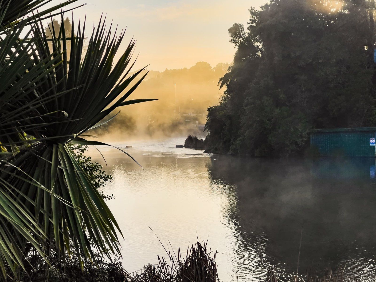
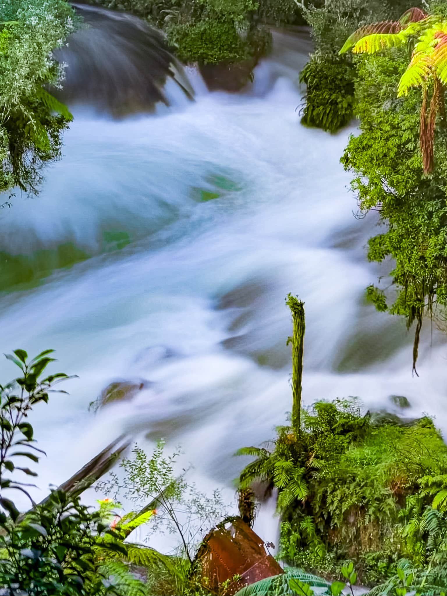
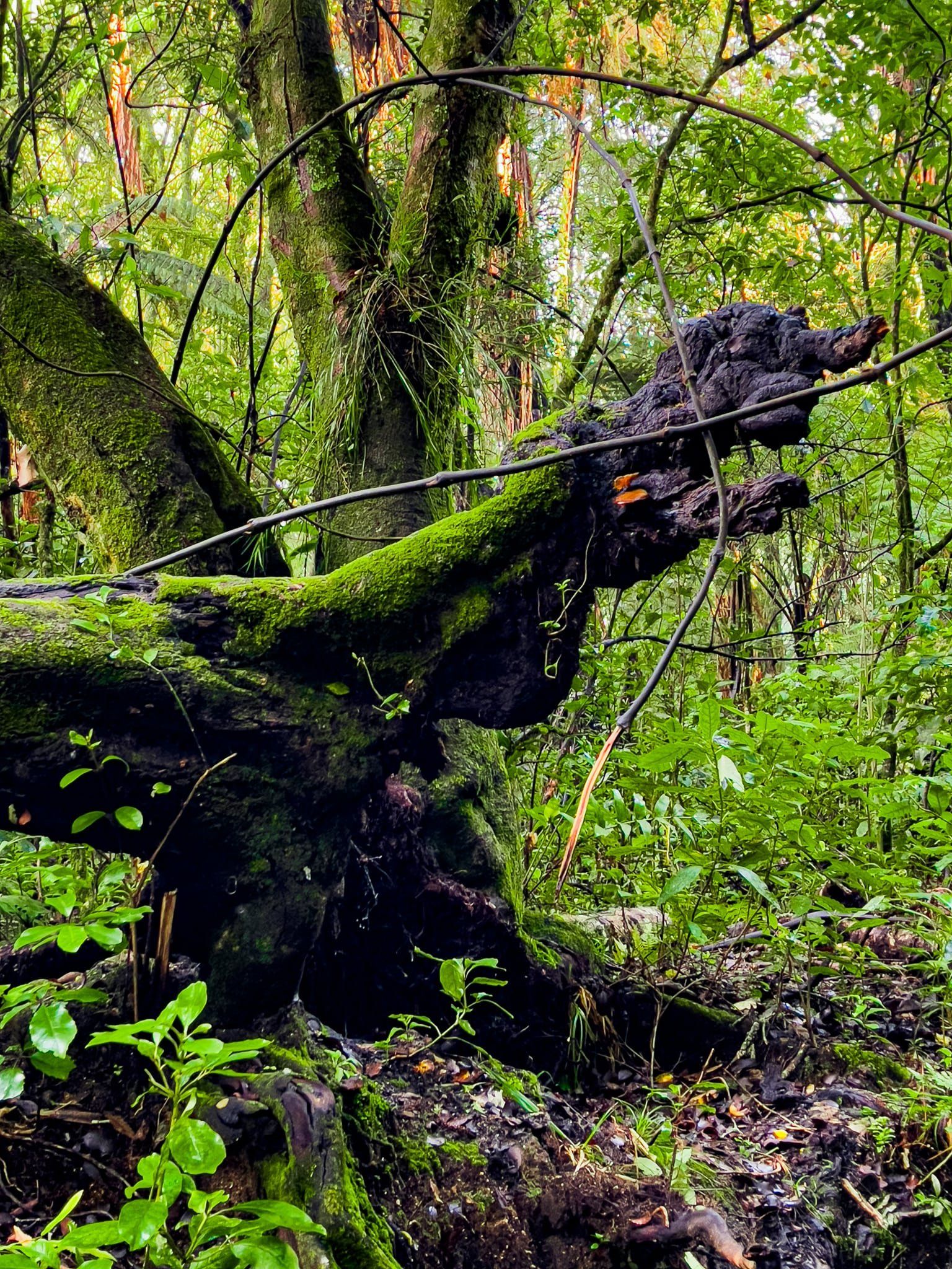
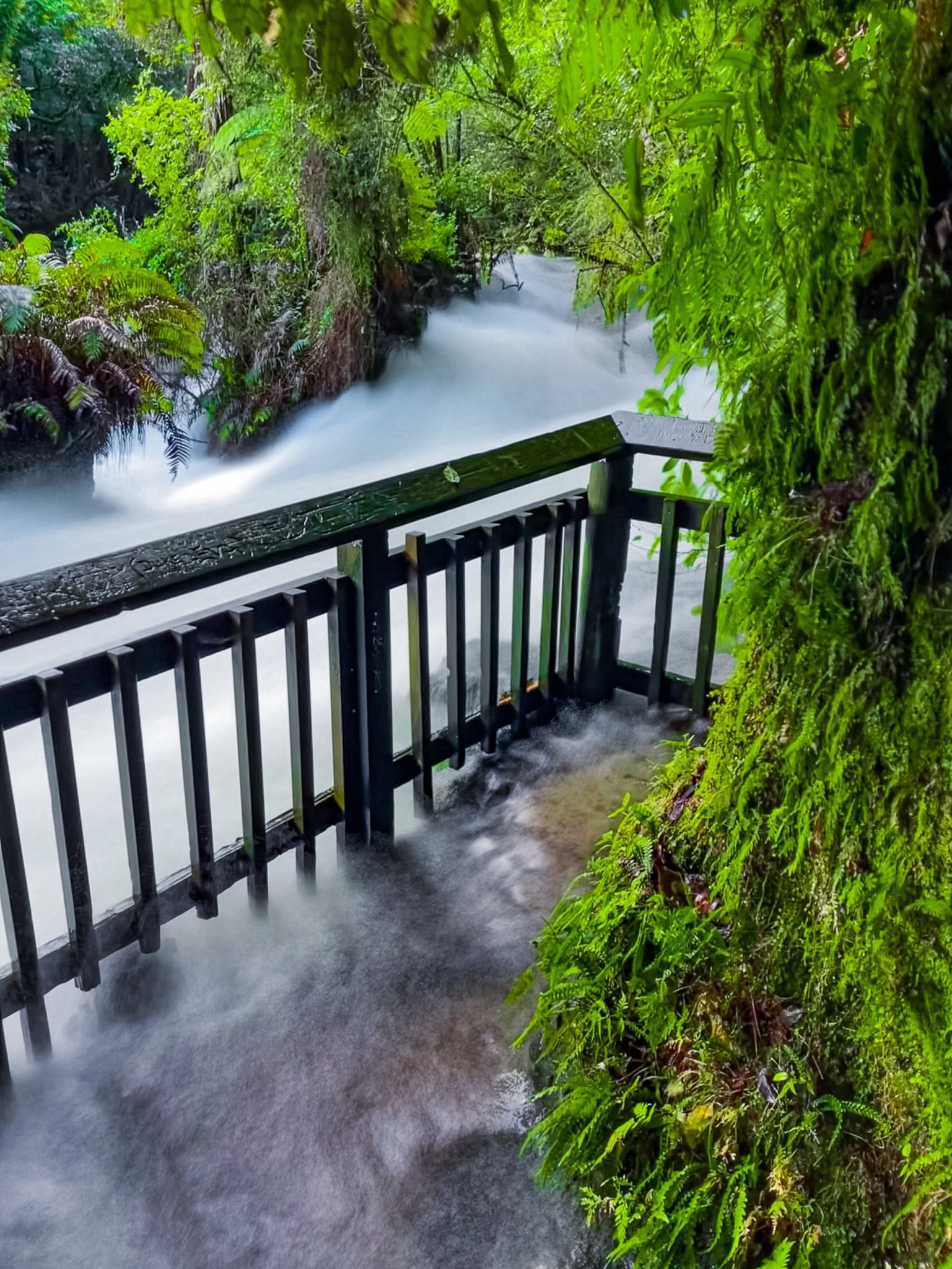
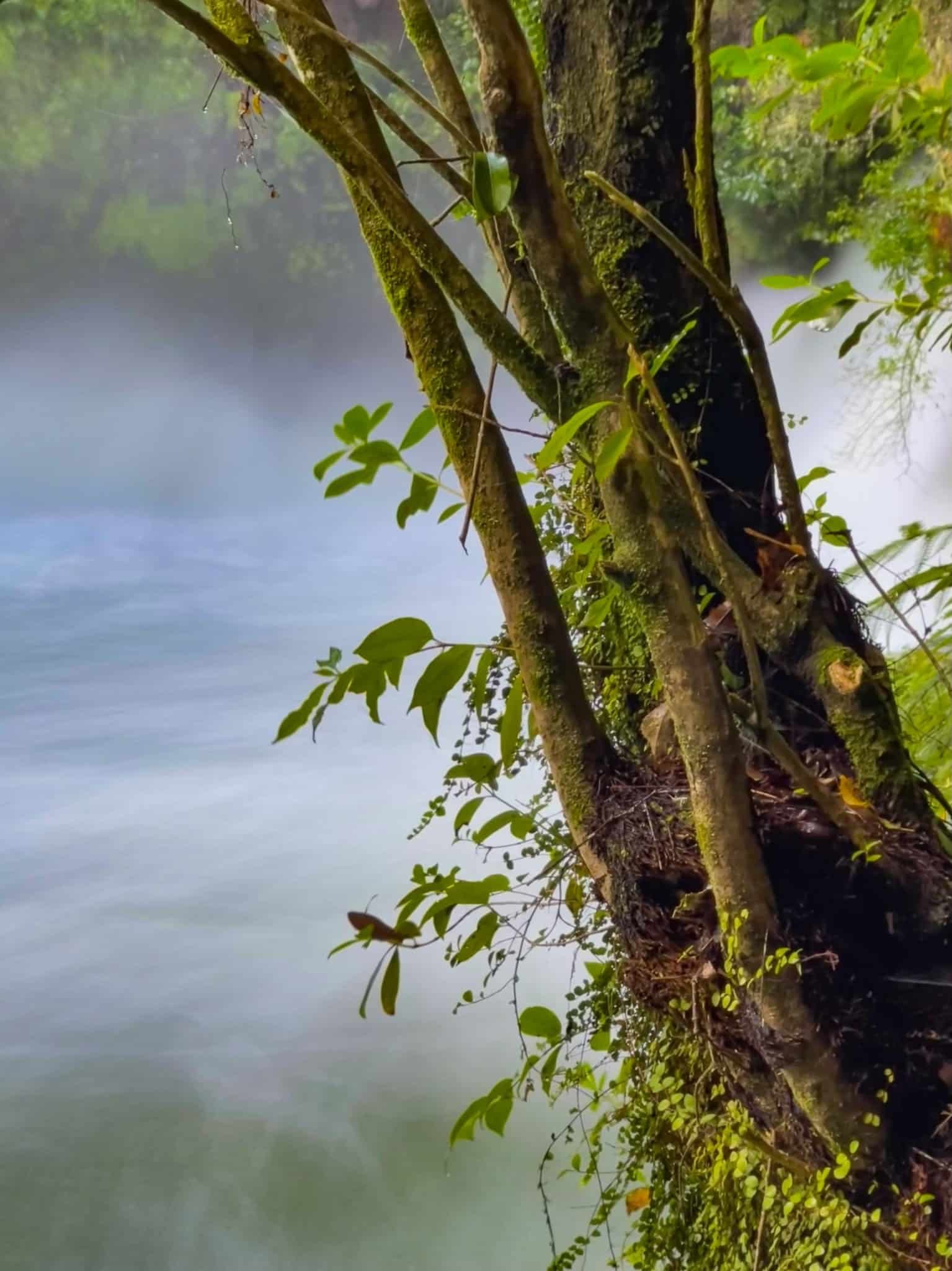
There is also access to the fabulous short Okere Falls Walk above the actual Okere Falls and rapids of the Kaituna River. This walk uniquely combines history of the NZ tourism and hydro power industries with pretty native forest regrowth, access to a cave, and viewpoints of waterfalls and rapids. You can also try out white water rafting with Rotorua Rafting or ziplining with Rotorua Ziplines.
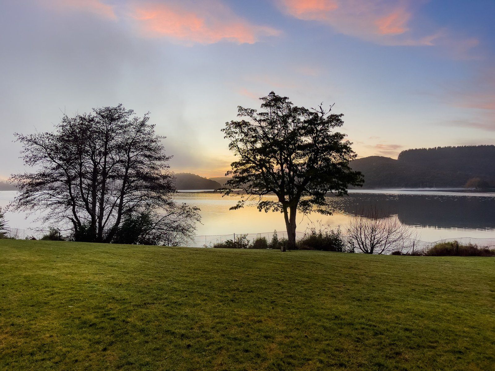
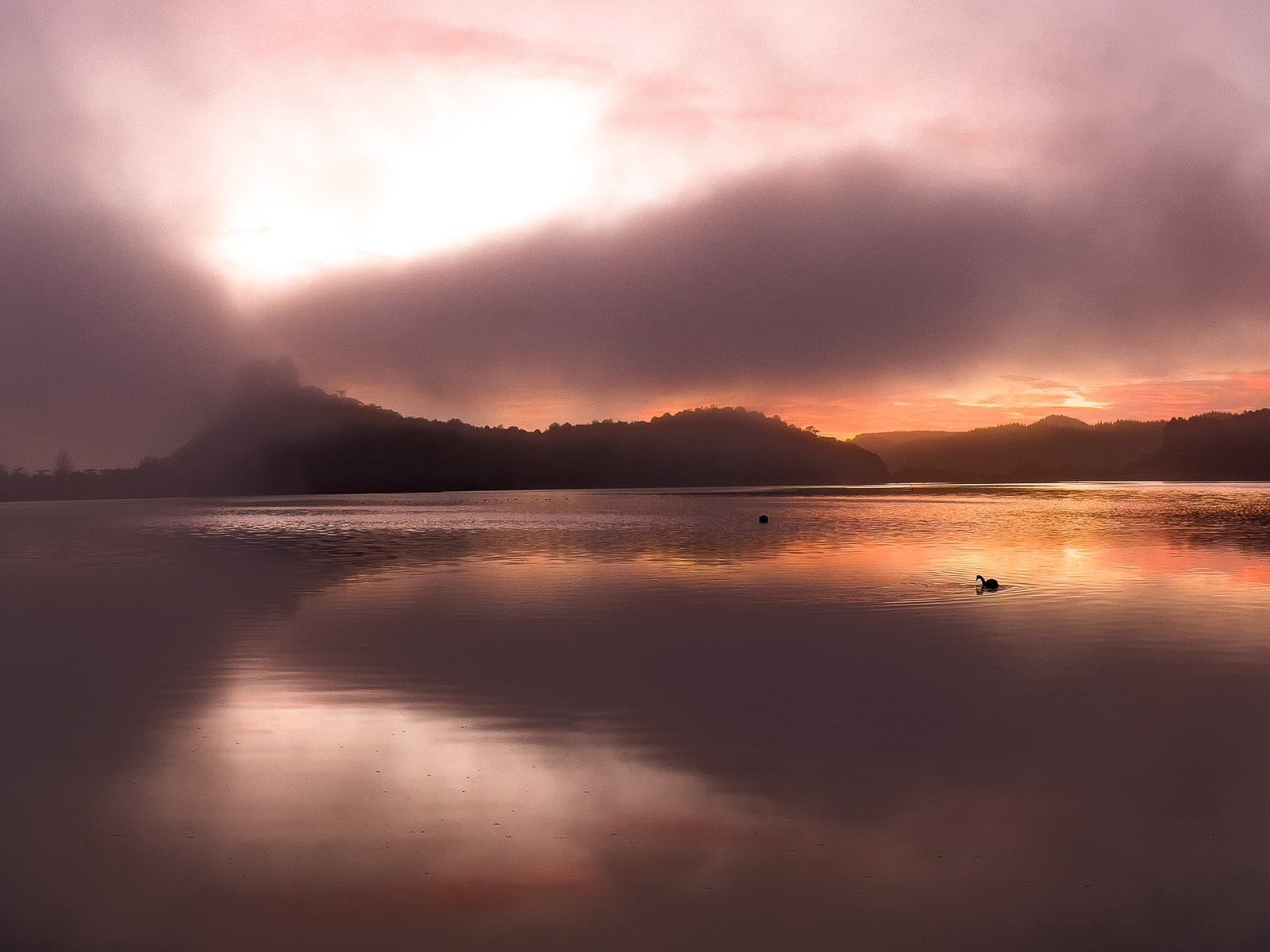
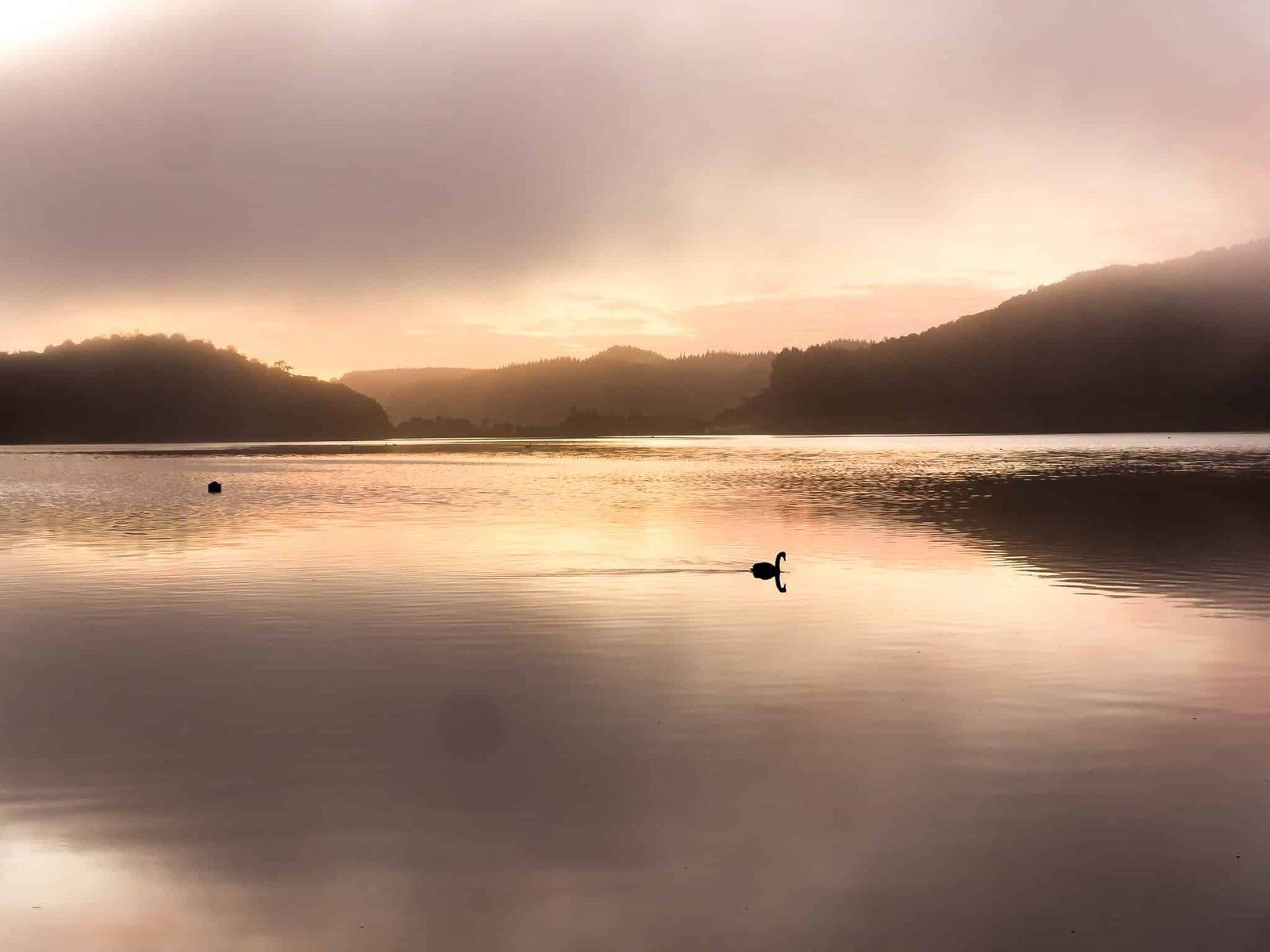
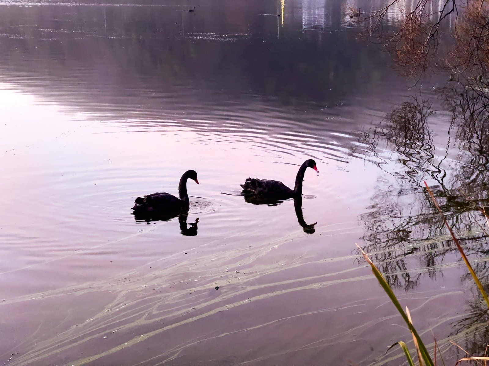
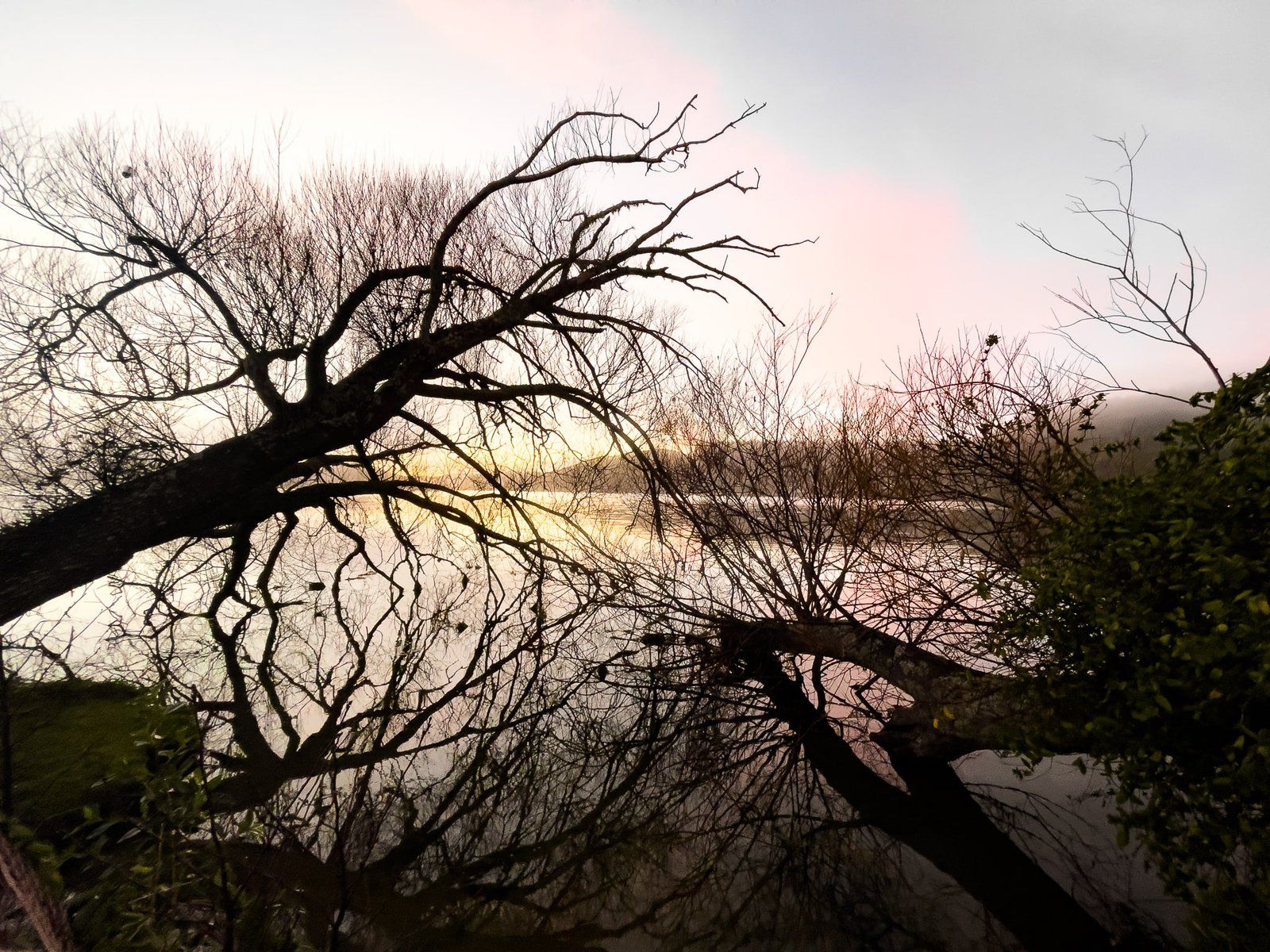
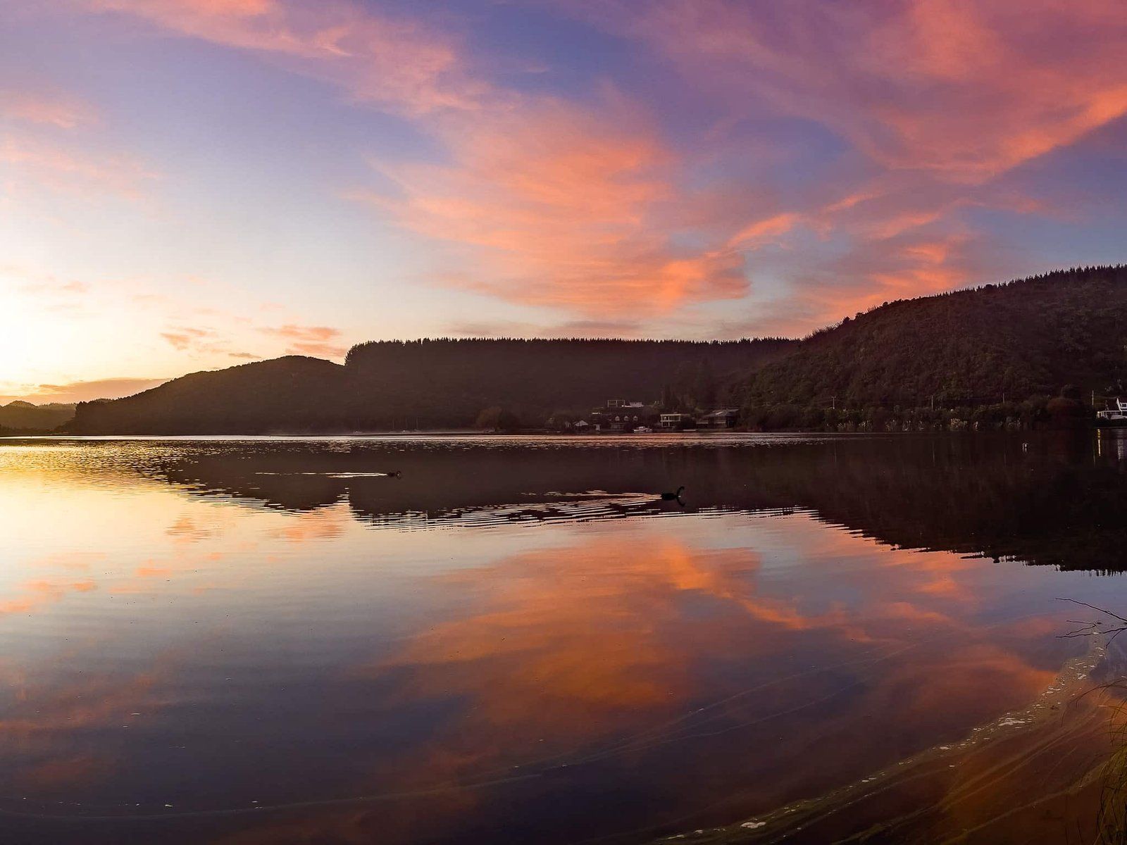
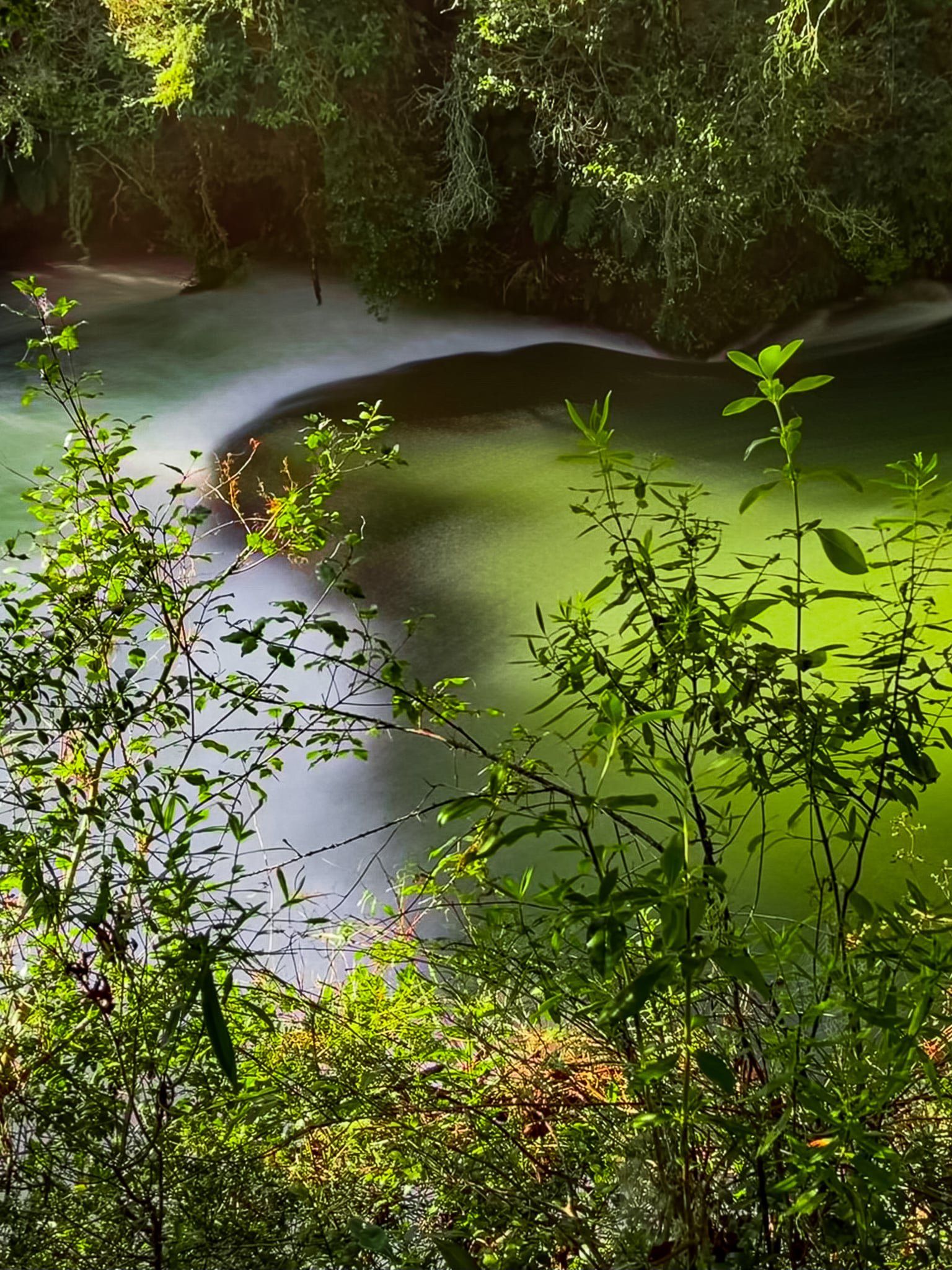
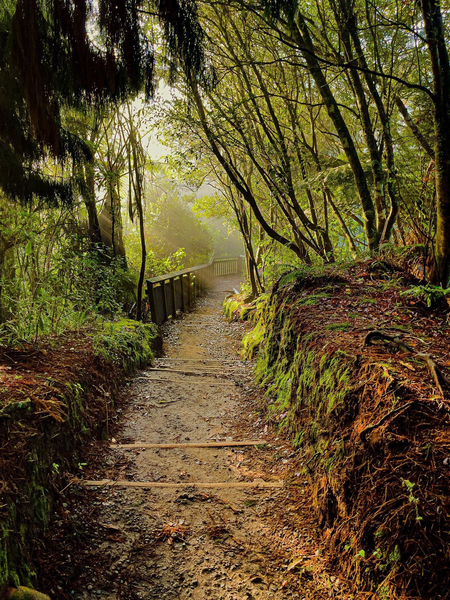
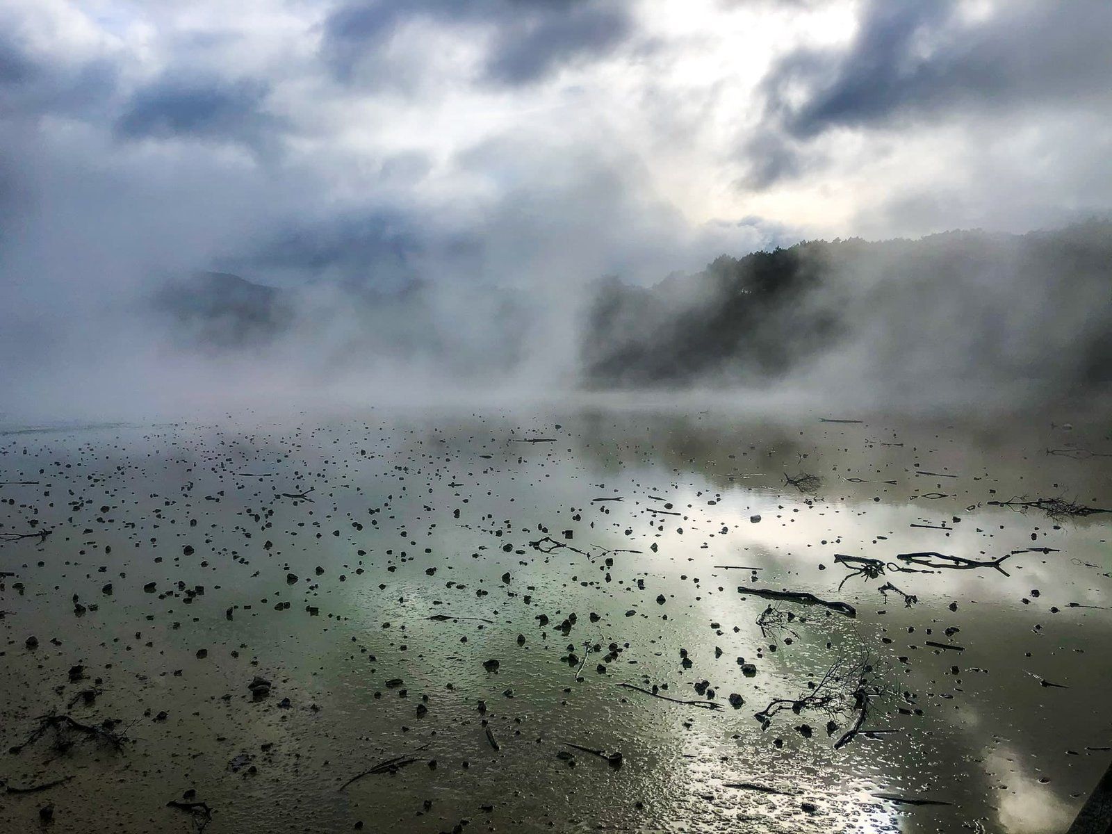
In addition, this end of the lake faces the sunrise, so start early to find a place to stop between Okere Falls and Okawa Bay. Add some early morning lake mist for a magical moment. From there, head to the cafe before setting out to explore the Okere Falls Track on the Kaituna River. The walk can be done in an hour but we recommend allowing a leisurely two or three!
Okere Falls Track
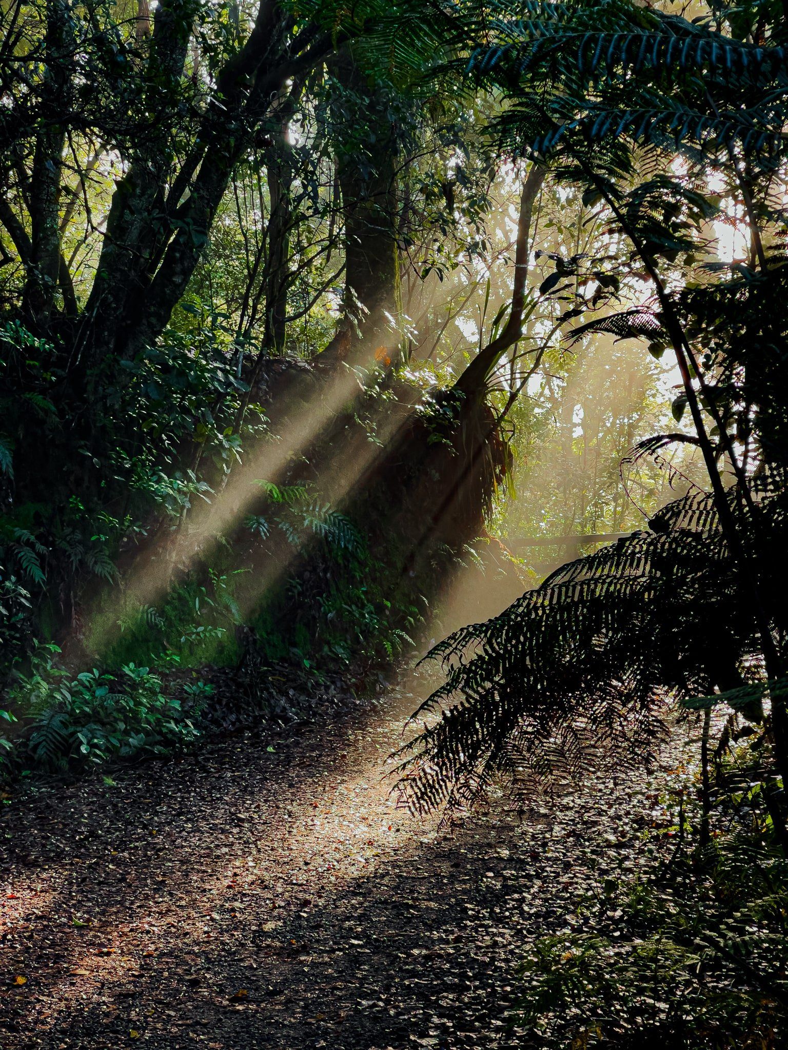
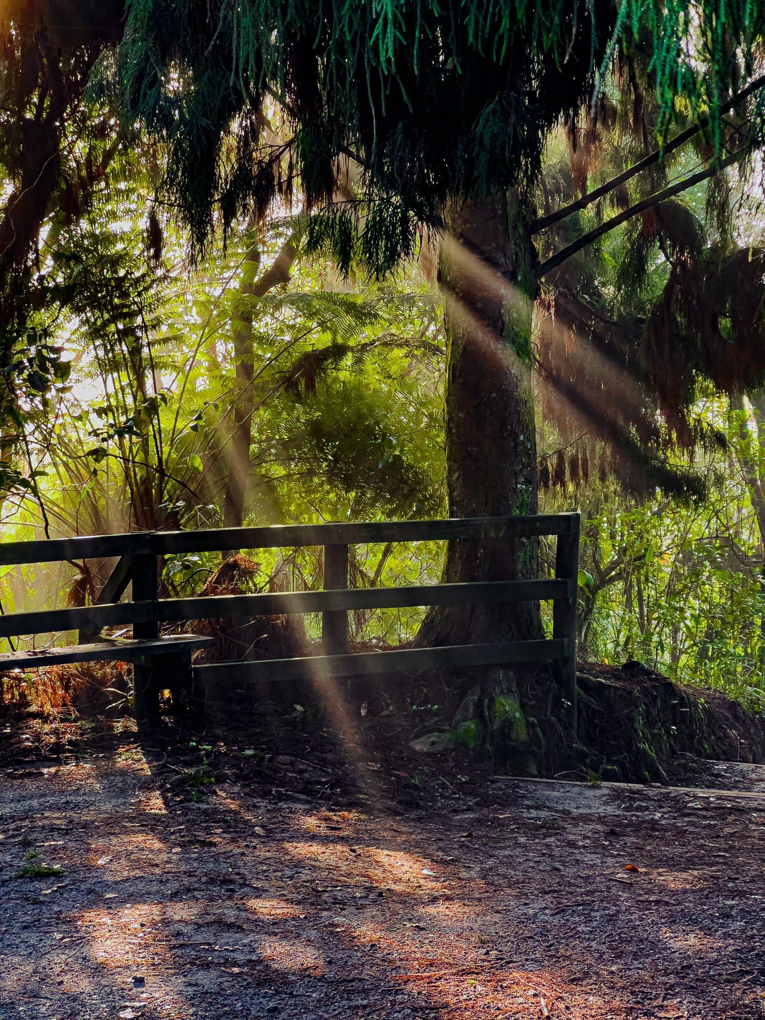
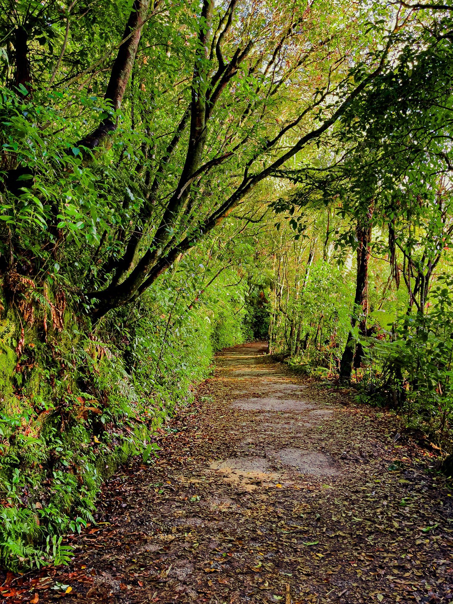
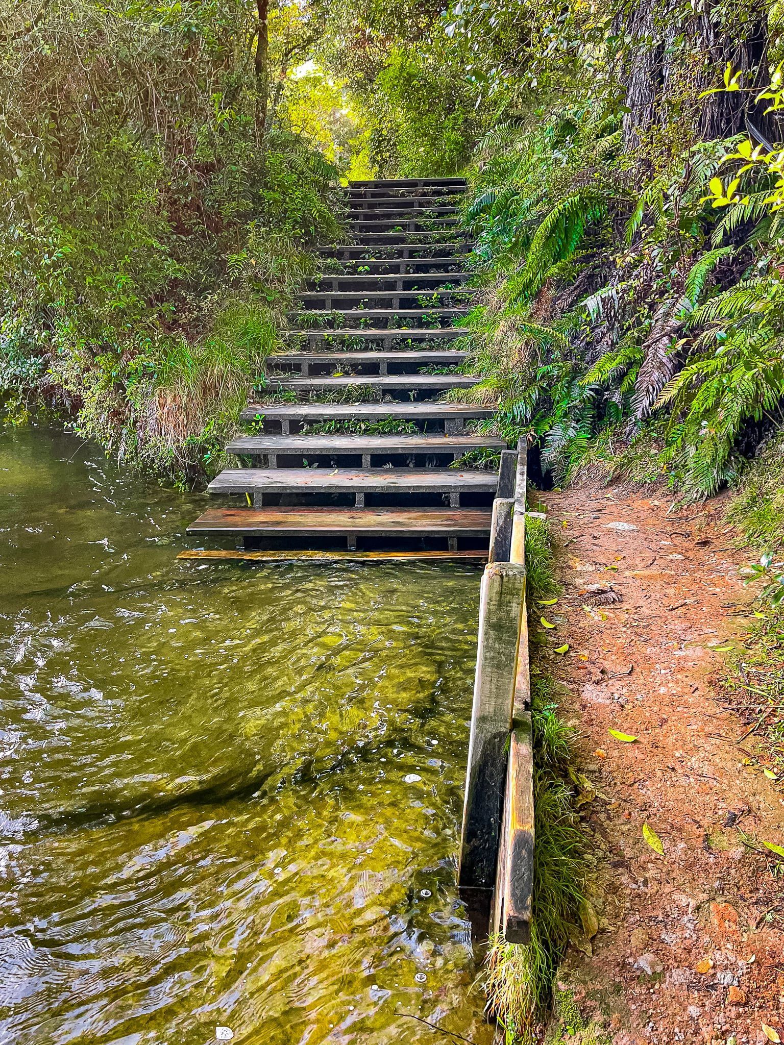
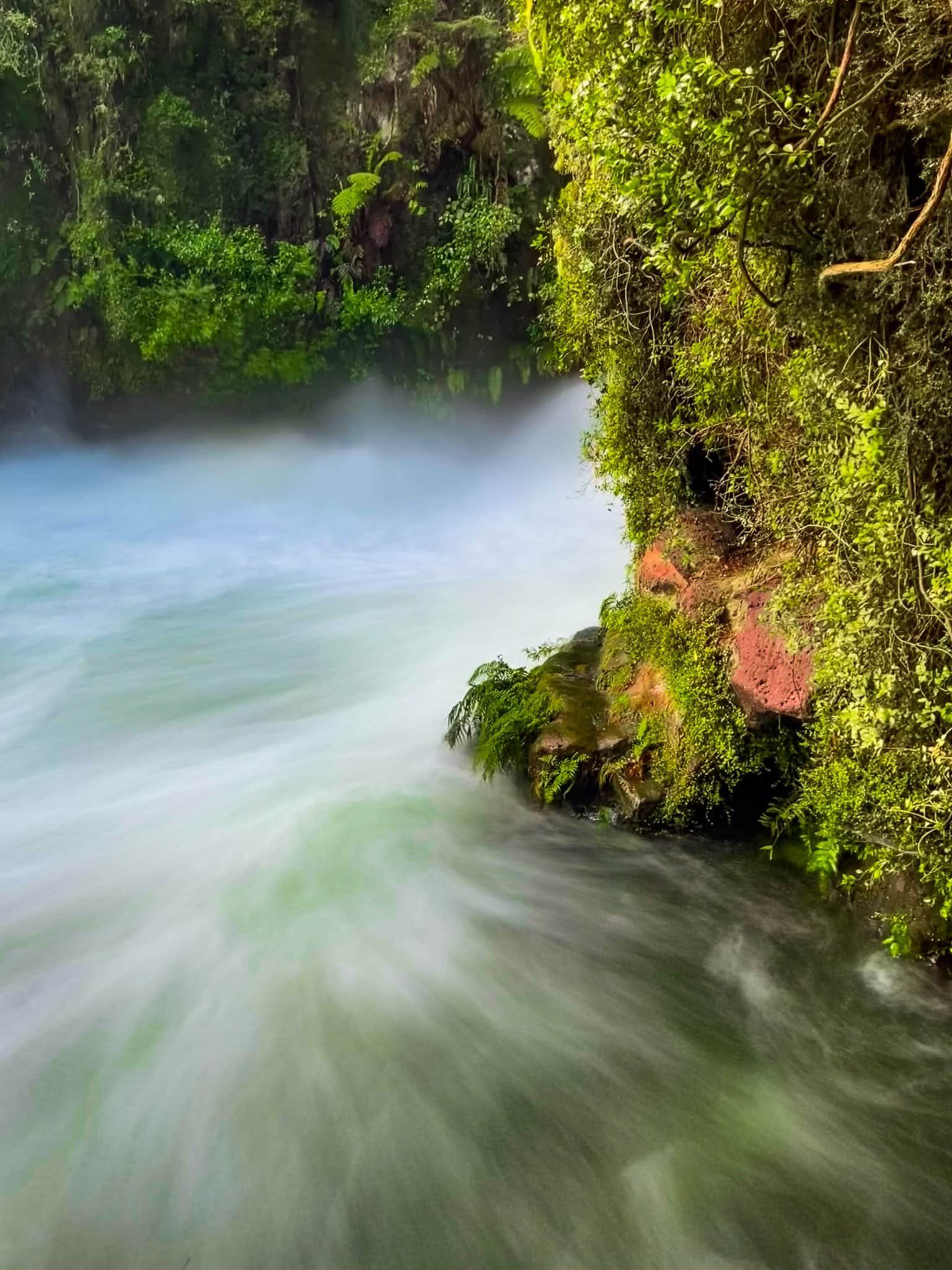
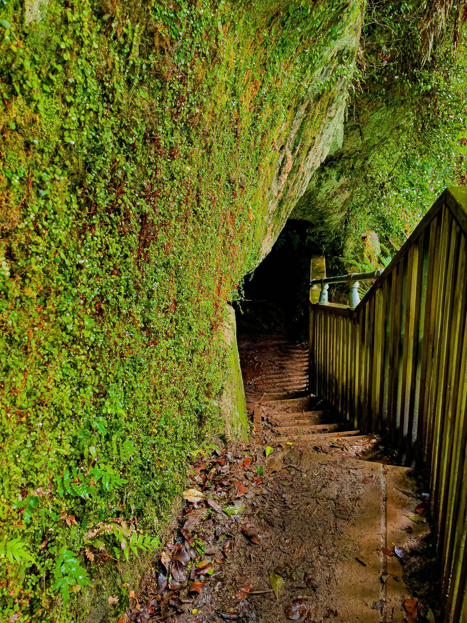
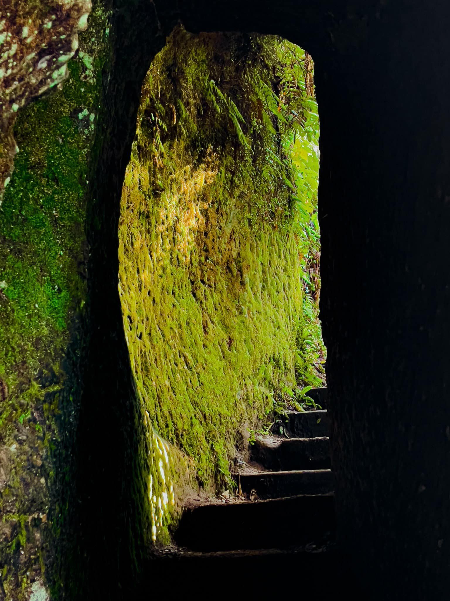
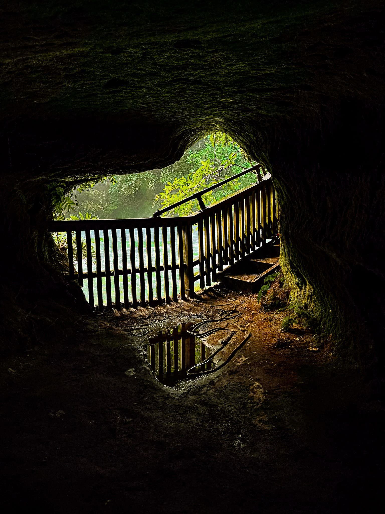
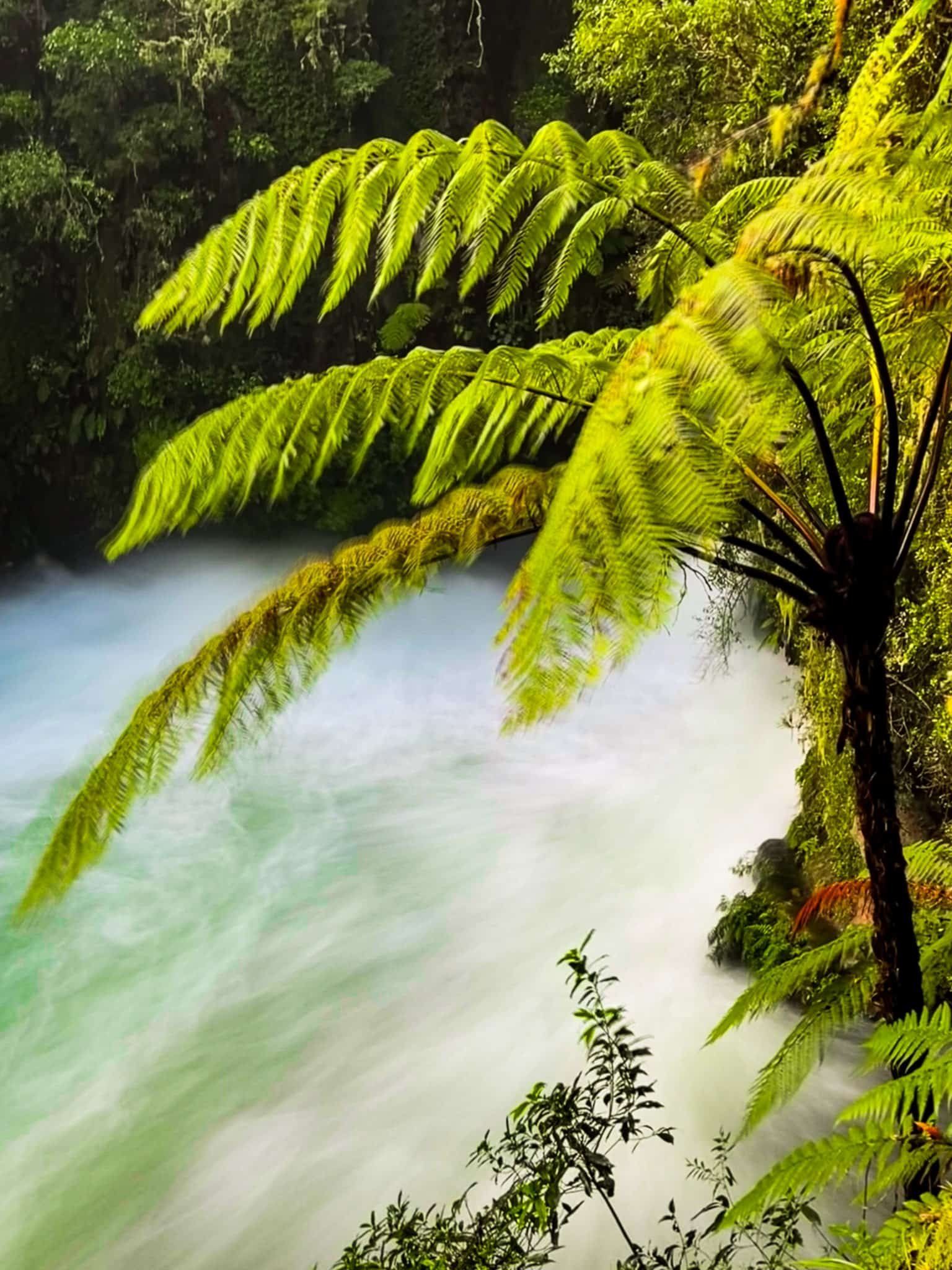
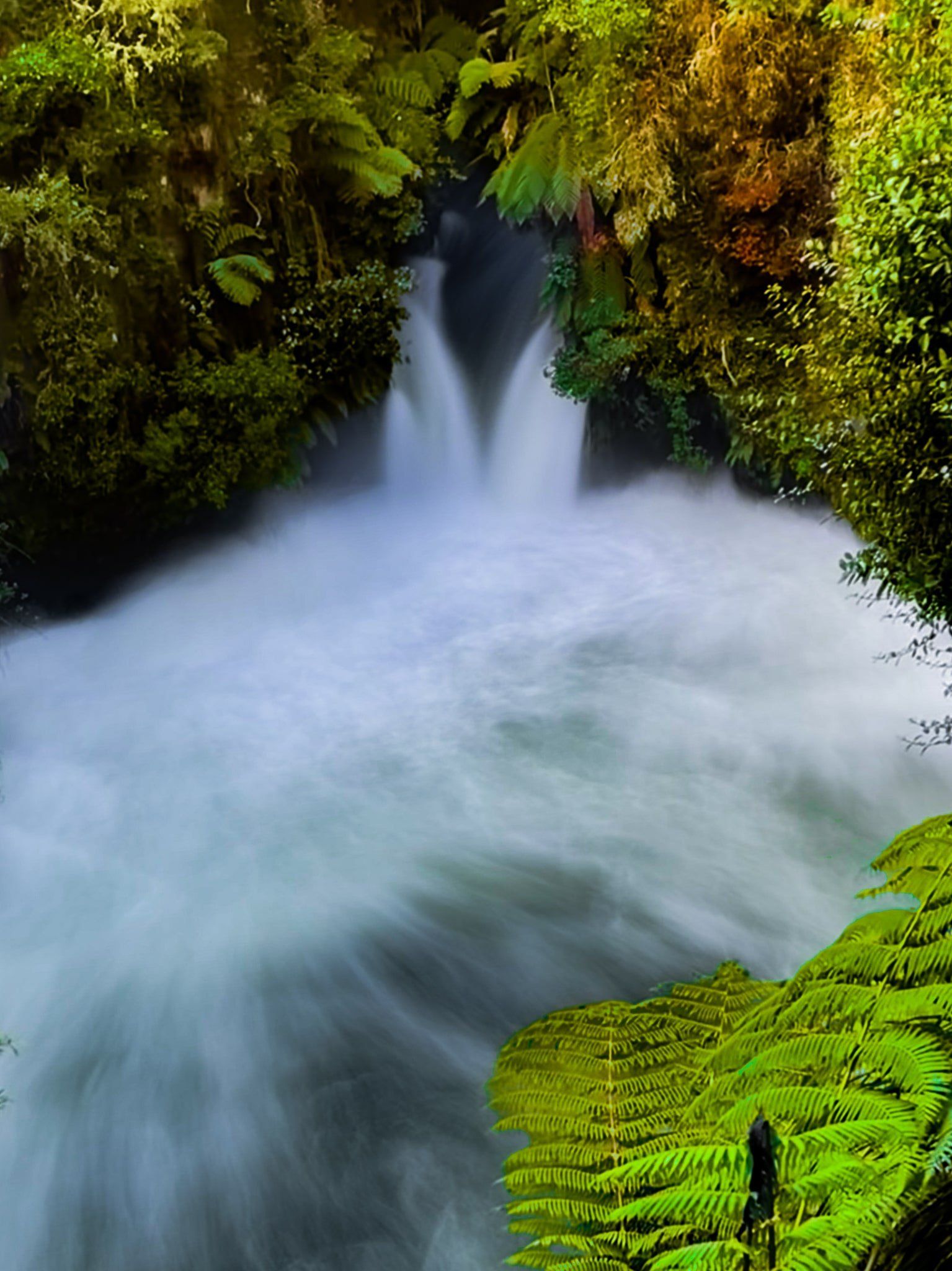
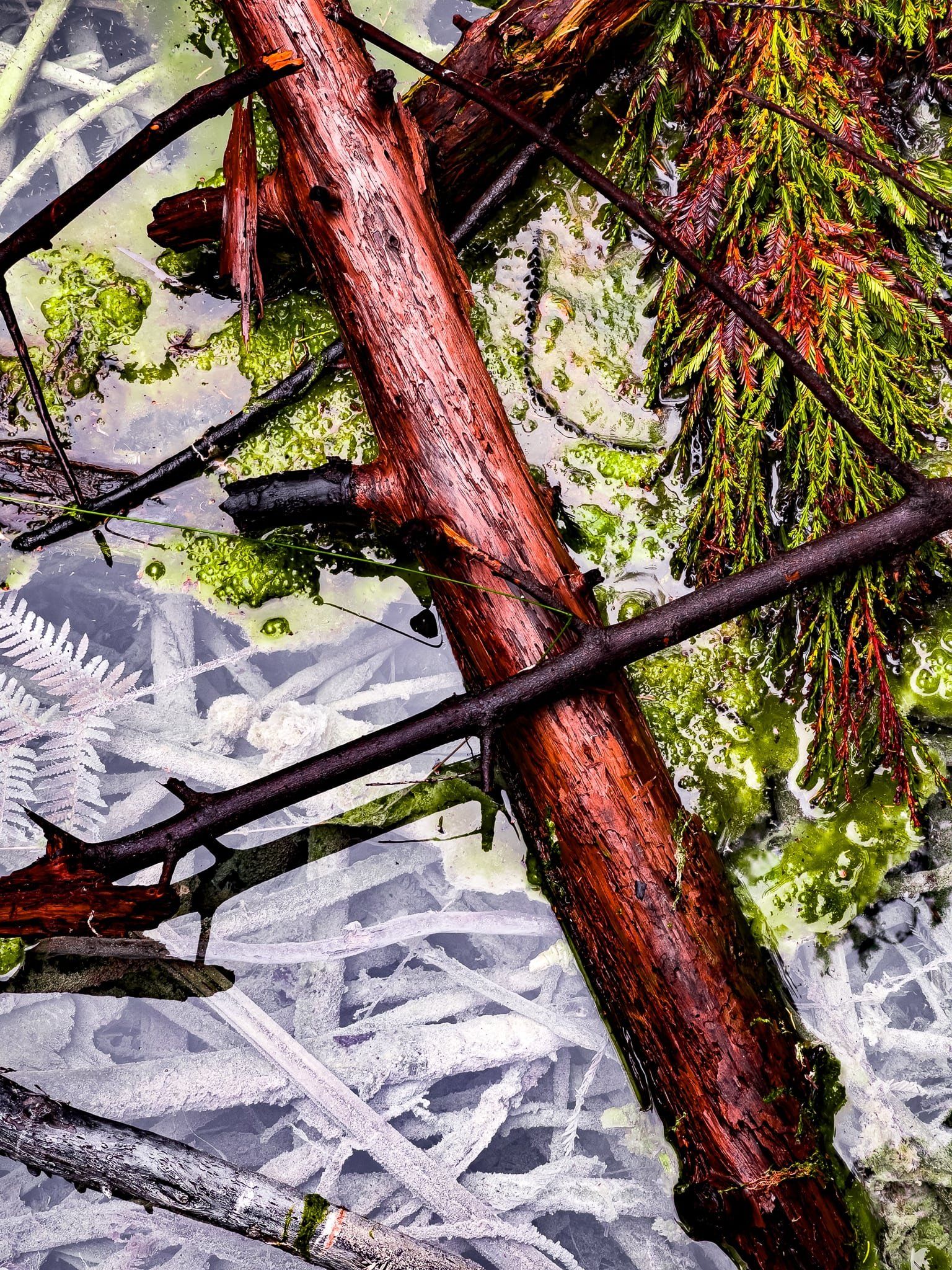
Okere Falls Track is an easy one-hour return loop above the Kaituna River. It starts near the Okere Falls viewpoint, follows the edge of the gorge through the forest, with a side trip to Tutea Falls and caves, then drops down to a river access point on the road. From there, return the same way or take the higher track back over the top of the ridge.
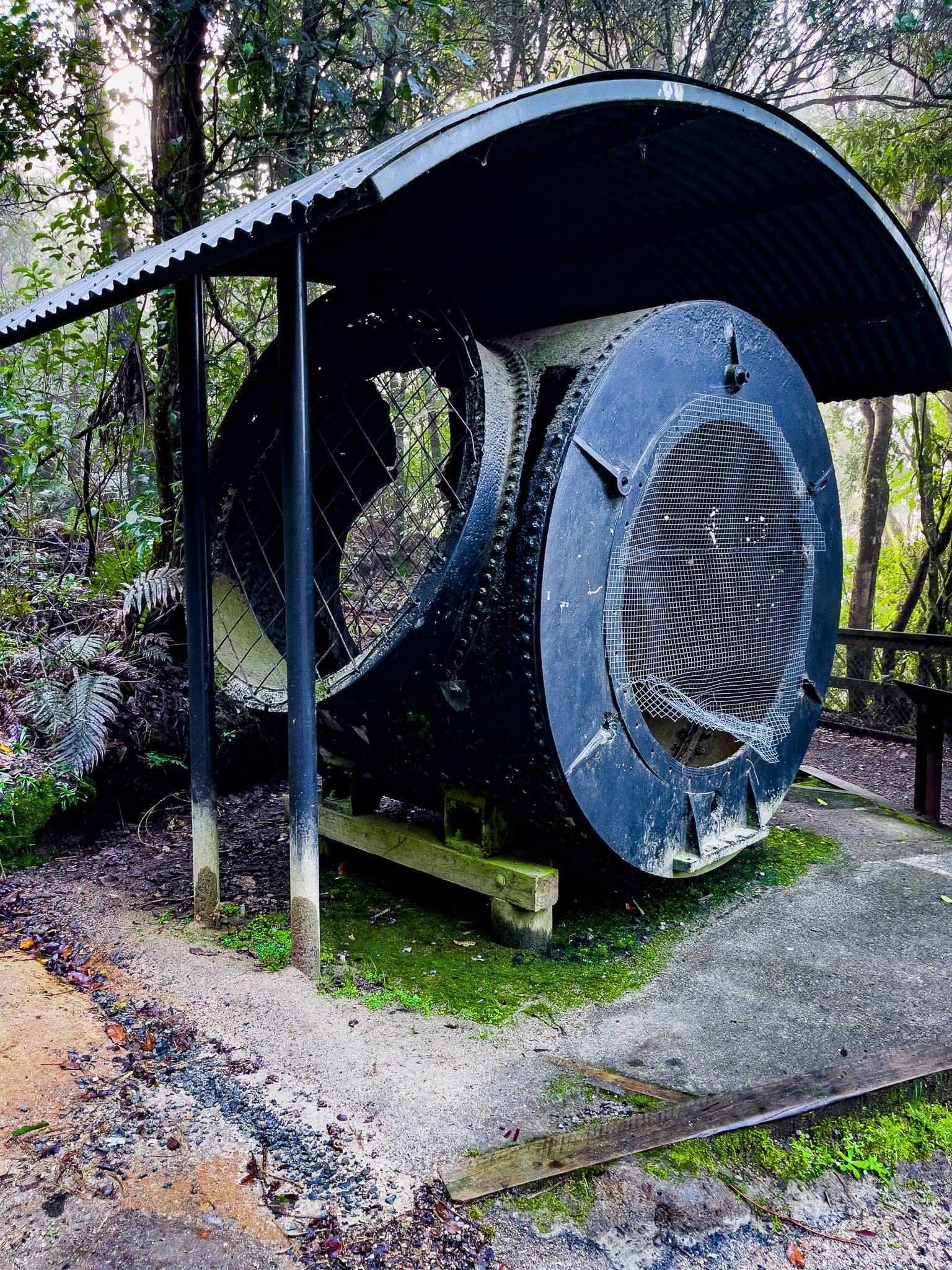
This is a wonderful picturesque walk with forest, rapids and waterfalls, as well as historical points of interest. Next to the start of the track and Okere Falls viewpoint, there is an old hydro generator. Okere Falls was the fourth location for hydroelectric power generation in NZ, with a power plant established around 1900.
It is now long gone, but look down and you will see a rusting section immediately below the viewpoint. And of course you will see the Falls themselves. If you want to walk down to the pool below the falls, there are some steps to a viewpoint near the other end of the car park. This was partly flooded when we visited.
There is a second panel at the start of the track which provides insight into early tourism. It was a popular excursion to boat across Lake Rotorua and up the Ohau Channel to Lake Rotoiti and then the falls, with Māori businesses providing boats and guides. In the 1870s, the road and bridges were built, which led to more visitors, a restaurant, and then the addition of trout in the river. It has continued to be a popular walk, now with adventure tourism options – white water rafting with Rotorua Rafting or ziplining with Rotorua Ziplines.
From State Highway 33 just north of Okere Falls Store, take Trout Pool Road for about 300 metres to the carpark on the right.
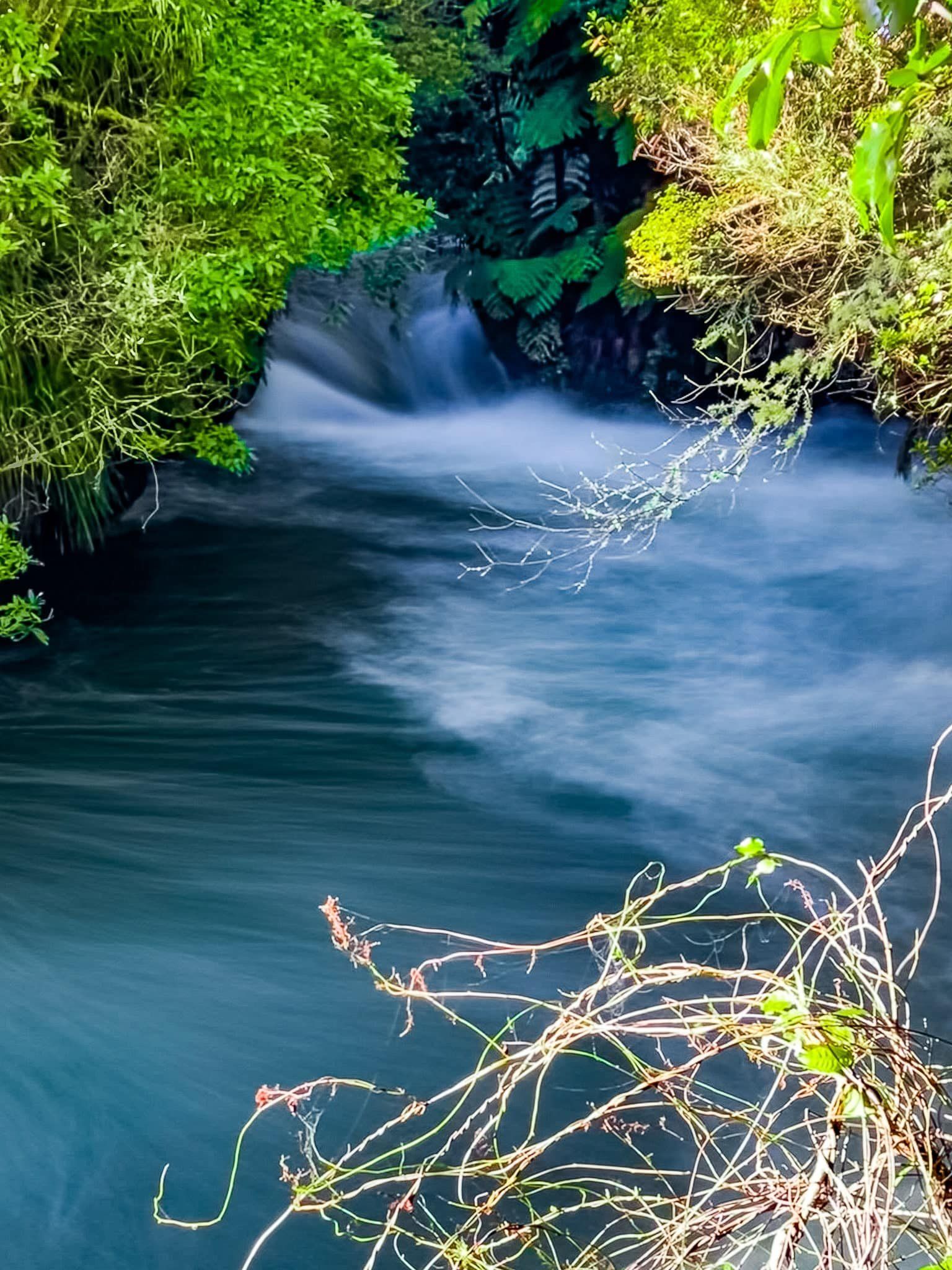
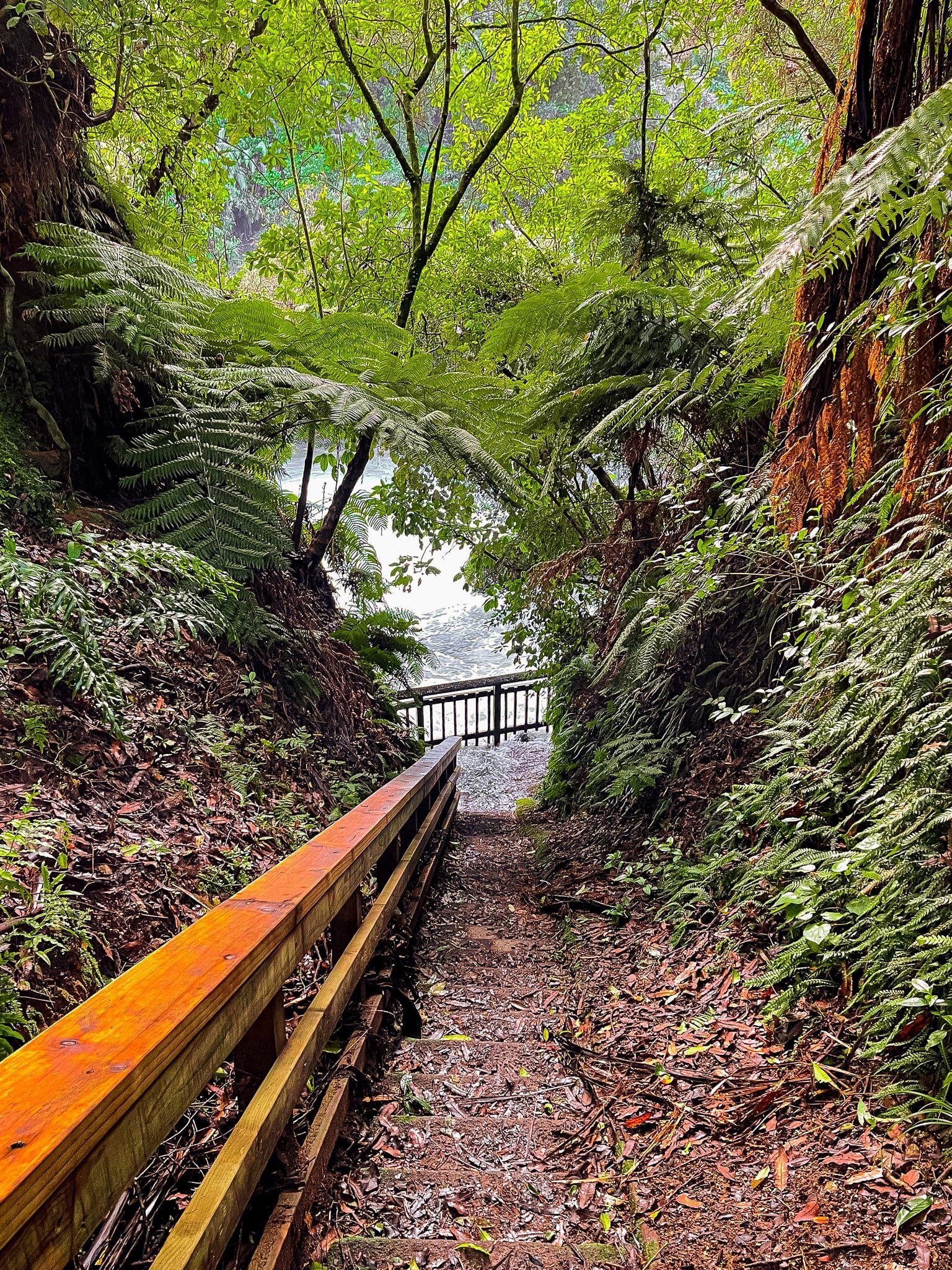
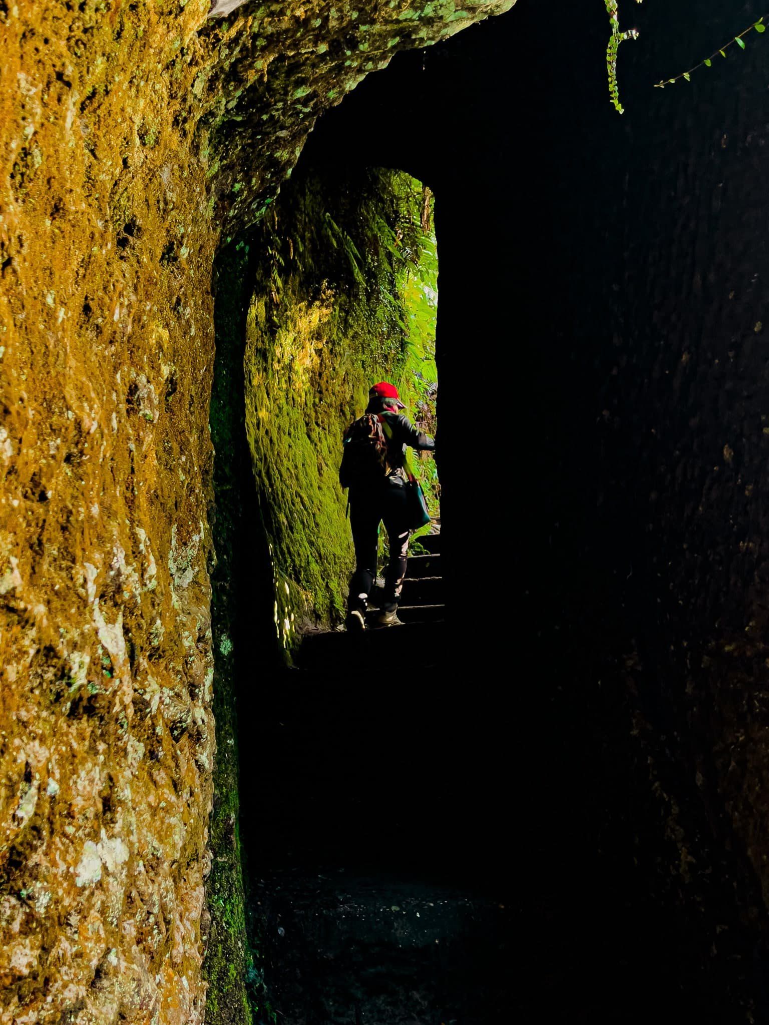
Tutea Falls and Caves
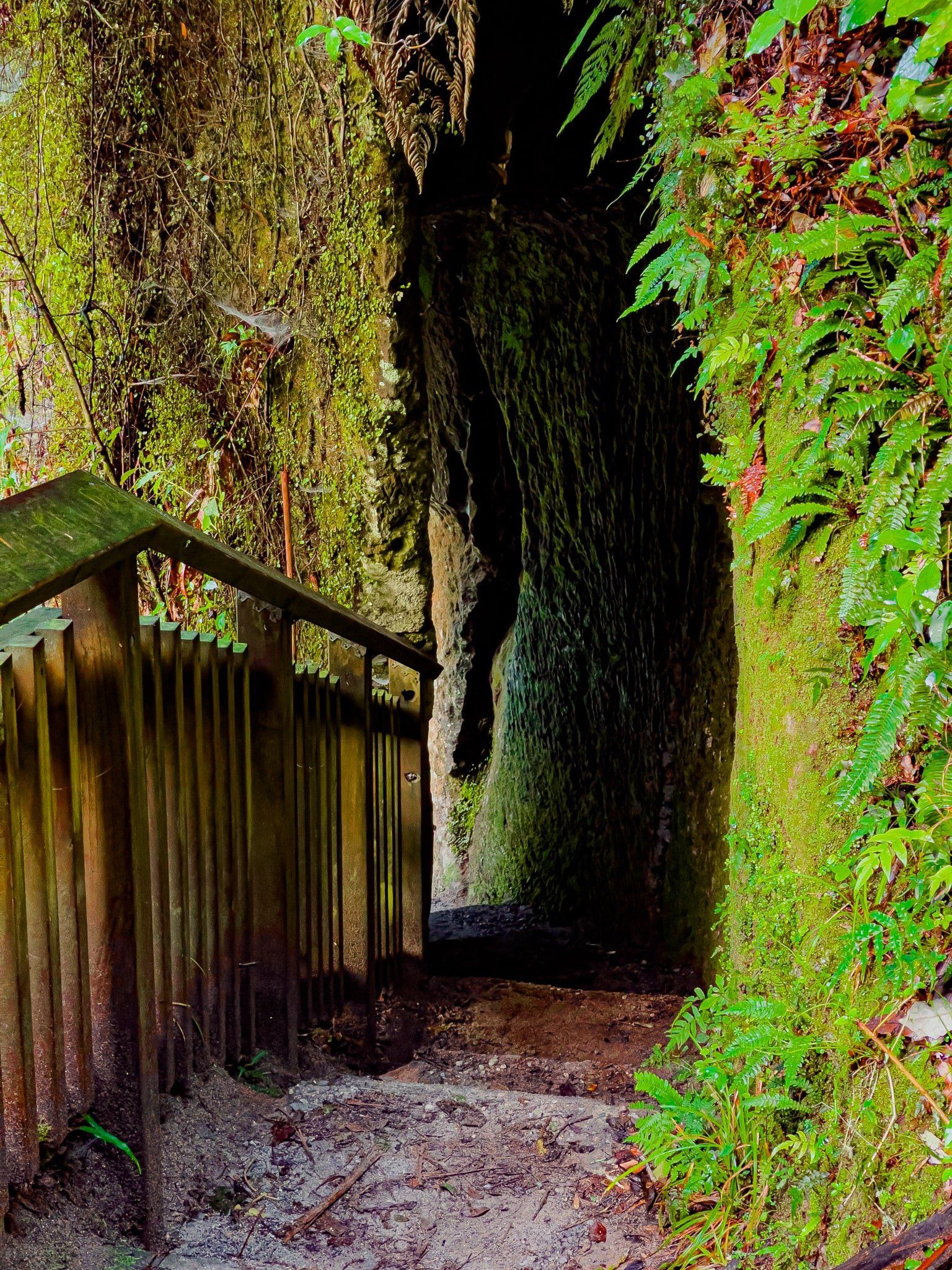
About halfway along the Okere Falls Track, there is access down to the seven-metre high Tutea Falls and caves. Local Māori used the caves’ difficult access for protection in times of war. As with visits to the Okere Falls, this walk has long been part of the NZ tourism industry, dating back to the 1800s.
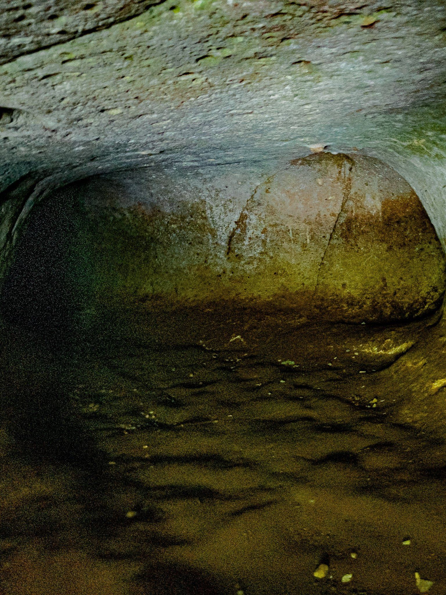
The falls were named for a Māori chief who is buried in a cave behind the falls. Head down the steps above the Kaituna River. As it drops down, the track is carved into the side off the cliff face and overlooks the Falls and large pool below. This section is narrow with short tunnels, but well-protected by a fence. At the bottom of the steps is a modest cave entrance (a different one to the gravesite of Tutea) and a viewing platform.
If you do the Rotorua Rafting Kaituna River trip, the drop over the Tutea Falls is the most thrilling moment. This drop is the highest commercially accessible rafting drop in the world. If you arrive while a trip is in progress, the platform will be occupied by photographers and safety support, for anyone who needs rescuing after going over the falls! Don’t worry too much, I’ve done the trip, fallen out and lived to write about it!

Rotorua
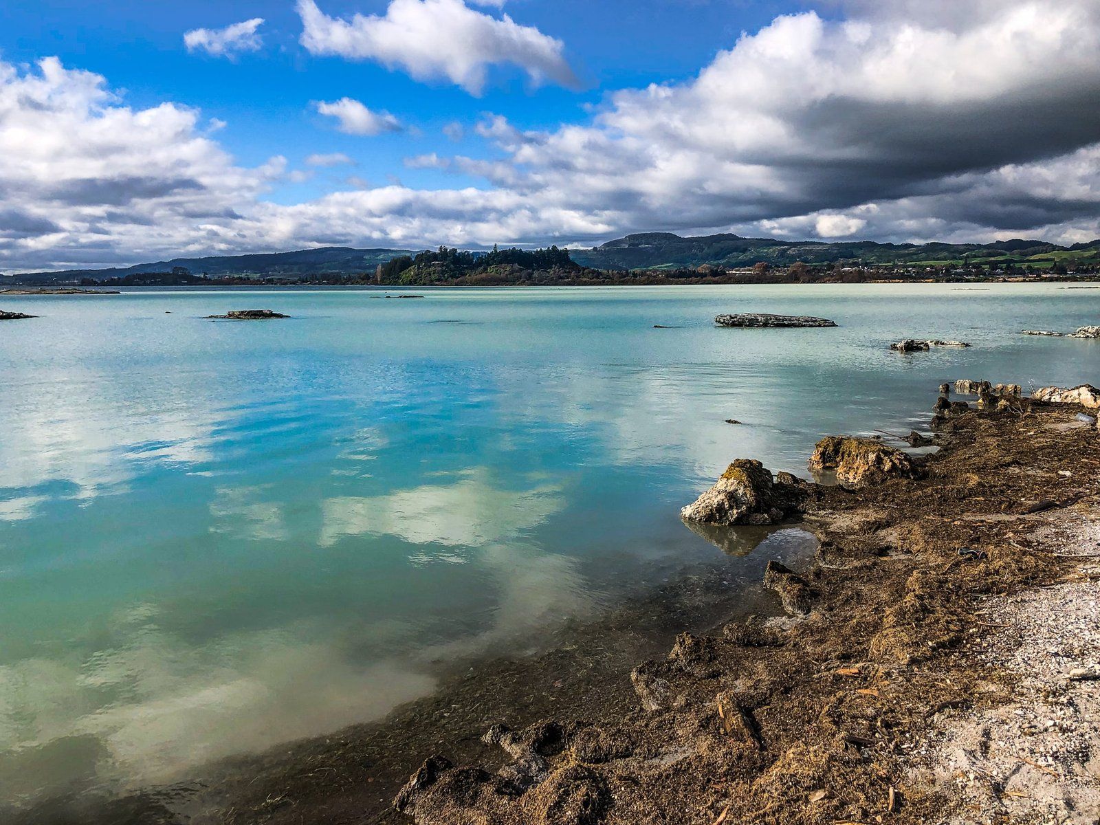
Rotorua is a city of 60,000 around the edge of Lake Rotorua. It is best known for the active geothermal region it is situated within and has been part of the NZ tourism scene for about 140 years. The lake itself is a 240,000 year old caldera and part of the enormous active volcanic region that stretches from White Island through Rotorua and Taupō to Tongariro National Park.
The name comes from ‘roto’ meaning lake and ‘rua’ meaning two: ‘Lake Two’. Te Arawa iwi presence dates back to Te Arawa chief and explorer Ihenga. It was the second major lake he discovered upon arriving in the region, hence the name. For a less prosaic version of how Te Arawa became associated with Rotorua, read here!
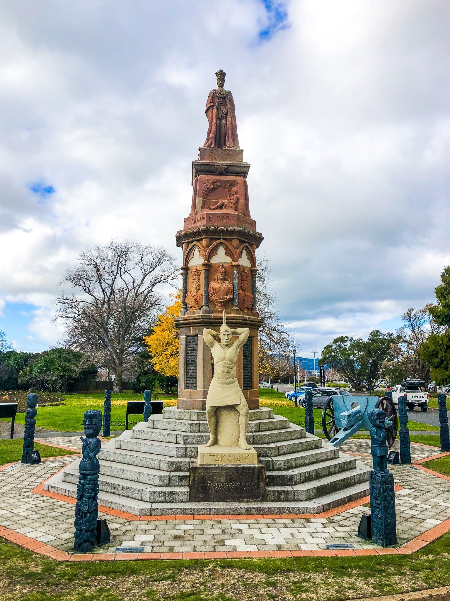
The first Europeans arrived in the late 1820s and it didn’t take long before tourists were turning up to enjoy the natural wonders of geysers and hot pools. The New Zealand Wars of the 1860s affected the region for a time, but by 1883 the town had special status to help its development as a spa town. From a meeting between Māori and European representatives, Māori agreed to gift 50 hectares of thermal springs “hei oranga mō ngā iwi katoa o te Ao”, translated as “for the benefit of the people of the world.”
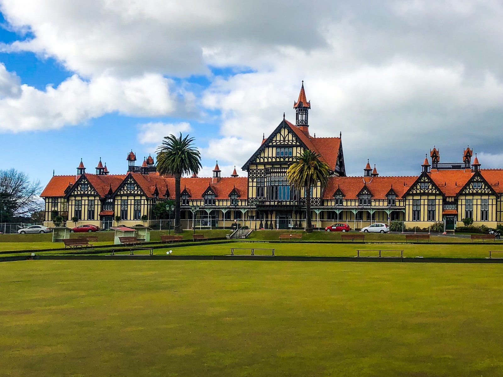
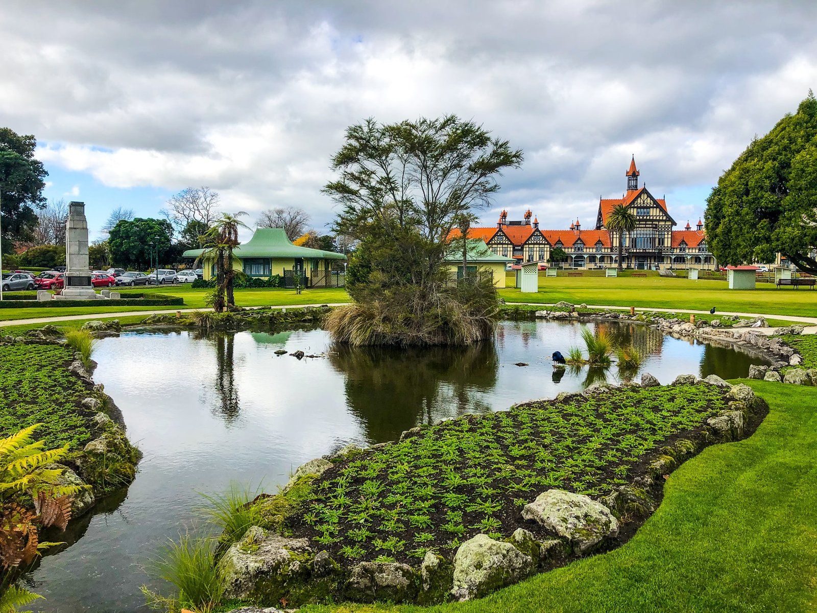
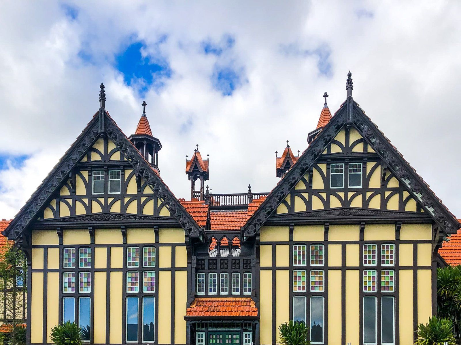
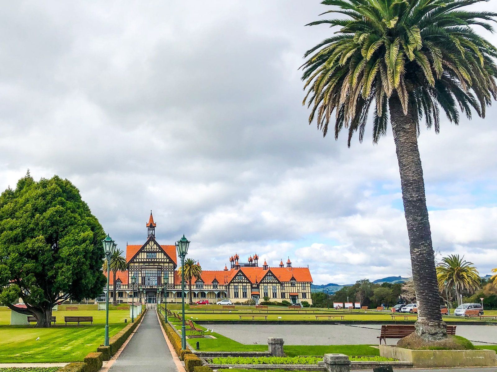
Consequently, several historic facilities were developed near the edge of the lake between Sulphur Point and Te Ruapeka Bay. This included the Bath House (now the museum), Government Gardens and Polynesian Pools (now Polynesian Spa). The Bath House and Pools piped water from nearby thermal springs directly into their facilities and rooms. This became a general Rotorua thing up until the 1980s when the geysers began to disappear and the bore holes were shut down.
Take a walk around Government Gardens and the nearby lake walkway to get an insight into where and how the tourism industry started, and access the Gardens from the northeast side of downtown Rotorua.
Whakarewarewa Forest and Scion
Much of the ancient native forest in NZ had been cut down by the late 1800s. This raised the question of what trees to plant to maintain the lumber industry.
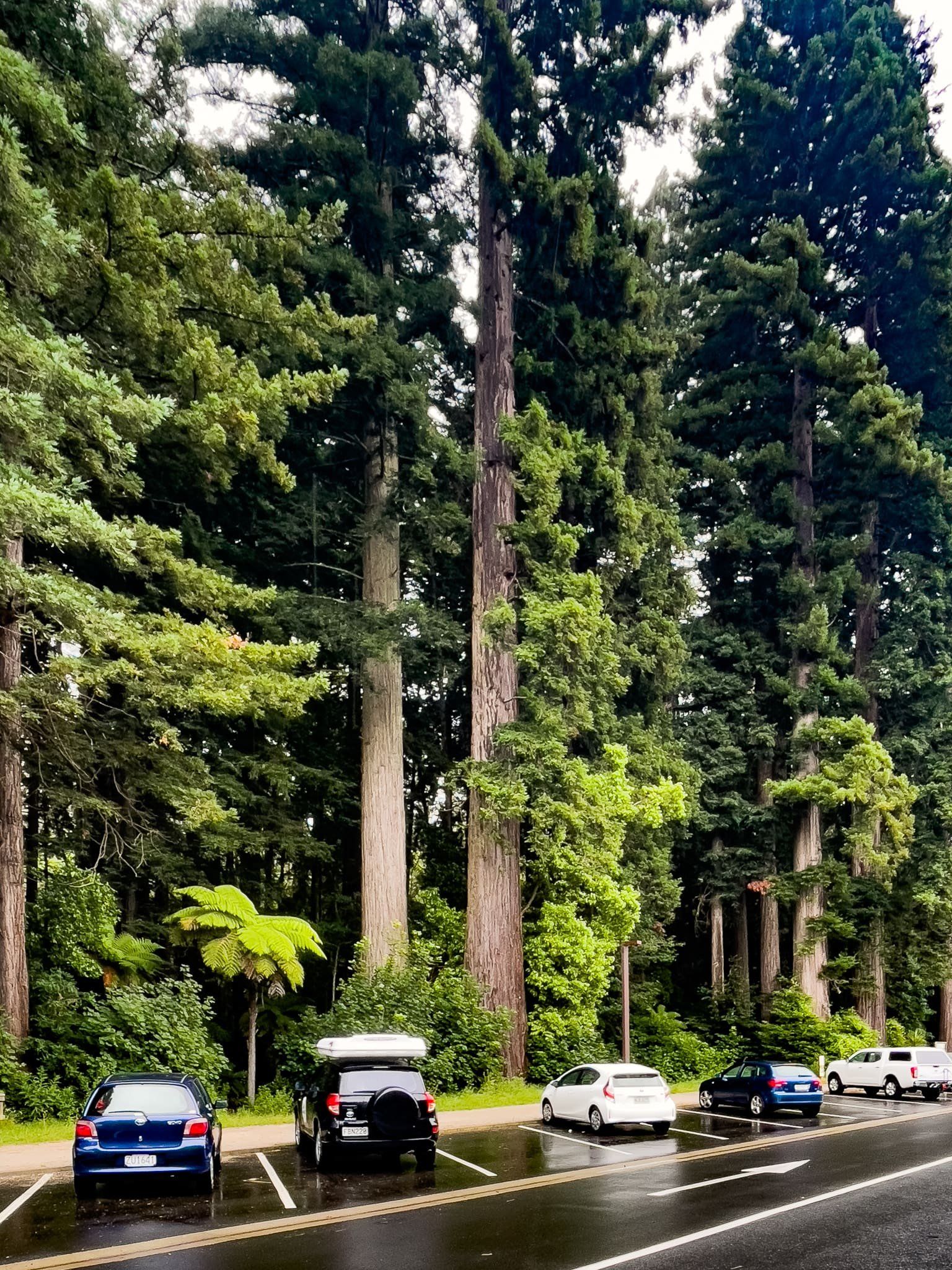
Plant scientists got together with the goal of making dreams for cheap wood come true. From around early 1900, 170 exotic species were planted as a test in Whakarewarewa Forest, many of them along the edge of Longmile Road and Tarawera Road.
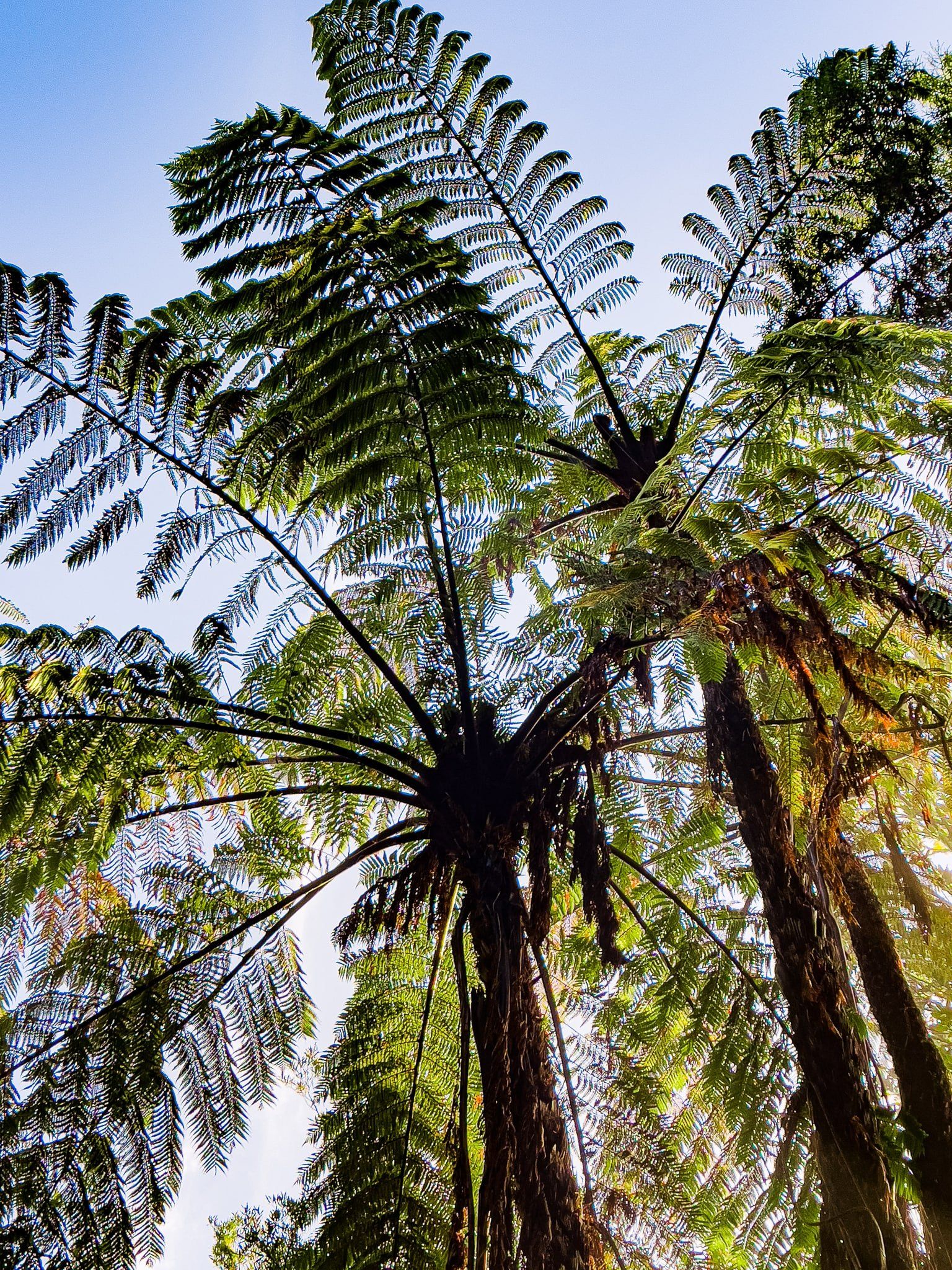
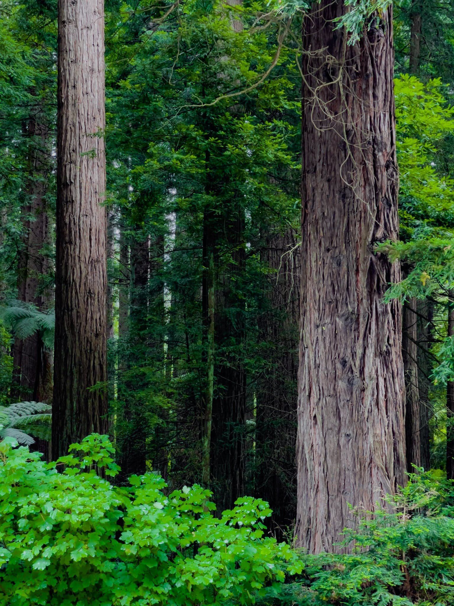
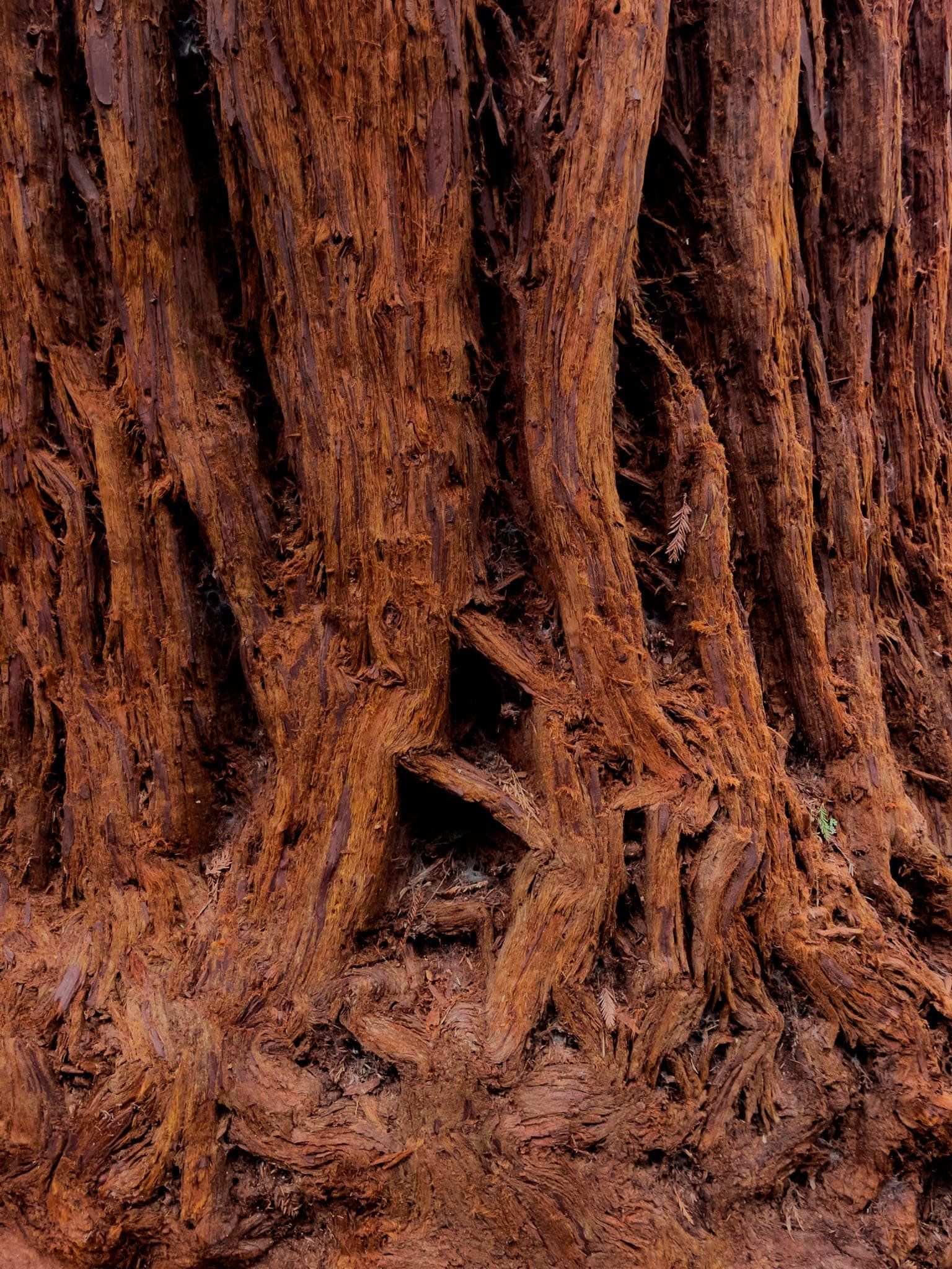
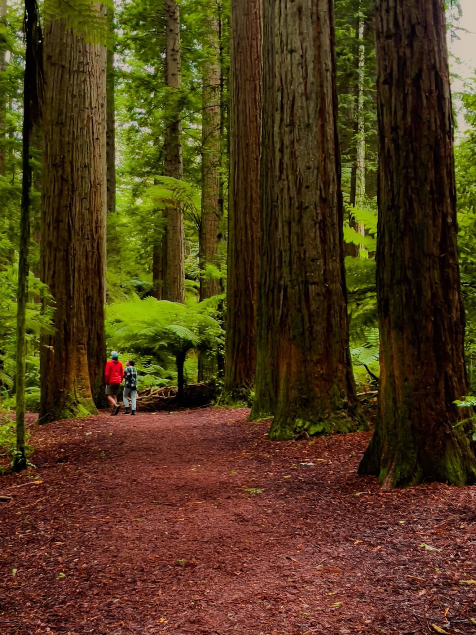
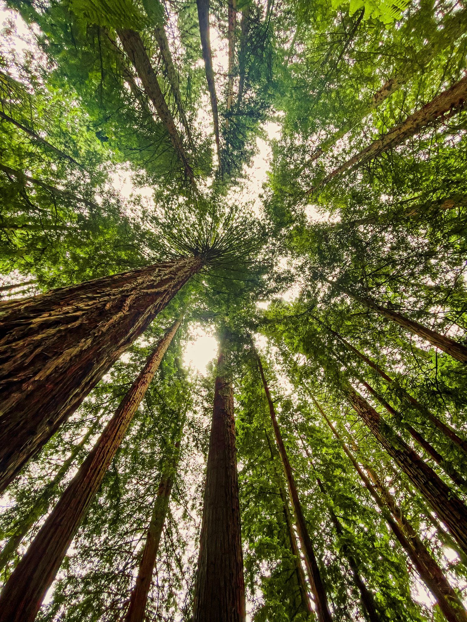
This included such magnificent species as sequoias and redwoods. As it turned out, the best performing exotic in NZ was the rather insignificant white pine and nowadays, for better or worse, these dominate the NZ forestry industry. Today, Whakarewarewa Forest is partly a forest fun park, The Redwoods. There are fantastic walks through big mature exotics, including the Redwood Memorial Grove, a treetops walk, and mountain biking.
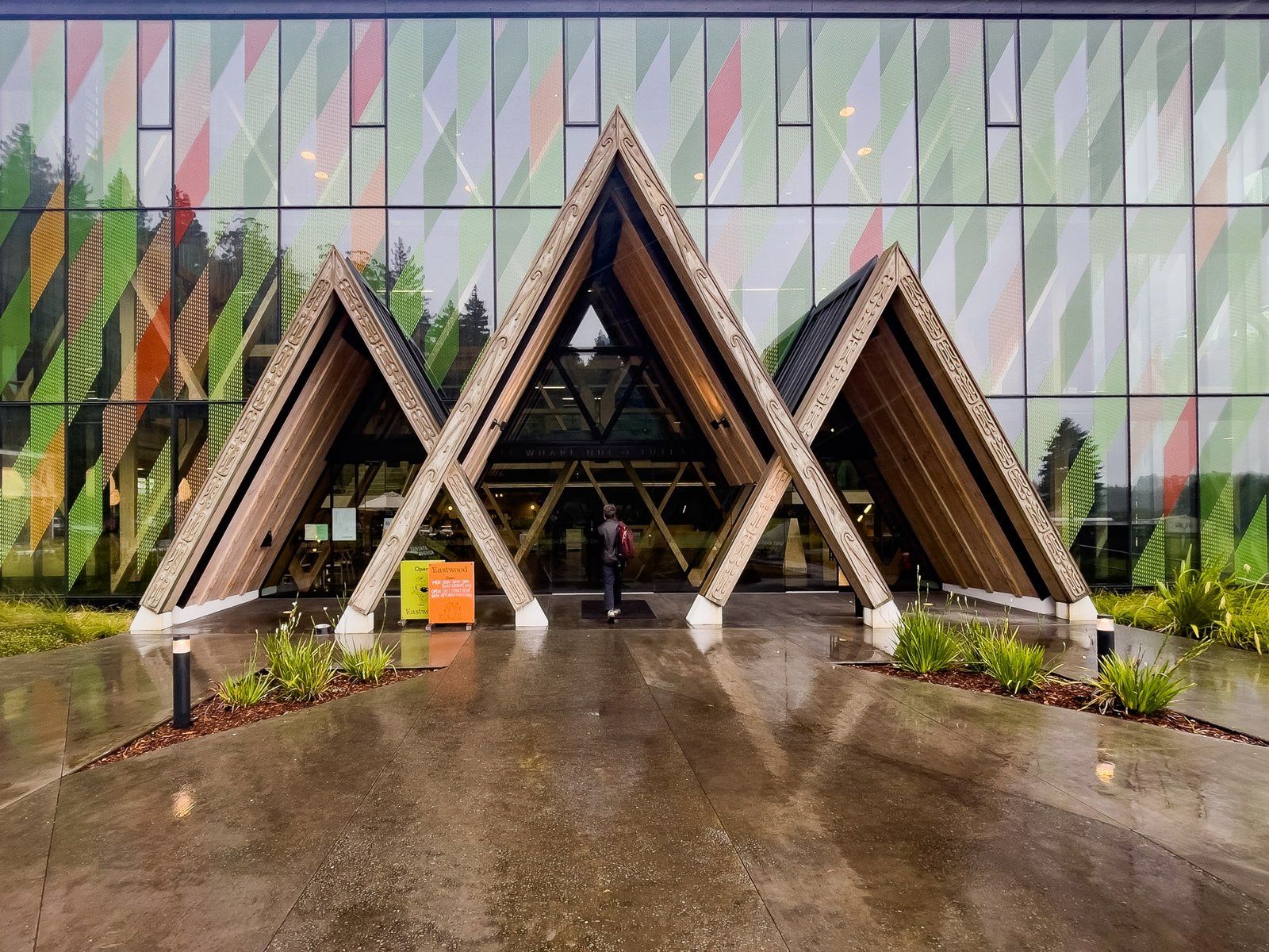
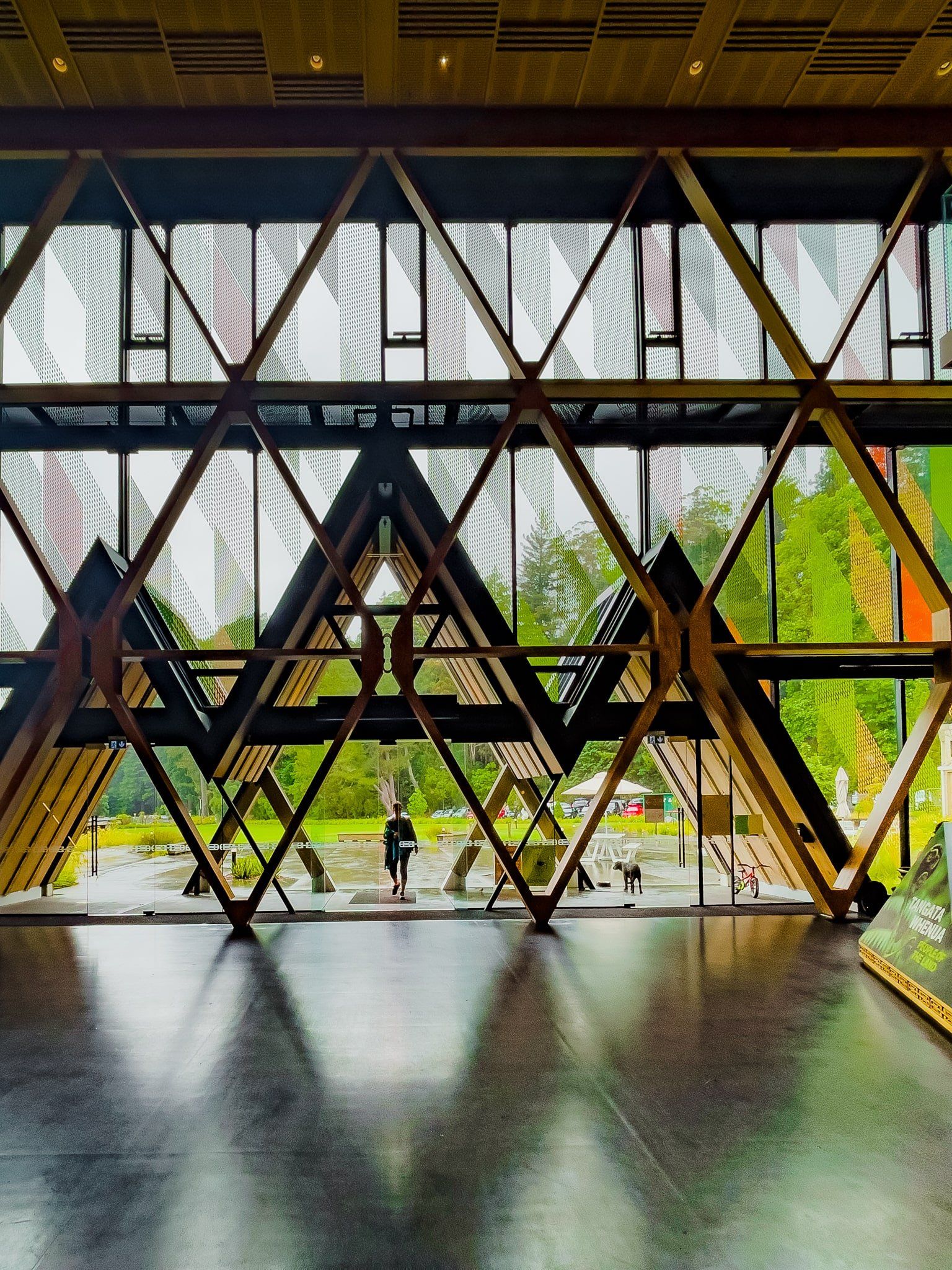
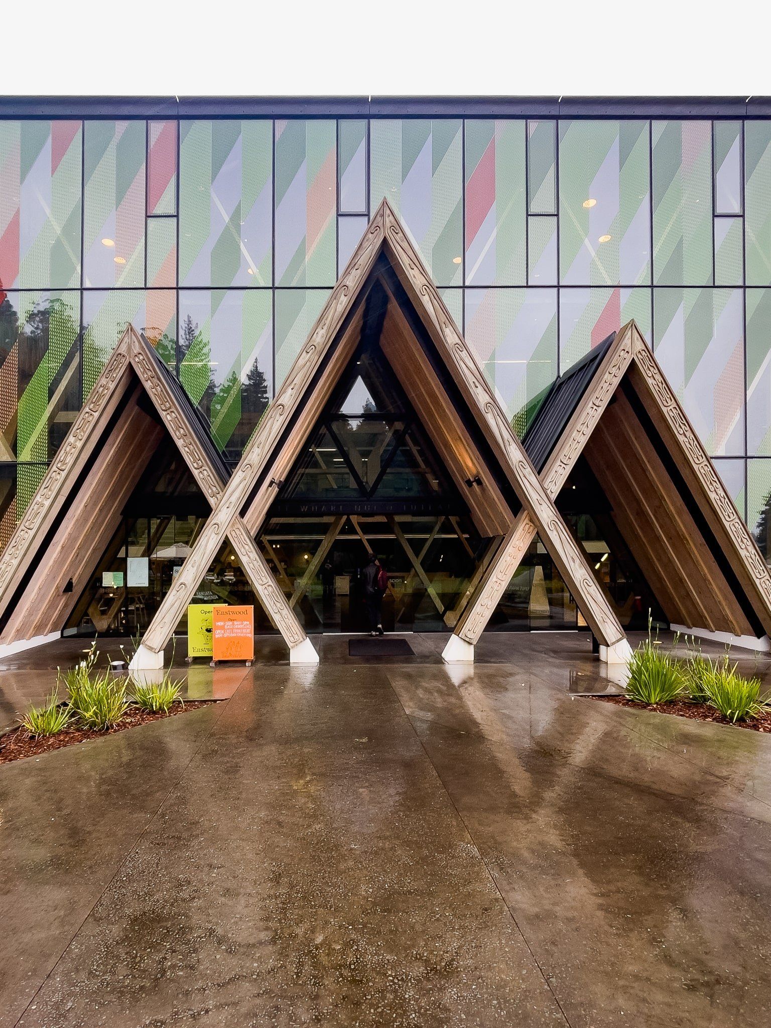
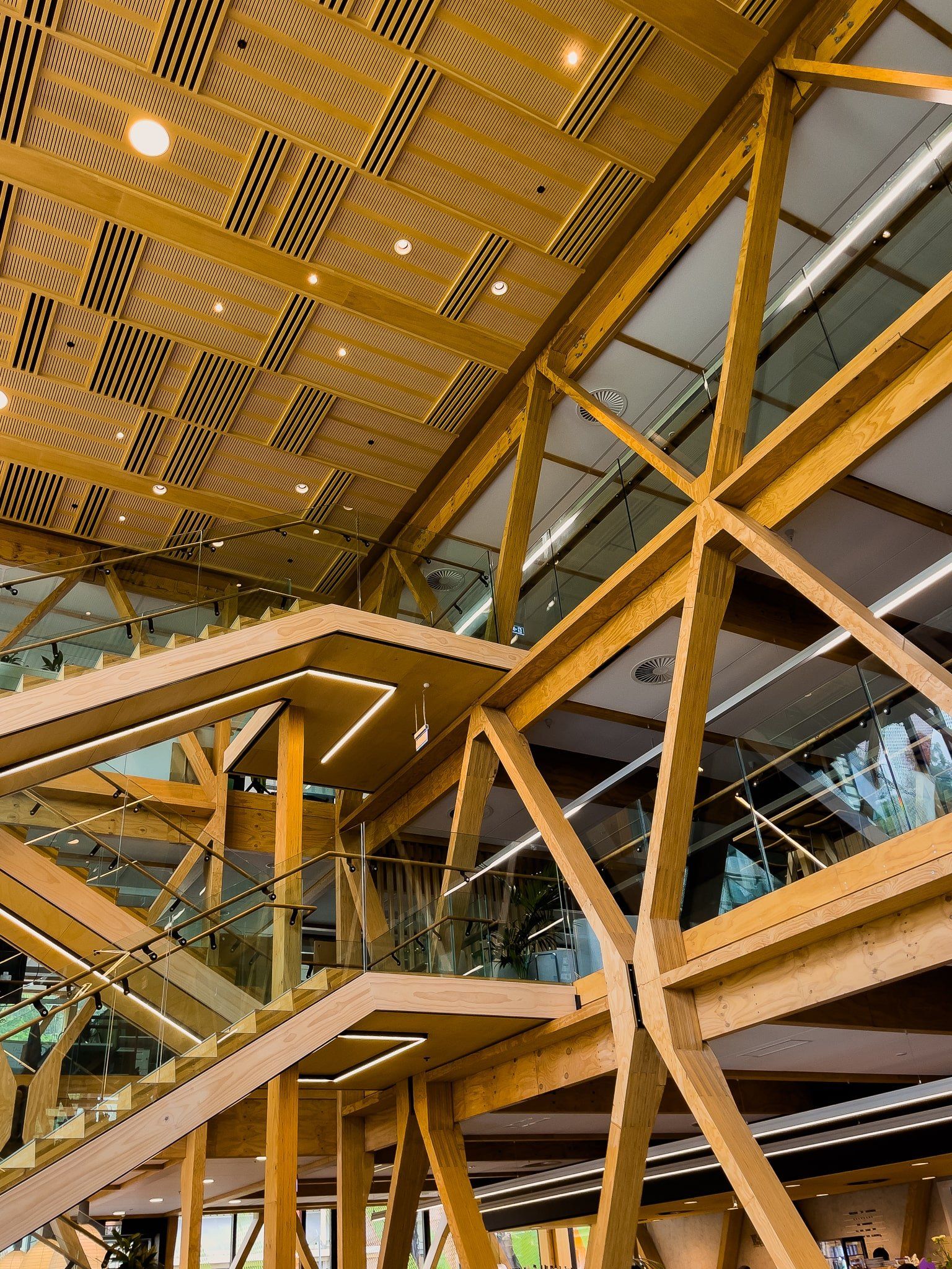
The New Zealand Forest Research Institute was established to support the development of the forestry industry. In the 1950s, a particularly unattractive facility was built right next to Whakarewarewa Forest, at the end of Longmile Road. More recently, the Institute was rebranded as Scion (meaning a twig suitable for grafting) and a stunning new building was developed in front of the earlier complex. Even better, there is a great cafe, plus panels and photo galleries describing the history of the industry, and it’s only a short walk from the Redwoods.
Redwood Memorial Grove, Rotorua
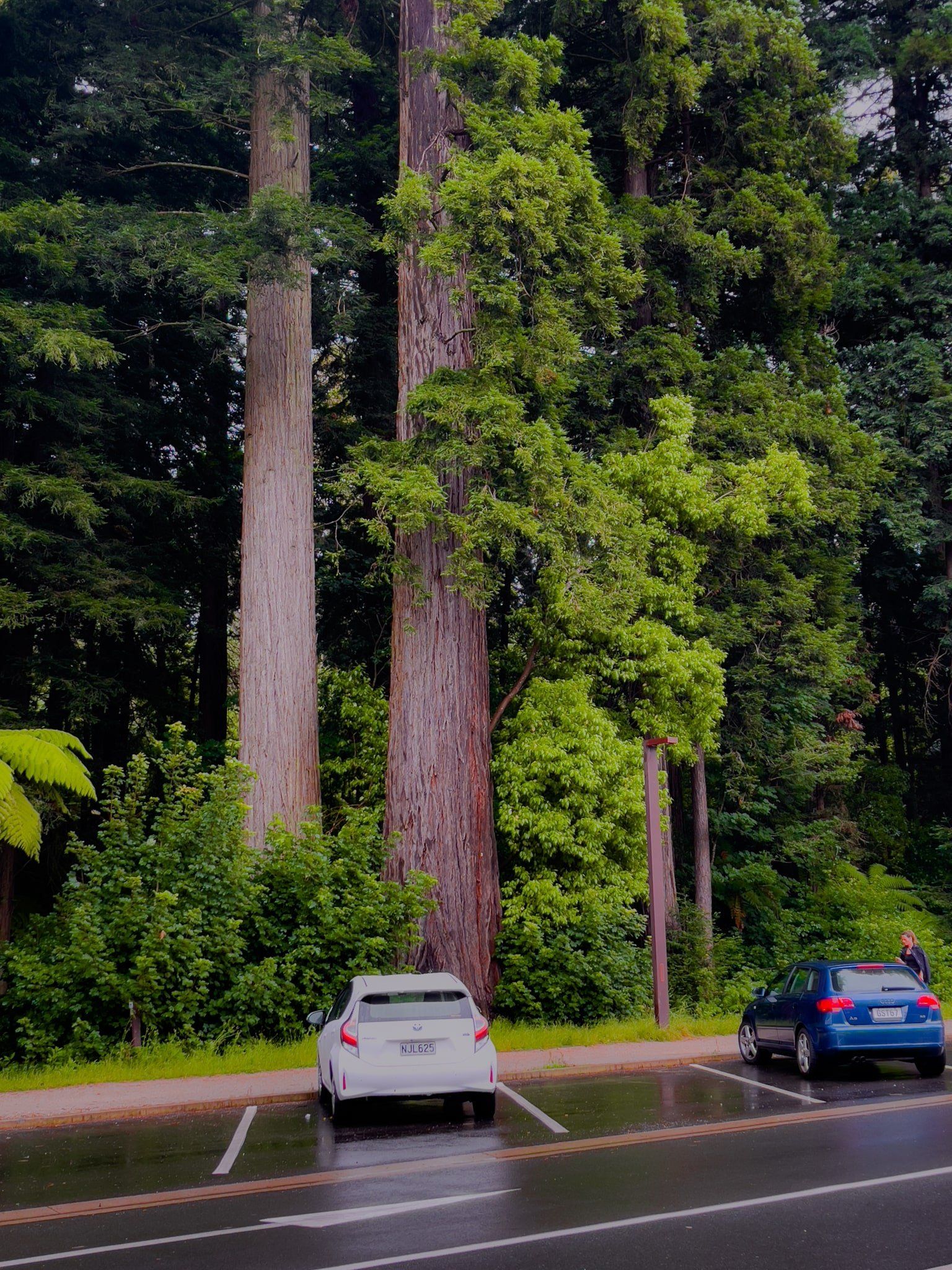
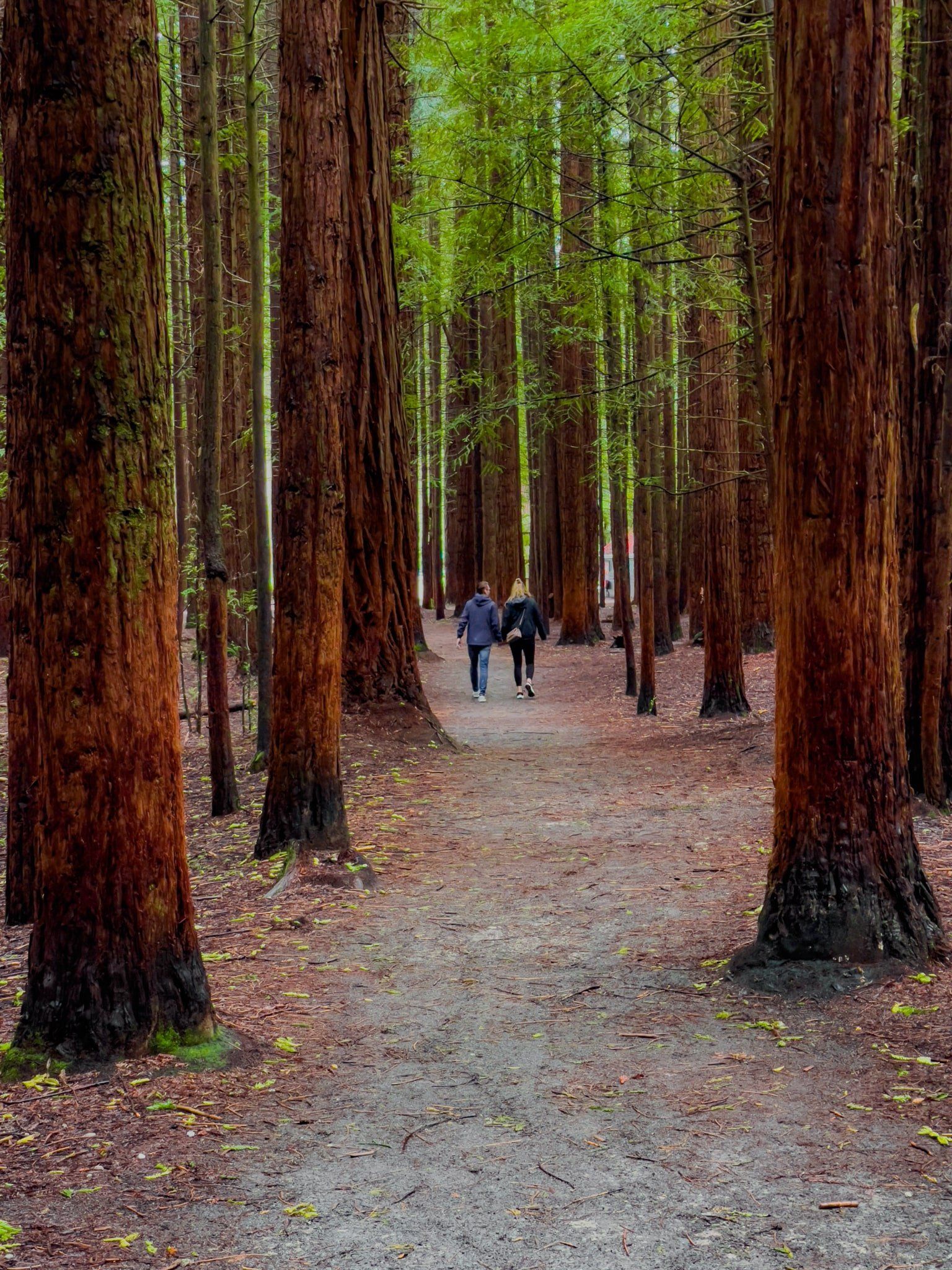
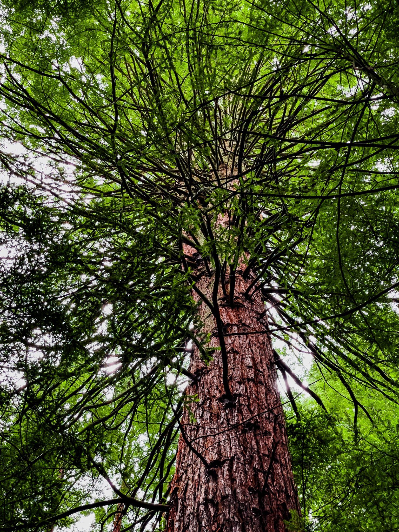
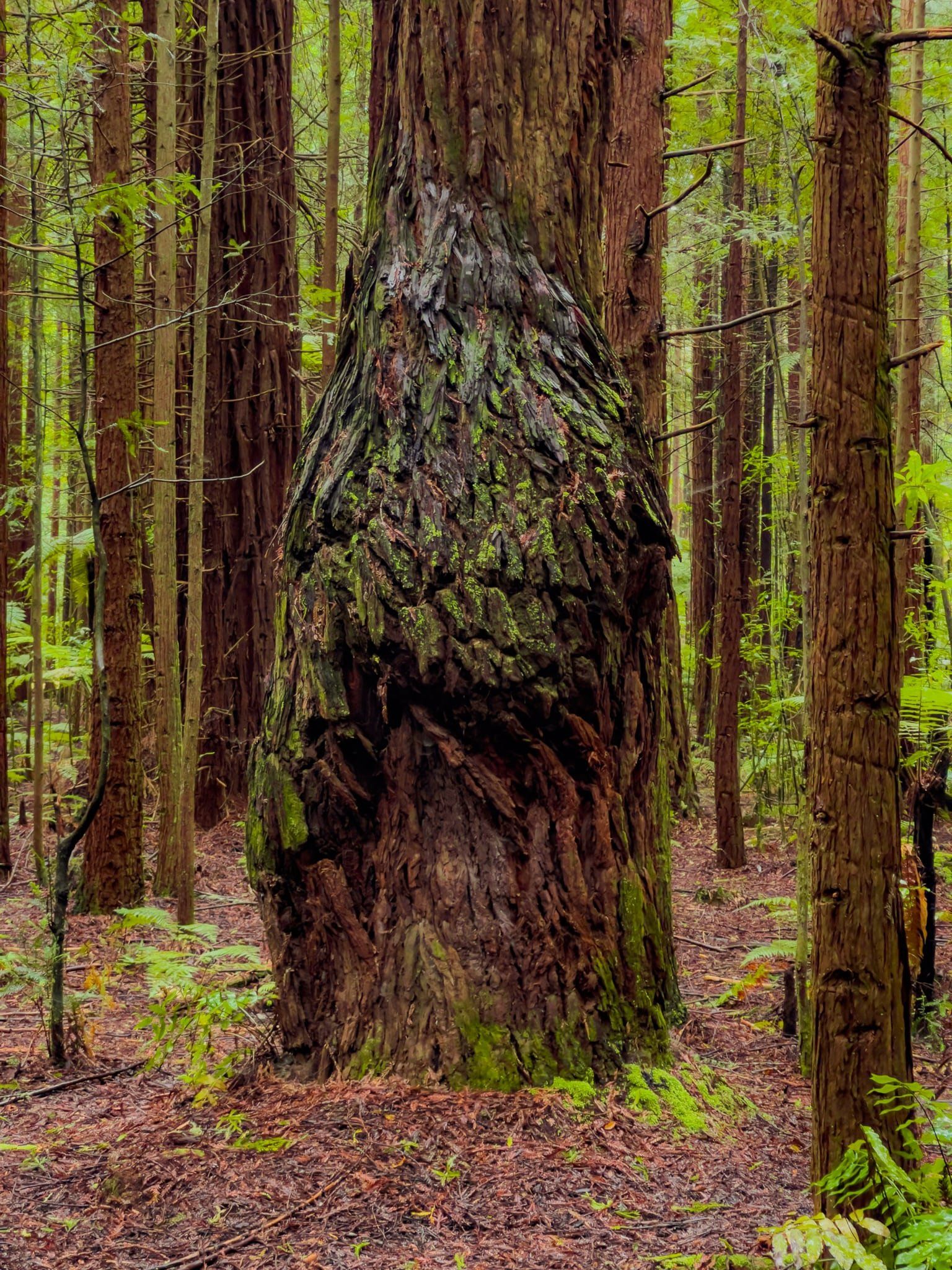
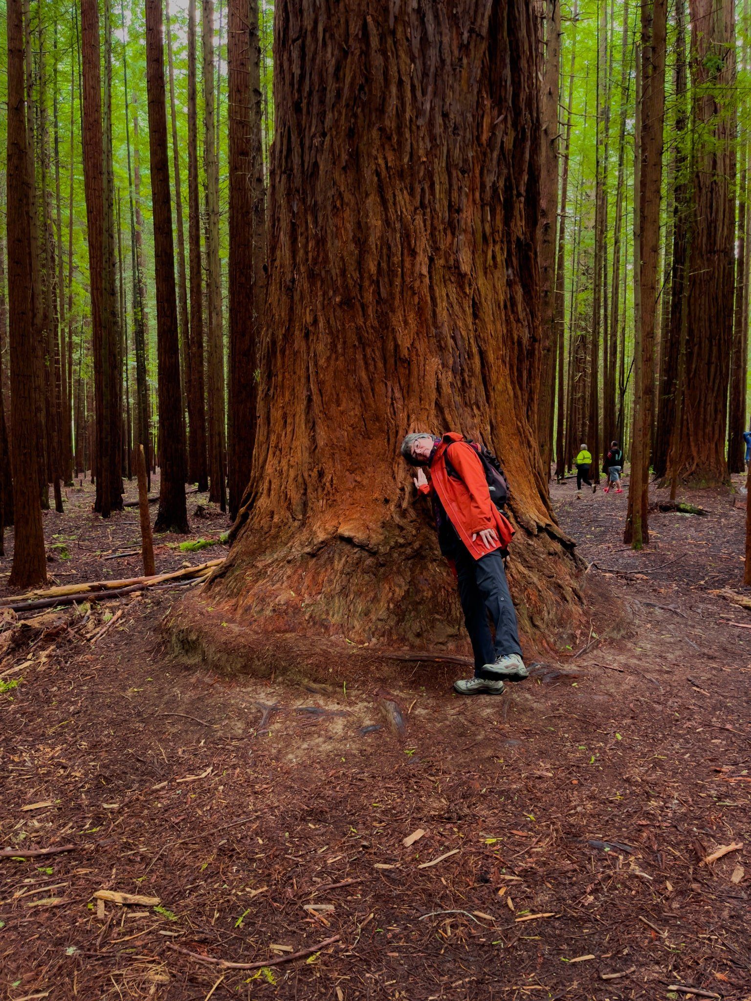
The Whakarewarewa Forest redwoods were planted around 1900 near Longmile Road and Tarawera Road. The twelve-hectare grove was one of many trials of exotic tree species to replace the now largely clearcut native forests. Subsequently, the redwoods have grown faster than they do in northern California due to soil quality and higher rainfall. The tallest is now over 75 metres after just 120 years, up with the tallest ancient kahikatea in NZ.
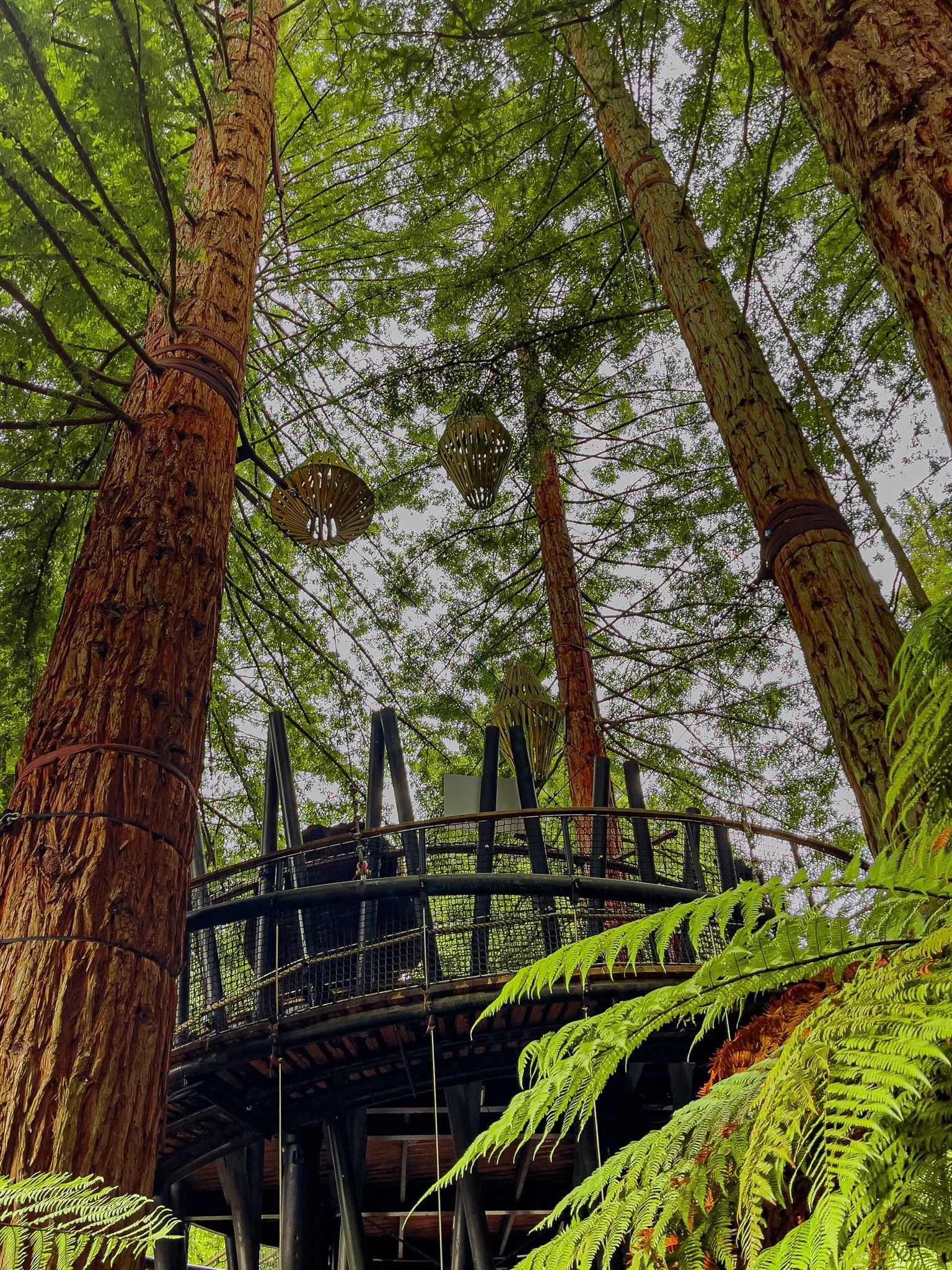
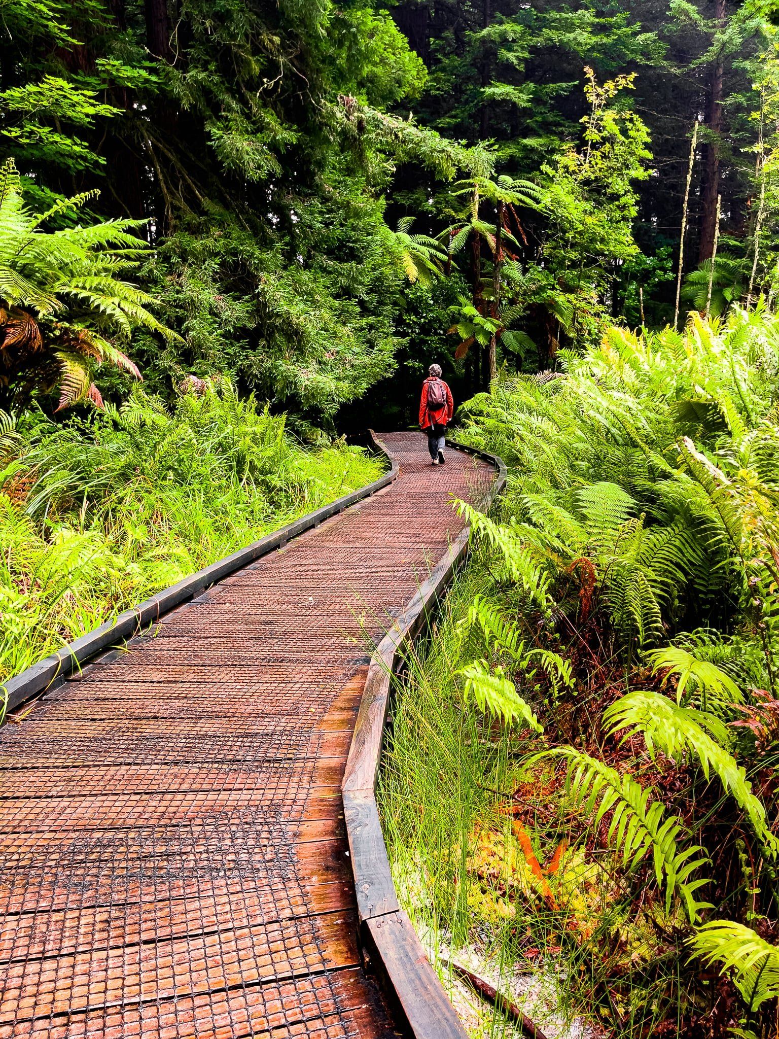
For most of their history, the grove was part of the commercially-oriented Forestry Service but six of the twelve hectares planted survived. In 1947, the grove was named the Redwood Memorial Grove to commemorate foresters who died in WW2. It was officially opened to the public in 1970 and was designated a Forest Park, providing permanent protection. A visitor’s centre followed in 1978. In 2009, the Redwoods and the greater Whakarewarewa Forest was returned to Ngāti Whakaue as part of a Treaty of Waitangi settlement. Also in 2009, a German engineer Alex Schmid suggested the Redwoods Treewalk and the treetops walkway was erected in 2015, blessed by the kaumātua of Ngāti Whakaue.
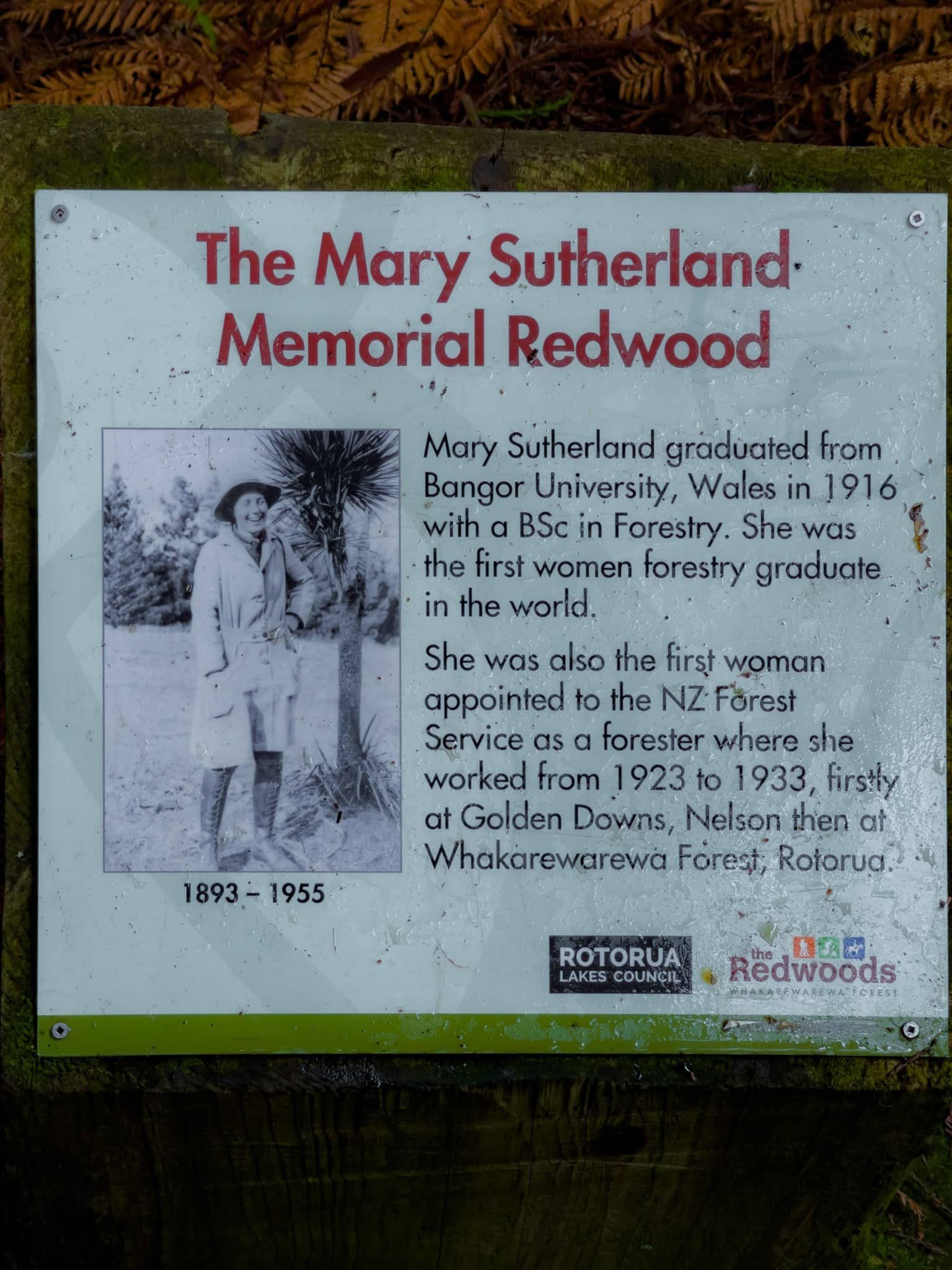
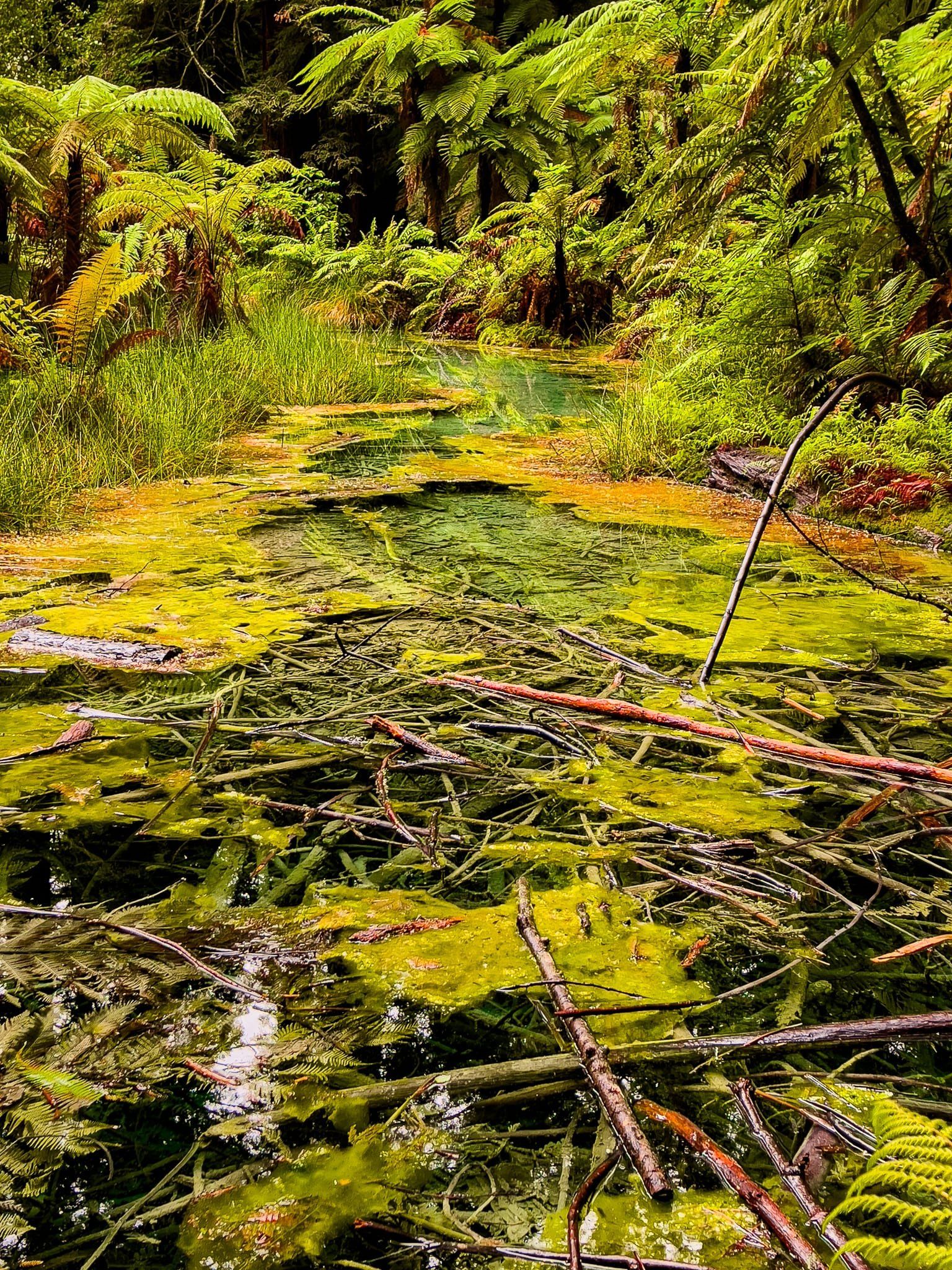
Walking around the Redwoods is a wonderful experience and it is a popular Instagram topic. The big trees are magnificent despite their relative youth. Although the focus is on redwoods, there are substantial sequoias and other big (although less colourful) pines. Parts of the grove have dense fern tree undergrowth for added colour. There is also a short boardwalk section through an interesting but sulphurous swamp. Don’t miss the Mary Sutherland Memorial Redwood, commemorating the first woman to graduate from a university forestry programme in the world in 1916.
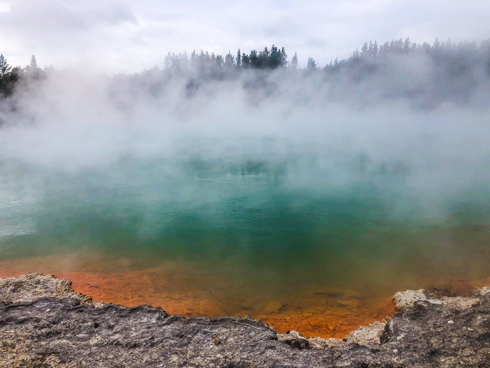
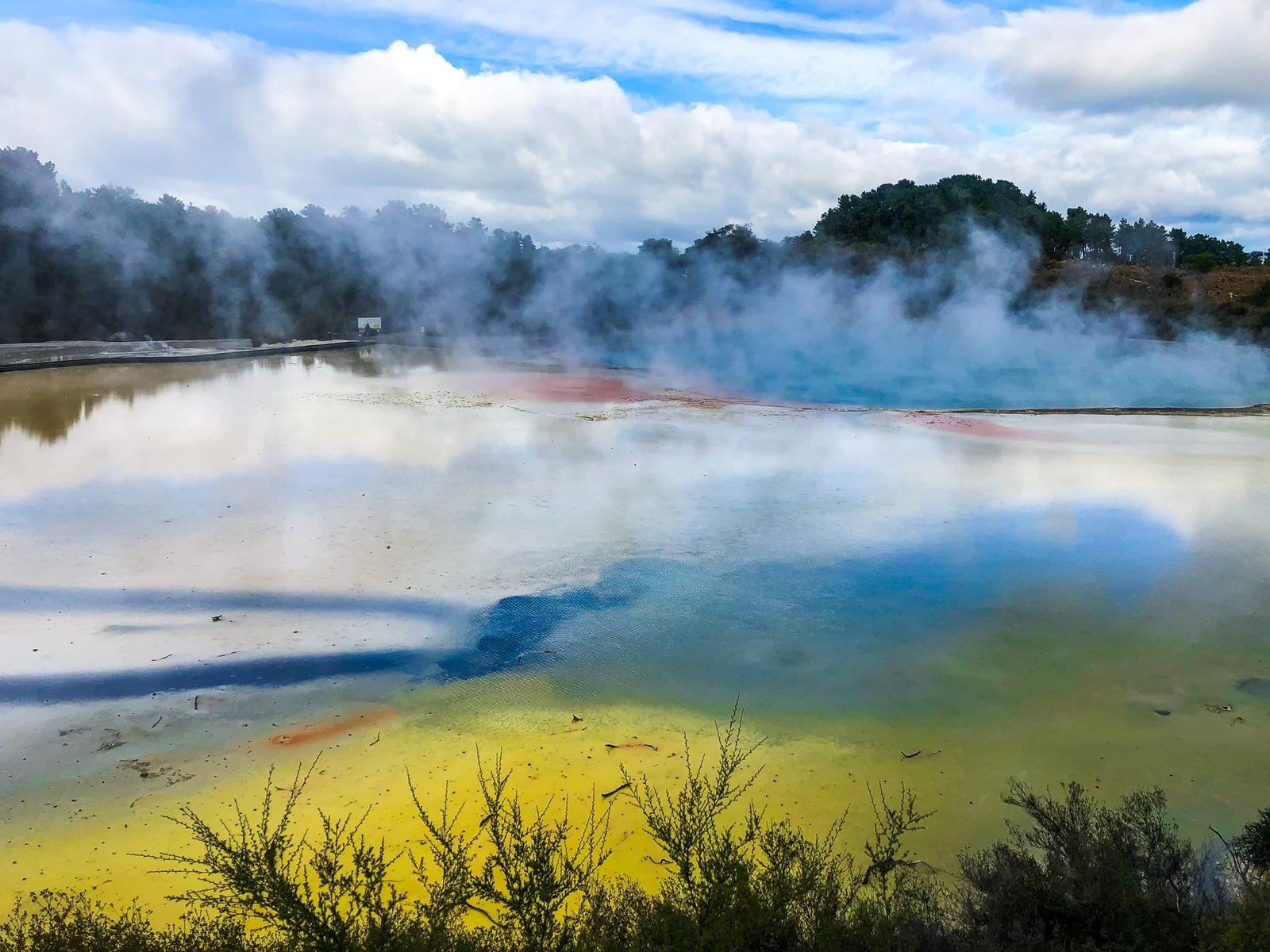
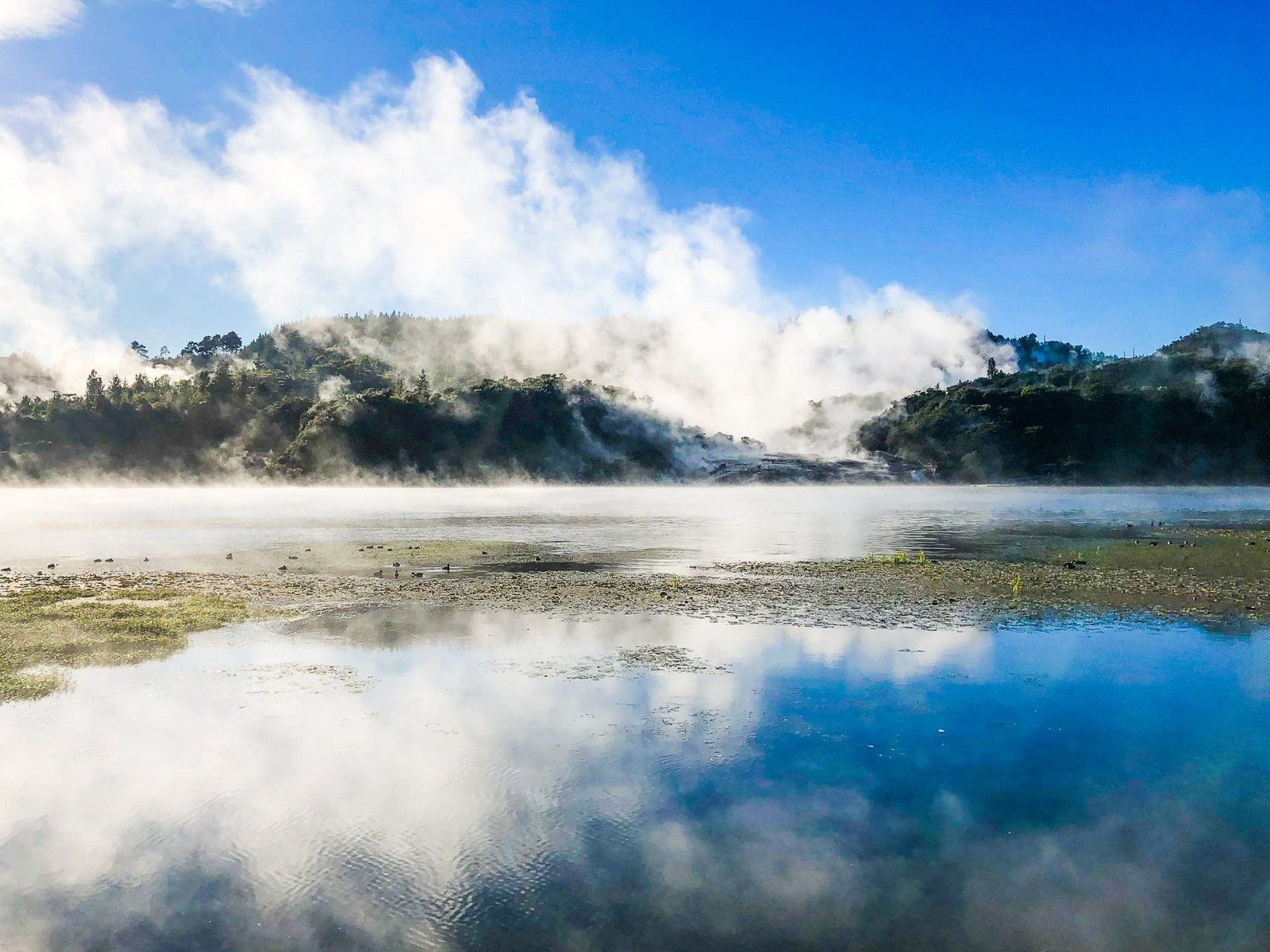
Waiotapu
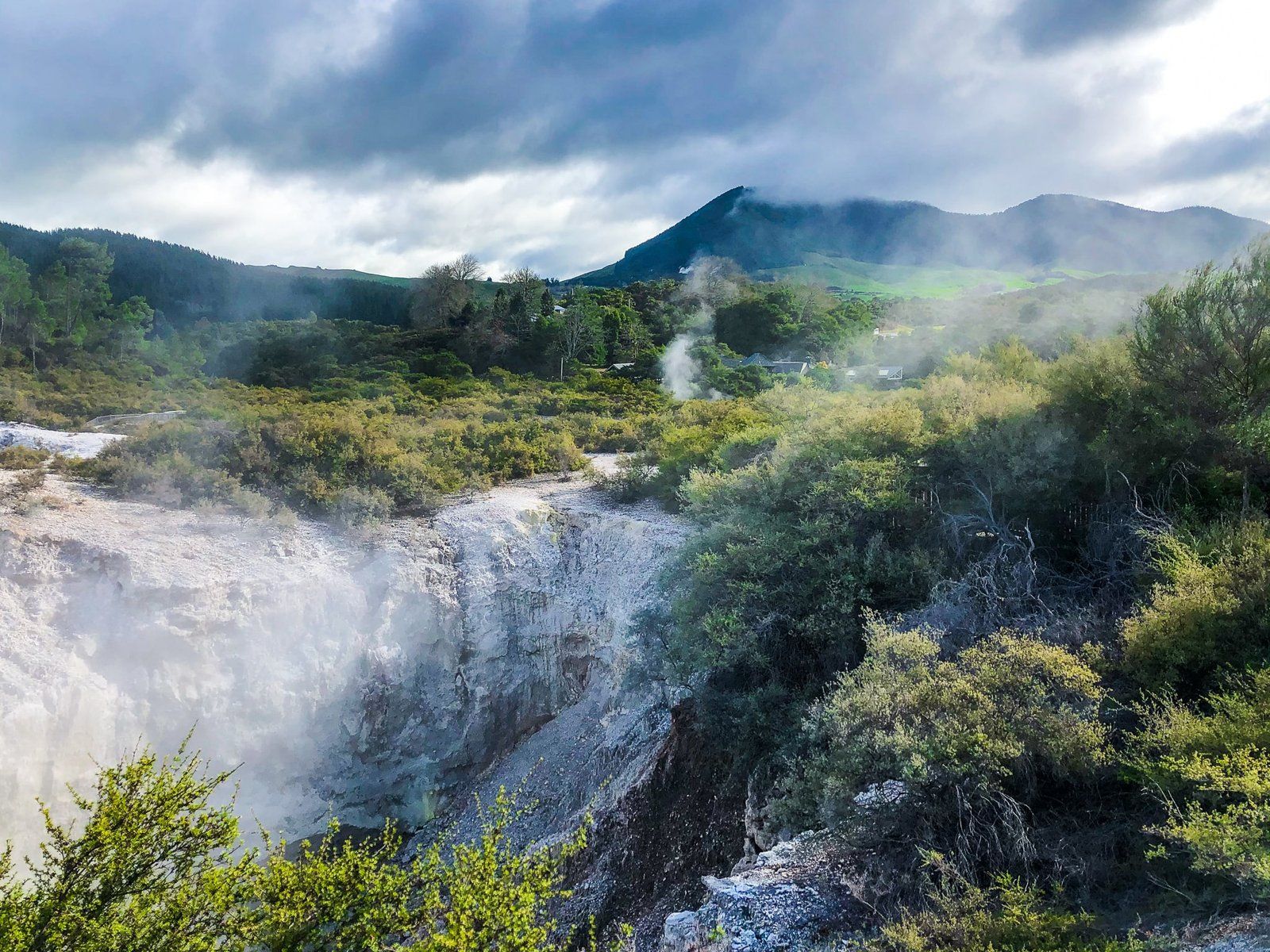
Waiotapu (also Wai-o-tapu) is one of the substantial thermal locations around the Rotorua region. Drive southeast of Rotorua on State Highway 5 for 27 kms, about 21 minutes. Access to the car park is along Waiotapu Loop Road.
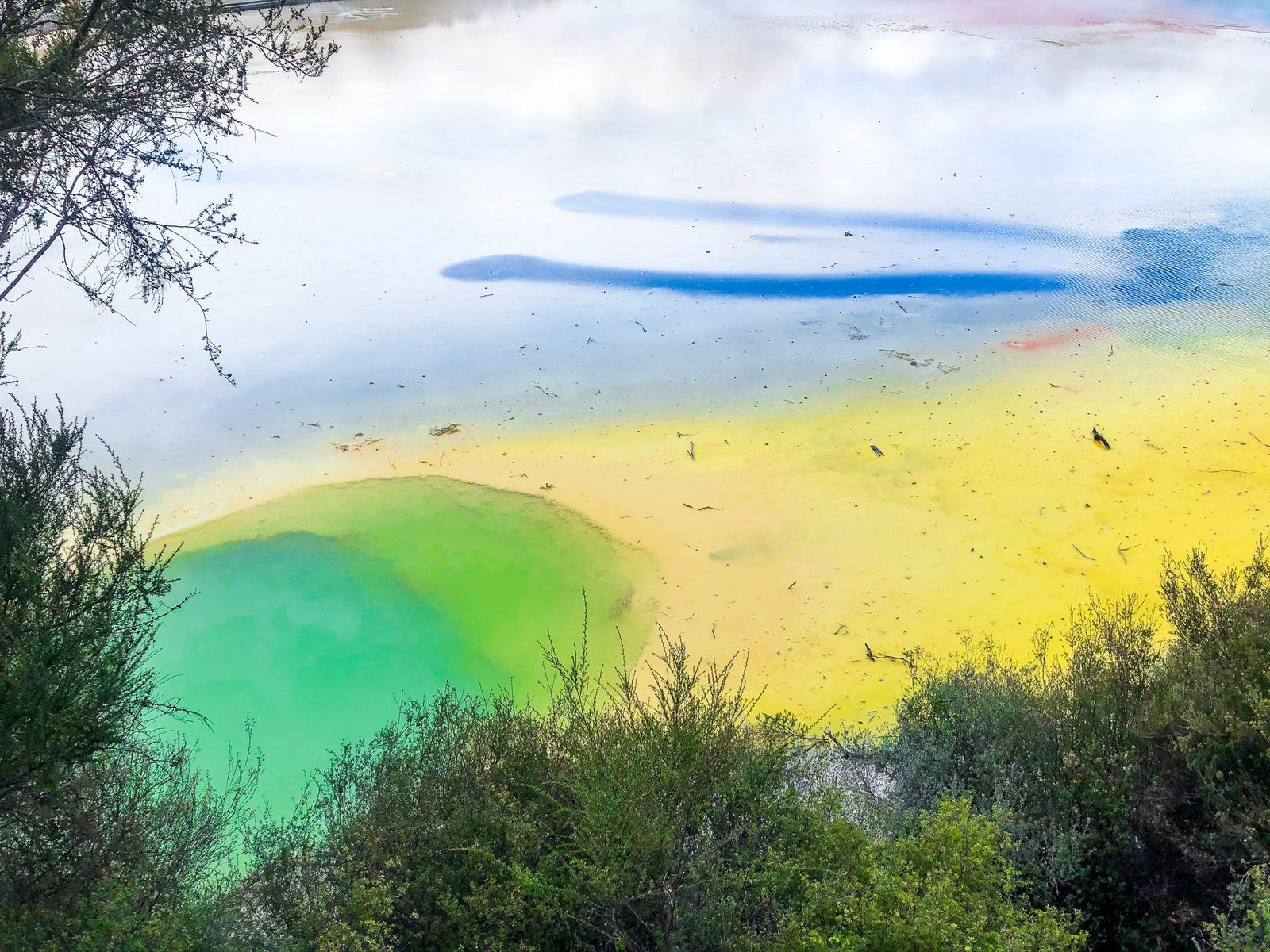
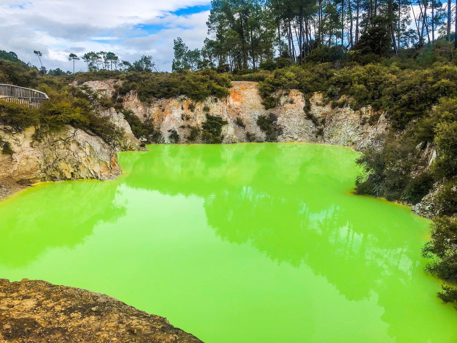
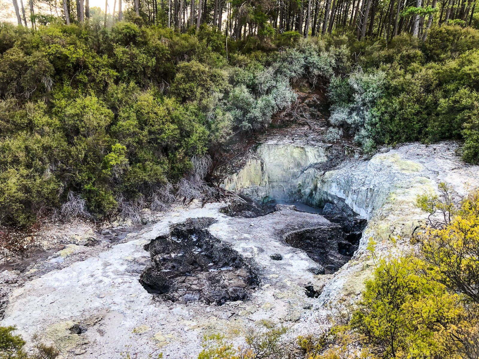
The area feature is the Waiotapu Thermal Wonderland, a colourful and diverse geothermal landscape, and a photographer’s delight. This sits on an 18-square-km geothermal system, believed to be one of the largest in NZ. Other highlights include the 10- to 20-metre-high Lady Knox Geyser (though you have to be there at 10.15 am) and the impressive Mud Pool. This is the largest in NZ.
Like most of the best geothermal locations there is an entrance fee, but we think a trip to Rotorua is incomplete without visiting at least one or two of the commercial options. A fuller list of locations can be found here.
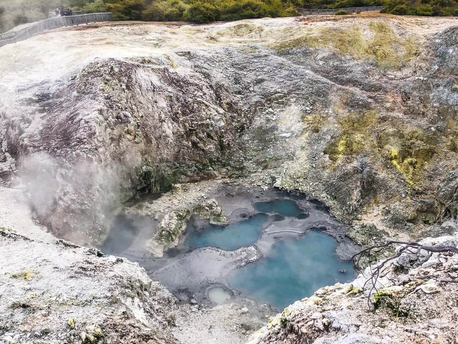
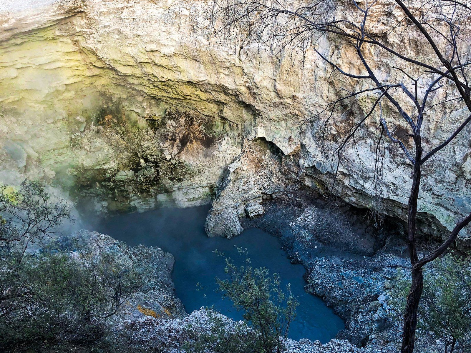
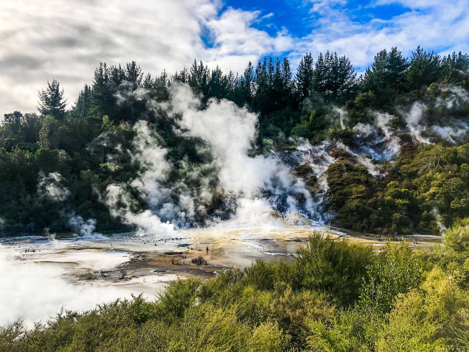
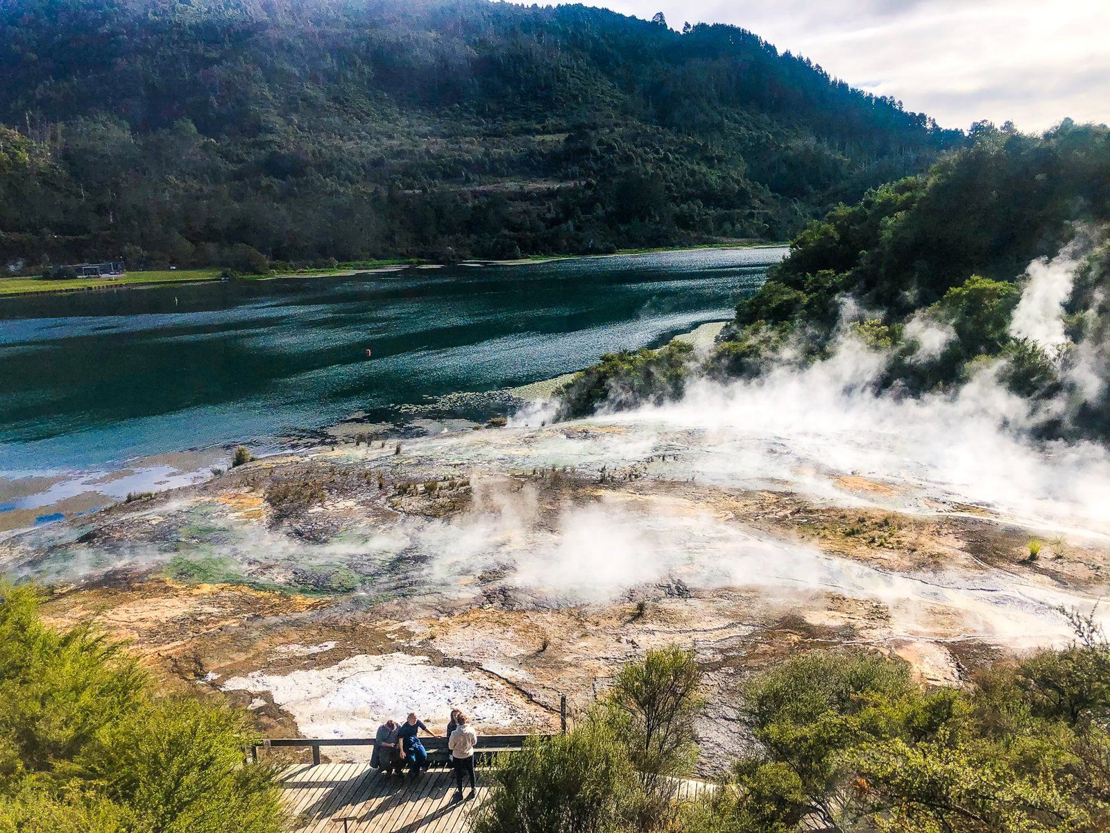
Orakei Korako
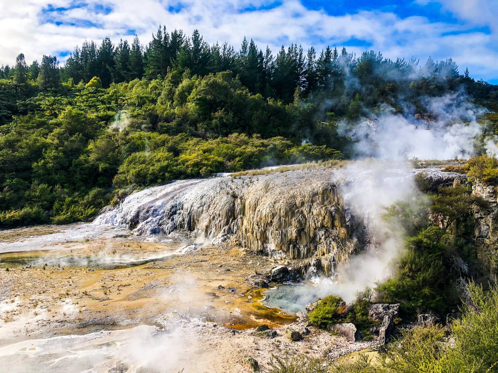
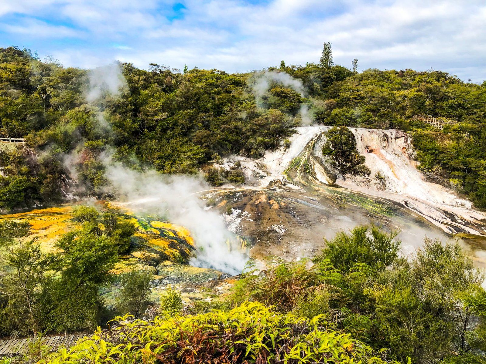
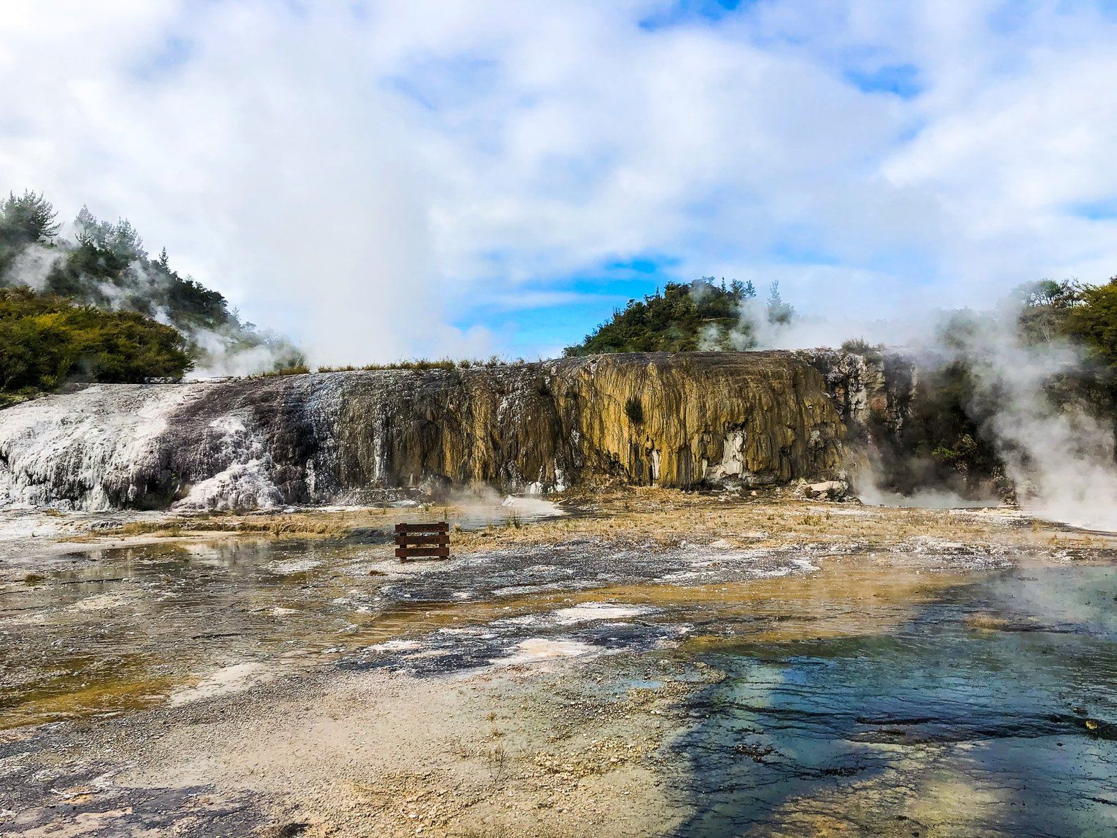
Orakei Korako (also The Hidden Valley) is more remote than most of the geothermal locations in the Rotorua region. It is a 53 minute drive (67 km) from Rotorua. Take State Highway 5 and turn right onto Tutukau Road just before crossing the Waikato River. Follow Tutukau until you reach Orakei Korako Road, which provides access to the thermal area. From the car park, you can take a boat over to the steaming terraces on the other side of Lake Ohakuri, a hydro lake on the Waikato River.
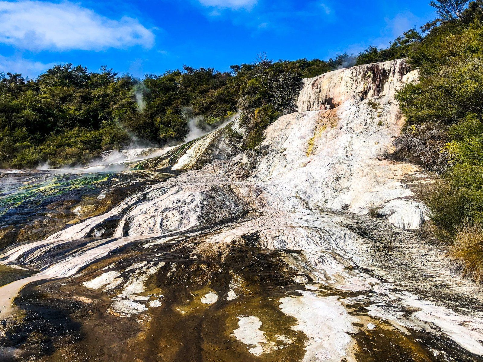
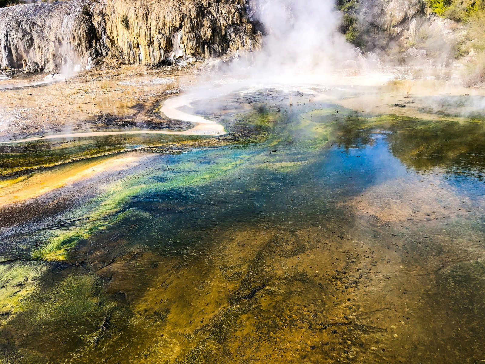
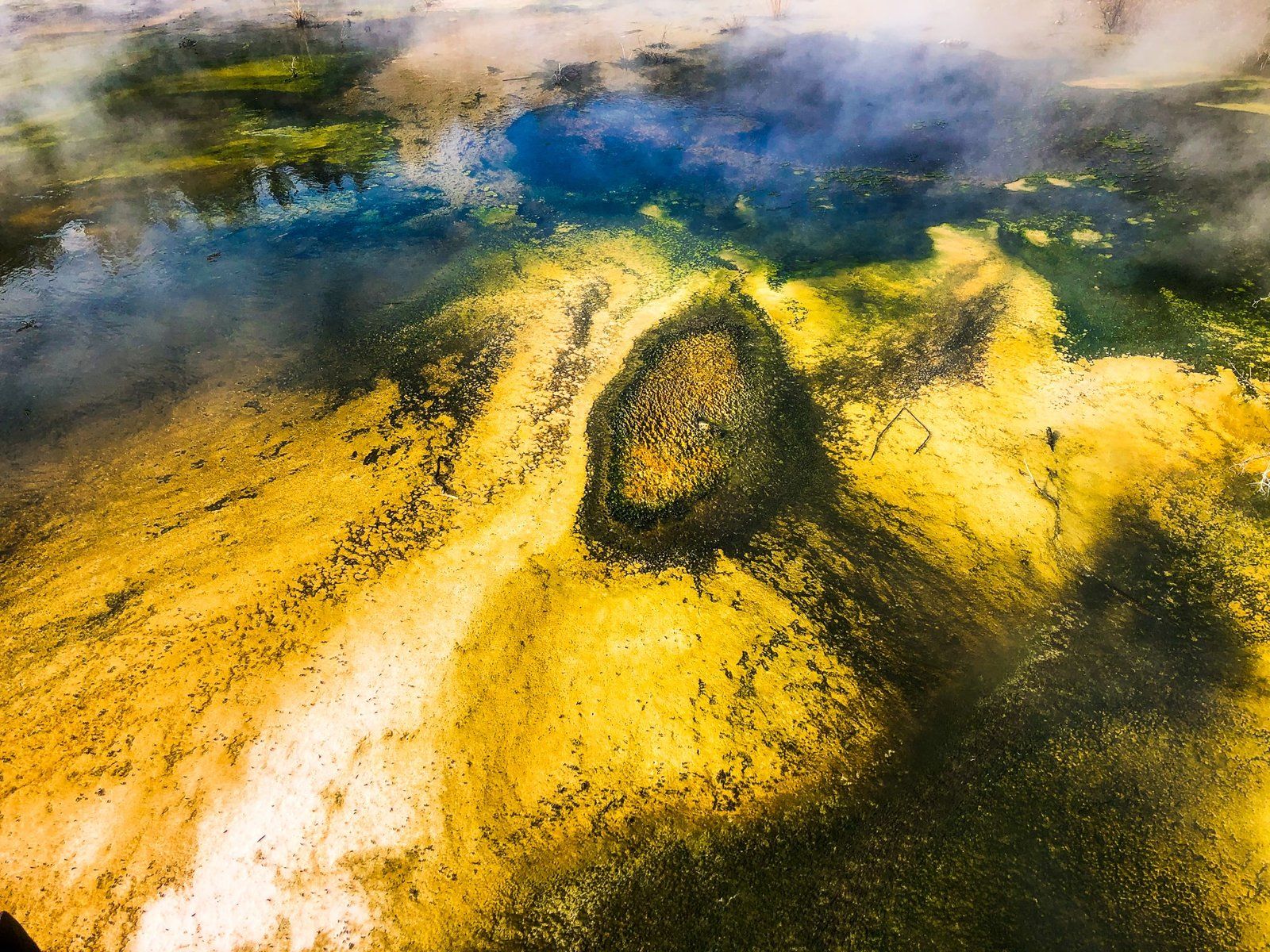
The formation of the lake raised the Waikato River by 18 metres, flooding two thirds of the original geothermal area. But what survived is still stunning. It includes the largest silica terraces following the destruction of the Pink and White Terraces in 1886 when Mount Tarawera exploded. These terraces start with the Emerald Terrace, then several terraces with various kinds of coloured algae that grow in the heated water.
The Golden Fleece Terrace is one of the most interesting features. It’s 40 metres long and 5 metres high and covered in a white sinter coating. The Māori name is Te Kapua, meaning The Cloud.
There are also various geysers and hot pools, along with the unique mirror pool cave, Ruatapu.
Like most of the best geothermal locations there is an entrance fee, but we think a trip to Rotorua is incomplete without visiting at least one or two of the commercial options. A fuller list of locations can be found here.
Want more Rotorua and Bay of Plenty Trip Ideas?
Check out the first blog in the series, Exploring the Best of Beautiful Rotorua, Part 1, and explore what the region has to offer around Tauranga and Mount Maunganui in our Bay of Plenty blog.